
HATFIELD CHASE HISTORY & NATURAL HISTORY
including the
ISLE of AXHOLME
Bryan Wainwright
Natural England
2022-25
Birding Site Guide
birdingsiteguide.com
Path: BirdingSiteGuide.com, Other Items, Annual Reports, Papers
Pictures & Maps: https://birdingsiteguide.com/index.php/other-items/86-annual-reports-papers/809-hatfield-chase-pictures-maps
JUNE 2025
Natural England have a policy to educated and disseminate information for free.
CONTENTS
LIST OF IMAGES & MAPS
Prologue 3
Preface 3
Introduction 4
The End of The Ice Age & Prehistoric Peoples 18,000 BP 6
Once Upon an Interglacial in Doggerland 7
The Holocene Begins 11,650 BP 9
Historic Time Periods and Characters 10
Bronze Age 2100 to 750 BC 10
Iron Age 500 BC to 800 AD 11
Roman 43 to 410 AD 11
Anglo-Saxon 500 to 1066 AD 17
Norse Rise & Saxon Fall 793 to 1150 28
Norman 1066 to 1154, towards Drainage 34
Extracts From Domesday Book 42
Place Names Past and Present and Meanings 43
A Strange Scottish Tale 45
Pre-Drainage Landscape Features & Vegetation from Norman Times 45
Chronology of the Lord of the Manor of Hatfield & Other Major Influences 59
Early Mentions of Wildlife 73
The Drainage 1626 74
Vermuyden’s Plan 77
The Immigrant Dutch and French Huguenots 80
Post Drainage, Enclosure & The Emerging Peat Industry 81
Maps and Some Notes About Them 82
The New Landscape 85
The Continuing Unpredictable Floods 98
Post Drainage Crops 102
The Victorian Era, Warping & Enclosure c.1820 to 1914 103
Warping Schemes 112
The Growing Awareness of Damage & Loss & Fight to Save the Moors 116
In the Twentieth Century 118
The New Millennium & Renewed Hope 124
The Modern Day Landscape & Archaeology 125
Famous Historical People of the Area 126
Human Remains 126
Human Artefacts 127
Historic Buildings & other Artificial Structures 129
Water Management Structures 133
Railways 136
Woodland 137
Present Woodland at Thorne 137
Present Woodland at Hatfield 141
Public Use Spaces 142
Legacy 143
Summary of the Effects of Vermuyden’s Drainage 143
The Present & Work Still to Do 145
Designations 145
Aims 146
Challenges 147
References 148
LIST OF IMAGES & MAPS (a separate document, see captions in this text for relevant placings)
Composite Map (see Key)
-
Norse Magic & Beliefs Channel (2022) Differences between Norwegian, Swedish and Danish Vikings Map 1. 21
-
Norse Magic & Beliefs Channel (2022) Differences between Norwegian, Swedish and Danish Vikings Map 2. 23
-
Norse Magic & Beliefs Channel (2022) Differences between Norwegian, Swedish and Danish Vikings Map 3. 31
-
Pre-drainage map by Vermuyden c.1626. Stonehouse, W.B. (1839) The History 5. Topography of the Isle of Axholme. Image from British Library (online source) public domain. 47
-
Pre-drainage map Vermuyden c.1626. Stonehouse, W.B. (1839) The History 48
-
Topography of the Isle of Axholme. Image from British Library (online source) public domain. Annotated 56
-
The Bounders of Hatfield Chase, Perambulation of the Chase Boundaries 63
-
Map of Isle of Axholme 1596. Special Commission of Elizabeth I 77
-
The Drainage of Vermuyden 1626-1629 Axholme & Hatfield 82
-
Composite Map Wainwright 2024 83
-
The Participants Allocation, Vermuyden 108
PROLOGUE
The Humberhead Peatlands (Thorne & Hatfield Moors) is a place made special to me as any local patch is to anybody by personal acquaintance as much as anything else. Whatever other factors determine the ‘worth’ of a place by any measure (including purely scientific) that which stands out is that of personal acquaintance. Not just your personal acquaintance, but that of those who have gone before; the history of the place. A naturalist’s/historian’s local patch is made more special to them only by increased familiarity; it is a totally subjective and personal perspective which can only be known by like-minded people. Intimate knowledge of a place is all about a sense of times and of belonging, of the changing seasons and the knowledge of the ebb and flow of nature in that place. Knowing its history strengthens this belonging and it tends to grow the more I delve.
I the author have been personally associated with the area once known as Hatfield Chase all my life and have amassed vast personal experience and library of published material on the subject, covering not only its natural history, but also its geology and history. This accumulated information however is scattered in many diverse and not always easily accessible forms from old, rare, out of print, obscure or locally published material and varies widely as to subject, relevance and accuracy and is not in any chronological order. In these many disparate forms then it is not easy for the layman to get a good overview of the subject area as a whole. Much of what is learnt is often recounted as hearsay and conjecture. Therefore, it is better to pin down these stories with actual references, if they can be found and to get the facts straight. It is then my aim to be able in this present work to present a fuller and truer overall picture of the local history of, or as Tomlinson put it ‘etymology’ of the place.
PREFACE
The purpose of this summary is to give an accurate and clear understanding of the aspects of the past in this area of the former Hatfield Chase. This will cover not only the physical and human contingents but also the natural history. It may seem like there is already a lot of information out there; and there is, scattered in books and manuscripts, online and in limited edition reprints of rare books. Even if like me you have obtained all you have come across, yet still the information seems uncannily difficult to bring together in the mind to form an overall picture of typical scenes from long ago. Surely many written pieces cover only one aspect and that can be exceedingly narrow in scope. Yet others which range more generally are written in obscure old foreign language or style and to anyone unfamiliar with it, it can be very difficult to follow. This is very much the case with the main reference work referred to throughout here, namely the book The Level of Hatfield Chace and Parts Adjacent, by local historian John Tomlinson 1882. This book’s main source is the diaries of local antiquarian Abraham De la Pryme (other spelling is Prymne). Though there is a great wealth of material of all kinds in this valuable book, nevertheless it is difficult to read for the several reasons mentioned, but mainly due to the very old sources used. Even at the time it was published reviewers lamented the chaotic layout (it is not very chronologically ordered) and the unconventionality of the book for a local history. John was an antiquarian from Epworth and only responded that he was pressed for time. In defence, it was much more difficult before digital writing for a writer and indeed the typesetter to re-order things, which often led to an extensive footnotes and appendices, as with this book. I hope to put these old quotes in better chronological order and context and supplement and expand the evidence with more information from other sources.
Even given some ability to read sometimes dense or old texts well the problem remains not only of scarcity of said works but also the seemingly polar-opposites views of many pieces. What are we to make for instance of descriptions of native Britons in Roman times? On the one hand they are described as living in woodland without permanent dwelling, having only temporary winter villages with a branch hedge and ditch corral around. They go naked in summer to better show their tattoos off and paint their entire bodies with blue woad dye to go into battle. Then other Roman accounts say they are sophisticated and refined and live in nice wood-framed, wattle and daub filled walled houses. They wear long fine tunics and are experts in metals. So, is one or the other or both inaccurate? Or could they both be right? Other issues are that after the Norman Conquest, French became the pre-eminent language, yet much writing from that time does not bear this out, so what exactly was the situation? Can we trust old sources equally, or should we rely on just one trusted one? And what of boundaries on maps and sizes given for Hatfield Chase and the accuracies or not of them? How can you make sense of the lie of the land from these many and varied maps where all the woodland is nearly gone and river courses have been drastically altered and the many meres of the area are now farmland fields? Even the very soil is at a different higher level due to warping. Places and names have changed, and names are not always readily identified perhaps because of different spellings, yet others perhaps mentioned in perambulations of boundaries are indecipherable or simply gone sometimes it says village or hill and there is now no village or hill. Hedgerows have disappeared and ditches and canals have been dug and other natural watercourses altered. There are far more roads, railways and canals now not to mention quarries. Tracing people can be equally confusing with gentry, nobility and aristocrats often naming their sons with the exact same name, so that without a full title or dates it is difficult to know whom a text refers to.
Maybe you are experienced and have the time to go through everything yourself. If not, then hopefully a summary such as this can prove useful. I, however, do not claim to be an expert in anything except natural history. My lifelong fascination with the wildlife of the area led into looking at the drainage history and then its history in more detail and this includes geography as well as human events. I have nonetheless been fortunate enough to have had a great amount of time to study them in both my personal and professional work, therefore, I have managed to come to a discerning understanding of past times from many sources and hope here to try to present a clearer overall picture of times gone by in this area for all. It is however, inevitable I will make errors and wrong assumptions for which I can only apologise.
The Humberhead Levels were formed from the bed of post-glacial Lake Humber and lie mostly in the county of Yorkshire (South and East Yorkshire) England but with smaller parts in adjoining (North) Lincolnshire and Nottinghamshire. Hatfield Chase was located in the southern half of these Levels, south of the rivers Ouse and Humber, the sized varied over time but at its greatest extent it encompassed an area as far north as Selby and north-west as Askern and as far south-east as Bawtry and east nearly to the Isle of Axholme probably using the arm of the River Don as its boundary where it turns NE to the River Trent. It should be noted that in some iterations though even the Isle of Axholme was included in the chase, or at least lumped with it, and therefore the eastern boundary was then the River Trent. The principal towns of the chase, excluding the Isle of Axholme were Hatfield, Thorne, Fishlake and Sykehouse, which over most of time were separate manors. A chase was a designated royal hunting ground governed by forest law, and a forest was a place of deer not trees! It was set aside for Red Deer Cervus elaphus specifically, though Fallow Deer Dama dama were also introduced (mainly by the Normans) and these two species were the principal quarry of the chase. Roe Deer Capreolus capreolus would also have been present but being much smaller and more agile and not in large groups were probably only taken opportunistically. But of course, the king could hunt anything he wanted, be it deer, fish or fowl. People lived here just as anywhere else, there were though these added restrictions. The keepers of the chase would prevent anyone taking any game, fish or fowl or even materials such as peat turves without permission. Though these laws were often laxly enforced and officials were often open to corruption. Various ‘crackdowns’ would be urged and some unfortunates from time to time over-harshly punished as an example.
The major river of the chase is the River Don, which historically had its three arms, which split with one going north before the joining of the River Went and River Aire just before it entered the River Ouse and the other two meandering east between the bogs of Thorne Moors and Hatfield Moors before heading northeast to their two outfalls on the River Trent just before its confluence with the Ouse/Humber. The one remaining northern arm now is the only channel for all three former arms of the Don and its tributaries. This river rises in the Pennine hills of Great Grains Moss at an altitude of 450 to 480 m in the parish of Pennystone, west of Dunford Bridge. It is 69 miles (111 km) long and has a good number of tributaries and reservoirs along its length. It flows past Rotherham, Sheffield and Mexborough, Conisbrough, Sprotbrough, Newton, Doncaster, Wheatley, Kirk Sandall, Barnby Dun, Stainforth, Fishlake, Thorne, joining with the River Aire and Dutch River past Rawcliffe Bridge and to Goole and finally into the River Ouse. Hatfield Chase is in its lower reaches.
The other tributaries of the River Don are the River Idle, from the south that ran north which was joined by the River Torne coming from the west but south of Hatfield Moor, it continued and joined the Don between the moors on the east before all flowed as one to the two River Trent outfalls near Adlingfleet just before the Trent joined the Humber. All these river courses have been vastly altered since as will be described further on. The whole area is a vast flat floodplain barely above sea level (typically 2 to 10 metres) with barely any hills, the Isle of Axholme being the grand exception having the lofty height at Epworth of 37.5 meters (123 feet). Any other hills are barely discernible rises in the ground sometimes with ambitious names, such as Mount Pleasant, a 3 m rise in the ground!
We are fortunate to have a great wealth of recorded history here and records go back to the earliest times. The history of a royal hunting ground here can probably be set as early as 1016 (Cnut) A.D. in the Saxon period, though it wasn’t then known as a ‘chase’ or chace. It was certainly more well defined and controlled from the Norman period, when it was first called Hatfield Chase and was a private chase of the de Warrens. It deferred several times to the crown later either from lack of a lord or removal of him as punishment, but only for short periods since favourites were soon found and given the fief of the manor. From about the fourteenth century (Edward II) it reverted to the crown several times until Henry VI, who in 1460 made the private chase his Royal Forest and Henry VIII declared it Hatfield Chase in 1548 (Read). It remained a royal chase until the 1626 drainage. During this time lords of the manor or masters of the game were still in place but they were not the owners. From Norman times all lands belonging to the crown were given to lords only as fiefs. It remained as the largest Royal Forest till Charles I gave Vermuyden the drainage contract in 1626. So, for over c.600 years it maintained its very wild and little altered state, with a very small, isolated and independent human population.
The wild nature of the area has always been a factor due to the bogs, flooded lands and forests. That this was a wildness for so long has benefitted the natural history of Hatfield Chase into modern times, with 6300+ species already logged while new species are still being added every year. This puts it in the top five for biodiversity sites in Britain. As for history, there is a great plenty of this, which however is recorded in many scattered unwieldly sources. Even the various attempts at collating the information in the past have been incomplete or somewhat disjointed as already mentioned above. This is regrettable as the events which have taken place relevant to the chase have often been of regional and even national importance with a great deal of turbulent times and notable events, involving persons of the highest royals to the lowest and meanest villein.
This wilderness, it can be seen, has always been a refuge for resistance against change by various peoples from the earliest times. The inhabitants of these regions were as wild as the land, waters and forests and had a long history of revolt against, what they thought of as unjust or tyrannical rule. They have always been independent and hated the rule of institutionalism. This attitude dates to before Roman times and has continued throughout all times in history. From Romans battling Cimbri to the two kings of proto-England that had their seat at Hatfield Chase and both of whom were killed in separate battles here. Even a prince was born at Hatfield too, though died shortly after. In 1070 King William (the conqueror) took vengeance on the whole of Yorkshire for their collusion with the Danes to keep his Normans from advancing north and taking full control. This ‘Harrying of the North’ was the largest devastation ever perpetrated against this area ever, but it wasn’t the last. William de Warenne, 5th Earl of Surrey 1160-70?-1240 (Lord of the Manor of Hatfield Chase) was a leader in the first Barons War and one of those barons who advised King John to accede to Magna Carta (1215). Sir John (I) de Mowbray 2nd Baron 1286-1322 Lord of Isle of Axholme and Hatfield, fought the king’s army at the Battle of Boroughbridge (1322) Yorkshire for Thomas, Earl of Lancaster, for which act he was captured, tried and hanged at York. Sir John (II) de Mowbray 3rd Baron 1310-1361 Lord of Isle of Axholme and Hatfield, who gave the Deed of Commoners Rights to the commoners forever. He was often a rebel who was twice imprisoned in the Tower of London and sided with Richard, Duke of York, and also had an influence in the War of the Roses (1455-1487). Henry VIII in his Dissolution of the Monasteries (1536-1541) made enemies of the people here and he exacted his revenge against protesters, principally supporters of the Pilgrimage of Grace (1536-1537) with one of the most murderously bloody campaigns in this area. Henry VIII wisely avoided this area later while passing through on his way to York, even though he was desirous of hunting on his royal chase here. The people then, were not about to give up their lands and rights and become only farmers so their wealth could be measured and then be taxed accordingly. On into the Vermuyden drainage period and the huge riots resulting from that which lasted for over a century. During these rebellious objections to the unfair drainage, the people again naturally became opposed to the unyielding king and this became probably the main factor in the lords here taking the side of the Parliamentarian Roundheads during the Civil War (1642-1651).
On top of these many national events, there were seemingly often personal feuds of one sort or another between royalty, gentry, ecclesiastical bodies and commoners, usually over land rights, succession, religion, rules of law or ladies. Conflicts continued from enclosure acts and loss of commons and the shared open field system, right up to the claiming of the peat moors by private interests for exploitation (Hatfield Chase Peat Moss Litter Company and four others formed the British Moss Litter Company founded 1896, were the first, extracting for horse bedding). Then the (coal) miners’ strike of 1984. There was then massive exploitation of the peat moors for commercial peat for the horticultural trade and as this industry became ever more ravenous and threatened to obliterate the peat moors altogether, protests to protect what was left began and dragged on, until the turn of the millennium. The central two peat moors are now the Humberhead Peatlands National Nature Reserve but the battle to maintain them and their biodiversity is an ongoing battle that is made more uncertain with modern farming practices, building and development and climate change.
THE END OF THE ICE AGE & PREHISTORIC PEOPLE 18,000 BP (Northern European time periods)
Summary of Prehistoric Times
The Ice Ages of the last two million years ended. The ebb and flow of these ice-sheets meant human ancestor hunter-gatherers had left as the ice came and returned when the ice retreated. This warming period meant more permanent settlements were now possible and there was the beginnings of agriculture and culture. This marked the start of the Holocene. The sea levels rose and started to drown Doggerland permanently and Britain gradually at first became more cut off from the rising seas.
We require a start time to work from but how far back shall we go? The formation of the earth, the start of life, from prehistoric times and the first human presence, or first civilisations? Fortunately, in these northern latitudes we have a very handy and relevant cut-off date we can use for such an investigation; the ending of a series of Ice Ages. The Ice Age time period is known in prehistoric terms as the Quaternary Era from 2 million years ago to now and is divided into the earlier ‘most recent’ Pleistocene and the current ‘modern’ Holocene. The Holocene then will be our focus and is determined by humanity changing from entirely hunter-gatherers to settled civilised people which in Europe was from 11,650 years BP. At that time Britain was still connected to mainland Europe and was only finally cut off at around 8,200 years ago from the rising sea levels. For context some events from the Pleistocene leading up to the Holocene will now be briefly mentioned.
For most of the Quaternary Era the people present were Palaeolithic or Old Stone Age (1 million years ago to 9000 BC) Neanderthal Man Homo sapiens neanderthalensis however it should be noted there was overlap in these periods with some tribes advancing faster than others, that followed the game on the edge of the receding ice. On the east-south-east coast of England, the earliest evidence of humans in Northern Europe are of footprints and stone flint tools from 900,000 years ago at Happisburgh, Norfolk. This area would be adjacent to the area of Doggerland to the east, where the southern part of the North Sea now is. Later in this period (around 40,000 years ago in this region) Neanderthals became extinct but not before breeding with their successors Modern Man Homo sapiens sapiens that recently then appeared in this region. Most people today have four percent or less Neanderthal genes. The ending of the last Ice Age began around 18,000 years ago, ending with the thawing of the most recent, of six or more ice covering events, the Younger Dryas from about 12,900 to 11,700 years before present (BP) (Wikipedia, Doggerland). The Younger Dryas is a notable recent megafauna extinction event, some species being mentioned later.
ONCE UPON AN INTERGLACIAL IN DOGGERLAND
Geologically speaking, the present Holocene landscape of the Humberhead Levels that the icesheets left after their scouring and deposition, sit on top of Triassic formations beds of New Red Sandstone (Keuper Marls) and limestone (200-250 million years ago) (Jones). The melt waters from the icesheets were still initially blocked to the sea by a wall of ice and moraine thus forming the massive Lake Humber at the western headwaters of the River Humber. This lake was at above 30 m O.D. so over 100 m above the then sea level, which meant that the rivers at times gouged deep gorges towards sea level. Eventually this lake breached and left evidence of its southern extent in the layers of lacustrine drift deposits, including Hemingborough Formation clays (Bateman et. al.) and which around the southern edge of Hatfield Chase left considerable depths of lacustrine deposits and of loess (blown sand and gravel) which are still worked to this present day. The draining of Lake Humber formed the vast flat Humberhead Levels which in this drier period became forested, but with the continued sea level rise from the melted ice around 5000 years BP river channels silted up and rose and the wetlands expanded across the floodplain. This paludification led to large wetlands with meres, fens and carrs to raised mires. Only areas of blown sand such as Sandtoft stayed high and dry (Van de Noort). By Roman times at least it was already half cleared of its trees by man and rising water levels curtailed regrowth, so in the lowest lying swampy areas largely isolated from the flow of the various rivers’ channels it became permanently waterlogged and began to develop into a true bog by the sustained growth of Sphagnum Sphagnum spp. mosses laying deep deposits of peat. So, the Humberhead Peatlands formed and expanded from its initial hollows.
Britain was separated from mainland Europe as the melting ice caused sea levels to rise with higher ground such as Dogger Bank perhaps remaining much longer as islands. So much water was locked up in the icesheets that the seas were considerably lower than today, in fact over 120 m lower. It should be remembered that people in these remote times were hunter gatherers and warriors; following game and conflict meant no fixed ‘home’ initially in the sense of housing and civilisation. The receding melting ice sheets were raising sea levels at a visible rate and diminishing then finally breaking the land bridge between Britain and the continent. The area between the east coast of Britain below the Humber mouth and the Germanic realm, from the Humber to Denmark, was known as Doggerland (as in the Dogger Bank area of the North Sea). It was as large as the UK and away from the Humber stretched north as far as Scotland. The River Thames flowed east then south and then joined the River Rhine which then went west, scouring out what was to become the English Channel. The inundation and final submerging of this area, to islands and then the near present sea level was not yet complete. It is likely therefore that the first inhabitants of the newly exposed land from icesheets of Britain were displaced from Doggerland by those rising seas, by heading north-west. Perhaps they would follow herds of large prehistoric game as they sought refuge from the waters on the newfound pastures that were now established following the receding ice sheets. Just about all trace of any previous life, landform or human endeavour had been scoured clean from the land and the pioneer colonists eagerly sought to populate this area as temperatures rose and plants and animals returned.
With the retreating of the ice came pioneer plants of grasses and hardy trees such as Arctic Willow Salix arctica and birch Betula, these were steadily overgrown by Ash Fraxinus excelsior, English Oak Quercus rober and Sessile Oak Quercus pretraea and Beech Fagus sylvatica forest. Along with the plants came the species that depended on them. Many would be familiar today, even if some no longer inhabit Britain. Also dredged skull fragments from Neanderthals have been found along with their tools such as pieces of worked antler harpoons, flint tools and land works which may be burial mounds.
We know Doggerland and the adjoining areas was quite well populated, from knapped flint remains and other remnants. But what was the place like then, what people and creatures roamed over this land? We can see evidence of vegetation from tideline tree stumps, and from fossil animals. Many mammal species, particularly the megafauna had become extinct with the Neanderthals, possibly exacerbated due to their hunting of them, and more went extinct or would become so during this period with the changing climate and increased human pressures. Vanished species (from the study area if not in some few cases globally) included such large herbivorous as Woolly Rhinoceros Coelodonta antiquitatis, Woolly Mammoth Mammuthus primigenius, Dwarf Elephants Palaeoloxodon and Mammuthus sp. European Ass Equus hemionus hydruntinus. Native horses which included several species: Tarpan Equus ferns ferns and Przewalskii Horse Equus ferns przewalskii and Kaagan Equus hydruntinus. The Giant Deer Megaloceros giganteus and various Bison Bison sub/species. Preying on these would have been huge predators such as Cave Hyena Crocuta crocuta spelaea, European Ice Age Leopard Panthera pardus spelaea, European Scimitar Cat Homotherium latidens Eurasian Cave Lion Panthera spelaea, European Dhole Cuon alpinus europaeus and huge Cave Bear Ursus spelaeus.
The recent land link with the continent is noticeable at the Humberhead Levels, of which the Humberhead Peatlands was a small part, by biotic affinities still evident in some cases today (Eversham, Skidmore) to particularly those of Poland and the Baltic states. They are Western outliers of their type, and so being are dissimilar to all other bogs in Britain and Ireland. The connection of land across this latitude in post-glacial days for several thousand years explains how this came to be. This then makes the Humberhead Peatlands uniquely special in the British Isles habitats and we will look at this more closely in later chapters.
Once Britain was again truly an island immigration of biota all but ceased, except for of course migrant species and a few late strong colonisers. The period was now around 8,200 years ago.
THE HOLOCENE BEGINS 11,650 BP
Summary of Holocene Times
The land is finally free of ice and has been colonised by plants and new animals attracting many different people to this new area. Sea levels rise cutting off nearly all influxes and fighting begins between the new settlers over land and resources. Colonisation continued in the favourable climate with the improvement of sea-faring boats. Many peoples came with the Cimbri dominating in England.
The Quaternary Era Pleistocene with its Palaeolithic (Old Stone Age) people had ended and the Holocene had begun and is this present inter-glaciation period. The Holocene includes the Middle or Mesolithic Stone Age (9000 to 4300 BC) and during this period Britain truly became an island, this process being completed by three giant Norwegian landslips each taking only a matter of days, known as the Storrega Slides (6225–6170 BC) which caused giant tsunamis. These tsunamis were up to 4 m or possibly higher than current high tide levels (so perhaps 125m+ surges above the sea level of the time) and washed up to 80km inland in parts of Scotland. This must have killed and displaced thousands of people, and this is borne out by what remains. Following this was the New or Neolithic Stone Age (4300 to 2000 BC). Modern Man appeared in this region and began the foundation of some farming which allowed civilization to develop along with writing and in Europe coincided with sea level rise that led to island Britain.
During these periods there were great waves of new immigrants, the first peoples known as Cimbri were a race of proto-Celts who originally came out of Armenia and were then based in Doggerland and Jutland, Germany; they were apparently driven here by rising sea levels causing submergence of the land by inundation and resulting in over-population, and likely ever-present conflict. Then others principally escaping invaders; the Galatians came from Anatolia (now Turkey, though some historians contend Troy was in Britain and was Celtish and attacked by people from the continent (Wolcott) led by Brutus after the Trojan Wars (1184 B.C.) through France and the later Phoenicians from Colosyria (Syria, Lebanon, Palestine = Canaan) were an Aryan race that colonised SW England and parts of Germany from 2000 BC and are the ancestors of Anglo-Saxon Brits and Scots (Wikipedia, Doggerland). The Cymru was a separate race of Cimbri in Wales. With advancements these new people brought the first civilisations and writings appeared which marked the beginnings of historic times. The incumbent Celtic Cimbri people fought successive waves of different invaders but ultimately retreated to remoter and or higher grounds north and west as the new people swept in and claimed the south-west and much of the south. But the Cimbri did not die away but instead increased in numbers and became more advanced and stronger in battle.
From the Saxon or Anglo-Saxon Chronicle:
The island Britain is 800 miles long, and 200 miles broad. And there are in the island five nations; English, Welsh (or British), Scottish, Pictish and Latin. The Anglo-Saxon Chronicle tells it thus.
“The first inhabitants were the Britons, who came from Armenia, and first peopled Britain southward. Then happened it, that the Picts came south from Scythia [steppes of southern Asia], with long ships, not many; and, landing first in the northern part of Ireland, they told the Scots that they must dwell there. But they would not give them leave; for the Scots told them that they could not all dwell there together; “But,” said the Scots, “we can nevertheless give you advice. We know another island here to the east. There you may dwell, if you will; and whosoever withstandeth you, we will assist you, that you may gain it.” Then went the Picts and entered this land northward. Southward the Britons possessed it, as we before said. And the Picts obtained wives of the Scots, on condition that they chose their kings always on the female side; which they have continued to do, so long since. And it happened, in the run of years, that some party of Scots went from Ireland into Britain, and acquired some portion of this land. Their leader was called Reoda, from whom they are named Dalreodi (or Dalreathians).” (Carruthers, 2013)
More species became extinct during this period with one of the more recent megafauna species being the ancestor of modern-day cattle, the Aurochs Bos primigenius about 500 years ago and extinctions continue in modern times with double figure numbers of other European mammals that have gone globally extinct since then including Tarpan Equus ferus ferus and most recently Portuguese Ibex Capra pyrenaica lusitanica and Pyrenean Ibex Capra pyrenaica pyrenaica. European Lynx Lynx lynx was lost to England with the last dying in the Lake District in the fifth or sixth century AD but they held on in Scotland until about 500 years ago.
Birds being more mobile and adaptable could generally hold out longer than arctic megafauna or other large mammals, but several now went extinct. In Europe, extinctions include the following with some in much more recent times due to other factors. Great Auk could be considered a relic from the ice-ages which survived the thaw but unfortunately was wiped out in Victorian times due to collecting. Giant Swan Cygnus falconeri, Great Auk Pinguinus impennis, Ibizan Rail Rallus eivissensis, Canary Islands Oystercatcher Haematopus meadewaldoi, Cretan Owl Athene cretensis and Pied Raven Corvus corax varius leucophaeus. Other vertebrates such as some fish species retracted range or also went extinct.
HISTORIC TIME PERIODS & CHARACTERS
Summary of Early Historic to Roman Times
New people brought new technology with profound effects, especially regarding new metals of bronze and iron. This meant better weapons and fighting between the varied tribes was endless. But then came the Romans who quickly asserted dominance and drove relentlessly north to the Humber. Here the natives were numerous and used the wild land that was unfavourable for marching armies to their advantage. The Romans however would not be stopped and even as they subdued these people they were marching on towards the Scottish borders.
BRONZE AGE 2100 to 750 BC
The Bronze Age began with the influx of new peoples with new technology from the Asian Steppes and Indian sub-continent and lasted until 800 BC when the Iron Age began. The history of the vegetation of our area is fairly well known in broad terms due to pollen samples from the peat. This takes us back to 13,000 B.C. From this evidence we can see there were major clearances at Thorne in the following periods 1740 to 1130 B.C. and 1440-840 B.C. for agriculture (Turner). Human artefacts from this time period have been found in this area, see further on.
IRON AGE 500 BC to 800 AD
This period began with the new technology that came from southern Europe and continued in parts contemporary with the Roman period. For Hatfield main clearances for agriculture were from 790 to 390 B.C. and 370 to 70 B.C. (Smith). The areas cleared were very extensive and most primary forest and in fact most of England’s wildwood had been cleared to near its present extent from long before Roman times (Rackham 1986) and this applies in the immediate area (Buckland). Though most of the wildwood had been cleared sporadically at one time or another over many centuries, it should be remembered that much of this clearance was not permanent or even of long duration due to only having primitive hand tools, conflict, famine, disease and migration.
The Britons knew Doncaster as Caer-Daun, City on the Don.
ROMAN 43 to 410 AD
Summary of Roman Times
Rome expanded to control nearly all England and Wales and sporadically parts of Scotland but in the borderlands never fully subdued the local tribes. On the continent the Germanic tribes, especially the Goths were being displaced by Attila the Hun and his armies. These fleeing land hungry Germanic tribes invaded the Roman Empire which eventually suffered an irresistible onslaught. The legions were withdrawn from Britain to help defend the Roman homelands but to no avail and didn’t come back leaving a power vacuum.
Chronology
Dates, if known of peoples life are without brackets, reign or specific events connected to them are in brackets.
Julius Caesar invaded Britain twice in 55 but was unsuccessful, returning in 54 B.C. and took control as far as the Thames.
Tacitus (reign AD 42-54) Roman ruler and writer.
Caractacus (Caratacus) and his brother Togodomnus (Togodomus) leaders of Catuvellauni native tribes in London and home counties area who were present in our region or their armies were at some later date.
Boudica female Cimbri leader, daughter of a king slain by the Romans.
Gogmagog Cymru giant warrior, the last of the giants.
Aulus Plautius was the Roman General before Publius.
Publius Ostorius Scapula the Roman General active in these parts against native tribes.
Cartimandua Queen of the Brigantes.
Emperor Claudius Roman Emperor.
Attila the Hun led his armies’ invasion from the steppes of eastern Europe into Western Europe.
Contemporary Glossary
Brigantes most powerful tribe of Britons and in this area.
Burgh or ‘brough or ‘borough means a fortified lookout post, which the Romans had many about Doncaster as this was a frontier land. The many names ending in this testify to that.
Catuvellauni London and home counties tribe.
Cimbri collective name for the Britons.
Cymru Welsh tribe of Cimbri.
Garrison a fortified permanent camp, these could be any size.
Goths a very powerful Germanic tribe.
Roman Empire dominant force in Europe in early times.
The Roman Empire is of Mediterranean origin, from the area now known as Italy and formed one of the greatest empires ever, invading Britain initially in 55 and 54 B.C. and permanently occupied from 43 A.D. and eventually ruling to around 200 A.D. Though Roman rule didn’t leave totally for long after and its legacy is still felt even today. In Britain this was progressive and was never total. There were 40 kingdoms in the British Isles at this time. In the SW and S where new immigrants, often Phoenicians or more likely traders with them since the sea farer Phoenicians colonised Britain very little, had forced the Cimbri away, were a people much more open to trade with Rome and they were soon quite ready to adopt their ways. The Romans described these people saying they wore long white tunics girt at the waist and that they were master metal smiths exporting for instance Cornish tin and Welsh copper as well as gold and silver. But as mentioned, much of the wilder and higher northern Britain remained under Cimbri rule and these areas were very much as they were in the Iron Age for much longer. This explains the different descriptions of the ‘Britain’s’ from before Roman times and after Roman occupation.
The Romans knew the Britons had carved out 40 kingdoms before they arrived, the most powerful of which were an untamed Celtic tribe known by the Romans by the derogatory term Brigantes and particularly meant those unruly tribes around and north of the River Humber who resisted Rome and who habitually were at war with each other and stole and plundered. These Brigantes were the most numerous and powerful pre-Roman tribe of Britain. They occupied all of what is now Yorkshire, except East Yorkshire and north to southern Northumberland and across to the west coast, except Cumbria, including Lancashire, Cheshire, Derbyshire and parts of Staffordshire and Nottinghamshire. They were a very fierce people and resisted Roman occupation greatly, very often beating the Romans here and in Gaul (France) and not finally submitting in this area until A.D. 70, some 115 years after the Romans first landing. In the north of England their main stronghold was Aldburgh (Aldborough) near Boroughbridge, North Yorkshire and here in the Humberhead Levels.
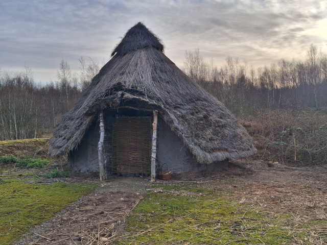
Some Cimbri were rumoured to be giants (as some say Gogmagog and Boudica were) and it is said that the dead of giants were sometimes to be found interred in huge hollow trunks of the largest ancient trees of the land. There is a Neolithic mound one at Clouds Lane, Beltoft perhaps 3,000 years old and a ‘Giant’s Graves’ that was once at Owston. Also, three tumuli at Beltoft existed until ploughed in 1800s (The Historian Magazine.com). The Cimbri commonly went naked and without shoes particularly in summer, some wore crude skins in winter. Their bodies had crude tattoos of animals from an early age, done by scoring the flesh and rubbing in dye, these marks lasting all their life. For battle they would paint themselves entirely blue with woad from that plant. They had no abode, their towns being the forest and groves of sacred trees. In winter they may make rude huts, of poles and thatch, some having wattle and daub walls, and a surrounding corral of thorn branches and ditch, but none constructed to last. This was for protection of themselves and their cattle. They grew no crops and supplement their hunter-gatherer diet, often with milk with blood let from their cattle. They were superstitious pagans and practised human sacrifice and often cannibalism, of enemies or criminals with their priestesses cutting their throats over large cauldrons and soothsaying over entrails. They held certain plants sacred, such as Scots Pine which they often planted and chiefly worshipped Mistletoe Viscum album especially where it grew on oak (Leland, Itinerary viii), and would not eat certain meats such as Hare Lepus, ewe, goose and some fish. They had druids who were their philosophers who looked to the sun and moon and the gods Mercury, Apollo, Mars, Jupiter and Minerva. Since they did not work metals they only got metal artefacts through trade with the Phoenicians on the coast. Their weapons at this time included: Shields and short spears, daggers, clubs, stone slings and large bow and arrow. Their main pastime was war and stealing from other Cimbri, and they would do so even when they had no need, just for fun. They were polygamous and raised all the children together. They always kept one fire burning all the time to light others. Interestingly, many Brigantes shaved their beards leaving just a moustache (Tomlinson) though the manner in which they achieved this and with what the blade was made is not known.
Tomlinson, speaking as a contemporary narrator tells us.
Brigantia is active enough now. Scouts have gone throughout our district, sounding the horn and striking their shields. The scattered families know what that means ; so all the men, and not a few of the women , seize their arms, which are the most valued treasure of every adult Briton. The British sword is of great length, and broad in proportion ; but it is pointless, being chiefly used like a club for striking. The British spear has a head of iron, when such can be procured, but it is oftener tipped with a sharpened flint. The war-chariot (a low two wheeled car, girt with formidable hooks and scythes) is brought forth, and the fleetest high-mettled chargers are harnessed for the fray. The Druid priests, who are rarely seen except on great emergencies, now come to the front ; human sacrifices are offered to propitiate the gods, and a sympathetic phrensy diffuses itself among the warriors. The British warriors throw off their skin coverings, which encumber the arms, and stand naked for action, using only their shields for protection : they are very agile in attack , and swift in retreat ; while the Roman invaders are encumbered with heavy armour. The King of the Brigantes has headed his bests, proclaiming that they must either conquer or become slaves. Battles are fought but soon ended, through superior military tactics of the Romans. Soon ended in the open field, but tedious and very protracted around Doncercen (Doncaster). The country for miles eastward is partly bog, and partly forest : these form a safe retreat for the natives, from whence they can sally to cut off any small detachments of the enemy. Such skirmishes so exasperates the Roman General, that he commands these forests to be cut and burnt down ; thus accomplishing a double purpose - first to dislodge the natives from their lairs ; secondly, to fill up and make a passage over the wide morass. It seems as if nothing can damp the courage of that Roman legion ; the Britons are driven further and further into dense jungles, where their war chariots are of no avail, and where only the Imperial infantry dare follow them. The boggy nature of the district is particularly ill adapted to the Roman Cavalry, which become cautious, after some experience, in pursuing the Britons. At length the natives are obliged to come forth unto the higher ground, and sue for peace; “Deliver arms:" this was the first demand, and proves to the natives that their condition from henceforth will be one of servitude. The Roman eye soon perceives that Don-cercen [Doncaster] is geographically well situated for a stand-point, being bordered by a confluence of rivers which are constantly over flowing, rendering the whole country eastward to the German Ocean, a succession of marshes, pools, and little islands. So these grand old civil engineers resolve to make a Castrum or Castella here, which shall keep the savage northern tribes from advancing south or west. The situation is admirable, since the Don river forms a natural protection from the east and north ; so that nothing is required but a circum vallion and moat sufficiently deep to obtain water at the river level. Building materials are plentiful and convenient ; the disarmed Britons must work ; digging, delving, carrying : but the Romans are skilled workmen. As clearly as our mental camera can take in an impression at this distance of time the Castrum is of rectangular form, surrounded by a wall, in which are gates, the main entrance, or Porta Principalis.
This mode of warfare proved to the Romans the most trying and hazardous part of their campaigns ; for it is computed by one of their own historians that the invaders lost more than 30,000 men in these skirmishes alone. The Britons used to transport a few sheep and oxen to some open spot on the line of pursuit ; so that when a small detachment of the Romans went to secure them, the soldiers were struck down by a number of the Britons who had lain in ambush. No quarter was given ; and so the invaders, who suffered much from want and exposure, put to death all their sick or disabled comrades, who could not keep up with the rest. We have read of Spartan rigour at an earlier date ; and here, in the primeval forests of the Brigantes, the Roman courage was signally manifested . To the Brigantes of this period arms would be valuable . As there was little native manufacture these arms were obtained at uncertain intervals and great cost, by traffic with foreigners at the sea coast. Centuries before the Roman invasion the Phoenicians traded here for tin , lead, and other products, giving various manufactured articles, particularly arms in exchange. They called the island Barat-anas, or " land of tin," which was afterwards corrupted into Bratanac ; the Romans subsequently altering the name into Britannicoe, or Britannia. Camden says the term is derived from the indigenous word Brith, or painted, and the Greek tania, or country ; signifying that the countrymen painted themselves. The old native name however, appears to have been Cumbri ; hence the designation Cambria, appropriated by the Welsh who, if any can may, claim to be descended from the Ancient Britons. An insular tribe like the Brigantes could only obtain their arms by barter with those British Kingdoms on the coasts, since the Phænician traders touched only on the coast. (Tomlinson, 1875).
In Roman times the area around Doncaster was described (not always accurately) as a forest of mainly ‘fir and pitch trees’ (fir was a general name for any evergreen conifer tree, pitch means Scots Pine). Pitch was used for caulking boats to stop them leaking. Caesar was specific when he said that no fir-trees in his time grew in Britain. Around Doncaster, the Cimbri had chosen this area of refuge because of its protective great bogs, marsh and forest with the Isle of Axholme acting like a natural fortress with the barrier of the River Trent on its east side and floodplain all about the rest. Axholme means island of oaks and reeds. The indigenous Brigantes (Cimbri) tribes used native woodlands as a refuge to launch their attacks on the Romans, having no fixed dwellings, killing in total 50,000 Romans or allies in this area alone (De la Pryme) (from Severus, Roman Emperor from 193, who visited Britain in 208 where he died in 211). So it was that the forays of these Roman garrisons were so enraged by the constant attacks by these Brigantes that they resolved to destroy their wild strongholds. To subdue them and prevent their expansion Roman garrisons with burghs were established at York (Eboracum) and also Doncaster (Danum) as frontiers to their enemies’ south-eastern edge. At Danum the garrison hosted Mounted Crispin Horse. After London and York, Doncaster was considered the next most important town by the Romans. Unlike them it was not walled, except for the castle, because it had so many surrounding ‘burghs or forts to protect it.
What follows here is an account of an important battle by the Roman writer, Tacitus (reign AD 42-54) between the Briton leaders Caractacus and his brother Togodomnus against the Romans which has been translated and the language has been simplified by Cross. The evidence that this battle or another involving the same characters took place at Hatfield is based on the Roman General Publius Ostorius Scapula being active in our parts in these years and leaving his name in the town of Austerfield. Accounts of Roman times are often confused about various battles and their exact date and location, but we know in this area Aulus Plautius was the Roman General and he was succeeded by Publius Ostorius Scapula. There is conflicting evidence for where this battle took place and whether it was Caractacus at Hatfield, and if he was whether this was the scene of his last battle as described? Other historians contend his last battle was in Wales, as in this account. It should be noted though that tribes from Wales did join those of the north in fighting the Romans. Perhaps Caractacus was not present then at Hatfield but some cohorts of the army he once led were? Several other historians note or confuse this or other battles and virtually continuous skirmishes here between Britons and Romans, but details are frequently murky as can be seen.
The other sources for this battle or at least other related conflict in our area are Stonehouse (1839) who notes this battle in our area mentioning Caractacus. De la Pryme tells us that here a great battle took place in 44 AD after which the Romans under leader Publius Ostorius Scapula burnt Hatfield to the ground. Furthermore, Roman battle sites were always named with the name of the general who fought it as the former part of the site name, hence Ostorius, who was definitely a general in the Roman army at that time and in this area. The latter part of the named battle site was usually affixed with the word ‘field’ giving Austerfield (Tomlinson). Further evidence of the conflicts of the time is given by Casson (1829) who says a great army was raised and encamped between Finningley and Austerfield (Osterfield). Even though Miller (1804) says there is little supporting evidence for a large battle. Actually, ‘all kinds of excavated weapons, shields, and coins, witness this’ (Korthals-Altes 1925). It may also be noted that in this area the Romans were the first people to make earth banks on a large scale and sluices to control waters and to make hard standing areas and tracks in boggy areas, some of which are still present today and will be given in more detail later.
Caractacus and his brother Togodomus led the initial British resistance against the Roman invasion, commanded by Aulus Plautius. Caractacus and Togodomus fought together in the opening battles at Medway and Thames. Togodomus was killed in the battle of the Thames and Caractacus fled with his warriors to continue the war in the land of the Silures (South Wales). There he led a successful guerrilla war against the Romans. When the Romans moved considerable forces into Silurian lands he took his warriors north into the land of the Ordivician tribes (North Wales). There, after fighting against the Romans for nine years Caractacus faced the Romans, in his last battle.
Caractacus selected a hill fort, to fight a decisive battle with the Romans, where it was both easy for the Britons to move forward to attack the Romans but also to retreat if things did not go well in the battle. At the same time, it would be hard for the Romans to attack or retreat. On the more gentle slopes the Britons piled up stones to make a rampart. The British warriors positioned themselves in front of these defences, but they were still protected by a river which was in front of them.
The chieftains of the various tribes moved amongst their men encouraging them. Caractacus, darted everywhere, telling his men that this battle would be the beginning of the recovery of their freedom or else of everlasting slavery. He recalled how their ancestors had driven back Julius Caesar, and through their bravery the British were freed from the threat of being ruled by the Roman military and government. While he was speaking, the warriors shouted applause; every warrior swore not to flee from weapons or wounds.
The Roman leader, Ostorius faced a daunting sight: the river and the rampart the British tribesmen had added to it, the hill fort and masses of fighting men everywhere. But his soldiers insisted they had the courage for battle and the prefects and tribunes encouraged this idea. The Romans surveyed the area and worked out the easiest way to attack. Ostorius, led his furious men, and crossed the river without difficulty. When they reached the defences, the British threw their missiles and the Romans suffered the worst casualties. But when the Romans formed the testudo and tore down the stone rampart, it became an equal hand-to-hand fight and the barbarians retreated to higher ground. But the higher ground was not enough to protect the Britons from the soldiers who rushed into attack. The lightly armed Roman soldiers harassed the enemy with missiles, while the heavily-armed soldiers closed in on them, and the Britons were broken, as they had no breast-plates or helmets to protect them. They were killed by the swords and javelins of our legionaries; if they turned around, they faced the sabres and spears of the auxiliaries. It was a glorious victory; the wife and daughter of Caratacus were captured, and his brothers also surrendered. Caractacus, sought the protection of Cartimandua, queen of the Brigantes. However, she put him in chains and surrendered him to the Romans. (Cross. Resources for history.com).
There seems to be two or more battle references above and some things have been lost along with the translation with our local antiquarians. More modern references state the following. The Medway battle was where Togodumnus was killed and Caractacus fled north-west to north Wales where his campaign continued. Caractacus was finally finished at the River Vrynwy, south of Oswestry, Shropshire (Welsh borders) by Ostorius Scapula, but not before escaping north to the Brigantes. It was here that Queen Cartimandua betrayed him and handed him to the Romans. Following his capture Caractacus was taken prisoner to Rome where he met Emperor Claudius and was allowed to make a speech. In his speech Caractacus spoke of how neither of them would be so famous if not for the battles they had fought. This persuaded the emperor not to execute him but spare him, he was released from his chains and re-united with his family and allowed to live as a free man in Rome (Heald).
The vanquished Brigantes all retreated to the great forest of fir and pitch trees (infers fir trees (none present) but maybe meant furze (Gorse) and Scots Pine) but also of Alder Alnus glutinosa, willow Salix, English Oak Quercus rober and Hazel Corylus avellana (Jones) that covered the area at that time but the Romans taking advantage of the dry season and a strong SW wind set the whole alight and with all the forces they could muster from the area plus their allies they burnt, slayed or captured the remaining Brigantes (Casson). Burning and chopping down conifer forests and flooding to deprive their enemies of hiding places was very common practice of the Romans all over their empire. This reference to burning is further evidence that it was mainly a forest of Scots Pine as this is the only type of native British forest tree that will burn standing (Rackham 1986, 2006). However, there was far more dead brush wood generally in forests then and this would undoubtedly have helped the fire, also the understory of the forest if stood on sand or peat, was frequently bracken, gorse and heather which would obviously burn strongly. Around half the forest was left standing so they set their allies and slaves to work to chop down with axes most of the remaining, leaving only the biggest trees and small woods for their timber. In a few weeks the work was done and half the Brigantes had fled. However, they did return to harass the Romans more. The Romans therefore turned to another strategy, breaching the banks of the Trent at Alkburrow, Lincolnshire (Alkborough) which lay on the north of the River Trent. They set slaves to work and soon breached an area half a mile long, which greatly flooded the whole area for many miles leaving only the Isle of Axholme and other isles above the waters. It was so extensive it covered all the Chase and land to the Trent, forever altering the courses of the rivers that ran through the Chase and also the course of the Trent. Stonehouse tells us that evidence of the River Trent course change can be seen from the roots of trees found at low water at Butterwick and when Drain Head at Ferry was cleaned out, when fir tree roots were pulled out from two feet below high water mark. Evidence of the previous channel, he suggests is to be found at Ferry Flash, two miles east of the present river and at Duke’s Farm, Laughton and at East Ferry. The river today does not divide parts of the parishes of Owston and Scotton as it used to. Stonehouse gives more details. A much wetter climate succeeded this period too and it seems the forest that did regrow only recolonised the areas of slightly elevated ground and the fen and mires increased to take over the rest.
Speaking about these killed ancient trees Pryme (or Prymne according to some; who was Thorne’s Reverend) cites a forest of pitch (Scots Pine) but also of “oaks, birch, beech, yew, thorn, willows, ash, &c.” (De la Pryme 1701). Pryme went on that the trees lay by their roots and “the tops were commonly in north-east”, and a “3d part of all being pitch trees.” Another interesting observation by Pryme “It was lately observed in digging the pit of a great decoy in these levels, that the roots of the firs always stood in the sand, and the oaks in the clay.”
From this period on the people were by degrees turned to Roman ways and customs, building their houses and dressing after their fashion. By 330 A.D. Hatfield was a prosperous town with much increased area of cropland and grazing animals. It was also safe being surrounded on three sides by water and only open to the west (De la Pryme).
Note on references: Roman rulers were frequent and accurate writers, and much is known from them, however on their withdrawal writing became scarce, mainly restricted to religious orders, and the passing on of histories in the oral tradition of sagas was the mainstay. Most sagas were never written down until hundreds of years later. Whilst many sagas are undoubtedly based on truth, it was not beyond the teller to get confused about events and people and to fill in and augment stories where parts were missing or forgotten. This has led often to several versions of the few written references, that obviously vary in actual accuracy, and unless supported by other evidence must be taken as not totally factual. For instance, many dates are conflicting for this early period and can often only be taken as approximate. De la Pryme or Prymne, the main English language source here sometimes confused similar named people, as Tomlinson noted!
Summary of Anglo-Saxon Times
The numerous displaced Germanic peoples expanded and routed the Roman Empire and millions were displaced, causing battles throughout Europe. Other Germanic tribes invaded Britain with Angles, Saxons, Jutes and Frisians gaining southern and eastern Britain initially and they implemented their well-ordered laws, administration, customs and farming practices. Landownership became important and battles between the numerous tribes was frequent.
King Vortigern (most powerful between 425-450) was King of the Britons.
Gildas c.450/500-c.570 a cleric.
Hengist and Horsa were Saxon brothers and leaders who were the first to come in force to these shores.
King Edelfrid or Edelferd son of King Æthelric, slain at the Battle of Austerfield 542 (obviously Saxon not the Roman one) whilst battling King Redwald, whose son Remerius was killed.
King Ælla is the first known king of Deira, ruling from c.560 until his death in 588. He was chosen as the Bretwalda or Supreme Monarch.
King Æthelric of Northumbria (and claimed Deira) succeeded Ælla ruling from 588 to about 604.
King Æthelfrith (or Ethelfrid of Bernicia from 593) -616 battled King Rædwald at the River Idle in 616, and Æthelfrith was defeated and killed; Rædwald installed Edwin as king of Northumbria. Rædwald's son Rægenhere may have been killed at this battle, but the exact date or manner of Rædwald's death are not known.
King Rædwald of East Angles reign 599-624.
King Cearl King of Mercia 606-626 (Midlands) ally of King Edwin and King Rædwald.
King Edwin 586-633 (1616 to 633 of Deira and Bernicia viz Yorkshire and central north England later united as Northumbria from 616) the most powerful king in Britain at the time, married the Christian King Cearl’s daughter Ethelberga. Edwin who had his royal seat at Hatfield converted to Christianity. He was baptised in York on 12th April 627 (Charles Cawley). Eventually he was killed in battle, along with his eldest son Osfrid, by the alliance forces of Penda and Cadwolleder. Eadfrith (or Eudfrid) Edwin’s other son was captured and soon put to death.
Nigel Fossard Earl Tosti was the Saxon owner of the Soke of Hexthorpe, which at that time included all of Doncaster too. He owned all the land from here to Northumberland. Later Doncaster became the larger and more important town.
Queen Ethelberga (Cwenburh or Quenberga) wife of King Edwin, daughter of King Cearl of Mercia.
Princess and Queen Eanfleda (Eanflaed) 19th April 626-after 685 one of Edwin’s daughters.
The Venerable Bede 672/3-26th May 735 an Angle monk of Northumbria who often used Gildas as a source.
Prince Osfrid Edwin’s eldest son.
Prince Oswald Edwin’s son that survived him and succeeded him. He was killed at the Battle of Masefield, Shropshire by Penda of Mercia.
Prince Eadfrith Edwin’s other son a Catholic priest.
Princess Wurfrean Edwin’s second daughter.
King Penda King of Mercia 626-655 (Midlands) contemporary of Edwin who he fought and killed aided by Cadwalloder.
King Cadwolleder King of the ‘Britains’ (Wales) contemporary of Edwin whom he fought and killed aided by Penda.
Alderman chief of tithing. Precursor of a council head or member.
Angles a Germanic tribe who came to rule this area. Gave rise to the name Angleland and England
Baron lowest hereditary order in royalty.
Borderer or Borholder a person who lived on the edge of a manor or common or land and often widely thought to choose to live there for poaching or to be beyond the law in neighbouring manors or on the common. Probably best known as referring to borderers on the English Scottish border, who were constantly at war in skirmishes and cattle rustling. Used as a reference here as one historian in this area used it.
Burgher these were the inhabitants of towns rather than a countryside villa.
Chiefpledge or Tythingman man in charge of running Frankpledge for his group or community. He maintained the law.
Carracute an area of land that was as much as a plough could turn in the ploughing season of a year (about 150 acres). As with other old measures of land this area varied whether the soil was heavy clay or light sandy soil.
Ceorles a free peasant without land or money, a Saxon soldier who fought for his Thane and was paid in the spoils with land or money, and thus would move up in status from a Creole. They became in later times Yeomen or Freemen.
Churl a lower middle-class person, generally a tradesman but owning less than five hides of land (600 acres).
Clan a tribe.
Colliberti were a middle sort of tenants between servile and free, or such as held their freedom of tenure under condition of such works and services. The same class of land-owners as were afterwards called Conditionales. (Stonehouse, 1839)
Copyhold land of the manor held under all same rights as Freehold, except the deeds were only given as a copy. They did not actually own the land and could not therefore sell it. People with copyhold agreements could not increase payments rents, so they often tried to get rid of this type of agreement.
Cottarii or Cottagers who paid a certain rent for very small parcels of land. They were divided into two classes, Cottarius and Cotterellus. Cottarius had a free socage (franchised) tenure, and paid a rent, in provision or money, with some customary service. Cotterellus held an absolute villeinage, and his person and goods were liable to be disposed of at the will of the lord. (Stonehouse, 1839)
Ealdorman a precursor to Earls who were the chief officer of a scir, these were precursors of shire. They were large landowners and were entitled to a third of the money from any fines.
Frankpledge a system whereby law was maintained by the whole community revealing any criminal. If the community did not reveal criminals, then they would all suffer a share of a fine.
Frisians a Germanic tribe.
Folk Land was allotted on recognised tenures or leases to freemen of towns or hundreds or tythings.
Freehold the holding of land not in common (the holder was known as a Privileged Villani at least or higher status such as Freeman) granted by a higher power than a lord. The thane of the manor had no powers over the ownership of this land. It was land permanently held in reward for service to the king or local constitutional ruler (an earl maybe). This may be for service of the community, such as building a church or for going into battle.
Freeman were not vassals of a thane (they did not have to answer to or serve a thane) freemen were often important people such as high ranked officials or outstanding warriors; they may be mercenaries.
Gavelkind an inheritance system where all offspring derived an equal share, Celtic in origin.
Guilds were originally formed now as groups of men above 14 years old who paid a surety to the elders, in case of future fines they may incur. All crimes, even murder could be paid for, but if the fine was not paid the person could end up a slave. These became mutually dependent people, most groups of which were in the same trade and these became guilds.
‘ham home of a chief.
Hundred-gemot local court held every month when all members came and brought their weapons too. This gave rise to the name Weapontake or Wapentac or Wapentake.
Hundredary or Hundreder head officer of the hundreds, also their captain in war.
Hundreds Consisted of ten tythings/tithings. Under the Saxon government every vill, containing ten families, had a peace officer, called a Head-borough who was a Freeman; and it may be presumed that such ancient vills as never had this officer were too small, and on that account were reckoned in connection with another vill in the vicinity. Ten of these townships, large enough to have a Head-borough, comprised a Hundred, over which presided a superior officer, called an Hundreder. Crowle, Belton, Epworth, Haxey, and Owston, would each be under the superintendence of a Head-borough; but these places not being sufficient by themselves to constitute a Hundred, were joined to several vills on the east side of the Trent, which, together, constitute the Hundred of Manlake or Manley. (Stonehouse, 1839).
Jutes a Germanic tribe
King or Queen or major Chief an elected leader or one who had shown great leadership in battle, of an area but not of all England. There were a great many of them sometimes only ruling small districts or several towns. They were maintained by voluntary donations from their subjects and if they fell out of favour could be deposed by a strong claimant without bloodshed. There were seven Saxon kingdoms, further divided into what became shires, then hundreds and then tithings.
Knights Templar (or Knights of St. John of Jerusalem) some of whom settled here for instance at Belwood (between Belton and Beltoft, Isle of Axholme) where they built Belwood House, built 1327 (Axholme Info). It was destroyed for the building of the M180 motorway (1977-79). Only the obelisk survives (Isle of Axholme & Hatfield Chase Landscape Partnership). Another settlement was provided for them at Sandtoft, where land was given to them.
Neatherd removed illegally grazed cows from commons and returned them to their owners.
Oxgang as much land as a pair of Ox could plough in a day (see Carracute above).
Outlaw a man not serving any liege.
Parishes a community with a church.
Parochial a community granted its own church by the Parish.
Peasant landless workers or who held only small parcels of land, the majority of the population.
Porcarii were free occupiers, who rented the privilege of feeding pigs in the woods, some for money, some for payments in kind. (Stonehouse, 1839).
Privileged Villani had Copyhold but it was equal in all respects to Freehold.
Reeve a local official who received fines on behalf of the king.
Saga a medieval, often Viking, prose narrative of history
Saxons a Germanic tribe.
Sceattas Anglo-Saxon coins found in this area.
Scir these were precursors of shire but somewhat smaller.
Serf a basic (agricultural) labourer, bound to the manor.
Servi and Ancillae were distinguished from absolute slaves, inasmuch as their lives and limbs were under the protection of the laws. (Stonehouse, 1839)
Sheriff the highest ranked Reeve the chief administrator of a shire.
Shire the area of land overseen by an Earl.
Slaves persons who lost their freedom due to crimes, who could not pay the fine or enemy captured in battle. Their life and limbs were unprotected, and as with livestock injury or killing of a slave entailed no crime from his master but if killed by someone else then a payment must be made by them to the master.
Socage ‘in soc’ (franchised) to a Baron or other larger land owner by service other than knights service.
Sochmanni or Socmans inferior land-owners who had lands ‘in soc’ or franchise of a Baron.
Swineherd removed illegally browsing pigs from commons and returned them to their owners.
Thane or Theng a chief/king/nobleman/ruler, possessing five hides or 600 acres at least. So a richer freeman than a ceorle. A Superior Thane held more.
The Saxon Chronicle (Anglo-Saxon Chronicle) this was actually written later when Saxons were under pressure from the Danes. It was a written chronicle of the Anglo-Saxons, in Old English, probably secular in origin from the 9th century. The original does not survive but there are nine copies which all vary somewhat.
‘ton hall of a chief.
Tything or Tithing were the sub-divisions of Hundreds; ten households owned by Freemen.
Vassal a subordinate person subject to another, such as a lord.
Villani only held their land on unbending service to the lord or king and this privilege could be withdrawn as punishment at any time. Villani did not have rights to sell or rent out land.
Wapentac like a borough or district.
Were a schedule list of fines payable for crimes, including murder.
-wics special towns for international trade, with reduced import taxes and other incentives. This encouraged items to be imported legally. Eoforwic became York.
Wite or fine paid for many and numerous fines which went to the King’s Reeve or Sheriff
Witen-gemot or witan national gathering or court of highest ranking people who determined the laws.
Picture 1. Norse Magic & Beliefs Channel (2022) Differences between Norwegian, Swedish and Danish Vikings. Map 1. YouTube.
As the Roman Empire shrank back to the Mediterranean, leaving British shores about 390, it took with it all conscripted young men to fight in its army. Many died and most of the rest did not choose to return (De la Pryme largely quoting The Venerable Bede (672/3-26th May 735) an Angle monk of Northumbria; he in turn was quoting a cleric, Gildas much of the time and a lot of the following about this early period is the same source/s). This depopulation led to a settled period of long influence during which the Germanic Angles greatly expanded along the coast and rivers, which led to increased settlements and farming and the reduction of much remaining mainly regrowth woodland by about 50% to near present. Due to the nature of the very wet land around the peat moors, old woodland was scarce around here at least since drier pre-Roman times and probably long before (Rackham 1986). The British Isles were now divided into several kingdoms and the establishment of the first counties and parishes began. The highly superstitious pagan Saxons thought it bad luck to inhabit anywhere they had not built themselves; towns and house alike. They therefore largely avoided inhabiting the abandoned Roman towns and houses with their odd structures and customs and different gods, and which may have been cursed and instead built their own.
During the 5th Century the Angle King Vortigern (most powerful between 425-450) was King of the Britons (Encyclopedia Britannica. Wikipedia) and was constantly troubled by the emboldened raiding, pillaging Picts from the north and to a much lesser degree the Scots of the north-east, who took advantage of the now lax rule by the Romans, who couldn’t spare warriors but were still trying to leverage taxes through a now cruel and contemptuous rule. Vortigern was too drowned in luxury, ease and vice to finish the Picts, when he became aware of Germanic Saxons landing on the east coast. Having established that they came in peace he made a pact with them so they could stay if they rid him of his enemies. The renowned Saxon leaders, brothers Hengist and Horsa came first with 300 picked warriors and later 10,000 and fought the Picts and Scots around here on the banks of the Don, Aire and Ouse and eventually drove them away north. Vortigern became increasingly greedy and foolishly wanted more geld; payment, from the Saxon settlers, which led to war and almost inevitable defeat of the Angles and Vortigern retreated to North Wales.
The Saxons but also fewer Angles and Jutes now held much of the land and great numbers of them left their over-populated homeland for these new shores. In the Doncaster area it was predominately Angles in charge. The land was divided into seven kingdoms as follows:
“Hengist, a Saxon, set up for himself a Kingdom in Kent, Cedric made himself King over Cornwall, Devonshire, Somersetshire, Dorsetshire, Wiltshire, Hantshire, and Barkshire; Uffa made himself King of Suffolk, Norfolk, Cambridgeshire, and ye Isle of Ely; Sledda made himself King over Essex, Middlesex, and Hartfordshire; Crida made himself King over Bedfordshire, Buck[inghamshire], Glocest[ershire], Oxfordsh[ire], Worster[shire], Warwick[shire],Rutland, Hant[shire], Leicest[ershire], Northampt[onshire], Shrops[shire], Stafford[shire], Lincolnsh[ire], Noting[hamshire], Darbys[hire], and Cheshire, which was called ye Kingdom of Mercia. [illegible] made himself King Surrey, Sussex, called ye South Saxons. Ida made himself K[ing] of part of Scotland, all Northumberland, Cumberl[and], Westmorel[and], Lancash[ire], Durham, and ye West part of Yorkshire, and Ælla, another Saxon prince, made himself King over Deira, which is all ye East part of ye Country, from ye River Tyne to ye borders of Derbishire {sic}, and Nottinghamshire, &c. : thus these Saxons divided ye Kingdom amongst them.”
P.2 Norse Magic & Beliefs Channel (2022) Differences between Norwegian, Swedish and Danish Vikings. Map 2. YouTube.
This handful of Saxon rulers; be they chiefs or kings or gentry ruled quite fairly and democratically. They had dependants who received land in return for services. These services were set at different bands or levels with corresponding type names. Many of these orders were adopted and adapted in later times particularly in Norman rule. The Norman feudal rule however was much more rigid and defined and so the meanings of the names evolved or changed. These meanings therefore, can seem at first perusal confusing and many need to be understood with regards to the time periods referred to. Lords and manors were earlier less defined concepts, with Saxon leaders of various power generally known as Thanes. See the contemporary glossary above for meanings. People who were vassals of the lord were in order: Sochmanni or Socmans, then Privileged Villani, then Villani and Colliberti then slaves.
It should be noted that kings often claimed areas they were not de facto ruling and maybe in dispute with other kings for, so at some times two kings may claim the same area.
In our area, there have been several important Saxon battles some with far more information than others, below the three main ones in this period are given. They are the Battle of The River Idle (Austerfield) 542, the Battle of the River Idle 616 (Retford) and the Battle of Hatfield Chase 633.
The first Saxon battle to note was recorded in ‘Henry of Huntingdon’ and refers to a battle near the River Idle (also called the Battle of Austerfield) between Bawtry and Everton at Scaftworth (today a small hamlet) in 542. Here King Edelferd of the Northumbers battled Redwald and slew Redwald’s son Remerius, but he was also slain. These are the few details of this battle. When the Austerfield Enclosures took place in Victorian times some artefacts were found.
As stated, the victorious Saxon Ælla lay claim as the first king of Deira. King Æthelric of Bernicia succeeded Ælla ruling to about 604 then King Æthelfrith (of Bernicia from 593). Æthelfrith fought many battles in England and Wales and caused many upheavals and was jealous of other kings. In our area he first fought a battle on the River Derwent, East Yorkshire (the upper parts of the river are in the Humberhead Levels but a few miles north of Hatfield Chase) and later was defeated and killed at the decisive Battle of the River Idle 616 at Red-ford (Retford, Nottinghamshire on the southern edge of Hatfield Chase) on the east side of that river.
The Battle of the River Idle 616 came about as Æthelfrith (or Edelfrid) was desirous to claim King Edwin’s Deira and join it with his Bernicia to form the kingdom of Northumbria, and so making him the most powerful king in the land. Edwin was considered at this time the most powerful king but due to constant claims by Æthelfrith and threats to his life had gone into exile eventually ending up with his ally King Rædwald, in East Anglia. Here, Æthelfrith tried to bribe the King Rædwald to either kill Edwin or capture him, and if he refused then they would be at war. For whatever reason Rædwald eventually consented to the removal of Edwin. De la Pryme goes on to give a colourful account of the events, wherein;
‘Night came on and Edwin went to bed, but was awoken some time later by a well-known and trusted friend, who told him of the plot against his life. Edwin, though troubled would not sneak away with his friend out of the kingdom. Instead, Edwin put faith in his friend Rædwald not to do such a thing. His friend left Edwin then in the dark street alone, and Edwin had a vision, of a figure which asked why he sat out alone on a cold stone at night? Edwin replied about his troubles and swore to the visitor that he would be faithful to any person who could deliver him of so many and so great troubles and give him a kingdom again. At this the vision disappeared and his trusted friend reappeared saying ‘Rise O King, come, cheer up.’ He explained that upon Rædwald’s queen hearing of the terrible plot to betray his friend, she had ‘scorned him to be either so base or so perfidious as to do as they desired.’ As soon as Æthelfrith heard his plot had failed he declared war upon Rædwald.
Rædwald and Edwin knew what was coming and prepared a marching army with all haste and headed for Deira, where Edwin could gather his forces. Æthelfrith keen to prevent them reaching Deira and increasing their army set off with all speed to intercept them, not even waiting for other parts of his own army to catch up. So, at Retford Æthelfrith battled Rædwald and Edwin and Æthelfrith was defeated and killed. Then Rædwald installed Edwin as first King of Northumbria (Bernicia and Deira) this may have been because his own son Rægenhere was (may have been?) killed at this battle. Edwin also ruled Eastern Mercia, the Isle of Man (Irish Sea) and Anglesey (a large island off north Wales). Edwin at age 20 (age not certain) became King of Northumbria (Deira) in 616 (age and date not certain). Edwin was now the most powerful Saxon king ever. Edwin wanted to marry the King Eadbold of Kent’s daughter Ethelberga but could not do so because he was a pagan not Christian. The occurrences that made Edwin finally take up Christianity was a promise to King Eadbold, which he did not follow up until later. He made his royal seat at Hatfield, his palace was called Cambodunum, and Doncaster was called Don-Cercen and he had the church built to wed Ethelberga. The prompt to finally convert though came later from an assassination attempt.
“The king of the West Saxons, envying Edwin’s prosperity, sent a messenger (really an assassin), who “ was admitted into ye Kings Presence on Easter Monday, at his Palace by ye River Derwent, in Yorkshire. Having advanced up to the King, as if he would deliver a message, he suddenly drew forth a Poison’d Weapon, which he had Privily hid under his Coat, and made a stroke at him ; which when Lilla one of the Kings’s attendants saw, he not having a shield then on his Arm by which he might keep ye Danger, suddenly cast himself between ye Ponyard and ye King, receiving ye whole stroak in his own Body, and Immediately dyd of the same ; yet ye stroke was not so fully put off, but part of ye Poison’d Weapon slightly Wounded ye King’s person.
“Edwin thus Deliver’d, tho’ lying under Cure, Resolves upon Revenge, and as he was considering how he might go about ye same, newse came unto him that his Queen, being exceedingly frighted with ye Danger that he was in, had fallen in Traval and brought forth a Daughter ; he was exceedingly Joyfull at this, and gave Publick Thanks unto his Idols for ye same while Paulinus was by ; but ye Good Bishop fell down on his knees, and gave thenks to Christ. After this ye Bishop and him falling and talking, ye King sayd that he would renounce his Idols and serve Christ, if that he would be pleased to heal him again, and give him victory over [his royal enemy] that sought his Life : and in earnest of fulfilling his promises he made his Daughter be Immediately Baptiz’d, with twelve others of his family ; and these were the very firs of ye Northumbers that Embraced ye Christian Religion.”
Edwin The Great, was the greatest ruler in Britain and it was he who built the original wooden York Minster. Edwin was a kind and just Christian king who saw 17 years peaceful reign as king of Northumbria and who ensured even a woman with child could wander his lands unattended without being molested and that suitable safe rest and drinking springs were provisioned along all highway routes. However, he faced increasing threats from King Penda of Mercia (Midlands) as he had been much at war to expand his kingdom. Penda had also made an alliance with King Cadwallon (of North Wales). Therefore, Edwin with his son Osfrith (or Osfrid) and with Eadfrith (Edwin’s second son and a Catholic who was made a saint) faced the pagan Gwynedd-Mercian alliance at the Battle of Hatfield (Haytefield) Chase on 12th October 633 (other sources say less convincingly 632) and was defeated and killed along with his sons and 10,000 others.
Pryme tells us:
‘After King Edwin had reign’d gloriously, happily and honourably 17 years, Penda, King of ye Mercians being puffed up with some victories that he got against ye West Saxons, and also envying King Edwin’s greatness, rebells against him, and brings in Ceoadwalla, King of ye Welsh, to his assistance, who drawing all their forces together privately fell furiously into King Edwin’s dominion’s, burning, killing and destroying all before them.
‘King Edwin being then at his royal seat at this town of Hatfield, where he had lately caused a noble magnificent chirch to be builded, as soon as he heard of their approach he caused all his forces (that upon such a sudden he could) to be gather’d together from all ye country round about ; and all the country being in arms, they flock’d under the standard of so great and good a king in great numbers, and pitchd their camp upon ye great heath on ye west side of ye town, that then spread it self as farr as ye River Don, which heath is since call’d ye Linggs, by this town of Hatfield. King Edwin took all ye care he could to line ye woods which were standing with his archers, from ye camp almost to Doncaster, with an intent to hedge ye enemy in, if it were possible, and got everything in the greatest order that could be. On the 3rd of ye Ides of October, ye spies brought word that ye enemy were advanced as farr as Doncaster, and that most of ye inhabitants being fled to ye king’s camp they had put all to ye sword, old and young, man, woman and child, that they fond therein. Upon this King Edwin encourag’d his soldiers all he could, tould them that it was probable that ye heat of ye enemy was over, and that they were somewhat satiate with ye spoil that they had gotten in ye towns they had sack’d ; yet nevertheless they were necessitated to fight to ye last man, because there was no hope of escape, ye waters keeping them in on ye north-east and south, and ye enemy on ye west ; and that therefore this was ye time in which they were to shew their manhood and valour. Yet, as no man ought to trust in his own prowess, therefore he intreated them to put their trust in ye onely true great and mighty god, whose religion they had so lately espoused, for it was unto him that they owed all their victories, glory and honour.
‘No sooner were these words out of ye pious and good King Edwin’s mouth, but a spy comes with ye newse that ye enemy were advanced of this side of Doncaster with their vanguard, but that ye rest lodged there all night ; this gave ye king certain information that they resolved to attack him. Order was therefore sent away over ye River Dun to ye north, for some partys that were approaching to hasten all they could, to strengthen ye king ; these marched most part of the night, and joined him next morning.
‘On ye morrow, which was ye 4th of ye Ides of October, ye enemy advanced with the whole body of their army, which was exceedingly strong, extending its wings from one side of ye heath to ye other, driving before them archers of King Edwin’s army, that set not only to hem them in, but also to gall them in ye flank, if it were possible.
‘About noon ye two armys were in sight of one another on ye Linggs. Edwin’s was commanded by himself and his son Osfrid, a valiant and courageous young man : and ye rest by several great lords and nobles expert in warr. The enemy’s army was commanded by ye two kings, Penda and Ceadwalla, and by their great captains.
‘As soon as all had drawn their forces up, ye trumpets gave ye charg, and together they went with the greatest of fury imaginable ; after that ye archers had spent their fury on both sides, they came to a close fight with their axes and seaxes, so thick that there was nothing but confusion and hurry from this world to the next
‘In ye midst of this heat ye noble and valiant Prince Osfrid, son of King Edwin, received his death wound ; and there fell also with him several noble lords and courtiers. Yet for all that ye battail remayn’d in its full force (neither side being use to anything but victory) until almost sun set ; about which time poor King Edwin’s army was overpowered, and he himself being hedged in, was after a most bloody fight (in which he lay about him like a rageing lion) slayn upon the spot.
‘The enemy no sooner saw themselves conquerors, but they set upon the town of Hatfield, murdered every man woman and child that they found therein, rifled ye church, ye king’s palace, and every house in ye town, then burnt it all down to ye bare ground, so that nothing escaped but ye altar of ye church, which being made of stone curiously wrought, preserved itself from ye flames ; which altar is still preserved in ye monastery of Thrywulf, in ye wood of Elmete.
‘The next day, when that the army was march’d away, several of ye country round about that had fled to save themselves from ye heat and fury of ye enemy, came to view the slain, and they found them to amount to above 10,000 ; amongst ye rest they found the body of poor King Edwin, all plaster’d over with dirt, blood and gore ; whose head they cut of, and sent it to York to some of his nobles there, that buryd it with great sorrow in St. Peter’s Church (York Minster), which he was then building. As for his body, and that of his son Osfrid, and the rest of his nobles, they were cast in a great hole all together, and a huge hill of earth thrown over them, which hill remains to this day in Hadham field, near ye lings-called now Sley-burr-hill, that is ye hill where the slayn were bury’d. The field having now been plow’d for many hundreds of years, has caused that the aforesaid hill is not now so conspicuous as it has been ; yet it is higher now than any other part of ye field, and every one knows it.
‘Paulinus, ye good archbishop, with ye Queen Eanfleda and Wurfrean, King Edwin’s daughter and [her] son, with Bassa, a noble and great commander of y deceased king, considering that their only safety being in flight, took shipping together and sailed for Kent, from where ye queen came, who were honourably and freely entertained there. They carry’d withthem most of the King Edwin’s plate, and pretious things, and amongst ye rest a golden chalice, consecrated to ye Ministry of ye Altar, which is yet, says Bede, preserved in ye church of Cantebury (Canterbury Cathedral).
‘This town was so ruined and destroyed by this cruel battal, that it did not recover itself of a long while after, that which was a great loss to it being, that it ceased to then (for hundreds of years together) to be one of ye King’s Courts, where they usually resided ; for ye Royal Court was then translated to Leeds, at which place ye after kings caused a splendid palace to be built.’
Edwin’s younger son Eadfrith was taken prisoner and soon killed. Following this utter defeat and destruction of the royal town and the burning of the church, the rest of his family; his wife and daughter Princess Wurfrean and her son, fled by boat along with Bassa (a commander) and Paulius the Archbishop and much of Edwin’s plate (treasure) to Ethelberga’s home county of Kent, there welcomed by her father the king.
The eventual battle site was mainly at the western most point of these defences and is located in fields between the present day A18 High Levels Bank and M180 motorway, immediately W of Crow Tree Bank. The dead were buried in a great pit nearby, the area alluded to being the area around the present Sley Burr Hill (Hadham Field?) and Slay Pits Lane, Hatfield (just east of M18 near the cemetery). People and groups (including the Battle of Hatfield Investigation Society) question the exact location of the battle, as they claim Hatfield referred to an area the size of a county as well as the town; as with York and Yorkshire today. However, in the account from Pryme it is clear. It states after victory, ‘the victors then set to destroy Hatfield and murder everyone, man, woman and child. Both Hatfield royal palace and the church were raided then burnt to the ground.’ Hatfield was so destroyed that it did not hold a royal court again for many hundreds of years, until it became a Royal Chase. There was no other royal palace around here and no other church for miles. Sley-burr-hill is referred to as the burial area and is still present today. This evidence does though depend on how accurate Pryme transcribed it from the records. The account of such an important battle, not just locally but nationally deserves these further investigation. Captain John Hatfield (Parliamentarian Army mid-17th Century) on a visit to the area (c.1660) could still see the remnants of the earthworks made for this battle. He saw historic remains of the battle including trenches from Hatfield Woodhouse to Wroot fortified with trees dug from the peat and stuck upright as palisades. He later lived here working as a Commissioner gathering scotts (drainage rates) for Lord Bradbourne. He was paid four times the usual rate to disrupt the levels and so hopefully force people to abandon their ruined farms for little or no cost to them. The following from (De la Pryme diary in Tomlinson. Tomlinson’s square brackets).
“Captain Hatfield was first of all in Lambert’s regiment, but when the King came in, and all the old rebellious regiments broke, he got to be in Gen. Monk’s regiment ; and Mr Corn. Lee [of a noteworthy Hatfield family] was his cornet.2” Ralph Thoresby and Captn John Hatfield appear to have been “on visiting terms.” Under date June 19th, 1683, the old Diarist notes:- “ Had the honour of a visit from Captain Hatfield of Hatfield, with some pleasing discourse concerning the antiquities of the place.”
“In company with Mr Ibbeston, a kindred Puritan, and formerly a partner in trade, Thoresby made several excursions into the Levels : “ Through Baln to Bramwith, where passed the river Don, at Sir Thomas Hodgson’s pretty seat, and thence to Hatfield, where kindly entertained at John Hatfield’s Esq.
“September 1. (1694) Morning, Mr Ibbetson prayed [they were punctiliously observant of religious duties] ; we after rode over part of the Chace, where cast up works do to this day testify the entrenchments of that vast army A.D. 633, when Edwin the first Christian King of Northumberland was slain, his army defeated, and his palace at Cambodunum burnt down. We rode by Hatfield Woodhouse, upon the banks, in the watery levels, to Wroot in the Isle of Axholme, all along seeing pieces of those trees digged out of the ground, in the trenches.”
In King Egbert (Ecgbert) reign as King of Wessex 770 to 839 he divided up land into counties.
NORSE RISE & SAXON FALL 793 to 1150
Summary of Norse Rise & Saxon Fall Times
The various Scandinavian raiders known as Vikings mercilessly attacked our shores bringing terror to settled people. Eventually the Vikings agreed to stop these pillaging raids on payment of a huge annual amount of tribute money. The land was later divided in two, north and south between the English and Viking kings, but the English king soon died leaving all to the latter. The monarchy did eventually come back to the English line with Edward the Confessor. This line of succession also ended, and a nobleman was appointed king. But others from overseas claimed the line and invaded resulting in the Battle of Stamford Bridge. This was quickly followed back down south by the successful Norman invasion which led to the Battle of Hastings beginning Norman rule in 1066.
Chronology
King Alfred 848/849-899 Alfred the Great was King of West Saxons (871-886) and King of the Saxons (886-899) he created more shires (counties) and boroughs (hundreds).
King Athelstan 894 to 939 (924 to 927) united the kingdoms in England to its greatest span up till now, and also took over control of most of Scotland.
King Sweyn Forkbeard of Denmark (963-1014) was king from 986 and from 1013 was also King of English. Son of King Harald Bluetooth.
King Æthelred 848 to 871 reign (865 to 871) English king forced to flee due to Viking invasions. In his war against the Vikings, he was responsible for massacres at their settlements including King Sweyn’s sister.
Edmund Ironside 990 to 1016 reign (1016), son of King Æthelred.
King Cnut c.995-1035 was king of England from 1016, King of Denmark from 1018, and King of Norway from 1028. Together this kingdom was known as the North Sea Empire.
Harold Harefoot c.1015-1040 King of England son of Cnut.
Harthacnut half-brother of Harold Harefoot and took the throne on his death.
King Edward the Confessor 1003-1066 ruled from (1042 to 1066).
King Harold II (Harold Godwinson) 1022-1066 ruled (1066). Won at the Battle of Stamford Bridge 1066. Shortly followed by defeat, when Anglo-Saxon rule was taken over by the Norman rule at the Battle of Hastings.
Harald Hardrada (Harald Sigurdsson) King of Norway (Harold III) 1046-1066 and also the Danish king (from 1064) and claimed to be the English king (from 1066) until he was defeated and killed at the Battle of Stamford Bridge.
William Duke of Normandy (c.1028-1087) also known as William the Bastard to become King William the Conqueror of England from 1066 after his success at the Battle of Hastings against King Harold II.
King Stephen I 1092 or 1096-25 October 1154 reign (1135 to 1154).
King Henry II 1133-1189 reign (1154 to 1189).
King David of Scotland 1324-1371 reign (1329 to 1371).
Contemporary Glossary
Asgard, Jötunheim, Niflheim the three worlds at the base of Yggdrasil.
Balder mythical innocent brother of Thor (there were also two sisters) who would host the rebirth of the new world from the ocean after Ragnarök.
Christ founder of Christianity, Israel and who’s birth is used to count years, as in BC (before Christ) and AD (after Christ’s birth). The Old Testament and bible are the principal text in their many versions, it covers before, the life of and after Christ.
Danes people from Denmark.
Danegeld a tax exacted by the Danes.
Danelaw the law of the Danes which in Britain covered their division of the land.
Goths one of the most powerful of the numerous Germanic tribes.
Hide about 600 acres at this time according to some but evidently reduced over time to around 120 acres.
Hun nomads from Eastern Europe and Central Asia who by 430 had established a large European empire driving many tribes away, such as the Goths. They were archers mounted on small swift horses.
Hvergelmir where lived a monster Nidhogg that attacks the roots of Yggdrasil.
Lindsey the area of Lincolnshire east of the River Trent.
Middle Ages Begin (c.500 to 1500) with the Dark Ages being the first half after the final collapse of the Roman Empire. It was so called because with the retreat of Rome, writing became scarce and science stalled, consequently little is known from this period.
Mímisbrunnr a well under Yggdrasil which is the source of wisdom.
Mongol fierce mounted east Asian people who could fire arrows at a gallop, and routed Europe.
Nastrande place of serpents and unending punishment awaiting at the end of worlds (ragnarök).
Niflheim the afterlife hell-like world the dead who were not slain in battle went to. This however was not the Christian hot hell of fire and brimstone but a frozen hell of pagan Norse tradition. It was not actually envisaged as a hell of punishment, that was not a pagan belief. It was a cold dull world where existence was hard.
Norman people of northern France.
Norns deities that spin the webs of fate at base of Yggdrasil.
Norse of Scandinavian origin.
Pagan a religion based on nature and spirits, and many gods and trolls of nature rather than one god. It could involve prophesizing, spells to invoke the gods and sacrifice.
Place name endings meanings:
-by places means farmstead, such as Cadeby.
-keld spring, such as Old Keld Drain.
-ness promontory or headland, such as Skegness.
-toft site of a house or building, such as Blacktoft.
-thorpe a secondary settlement such as Scawthorpe.
-thwaite originally thveit, woodland clearing such as Braithwaite.
Ragnarök the end of the world.
Saga stories concerning Norse history, heroes, or fantasy tales.
The Saxon Chronicle (Anglo-Saxon Chronicle) a written chronicle of the Anglo-Saxons, in Old English, probably secular in origin from the 9th century. The original does not survive but there are nine copies which all vary somewhat.
Urdarbrunnr the Well of Fate at the base of Yggdrasil.
Valhalla the paradise hall in the afterlife that slain warriors went to.
Viking often piratical raiders of Scandinavian origin.
Viking Alliance or Viking Great Army as suggested the coming together of disparate groups of Vikings with the common goal of claiming Britain outright. They started in the north sacking York in 867.
Wite a fine for serious offences, but could be a payment made instead of some owed service.
Yggdrasil or Mimameidr in Norse mythology a giant Ash Tree supporting the world with gods, giants, demons and men; Valhalla (heaven) and Niflheim (hell).
Yule-tide feast of the winter solstice.
The Scandinavian people were collectively known as the Norse people, and when engaged on their travelling, raiding sprees they were known as Vikings, though this term has been generalised. They were pagans; Pagan is a religion based on nature and spirits, and many gods and trolls of nature rather than one god. These included but were not limited to Thor, Odin (or Oden, or Woden), Freyja, Frigg, Freyr, Tyr, Loki and Heimdall. This could take many forms and included druids (sort of religious advisors who were very knowledgeable about the heavens and kept the dates) and soothsayers (prophecy makers and story tellers) and in its worst instances included sacrifices of animals and even despicable humans sacrifices and ‘reading’ of their entrails. Stone circles were built as calendars and as religious sites and rune stones with symbols or writing erected. The original religious meeting places were in groves of old trees, giving rise to imitation in church columns. They had many symbols such as Celtic knot and the never-ending loop, which symbolised the interconnectedness of all things in nature. Animal carvings were often done where they were intertwined with trailing, climbing plants also symbolising interconnectedness. They represented the world as the great Ash tree Yggdrasil or Mimameidr, which supported the world and its roots extended down into Asgard, Jötunheim and Niflheim. Asgard was home of the gods, Jötunheim was the land of the giants and Niflheim the dread underworld. There were also three wells present: Urdarbrunnr (Well of Fate) from which the tree was watered by the Norns, who are the deities who spin the Fates from threads at the base of the tree; Hvergelmir (Roaring Kettle) where lived a monster Nidhogg, that attacked the tree’s roots; and Mímisbrunnr (Mimir’s Well) the source of wisdom, for the waters of which Odin sacrificed an eye. They believed the end of the world would come for mortals and gods and called this time Ragnarök (Old Norse: ‘Doom of the Gods’). This prophecy would be foretold by moral chaos and cruel winters. The earth and gods will be attacked by monsters of giants and demons which will destroy all and men and gods will die like heroes, the skies will become dark and the earth sink into the sea and the stars will disappear. After Ragnarök (Doomsday), the world tree, though badly shaken, was to be the source of new life. The earth will be reborn anew and rise from the waters, the innocent Balder shall return from the dead and the hosts of the just will live in a hall roofed with gold (Encyclopaedia Britannica). They believed in good and evil spirits, and of creatures from beyond this world and so were extremely superstitious and made sacrifices to appease them and offerings to the gods. They believed in afterlife, for those men killed in battle this meant dwelling for eternity in Valhalla, with its great hall and daily re-living of their last battle and endless feasts and fun. Men who did not die in battle sank to the underworld, Niflheim which is similar to Christian hell, except based on a frozen world, but there was no devil or demons punishing souls. This frozen hell is in our times depicted in stories and films; Snow White, Game of Thrones and many more. Christians rid pagans of sacrifices and other barbarous or superstitious practices and tried to suppress pagan beliefs, often not totally successfully, with much being eventually amalgamated into Christianity. Pagans celebrated the start of winter on the Winter Solstice on 21st or 22nd December, by a feast, Yule-tide (or Ieul-tide). This feast however got shifted to the 25th December with the adoption of the Roman calendar in 1752 (UK) and to bring it into the Christian fold now celebrated Christ’s birth. Christmas trees are brought in to homes by Christians, and links to pagan practice of bringing in plants to symbolise ongoing seasons in nature. Mistletoe is still used by Christians. Stone columns mimic the tree trunks of sacred groves.
The Norse held their belief systems together with stories or sagas, which could be about their gods, history, or about battles or heroes, and often were written as prose, a famous example being The Saga of the Volsungs. There are at least a hundred sagas.
The Norse were from Norway and Sweden (and later Iceland) and the Danish Norse or Danes were from the area now known as Denmark. These three Viking groups were very different, the Danes were the most numerous and best organised, they were generally a settled people and when they migrated to other lands they went in peace and tried to remain so. They moved in large groups with many ships and were the principal Vikings in our area. They migrated really, out of a need for more land for their growing population, with conquest coming later in the Viking alliance, in which a full invasion from 865 began. The Norwegians were totally different and were less numerous and organised and much more violent and readily plundered, murdered and raped. They were seen as uncontrollable and without a single overall leader or king and in consequence had many battles even amongst themselves. Because they were in smaller groups, they targeted less populous areas such as islands and remote coasts and places where they could easily flee. This meant they attacked the Scottish Orkney Islands and Shetland Islands and Scottish west coast and islands (and onto Faroe's Islands and Iceland and North America). They raided for spoils rather than land. The Swedes were the richest and most cultured and the longest and most devoted Pagans. They took Pagan spiritualism to its highest form. They also were less into raiding and conquest. Many of them left their homeland due to the threat of the all-powerful advancing, from the east, Mongol army, which was devastating much of Europe with bow and arrow armed mounted army. They travelled south and were the founders of the Goths and all their variants which continued west through the Mediterranean to Spain across the Straights of Gibraltar island hoping back to Italy where many settled in Lombardy region.
P.3 Norse Magic & Beliefs Channel (2022) Differences between Norwegian, Swedish and Danish Vikings. Map 3. YouTube.
As stated, these peoples did not all come at once, there were different waves from different sources, some more violent and some trying to be peaceful and they came to our area up the Humber in these years: 797, 838, 839, 865 Viking Alliance, 867, 868, 870, 928, 942, 944, 987, 993 (Stonehouse, Tomlinson). Just before the first of these raids, dire warnings had been predicted from recent events.
‘there were terrible signs in the heavens, with famine and pestilence on the earth.’ The Saxon Chronicle, under date 793 records and De la Pryme recounts:
“This year dire forewarning came over the land of the North-humbrians, and miserably terrified the people ; there were excessive whirlwinds and lightenings, and fiery dragons [Or Comets ?] were seen flying in the air. A great famine soon followed these tokens.”
In the first year mentioned a fleet came up the Humber and plundered all the country around, taking a very large booty home. The same followed in 838, when Lindsey (in the present area of Lincolnshire east of the Trent) in particular suffered and many were wantonly murdered. This happened most at all parts accessible by boat.
In our area at this time, it was mostly the Danes, in total over 35,000 of them. The influxes did not all fall neatly in the time periods given, as will be seen later. The main invasion and latter collusion with the Anglo-Saxons against the Normans (at least in Northern areas) came following Roman withdrawal, many leaving the continent as Rome retreated. In 865 the Vikings decided to join together and form the Viking Alliance or Viking Great Army, with the aim of full conquest. Though largely driven out by the northward advancing Normans, their influence was great in some areas, such as York which they sacked in 867 killing two Saxon kings in the process and called it Jorvik. This town was their capital. De la Pryme tells us:
“In 867 a Great Fleet of them landed in ye Humber, which put this town and all ye Country in great Fear ; they ruined and Destroy’d all before them, marching to ye City of York they took ye same, Routed a huge army of Northumbers, and slew two Kings upon the place, that pretended to Kingdom.
“The next year ye same army of ye Heathens marched Southward through ye Heart of ye Island, Burning, Destroying and Murdering all before them ; at which time the Inhabitants of this Town fled into ye Moors and fastnesses about ye Town, to save themselves, Where they carry’d ye Best of their Goods, and hid the Rest ; which when ye Enemy perceived they took what was Left, Ransac’d the Church, and Layd ye whole town in Ashes.”
Battles continued for more than another hundred years’. In 870, they left York and passed through the Isle of Axholme, laying waste to Lindsey and everywhere else. In 886, King Alfred reached a deal with the Vikings and split Britain with the North-East, our region, falling into Danelaw and later Danegeld had to be paid as a tax. Battles continued however.
“In 910 Edward King of England, hearing that ye Pagans had seized upon all ye Kingdom of Deira and Bernicia, and that they often made Incursions into Mercia, he Raised a Huge Army, set upon them, overthrew them, kil’d many thousands of them, and brought them to subjection. This Town of Hatfield, standing between ye two nations, cannot but have been concerned in this Warr, and to have suffer’d therein ; and in 928, 942, and 944, ye Dains were much in these parts, to ye no small Damage of ye Country, who Burnt, kill’d, murdered, Ransack’d all, destroyed all before them.”
Again in 993, a party of Danes sailed from Bebbanburgh, Durham and into the Humber, once again laying waste to all along the shores. The heavens portended doom as De la Pryme says:
“In 987, or thereabouts, was seen at this Town, and all over England, a most dreadful comet, resembling half blood and half fire, a sad presage of ye approaching Evils, for in ye year 993 there came such vast numbers of ye Dains into Humber, and upon all Coasts of England, that there was no resisting of them ; they were so numerous that they Rob’d, Ruin’d, Burnt and Destroyed all before them. Upon this Ethelred, ye King of England, was forced to send Ambassadors to ye Danish Capting with great Presents, to desire and beseech them to cease their Barbaritys and they would give them Lieve to Inhabit ye Land, and would pay them 20,000 pounds a year. The enemy agreed to this, and was well pleased and content, and ye whole Country also, to be freed from ye Daily Ravages made upon them.”
This marked the start of Danegelt payments as the Saxon Chronicles under date 991 says:
“In that year it was decreed that tribute, for the first time, should be given to the Danish-men, on account of the great terror which they caused by sea-coast ; that was at first ten thousand pounds : this counsel was first given by Archbishop Sirac.”
Three years afterwards the amount increased to £16,000 ; eight years succeeding the sum demanded was £24,000 ; in 1007 £36,000 was paid ; while in 1012 the impost had increased to £48,000.
In 1013, Sweyn, King of Denmark came himself to England and laid waste to the East Angles from Sandwich. He then moved on and did similar along the Humber. He came then to the Trent and sailing up there landed at Gainsborough, which was near Torksey, which before in 872-3 had been a Viking winter camp 5 km south on the east banks of the River Trent (Hadley, Richards. Jarman). Here he assumed himself king, however in the following year he died there and was succeeded by his son Cnut. Cnut tried to establish better trust from the people and gained the trust as their leader. King Æthelred who had fled to France under the protection of Richard Duke of Normandy, hearing Sweyn was dead, sent his son Edward to make reconciliation. This went well and Æthelred returned as king, but then amassing his army sought revenge on the collusion of the people of the district and attacked Lindsey severely reeking revenge by burning the country and putting all to death. The Danes in the meantime had retreated to their ships with all the plunder they could carry and headed to Sandwich and then home to Denmark. Æthelred died in April 1016, succeeded by his third son Edmund.
King Edmund made a pact with Cnut that divided the kingdom with north of the Thames being for the Danes, and south of the Thames and London retained. However, Edmund died in November 1016 leaving Cnut as king of all England from 1016 to 1035. Cnut was a fair and progressive king. The tale of him sat on his thrown ordering the tide back, was not to show his strength and arrogance, but to show he was just a man and was ruled by the lord just like the ocean. The king cried, “Let all the world know that the power of kings is empty and worthless, and there is no king worthy of the name save Him by whose will heaven, earth and the sea obey eternal laws.”
Cnut made all men equal in law, and ordained local councils meet at least twice a year and county councils thrice. He also made donations of money to the crown voluntary by all men, commanding his reeves (fine collectors) would supply enough income to maintain him. One further law he made is especially relevant to laws of the chase and is the basis even today of the law of game in England. “I will that every man be entitled to his hunting, in woods and field, on his own possession. And let every man forego my hunting ; take notice where I will have it untrespassed on, under penalty of the full wite.” (Tomlinson). This established that game was yours if it was on your land, however, where the king decreed a royal hunting ground, then no-one except the king (or his assigns) could hunt there. Any trespass on the kings hunting ground would result in a fine. These royal hunting grounds became known later as Royal Chases.
Cnut was succeeded by his son Harold Harefoot until his death in 1040. Harthacnut, already Danish king, continued the rule here but died only two years later in 1042 and in 1043 the monarch was again of the English line when Edward the Confessor took control and was appalled by Danegeld payment and stopped it, but died in 1066 leaving no heir. The tradition of land ownership by manors dates at least back to Edward’s reign. An English nobleman, Harold Godwinson, was chosen for the throne. However, there were other claimants that soon invaded with the first being led by Harald Hardrada at the Battle of Stamford Bridge, North Yorkshire, the latter being defeated. Only three weeks later, the Battle of Hastings took place and Harold was defeated by William of Normandy and his 50,000 strong army ushering in the Norman rule (Wikipedia). Interestingly, both King Harold and King William had Norse lineage.
NORMAN 1066 to 1154, towards DRAINAGE
Summary of Norman towards Drainage Times
On the continent the mounted Mongol hordes swept all before them, displacing millions of Germanic people causing instability throughout Europe. The English crown was in contention and the Norman William the Bastard took advantage of a worn-out army (after the Battle of Stamford Bridge) and invaded the south and victoriously claimed the crown. He introduced a strict feudal system based on faithful service and reward. King William led probably the most brutal subjugation of the north wiping out most of the Anglo-Saxon people there and trying to starve the survivors due to their colluding with the Danes to drive or hold the Normans back. Magna Carter followed then Civil Wars, and European famine followed by the Black Death. The War of the Roses ushered in the Tudors which led to the Dissolution of the Monasteries.
Chronology
People and major events that affected the area of Hatfield Chase. Line of succession of Lord of the Manor of Hatfield is given, and bullet points are other people or events. More detailed accounts are given further on, but this list gives the relevant names and dates; without brackets is time they lived (if known) and in brackets reign or relevant event dates.
King William I (William the Conqueror) c.1028-1087 (1066 to 1087).
William de Warenne, 1st Earl of Surrey -1088 married William the Conqueror’s daughter Gundred.
William de Warenne, 2nd Earl of Surrey -1138
William de Warenne, 3rd Earl of Surrey 1119-1148
Isabel de Warenne, Countess of Surrey -1203
William de Warenne, I Count of Boulogne, Earl of Surrey c. 1137-1159
Hamelin de Warenne, 4th Earl of Surrey -1202
William de Warenne, 5th Earl of Surrey 1160-70?-1240
-
Magna Carta (1215)
-
First Barons' War (1215–1217)
John de Warenne, 6th Earl of Surrey 1231–1304
John de Warenne, 7th Earl of Surrey, earl of Strathearn 1286-1347
-
Second Barons’ War (1264-1267)
Roger de Mowbray, 1st Baron Mowbray 1254-1297
Thomas 2nd Earl of Lancaster, Leister, Derby, Lincolnshire, Salisbury c.1278-1322
-
Alice de Lacy 1281-1348
Sir John (I) de Mowbray 2nd Baron 1286-1322
Sir John (II) de Mowbray 3rd Baron 1310-1361
Reverted to the Crown Edward II between 1322 to 1327. Remained in crown ownership basically until the drainage, with appointed people in charge.
-
Queen Philippa of Hainault 1310-1369
King Edward III 1312-1377
-
Great Famine 1315-17
-
Prince William of Hatfield 1336 son of King Edward III and Queen Philippa.
Reverted to the Crown Henry VI 1421-1471.
Humphrey Stafford, 1st Duke of Buckingham, 6th Earl of Stafford, 7th Baron Stafford 1402-1460
-
War of the Roses (1455-1487)
Edward IV, Edward V.
King Henry VII 1457-1509 (1461 to 1509)
King Henry VIII 1491-1547 (1509 to 1547).
Sir Gervase Clifton 1516-1588 Master of Game
-
Dissolution of the Monasteries (1536-1541)
-
Pilgrimage of Grace (1536-1537)
Francis 5th Earl of Shrewsbury (1500-1560)
George 6th Earl of Shrewsbury (1528-1590)
Robert Cecil 1st Earl of Salisbury 1563-1612 as Lord Treasurer conducted the royal survey 1607
Queen Elizabeth I 1533-1603
Sir Henry Lee 1533-1611 Head Keeper and former army officer for Captain Hatfield
Edmund Lord Sheffield 1564-1646
King James I 1566-1625
-
William Swift 1502-1582 Royal Bowbearer
-
Sir Robert Swift 1568-1625 Royal Bowbearer
Henry Frederick, Prince of Wales 1594-1612
King Charles I 1600-1649
Johannes Liens The principal engineer for the 1626 drainage
Cornelius Vermuyden 1595-1677 Dutch drainage engineer and accountant for the 1626 drainage.
Agisting pasturing animals at a cost on the commons. These may even be animals from another manor.
Assarting the act of clearing wooded lands for use in agriculture or other purposes, which may be an offence, if done secretly without permission.
Banksman the man in charge of maintaining river banks in good order.
Baron a lesser earl, usually not holding a full county in area.
Bordarii tenants of bordars smallholdings.
Bordars tenant holdings with a house and land of his lord’s demesne and bound to provision of victuals. This included dairy products produced on a smallholding type way. The land was often not in one parcel but scattered around the manor.
Carucate a measurement of land which a plough team with eight oxen could plough in the ploughing season. This could vary between 60 and 160 acres depending on type of soil (Thornton).
Chase/Chace or Royal Chase the former could be a private chase but most were the latter royal hunting ground, unenclosed for hunting Red Deer (or introduced Fallow Deer) by the King or nobility and subject to Forest Law. Other activities in the chase may be restricted too such as taking other game, fish or fowl, or materials, unless with permission, but other things carried on as normal.
Chase and Forest Law in the chase there were employed by the king in descending rank a single Surveyor General, most of whom are unknown until Henry VIII and then were Thomas Lord Darcy, then Frances Earl of Shrewsbury, then for King James I and King Charles I, was George Earl of Shrewsbury, following which the manors were sold to the Dutch. Below them were the Royal Bowbearer who was a single person, based at Streetthorpe (Edenthorpe). For example William Swift was followed by his son Robert Swift who was the last. Then under him was the Head Keeper which for example Henry Lee was for Henry VIII. Below him were Masters of the Game this included at least 19 people at 19 stations, see further down.
Comes or Comitatus a Norman Earl who was in charge of at least one Viscount and so two or more Sheriffs. If due to war the Earl had to go and fight for the king, he would leave this Vice-earl or Viscount in charge.
Common land was owned by the Lord of the Manor/s, with commoners’ rights enshrined in law. Commons were generally the areas of ground within the manor which were the worst for cultivation, or anything else, and so often termed ‘wastes’. Due to not being cultivated, they were often wooded, or on chalk were grassland and this provided limited shared resources. Large commons were often divided between manors, so as no one manor had an unfair amount of bad ground. This is the case with Thorne Moors and its contingents. Commons were used generally for grazing and browsing with cattle, foraging ducks or chickens and pannage (of acorns) for pigs. Additionally, woodland provided dead wood for fires and construction for a pen maybe (estovers) but large timber could only be taken with specific permission from the lord. The right of turbary was also given on peat ground, and this was the cutting of peat blocks for fuel, each household was given a specified width to cut back into the common for their own use and not to sell. Other mineral rights were covered by the term ‘Common in soil’. There may be rights to fish called piscary and rights to certain wild game (ducks or rabbits maybe) known as ferae naturae. Bye laws sometimes allowed for a payment to build a house on the common.
Commoners subjects of the lord who had legal rights to his common. Not all subjects had common rights and these rights may not be equal. Commoners often had to pay for these rights but this was done usually by some service to the lord not by money.
Coppice rotational cutting of woody shrubs commonly of Hazel Corylus avellana, Ash Fraxinus excelsior, Alder Alnus glutinosa, Sycamore Acer pseudoplatanus or any vigorous tree, to ground level by harvesting the poles which were allowed to regrow for seven to 12 years (depending on intended use) uses were often for firewood, charcoal, fencing or building materials as well as shafts for tools.
Copyholder held land in same way as a freehold person but did not actually own the property. They had no rights to sell it and if they rented it out they could not increase rents.
Cottager a rural labourer, who lived in a cottage type house. These had a parcel of land with the house which often was around the size of a large garden today and was mainly for use of providing food for the house. Crops, that were not main crops as grown on the open field system were grown here such as Peas, Broad Beans, Runner Beans and salad and herbs.
Deer these large forest herbivores were the best game to hunt in terms of the chase and provided the best red meat. There are only two species of native deer: Red Deer and Roe Deer. From the continent came Fallow Deer, not as large as Red and not as agile as Roe and easily domesticated in parks for ready meat.
Demesne land of the manor retained and maintained by the lord of the manor for his victuals. It may be rented as bordars, for the same. The land was often not in one parcel but scattered around the manor.
Dissolution of the Monasteries 1536-1541 removal of Catholic church, buildings and lands from England by Henry VIII and replaced by the new Anglican Church or Church of England. The Catholic church, ruled as now by the pope in the Vatican at Rome was considered too powerful and rich and a challenge to the king’s rule. Payments to the Catholic Church and provision of fighting men was a very costly drain and also the king wanted a divorce, which was not permitted by this church. All the wealth was seized by the king, as were monastic lands and all large buildings such as monasteries destroyed. Churches were also destroyed but mostly were just defaced, as the people still needed places of worship for the new church. The Pilgrimage of Grace 1536-1537 was the movement of protest against the monasteries being dissolved.
Domesday Book; Day of Judgement written 1080-1086 commissioned by the above conqueror to assess what spoils he had won and ascertain the level of taxes he could leverage.
Duke the highest nobility not of immediate royal line, a liege who ruled a county or several counties on behalf of the crown. The lands they held were known as fiefs in that they were held in accordance with feudal law. They were never absolute owners, only owners for life if obedient to the king.
Earl or Comes below a Duke became the comitatus of at least one county or several counties and over-ruled barons. The lands they held were known as fiefs in that they were held in accordance with feudal law.
Enclosure or Inclosure was the removal of legal rights from commons and shared rights from the open field system, making these lands private or enclosed, started in 1600s but really took off in 1800s and made easier by various Acts of Parliament. Because subjects had legal rights, permission from parliament had to be sought (Act of Parliament) and all but the lowliest subjects compensated with land or money, but many peasants were simply kicked off the land and became hobos. Millions were dispossessed (particularly single women) and whole villages became abandoned in many cases. The lowliest subjects, usually 50% or more, became farm labourers, who received payment in kind (dwelling and food) or were brought in as paid labourers as needed (hobos). If people would not leave their land military force was often used. However, much later, as husbandry and machinery became more efficient many migrated to the towns to become workers in the industrial revolution. Following enclosure, land boundaries were often demarcated by the planting of Hawthorn Crataegus monogyna (quickthorn) hedges. This was also because the land would now be used for more profitable livestock. The landscape of Britain was forever altered from the large (each often over 100 acres) open fields to irregular shaped smaller and different sized hedged fields. This is evident as the oldest hedgerows date back to the earliest enclosures of 1600.
Enfoeffed given, as in an estate to a lord.
Esquire not nobility, originally the Knight’s shield bearer, perhaps being granted the right to train to become a Knight if they had good aptitude.
Estate in this context, land belonging to the lord of the manor.
Feudal System a system of land allocation and title based on servitude, in peace and war. The king was the ultimate landlord and everyone else was a tenant.
Feorm food used as payment for rent by the population to the lord.
Fief an estate or estates of land held under feudal law, in which services were render in return for holding thereof. These estates would comprise of several manors each with a lord and have an Earl or Duke over-all. Any action against the king or his wishes could result in confiscation of the manor/s, the estates were never held absolutely by the lords.
Forest a place of (Red) Deer, which may or may not have Forest Law applied.
Forest Law rules could apply where Red Deer or introduced Fallow Deer occurred, it was not limited to just Royal Chases.
Freeman held a house and/or land permanently that was not subject to control by the lord of the manor, nor were they vassals (they did not have to answer to or serve the local lord, though often did, instead they could serve a higher power, say an earl or the king). Often given for valiant endeavours freemen were often important people such as knights or high ranked officials.
Geld Tax periodic tax, first raised for the Danish wars, at a number of pence per hide or carucate.
Glebe the land held by a clergyman, from which income may be derived.
Grassmen oversaw grazing of the commons.
Harrying constantly and persistently harass, attack. Harry being a popular slang for Henry, as in kings’ names.
Harrying of the North King William’s revenge on the Anglo-Saxons for colluding with the Danes to prevent the Normans’ advance north. King William bribed the Danes to leave and then took over York from which he led a campaign of destruction and murder on all around. He also destroyed the seed crops to cause famine and from all this which it is estimated to have cost the lives of up to 100,000 to 150,000 people.
King or Queen absolute monarchs whose word was law and who ruled parliament, until of course Magna Carta and Bill of Rights which began to change things.
Knight could be a lord of a manor, but not always; a mounted warrior and feudal vassal to the Earl, Duke and King. An officer in an army. Knights who were not lords were freemen.
Knights’ Fees were the 60,000 divisions of the land, each one of which had to provide a mounted knight for royal service for 40 days a year. The lord if an Earl or Duke may possess more than one of these 60,000 land parcels and so must provide a mounted knight from each holding.
Lord a lord held a manor and was generally a knight, one lord to each manor. It was typically based on the Anglo-Saxon version above of a village of hundreds or tythings. The Norman conquest made the class system more defined and rigid. The lord provided for all people in his manor and they worked for him. From them he was obliged to train younger men in warfare and when called on by the king would bring them to the king’s aid, the lord assuming the position of officer of his men.
Liege in feudal terms a person of higher status for example, one owning a fief. It was a general term for the higher feudal person in an exchange. For example: the king was a liege to everyone and an earl was a liege to a lord. The lower status here is known as a vassal.
Magna Carta 1215 brought about by a barons’ and knights’ revolt to protect themselves against unjust actions against them by the king (unfair taxes, unjust imprisonment, arbitrary confiscation of privileges of taxes and lands, protection of inherited rights) and safeguard the privileges of the church. It tried ending the rein of absolute monarchs by making them adhere to parliament and requiring that the king is not above the law, amongst other things, it stated no-man could be denied justice and they could not be imprisoned except if found guilty in a court of law (Heald). This charter was broken later by King Charles I and led to the Civil Wars. It was later used as a basis for the writing of other countries’ constitutions.
Manor a tract of land and with a house of the lord (manor house) of an estate between 700 and 1,500 acres depending on time period and area and ruled over by the Lord of the Manor. This was the lords personal land for his provision known as his demesne, not the full extent of the township he ruled, which would also include other lands of the open field system, commons, church glebes and tyth, closes, woodlands, hay meadows as well as various water bodies and their ings and marshes. Tomlinson states when referring to the amount of common land Vermuyden seized from the commoners (2868 after all) of the Isle of Axholme (13,400 acres of which the commoners eventually got returned 9868 acres in a decree of 1692, and the participants eventually settled on 2868 acres) that this was four times the size of any manor in the land allowed by the Court of Exchequer at that time; in 17th century, so manors demesne of about 700 to 750 acres. This size allowance for a manor house and demesne was not always the same size, in times past manors demesne were often larger between 1,200 to 1,800 acres, and may also be larger in low population upland areas. The whole manor may include one, possibly two villages and maybe other outlier residencies, farmland of three open fields system and commons, with woodland.
Manor House the residence of the lord of the manor and his entourage.
Manse a house provided for a minister.
Messuage the dwelling house of.
Mongol warrior people from the Asian steppe, mounted on swift small horses from which they fired their arrows. Displaced many people when they invaded Europe.
Norman people from northern France.
Nowter herdsman or neatherd protected animals grazing on the commons.
Open Field System land that belonged to the lord of the manor but over which his subjects had rights, some may be given to the church as a tythe. It was a land share system where generally two or three fields of 100+ acres were divided up into strips called furlongs (220 yards) and these were further divided into selions (very variable in size), and each subject had several of these scattered around the fields. They were scattered so everyone got a fair share of good and bad soil. The open field was divided into two or generally three large units or fields for the rotation of three main crop types. One part would be fallow, another would have root crops and corns and the third would be legumes (plants that fix nitrogen in the soil including peas, beans and clovers) which would enrich the soil for future crops. Fallow fields could be grazed later and were sometimes planted with non-fussy crops such as turnips. Turnips were the usual first crop on any just drained, cleared or warped land. Cropping was often more complicated, though with several crops often intermixed, because of ridge and furrow varying moisture and light or for other factors.
Oxgang gang of generally six oxen for ploughing. Only relatively wealthy people used Oxen and poorer people used their cattle, which were inferior for ploughing.
Page a youth of nobility who may train to become a knight.
Park an enclosure for generally non-native Fallow Deer.
Patron lord of the manor.
Peculiar the property of, in the ecclesiastical sense.
Pollard. Cutting a tree (most often willow or poplar species) down to a level of just above head height every year or few years, this also greatly extends the life of the tree. This provided wood for baskets, firewood or forage but leaving a sturdy trunk protected the leaves from browsing. The eastern arms of the River Don were lined with ‘ancient willows’, and willows being short lived naturally only get ancient by being pollards.
Pynder checked animals were legally grazed on commons and removed illegal ones back to their owners.
Ridge and furrow Ploughing was done by ox-gangs and not by large horses (Shire-horses) until much later. The primitive non-reversable ploughs produced these deep ridges and furrows. Different crops were sown on the ridges (corns) and in the furrows (often pulses). Though no longer practised the distinctive ridge and furrow soil pattern can be seen in several places in the Isle of Axholme where it persisted, to this day.
Royal Bailiff or Reeve collected all monies due the king such as free farm rents, leases and fines.
Scotts drainage rates, for the maintenance of all drainage works and paid annually.
Sheriff the chief or head Reeve who had power over at most one county, above them was a Viscount or Earl who held power over two or more counties.
Slave a criminal who had lost their freedom, killing of a slave was a small crime.
Small Beer a barley-based drink fermented by yeast. In olden times when much water was unsafe to drink, it was safer to drink fermented drinks as the alcohol killed pathogens. This, however, was not conducive for work, and would be fairly expensive. Small beer was provided instead which had a very low alcohol content (<1%) and was made by a second brewing of the ordinary beer batch ingredients by simply adding a little sugar to restart fermentation. The drink was given to labourers as part of their allowance in stoppered earthenware jars.
Socmen or Sokemen held manors land as a soke, in the form of a franchise from the Baron or Earl, enjoying all the same rights to it as them except it was not theirs to sell. Socmen were generally inferior landowners though and there were several associated with a manor as they were required to run the Manor Court.
Soke lands held by Socmen.
Squire as Esquire.
Tack incremental increase in land held, often illegally by moving a fence or ditch a bit further out or clearing further into common land.
The Eyre was an inspection of local officials’ efficiencies ordered by Thomas Cromwell in 1538 and included Hatfield Chase.
Turbary the right of, was given on peat ground, and this was the cutting of peat blocks for fuel, each household was given a specified width to cut back into the common for their own use and not to sell. The length was as much as they were able to clear into the common peat.
Tyth was a land endowment nearly always from the lord of the manor to the church originally of four parts but later reduced to three in King Alfred’s reign (886-899) to a first part for the church, a second for relief of the poor and a third for maintenance of the parish priest (glebe). The latter two were often given to another religious house, who often failed in their duty to distribute as intended instead appropriating all to themselves, but they did invariable use the proceeds to maintain said churches. Though illegal, nothing could be done.
Vassal in a feudal system a lower ranking or status, with liege being the higher. For example: everyone was a vassal of the king and a lord was vassal of an Earl.
Vicar held churches who’s tythe had been passed on, usually to another religious house.
Vice-earl or Viscount was above the Sheriffs of several counties and stood in for the Earl when needed.
Villeins (or villani or villanes) a class of people just above slavery, basic unpaid labourers that worked the lords land, they were bound to pay the lord a percentage of their yields.
Wapentake equivalent to Anglo-Saxon Hundreds.
War of the Roses 1455-1487 a feudal war between the houses of Lancaster (red rose) and York (white rose), in which the former was victorious and led to the age of the Tudors.
Yeoman an important person such as a landowner or a middle-ranked servant of a lord.
Following this Norman Conquest William the Bastard of Normandy became King William I (William the Conqueror) who bribed the Danes to leave this country which they did, but in 1068 Cnut and his uncle Osbeorn and five other Danish chiefs returned. This time they came as allies of the Saxons to drive off the Normans north of the Humber. They moored at Trent Ness, the confluence of the Trent with the Humber and the Don not far away, and this place took the name of Æthelingsfleet (Adlingfleet). The name comes from Edgar Ætheling, King Harold’s heir to the English Crown, who having fled to Denmark now came back with them on this expedition. The Danes having established their camp, put the locals in great fear yet left them unmolested, however this did not apply to other areas beyond their Saxon allies and this camp and they still continued their rape and pillage of everywhere beyond held by Normans.
De la Pryme, again getting his facts muddled tells us “But ye next year Swain himself, King of Denmark [Pryme meaning 1070 but probably was 1068, and not Swain but Cnut] gathering a huge navy and army together came in person into Humber, destroy’d ye county on both sides that great estuary, put all the people in great fear for many miles round about, and made them swear allegiance to be true to him or else he would destroy them, which they accordingly did : then sending part of his fleet up ye Trent, ye Ouse, and ye Dun, and other rivers, they detroy’d ye whole country where ever they came, carrying everything to their ships that was of any worth. This town was in great alarm at this, and was allways in arms ; but ye enemy made no attack upon them, but having ravaged and pillag’d as much as they well could, they returned with great booty into their own country ; and praised be God! never infested England after unto this day.’
They went as far as York, plundering, destroying and murdering and especially any Normans they could, killing around 3000 at the castle there. Their position at the river confluences was a strong one but the Saxons hadn’t reckoned, but really should have, on the mercenary nature of the Danes, who took the offer of a huge bribe from William the Conqueror to abandon them and go home. Following this in 1069 the Saxons of Northern Britain were severely punished for their collusion with the Danes in trying to stop the advancing Normans and vast areas were laid waste by destroying houses and crops and massacring every living person, including women and children, so that even hundreds of years later the area remained wild and depopulated (Stonehouse). This was to become known as the ‘Harrying of the north’ and included all Yorkshire and the north of England. York was especially singled out for punishment (Tomlinson). This and all the previous ravages of the last 200 or so years literally left the whole country a depopulated desert for a hundred and more years (Tomlinson).
King William didn’t alter manors sizes but introduced a strict feudal system, with many tiers and everyone having their fixed allotted place. No one moved up the hierarchy without service to their liege; lands were awarded to knights, aristocrats and gentry for services to the crown. They all pledged allegiance to the king in battle and if they failed in their servitude they could forfeit all lands, rights and titles and be fined, jailed or hanged. The royal family and dukes (dukes were not of direct royal line) ruled huge areas of land often several counties whole or in parts. They appointed Earls, generally one for each county or several blocks of land. The earls in turn had lords for each town and its contiguous lands; a manor. Lords were generally knights (though this may not be the case for several reasons such as lack of opportunity, training, health, skill, age or choice) but they also had other knights in their lordship, who were generally freemen, and so not vassals to the lord. They would invariably serve the lord in their area though, unless they fell out. The king determined how many mounted knights should be provided by each lord (knights fees) by dividing the kingdom into about 60,000 feudal units called Knights’ Fees, these lands had to furnish in allegiance to him one mounted knight for 40 days of use by the king a year. So, if the lord held more than one division of these land parcels then he must provide a mounted knights from each or if unable to, pay a wite, which in this case was not so much a fine as simply money instead of.
King William ordered an assessment of his gains by commissioning the Domesday books. He did not trust his defeated subjects so appointed Justiciaries who collected information on oath from nobles and clergy and the councils. Information was collected on value of homes, land and businesses, particularly how much was used for what purpose such as under plough, meadow, pasture, woodland, mills and fisheries. But he also collected the same information for the times of Edward the Confessor. Much of England was not covered though for various reasons. In the far north the Scots held much ground and raided even more, they knew Doncaster as Doncastle. In much of Yorkshire, it was yet still a lightly inhabited waste after King William destroyed the whole, including York with his ‘Harrying of the North’ with so few left alive, the survey was done later here and was often not as complete or thorough. Hatfield was one of the last places and some manors in our area were missed altogether. During the enquiries the officials of each area were asked if there was scope for increased production, and therefore more taxes. They were also to assess how many men at arms could be provided by each area.
King William saw from Domesday Book how powerful the church had become. To keep them on his side he made them exempt from taxes and generally treated them very well. Barons were encouraged to build churches and the barons liked this as this atoned for any of their possible sins. Also, the congregation would pray for their lords, barons and their families.
Dukes and earls had many manors throughout the country and would appoint a baron or lord at any they did not reside at. So, while all were lords, they were not always the de facto owners. And in fact, all belonged to the king, but this would change.
EXTRACTS FROM DOMESDAY BOOK 1086
The Soke of Conisbrough that included Hatfield Chase
William de Warren was the Earl of Surrey, and owned Conisborough as well which consisted of 20 manors and he had a soke there: The following lists the manors belonging to the Soke of Conisbrough:
Coningesburg. To the soke belong these manors – Rauensfeld (Ravenfield) one carucate and a half ; Cliftone (Clifton) three carucates ; Bradeuulle (Braithwell) eleven carucates ; Barneburg (Barnborough) six carucates ; Holand (Hoyland) one carucate ; Bilam (Bilham) one carucate ; Daltone (Dalton) three carucates ; Wilseuuice (Wilsic) fifteen carucates ; Herthil (Harthill) and Cuietone (Kiveton) thirteen carucates and a half ; Estone (Aston) six oxgangs ; Sandale (Sandall) two carucates ; Greseburg (Greasborough) three carucates ; Cuzeuuorde (Cusworth) three carucates Bramelie (Bramley) three carucates ; Weinesforde (Warmsworth) one carucate and six oxgangs ; Domnitone (Dinnington) two carucates ; Aneston two carucates ; Stenforde (Stainforth) three carucates ; Branuuite (Bramwith) six oxgangs ; Fiscale (Fishlake) five carucates ; Torne (Thorne) four carucates ; Todeuuorde (Tudworth) one carucate ; Hedfeld (Hatfield) eight carucates ; Stirestop (Streetthorpe/Edenthorpe) two carucates ; Sandela (Sandall) one carucate and three oxgangs. To be taxed together fourscore and six and fifteen acres (54 carucates and six acres). Land to fifty-four ploughs. Bawdwen’s translation of Domesday Book.
More detail on the principal towns given here in modern English. In the Wapentake of Strafforth (Stainforth) at this period were 124 places and this included both Thorne and Hatfield (and indeed Doncaster) (Open Domesday). Thorne was then almost an island covered with thorns and surrounded by marshy ground. The town was built on a ‘ridge of sand and gravel, extending for more than a mile, from Wyke Well, near where the Manchester, Sheffield and Lincolnshire Railway Company have built their station, to what is called the Gyme ; thence descending somewhat abruptly to Thorne Quay near the River Don. On this elevated land was built the ancient town. Here was the Hall and the Hall-garth, the Tithe-barn, the Church, the Castle, the Manor-mill (turned by wind-sails), and other such buildings as exigencies of the times required. Probably there did not exist a score of dwellings where the modern town of Thorne now principally stands, until Vermuyden had thrown up that huge bank from Ash-field to Simon-House (Tomlinson). In Domesday Book the area was one of the last to be surveyed after being laid waste and it should be noted that the population estimates were not very accurate with most of the poorest not counted as they were unimportant, generally only landowners and tenants were counted as they could be taxed, landless peasants couldn’t pay anything and so weren’t worth bothering with. The accounts are:
Hatfield Located in the lower division of the wapentake of Strafforth [Stainforth] and Tickhill in the West Riding of Yorkshire. The town was in the heath and woodland area of Doncaster and stood on slightly higher ground.
Hatfield: Hundred: Strafforth, Area: West Riding, County: Yorkshire, Total population: 13 households (medium). Total tax assessed: 8 geld units (very large). Head of manor: Conisbrough. Taxable units: Taxable value 8 geld units. Value: Households: 12 freemen. 1 priest. Ploughland: 6 men’s plough teams. Other resources: Woodland 6 x 6 furlongs. 1 church. Lord in 1066: Earl Harold.
Lord in 1086: William of Warenne. Tenant-in-chief in 1086: William of Warenne. Phillimore reference: 12W267.
Amount of woodland in Hatfield Manor 6x6 furlongs [a furlong is 660 feet, or 220 yards, or 201 metres so about 144 hectares (BPW)].
Thorne Located in the lower division of the wapentake of Strafforth [Stainforth] and Tickhill in the West Riding of Yorkshire.
Thorne: Hundred: Strafforth, Area: West Riding, County: Yorkshire, Total population: 16 households (medium). Total tax assessed: 4 geld units (medium). Head of manor: Conisbrough. Taxable units: Taxable value 4 geld units. Value: Households: 11 villagers. 5 freemen. Ploughland: 4 men’s plough teams. Lord in 1066: Earl Harold. Lord in 1086: William of Warenne. Tenant-in-chief in 1086: William of Warenne. Phillimore reference: 12W247.
Note the manor house was not the present manor house.
Other Areas in the Chase Mentioned
Tudworth: Hundred: Strafforth Area: West Riding, County: Yorkshire, Total population: 14 households (medium). Total tax assessed: 1 geld units (very small). Head of manor: Conisbrough. Taxable units: Taxable value 1 geld units. Value: Households: 7 villagers. 7 freemen. Ploughland: 3 men’s plough teams. Other resources: 20 fisheries. Lord in 1066: Earl Harold. Lord in 1086: William of Warenne. Tenant-in-chief in 1086: William of Warenne. Phillimore reference: 12W257.
The 20 fisheries of Tudworth Ings produced 20,000 Eels Anguilla anguilla a year.
Fishlake: 5 carucates, 4 ploughs, 11 sokemen, 6 villeins and 7 villeins with ploughs. Woodland 5x5 furlongs. [So about 100 hectares (BPW)]
Stainforth: 3 carucates, 4 ploughs, 7 sokemen. Woodland 1x1 furlongs. [So about 4 hectares (BPW)].
Austerfield: Gilbert Tison held the manor of Finiglei [Finningley] after the Conquest; half a plough, 15 villanes [villeins], 4 bordars, 5 ploughs and a half, wood pasture 2 miles long and 2 broad [which is 1036 hectares (BPW)]. Value in King Edwards time forty shillings, now five shillings. Before the Conquest the manor was owned by Suain, who now has 6 oxgangs of land to be taxed, land to 3 ploughs. (Peck)
De la Pryme translated parts from the Domesday Book thus.
“In ye Conqueror’s survey, the town’s name is writ Stanford [Stainforth], and it is said to be within ye stoke of Conisburrow [Conisbrough]. In the time of King Edward The Confessor, it was part of ye estate of Earl Harold, and was given by ye Conqueror to his son in-law, William Earl of Warren. In it was seven sokemen with four carucates and it had wood hard by it which was pannage for hoggs and feeding ye tennents cattle one quarantine long and as much broad."
"So that it appears to have been a fine large town, bigger than Thorne was, which had it five sokemen, and undoubtedly it continued a large place for many ages later".
PLACE NAMES PRESENT AND PAST AND MEANINGS (if known)
Place name spellings were not as fixed in the past when few people could even read or write and there was no quick and easy way to get the correct spelling such as dictionaries or the internet. Names thus appeared in documents and maps which were different to how educated locals would have spelt them. Many were altered according to the authors spoken accent or guesswork. Modern name is first in bold.
Adlingfleet Æthelingsfleet. Named after the person.
Alkborough Alkburrow.
Aston Estone.
Aukley Alkeleye, Awkeley.
Austerfield the first part refers to the Roman commander and the second; field, is attached as a site at which a battle had taken place. The Roman camp was located between Partridge Hill and Finningley as many remains found in the former Deer Park attest.
Axholme an island of oaks and reeds (so Isle before the name is actually redundant) (fhs.org.uk).
Barnborough Barneburg.
Barnby Dun Barn by the Dun.
Battle of Austerfield 542 besides the Roman battle here there was another later one ‘by the side of road to Finningley, near the waters of the Idle’. Another above, defines its places as at Scaftworth near Bawtry. This is when Edelferd King of Northumbers slew Remerius son of Redwald. Edelferd was also killed.
Bearswood Green Bear’s-wood Green, Bereswood Green, named after a great wooden house there or some houses that stood by a wood (De la Pryme). The Green Tree pub is in this area now.
Bel’ means sacred shrine or figure. Belwood and Belton being examples (Celtic and Brythonic origin)
Bilham Bilam.
Braithwell Bradeuulle.
Bramley Bramelie.
Bramwith Branuuite.
Burnham (High and Low) means holy well (Saxon) the well here is now dried up and forgotten.
‘Carrs these areas of wet woodlands gave names to places such as Uggin Carr, Potteric Carr, Bessacarr, Remple Carr.
Castra means camp (Roman).
Clifton Cliftone.
Conisbrough formerly Conisbrough was known by the Britons as Caer-coan.
Crowle Crvle a crook or bend, as in the River Don there.
Cusworth Cuzeuuorde.
Dalton Daltone.
‘Dike or Dyke areas being drained by ditches gave rise to names such as Dykesmarsh, Turnbridge Dyke.
Dinnington Domnitone.
Doncaster The early Britons called it Caer-Daun (City on the Don) and Campodonum and by the Romans Danum. The Saxons called it Don-cercen, the Picts and Scots Doncastle.
Epworth Heape means farm and Urde means hill in Saxon (Stonehouse).
Edenthorpe Streetthorpe, Striterop, Sristerop, Tristropp.
Finningley Fynnyngley, Finiglei.
Fishlake Fiscale.
Goole means mouth, as in river.
Greasborough Greseburg.
Gunthorpe Gulnethorpe.
Harthill Herthil
Hatfield Hedfeld, Heathfield, Hayterfield.
Haxey Ax or Axel. Haxa is old German for druidess (Read).
Hoyland Holand.
Johnny-Moor-Long John-a-More-Long.
Kiveton Cuietone.
Laith means barn.
Lindholme Ling Holme or Ling Island.
‘Marsh gave rise to names such as Marshland, Thorpe Marsh.
Marshland Merskland, Mersland was the area west of the north arm of the River Don: of Snaith, Sykehouse and Fishlake etc.
Monastery of Henes in Sandtoft in the Isle of Axholme granted by Roger de Mowbray between 1147 and 1186 to Knights Templar.
Pons means bridge (Roman).
Ravenfield Rauensfeld.
Rawcliffe Roe-cliffe, deer cliff.
River Cheswold a tributary of the Don and was known as Cheorlwald by the Saxons.
River Don or Dun, Dunn, Dune.
Rufford Rughford.
Sandall Sandale.
Stainforth Strafforth (in Domesday book) Staynford, Steynford, Stenforde, Stanford. A stony ford over the River Don.
Sykehouse Dowsthorpe.
Thorne Thorn, Thurn, Thurne a hill covered with thorns.
Torksey Viking camp five miles south of Gainsborough.
Trent Tri-sant (Celtic) or Trespasser as it flooded over the lands (The Historian Magazine.com).
Tudworth Tudeuuorde, Tridsworth means Populous village. Main residence of the Portingtons family for many years.
Warmsworth Weinesforde.
Wilsic Wilseuuice.
York Jorvik.
Some other useful meanings in names are Closes meaning enclosed or private, perhaps next to the house. Kirk meant church. Thorpe meant a hamlet or village.
A STRANGE SCOTTISH TALE
A quirk of Doncaster is that in this period 900 years ago, the town was given to Scotland in 1136 by King Stephen of England, when the town was ceded to King David I of Scotland in the first Treaty of Durham, this was to stop him invading and claiming more land. The town was forcibly taken back, after King David started raiding and claiming more land again in 1138, by Henry II in 1157. However, the town has never officially been given back. But the idea that Doncaster was ever part of Scotland is not actually true, as it was only given as a fief, not in perpetuity, and since King David broke the terms of the fief, it was automatically forfeited back to the crown (BBC Hidden Britain).
Town Population in 1369 (Tomlinson, 1882)
Hatfield had a population of 123 in 1369 and in 1379 this had risen to 285, excluding criminals, and all were lowly husbandmen or labourers. Hatfield arable land amounted to 2,400 acres in at least two open fields (Byford).
Stainforth (Staynford) 67 (aged 16 or over).
Fishlake in 1379 had 375 inhabitants.
Campsall 352.
Doncaster 760 adults and was a larger and more important town than Sheffield and Rotherham. Doncaster and Tickhill were the only trading towns in this Wapentake with 8 merchants in the former and 7 in other guilds.
Thorne 172 aged over 16 years (in 1377, Richard II Poll Tax return).
Doncastle was in the Thirteenth century owned by the De Mauleys who acted as if they were kings, and their stone castle was where the St. George’s Church is now. Stone from Doncaster was now used to start the building of the present York Minster. Wolves were still present in the area in 1311 as listed in animals of the Chace (sic) (Read). Around the late 14th century, the kingdom was divided into 37 shires and also the Bishopric of Durham and the City of London. In these shires there were in total 8,600 parishes (so manors with their own churches).
PRE-DRAINAGE LANDSCAPE FEATURES & VEGETATION FROM NORMAN TIMES
Glossary
Blackwater is a name used on Thorne and in this instance refers to the now county boundary ditch, Blackwater Dike. The name blackwater could refer to any peat water and here was originally used as a name for some natural peat water pools which were ‘100 yards about and for the most part 14 yards deep always full to the top, in dry or wet season, and never overflow: the water is black.’ (Tomlinson 1882). The super-absorbency of sphagnum moss is responsible for this extra-ordinary regulation and retention of the water. Other such pools on the early maps were Wild Pitts. These pools were fairly numerous and many smaller ones were unnamed but they were gradually destroyed over time as peat exploitation by extraction continued and increased.
Bog an area of permanently flooded ground on generally nutrient poor soil where sphagnum moss grows and upon dying and being submerged by continuous growth does not rot in the acidic water but instead compacts down into ever increasingly deep peat. This self-generated high acidity prevents most all other plants’ growth and the matt of nutrient-poor moss stops young roots reaching the underlying nutrients in the basal soil. Over thousands of years this accumulation forms a dome of moss, which lifts the water level often several meters.
Carr woodland on seasonally inundated land. Typical wet woodland species are Alder, Birch and willows.
Fen permanently inundated grassland on nutrient rich ground, so not allowing sphagnum to grow and form peat. Reeds Phragmites australis, which require nutrients, grow in fens and a much coarser peat of sedge and rush may form. Scrub such as willow may be scattered on it.
Heath habitat on free-draining and so generally nutrient poor sandy or dry peat soil, which would include species such as birch, willows, Scots Pine, gorses, heathers and Bracken.
Ings seasonally flooded grassland; meadows on the edge of rivers and other water bodies.
Lagg the peripheral margin of a bog, where nearly permanently wet, trees such as alder, birch and willows may get established by their roots reaching the basal soil below and so form light scrub or thickets. This would be carr woodland.
Loess wind blown sand and sediment that can form into rock like deposits.
Mire a bog.
Ombrotrophic rain fed, as in type of bog. Other bogs may be fed by overflow from lakes or by rivers.
Moraine mineral deposits left by glaciers which have been dragged along and been broken down under their ice.
Park an enclosed area to retain deer for ready meat.
Peat a compacted fibrous residue of plant matter formed by preserved Sphagnum mosses; which is preserved by the lack of oxygen and acidic water the moss creates to prevent other plants growing. Tannins stain the mass brown.
Preamble in terms of the chase, an annual walk of the boundaries by officials, to re-affirm them. This was done by land features and buildings, or by stone or wooden marker crosses, and written down in a legal document.
Raised Mire the dome of a bog formed by sphagnum moss growth and accumulation.
Swamp living forest on permanently inundated land, not really applicable in UK, except for a standing forest inundated permanently and dying. Real living swamps comprise of Swamp Cypress trees and the like.
Turbary a right to dig peat for fuel for personal use from a common, but not to sell.
The Humberhead Levels, encompass an area as far north as Selby and west as Askern and as far south as Bawtry and east to the River Trent. The Levels as we have already seen were formed by the draining of Lake Humber as the icesheets of the last ice-age thawed. Hatfield Chase was located in the southern half of the Levels, south of the rivers Ouse, with Askern being the north-west extreme, Bawtry south-west extreme and the Isle of Axholme or the River Trent at times the eastern boundary. The rivers across the flat chase area by volume: River Ouse as it flows east becomes the River Humber and this water way is the northern limit of the chase and not considered as in it. Similarly, the major River Trent forms the eastern limit and is not considered as part of the chase. Next is the River Don with its three arms, two going west to east across the chase and the third going north on the west side. The Don is by far the most voluminous river actually of the chase. Then the River Idle, which was joined by the River Torne coming from the west but south of Hatfield Moor, continued from the south and joined the Don between the moors and to the east before all flowed as one to the River Trent outfalls (two outfalls) near Adlingfleet just before the Trent joined the Humber. After man’s alterations however these natural courses have been much diverted. Along many of these rivers it was stated by Stonehouse were lined by many ancient willow trees. If these willows were indeed ancient then their lives, usually short in terms of trees, could have been extended greatly by the practice of pollarding. Cutting the tree down to a level of just above head height every year or few years. The many branched regrowth of even sized poles provided wood for baskets, firewood or forage but leaving a sturdy trunk protected the leaves from browsing.
P.4 P.5 Pre-drainage map by Vermuyden c.1626. Stonehouse, W.B. (1839) The History & Topography of the Isle of Axholme. Image from British Library (online source) public domain
The main rivers shaped the landscape and were principally the Don which was a large powerful muddy, turbid river from the Derbyshire hills which split into three arms at Stainforth. The main north bound arm carried by far the most water to the Aire and Ouse collecting the River Went on the way. The other two arms split south of Thorne and made their leisurely way across the flat lands between the two moors before heading north past Crowle before joining the River Trent just before its confluence with the River Humber. After splitting from the northern arm the southern arm flowed east and entered Thurmere (Thorne Mere, which was the Great Mere but see further on) just south of that town and divided into two exiting it. From here the north arm, sometimes referred to as River Dun, of these two formed another mere called Newflete just north of the present A18 and west of Black Bull pub. The south arm of these two sometimes referred to as The Bryer (or Brier) formed another mere called Bradmere or Bradam near Tudworth. At the east side of the peat moors the Don is joined by the combined waters of the Torne and Idle, and just before this junction, on the Idle, was another large mere called Messic Mere. The combined waters then headed north to Crowle and just after bent sharply south again and divided into two arms again for a short stretch before re-joining then going north-east to Eastoft after which it divided again into two arms which entered the Trent at the outfalls opposite of Burton on Stather (south outfall) and Adlingsflete (Adlingfleet north). See map.
Sir William Dugdale, in his book History of Imbanking and Drainage, and who was a contemporary and supporter of Vermuyden notes some early drainage works from Edward II (1284-1327) and Edward III (1327-1377) reigns, so from around 300 to 350 years before his time. In 1292 (the 8th year of Edward II reign) he notes that the River Don at its northern end around Wormley Hill had been straightened, but this had caused problems of flooding at the Marshland villages of Sykehouse and Snaith area.
“ In 8 Edward II. Upon complaint made by men of Merskland [Marshland], inhabiting upon the River of Done, that the said river, whereunto the sewer of the neighbouring parts did use to run, was partly by reason of the sea tides, and partly by undue straightening, so obstructed and stopped, that most part of the lands thereabouts were overflowed ; which complaint being exhibited to the King in Parliament, then sitting at Westminster, he constituted John de Doncastre, Roger de Cloherne, and Robert de Amecotes his commissioners to enquire thereof, and proceed to redress the same.”
The next part may relate to the above or not, Tomlinson doesn’t clarify.
“ In the same year, upon a petition to the King in parliament by the inhabitants of Merskland in this county, and they of Axholme in Lincolnshire, shewing that whereas King Edward the Second, at suit of them the said inhabitants, suggesting that the river of Done, which is the division betwixt the said counties, where the course of the water had wont to be, as well as for the passage of ships from the town of Doncaster unto the river of Trent, as for the draining of adjacent lands, was obstructed by sea tides ; and thereupon gave commission John de Doncastre, and others, to clear the same, and reduce its ancient course. Which commissioners did accordingly cause a trench of xvi feet and one grain of barley [16 feet more or less] in breadth to be thereupon digged at the charge of the men of those parts, from a certain place called Crulleflet hill unto Denmyn ; and did thereby reduce that stream to its ancient course. And that since the said trench so digged there were bridges, flood-gates, and divers other obstructions, made anew in the said stream, so that it had not sufficient breadth, but that the passage of ships was hindered, and the adjacent grounds overflowed : he therefore constituted Roger de Newmarsh, Thomas de Levelannor, John de Ludington, and John de Rednesse his commissioners to remove those obstructions.”
These problems of water flow to stop flooding and removing obstructions for shipping against the needs of the local people for bridges, fords and fish garths continued into the reigns of Richard II (1377-1399) and Henry V (1413-1422). It became a problem also of the religious houses with land, in manors, and fishing interests here, namely the Abbeys of Selby and of Roche. Tomlinson gives more details on the same.
The name Great Mere refers seemingly to the mere closest by Thorne but other references refer to times of great flooding when the waters merged and the depth could be as much as around three feet in summer, but typically ‘were ankle deep for half a mile altogether’ and ‘the track – for road there was none – was full of deep boggy holes’. (Read). Martin Taylor (1987) in his excellent book Thorne Mere & The Old River Don tries to resolve the confusion of earlier map inaccuracies and the variable nature of place names, particularly the position of the Great Mere. He acknowledges there were at least three or more large meres in the area, all of which varied greatly in size depending on the amount of incoming water from rivers, rain or tides. He also notes that arms of the rivers could overflow and flood ground making temporary meres without changing the river course, which he cited to explain references, though unclear, to another mere at Tudworth. Specifically, Taylor tries to pin down which mere Leland was referring to on his journey from Thorne to Sandtoft at the Isle of Axholme. Leland travelled the land collecting information as Henry VIII antiquarian and passed through our area in 1538, did not collect as much information on our area as he might have, following Henry VIII Dissolution of the Monasteries which was particularly brutal in Doncaster. It can be seen from references further on, that Henry VIII was not given to mercy and forgiveness, executions were likely for anyone be they lords or earls if they opposed him. Prior Cooke was hanged for not accepting the King’s supremacy (in religion) and both the orders of the White Friars and the Grey Friars (both located in town) and Roche Abbey and the house of The Austin Friars, Tickhill were dissolved and their land and possessions seized. Depending on which commissioners were tasked with the dissolution order, it could lead to great variance in the manner and amount of destruction. Sometimes it was orderly and certain items the friars could keep, perhaps to give to a new Church of England church, in others there was pillaging and brutality.
The tithes from Thorne Church, Hatfield Church and Stainforth Church which were taken from the now defunct Roche Abbey by the crown were sold to private interests, as were the manors of the abbey.
The Austin Friars account is thus:
Richard Robinson, the prior, gave evidence respecting the relations of the prior of the Austin Friars of Grimsby with the rebels in 1536. He and seven brethren gave up the house to Sir George Lawson and his fellow commissioners, 19th November 1538. The goods, including a clock and a pair of old organs, were sold for £5 1s. 8d. Of this sum £2 10s. was distributed to the friars. The lead (80 or 90 fother on the roofs of the various buildings), two bells in the bell tower, and two chalices weighing 16 oz. were reserved. The demesne lands consisted of 9 or 10 acres of orchard, meadow and pasture, and about 46 acres of arable land: all these lands, the collector of rents noted in 1539, are let to John Robinson by indenture under the common seal of the late priory for sixty years at a rent of 53s. 4d. Further, the friars owned in the town of Tickhill an acre of arable land at the lime kiln in the South Field, given by Christopher Norris about 1528, and a cottage in Westgate as well as a very considerable property in Newton on Derwent, which was let to tenants of the priory for 108s. a year. The total annual rent amounted to £8 6s. 2d. (Wikipedia). [A fother of lead was a long ton of 2240 lbs or 1016 kg, though this could vary (BPW).]
Of Roche Abbey there exists an account of its destruction, on 23rd June 1538, by an eye-witness, Michael Sherbrook, a priest and rector from nearby Wickersley.
“For the church was the first thing that was spoiled; then the abbot's lodging, the dormitory and refectory, with the cloister and all the buildings around, within the abbey walls,”
“For nothing was spared except the ox-houses and swinecoates and other such houses or offices that stood outside the walls – these had greater favour shown to them than the church itself.”
“This was done on the instruction of [Thomas] Cromwell, as Fox reports in his Book of Acts and Monuments”, “It would have pitied any heart to see the tearing up of the lead, the plucking up of boards and throwing down of the rafters. And when the lead was torn off and cast down into the church and the tombs in the church were all broken (for in most abbeys various noblemen and women were buried, and in some kings, but their tombs were no more regarded than those of lesser persons, for to what end should they stand when the church over them was not spared for their cause) and all things of value were spoiled, plucked away or utterly defaced, those who cast the lead into fodders plucked up all the seats in the choir where the monks sat when they said service.”
Sherbrook continued “These seats were like the seats in minsters; they were burned and the lead melted, although there was plenty of wood nearby, for the abbey stood among the woods and the rocks of stone,” “Pewter vessels were stolen away and hidden in the rocks, and it seemed that every person was intent upon filching and spoiling what he could. Even those who had been content to permit the monks' worship and do great reverence at their matins, masses and services two days previously were no less happy to pilfer, which is strange, that they could one day think it to be the house of God and the next the house of the Devil - or else they would not have been so ready to have spoiled it.” (Wikipedia)
There were also two other religious institutes dissolved in the Isle of Axholme for which we have to turn to Read’s account some of which is based on Pryme’s (or Prymne as he writes it) which gives the accounts of the Carthusian Monastery at Low Melwood and a house at Holme between Owston and Gulnethorpe [Gunthorpe]. Read has some facts wrong, which I have corrected from other sources (Wikipedia, A History of North Lincolnshire’s Posts) such as date of Dissolution and the name of last Prior.
The Carthusian Monastery at Low Melwood, known as The House of the Visitation of the Blessed Virgin Mary or ‘The Priory in the Wood’ was built around an existing chapel in 1396 (in 19th of Richard II (1396) and maybe even not finished till 1398 according to some sources) by Sir Thomas (de) Mowbray, 1st Duke of Norfolk, Earl Marshall of England, Lord of Epworth in 1366. In 1399 founded the Carthusian Monastery at Low Melwood, Isle of Axholme, and was dedicated to St John the Evangelist and St. Edward the King and Confessor. Leland says it was “By Milwood Park side.” The monastery had 100 acres around it and the manors of Melbroke, Wappenbury, Sharnford, Coppeston and Walton all in the county of Warick and many other parcels of land scattered about. The inmates followed a very strict order. They were strict vegetarians and drank only water and fasted eight months in the year. At weekends they could not eat white foods such as milk, butter and cheese and they were never allowed to eat outdoors. Their food was brought to them in their small sparse cells which they could only leave for official duties of work and prayer. They worked the food gardens and did various crafts. Their meals were brought to them in their cells in silence as they were never allowed to talk unless answering a question from a superior. Superiors could only talk on certain days after noon. Depending on time of year they went to bed at 5, 6 or 7 pm and rose again at 10 pm for double matins then bed again till 3 am and rose again at 5 or 6 am. Their beds were wooden boards covered with straw. They wore plaited hair shirts with hoods and a half dress in bed.
The Abbot and Convent of St Nicholas at Angiers moved their monks from Kirkby, Warickshire to Low Melwood under Royal Licence and Pope Boniface the Ninth granted them a bull. This was a leaden bull with saffron coloured threads used in the Festival of the Virgin on 2nd July.
Dissolution we are told by Read came in 1553 which must surely be a misprint and must really be 1535 as other sources say. Dissolution was started out by the King’s Visitors 1533, and the prior was Saint Augustine Webster, who for refusing the Oath of Supremacy was imprisoned in the Tower of London and later martyred (executed) 16th May 1535 and canonised (made a saint) (British History, Wikipedia). The last prior was Michael Meekness till 1338 when on a visit to London he was informed that his prior and lands had been reallocated. The prior here was equal in status to an abbot but without such grand living. Upon his return to the monastery we are told by Read that he said “he had gyfne [given] up his office, the house, the land, but was the goods” and was conveying such out of the houses as soon as he wa back. “Wax worth x lb [10 pounds] pewter vessels iii score [36] or there aboute; iii [3] pecys [pieces] of wolan cloth, a great quantyte of spyce, with many other things. Our chese and fyshe is greatly wasted, our rydyng horses is gone.” He was further accused of letting farms after giving up the lands, to one of his kinsmen, assisted by Mr Stockwith. After the land and houses were taken there was great waste of untilled land and harvested crops going to waste “husbandry is neglected, our land is not tylde, make as not led our corn lieth [lies] in the barn, some is threshte, and is not grinded: much is yet to be threshe, and maketh hurt by the vermin.” “Now worshipful fader, for the love of God, help us at this great nede, and send us such comfortable councell; our reward you in hevyn, and ever more kepe you all your devoute brethren. Amen.”
This shows clear distress, misery and waste that followed Dissolution.
Pryme says in his diary of 1697, that he had visited this place several times and that it had left a lively imageon his youthful mind. “It was,” says he, “a great and most stately building, of many storeies high : all of huge squared stone, and wholly built upon vaults and arches, under which he passed a great way. All the huge stone staircases, huge pillars, long entries with doors on each side leading into opposite rooms. I remember the dining-room also : it was at the end of one of the entries ; in it were long oak tables ; it was lighted by great church windows, much beautified with painted glass. The outside of the house was ornamented by semi-arches, jutting from the wall, borne by chancelled columns, and the top was covered with lead. The doors were huge and strong, and ascended by a great number of steps : and places were made through the turrets to defend the house. The whole was also the finest gardens and orchards I ever saw : but now, I believe, there are none of those things ; for about ten years since, all or most part being in a ruinous state, the house was pulled down, and a less one erected on its site.” (Read)
The Moat still remains and encloses about eight acres. The chapel steeple stood until recent years and was used as a dove cote. This and other bits were demolished by owners who acquired it in the last few years. Another owner or part owner dug up the foundations which were very extensive. The original building was of brick coyned [quoin; masonary bricks at the corners of walls] with great ashlar stones [evenly sized and shaped and dressed stone], many of which are still to be seen in the farming buildings which have been erected of late years, and parts of the window sills and other large carved stones may be found in the cheese presses, horses blocks and door stones of the parish.
The cellars of the present house, the kitchen doorway, the pantry and dairy, are part of the original building. There is a stone pillar, of immense thickness, in one of the cellars, which probably supported some of those lofty arches which Prymne mentioned. Read then gives a sketch ground plan.
Mowbray also founded the Axholme Charterhouse (for poor relief).
Therefore, Leland did not pursue his ecclesiastical interests as fully here as usual. His accounts follow, and I have included the bit just before also, about Hatfield.
“From Cunisborow a to Dancaster a 3. miles by fruteful ground. From Dancaster to Heathfeld b by champayn sandy ground a 5. miles. There is a faire paroch chirch in the village ; and a parke therby. The logge or manor place is but meanely buildid of tymber. The quarters about Heatfeld be forest ground, and though wood be scars there yet there is great plentie of red deere, that haunt the fennes and the great mores thereabout, as to Axholm warde and Thurne village. The lordship of Heatfeld sumtyme longgid to the Lord Mowbray. From Heatfeld to Thurne village c 2. miles passing over an arme of Dune. By the chyrch garth of Thurne is a praty pile or castelet wel dikid, now usid for a prison for offenders in the forestes, but sumtyme longging to the Mulbrays as Thurne did. The ground al about Thurne is other playn, more or fenne.”
[* So Ckarfoy added in Leland's MS. since Stow copied it. He has not these words.]
Key: a Conisbrough. b Hatfield, Yorks. Thorne. (Archive Stream.org)
“From Conisbrough to Doncaster 3 miles by fruitful ground [good farmland]. From Doncaster to Hatfield by champayn [stony] sandy ground 5 miles. There is a fair parish church ; and a park [a deer park] thereby. The lodge or manor is but meanly built of timber. The quarters about Hatfield are forest ground, and though wood is scarce there yet there is a great plenty of Red Deer, that haunt the fens and great moors thereabouts, as to Axholme ward and Thorne village. The lordship of Hatfield at one time belonging to the Lord Mowbray. From Hatfield to Thorne village about 2 miles passing over an arm of the Dun. By the church garth of Thorne is a pretty pile or small castle [Peel Hill] well diked [with moat], now used for a prison for offenders in the forest, but sometime ago belonged to the Mulbrays as Thorne did. The ground all about Thorne is other plain [flat], moor or fen.” [BW]
Leland then wrote “From Thurne, by water, to a great lake caulled the Mere, almost a mile over, a mile or more. This mere is full of good fische and fowle. From the Mere by water to Wrangton Cote a 3 miles in a small gut or lode. All this way from the Mere to Wrangton the water berith the name of the Brier. The ground there is very fenni on both sides. From Wrangton to…….? where I came on land in the Isle of Axholme about a mile: so that from Wrangton thither the water is called the Idille; yet it is the very same water that the Bryer ys and of certente Idille is the ancient name.”
“From Thorne, by water, to a great lake called the [Great] Mere [or Newflete], almost a mile, a mile or more. This mere is full of good fish and fowl. From the mere by water to Wrangton Cote is 3 miles in a small gut or lode [a creek or channel, probably tidal]. All this way from the mere to Wrangton the water bears the name of the Brier. The ground there is very much fen on both sides. From Wrangton to [Sandtoft] where I came on land about a mile into the Isle of Axholme: so that from Wrangton where the water is called the Idle; yet it is the very same water that the Brier is and its certain that Idle is the ancient name.” Note: the miles used by Leland were 6600 feet (10 furlongs) not the later fixed length of 8 furlongs [BW].
Taylor concludes convincingly that Leland was talking of the mere known as Newflete and that the first part of Leland’s journey from Thorne must have been on the north arm of the eastern River Don arms, contrary to Vermuyden’s notes on his map below (see pictures and maps but the writing is tiny) showing southern arm from Thurmere. The fact that Leland did not say the name of the mere he crossed, perhaps because he was not sure which he was on, is telling, Vermuyden, reasonably assuming he set out by boat from Thurmere rather than Newflete. It is quite possible therefore that he had not seen the still larger mere hard against Thorne (Thurmere or Thorne Mere or Great Mere) as shown on Vermuyden’s map.
That this area was subject to tidal inundation there can be no doubt, and all the area around here was later warped using the tides, that is, covered by human intervention by a thick layer of tidal silts, to over 1 to 3 m. The rivers of the area were known to be tidal even as far as Bawtry, which once boasted a port.
That great floods happened is stated by De la Pryme; From Haxey (Isle of Axholme) to Bearswood Green, Hatfield (still on today’s maps near Green Tree pub) was of a continuous lake, communication from one distant patch of dry land to another having to be undertaken by boat. The type of boats were 40 tonne keels with a single mast, very similar to Viking and Anglo-Saxon boats (Byford). And “Large boats laden with xx [20] quarters of corn usually passed over from the river Idle to Trent bank ; men also rowing with lesser boats to look swans over all parts of it ; and in like sort over Star Carr and Axholme Carr ; insomuch that there was no less than sixty thousand acres thus overflowed by the same great waters.” “The surface of this entire district was broken and irregular peat moors alternating with sandy knolls, pools and lakes.” Pryme states “There were in King Charles ye 1st days, and long before, 15 Manours bordering upon ye Levels of Hatfield Chaise, all in ye King’s own hands, which Escheated unto him upon ye acts of forfeiture and rebellion by those that formerly owned them. In ye midst of all which was a great leavel of 90,000 acres of land, or thereabouts, a continual lake and rendezvous of ye waters of all ye country round, because that ye Idle, ye Torn, ye Dun, ye Went, ye Air, and ye Trent did flow therein-ye 1st by Luddington, ye last [last but one, namely the River Aire] by Turnbridge, to ye great distruction, impoverishment and ruin of ye neighbouring country, and ye keeping of it perpetually poor, so that neither Epworth, nor Croul nor Thorn, were market towns. Yet in ye sayd Levels were several hills, called Lindholm, Bradholm, Tudworth, Hains, Middlings and others, which with ye neighbourghing highlands had a great chase of Red Deer upon them, which did a prodigious deal of mischief to ye country. And then furder, ye forrest laws were so strict that ye people were almost in a state of absolute slavery ; [although] his majesty permitted ye inhabitants for certain fees and upon certain conditions to have common.”
Tudworth was described pre-drainage by Pryme.
“This place was before ye Drainage a Pleasant, fine and Long Island, or however a kind of Peninsula Joining by a small neck of Land upon Bereswood Green, and extended it self northwards unto Old Dun [the southern arm of the two of the River Don between the moors], that parts it from Bradholm in ye Parish of Thorne.” The river near Tudworth was intersected by that great mere [Bradholm] more than a mile across, which Leland records ; while the almost impassable morass north and east made Thorne also seem little better than an island. (Pryme in Tomlinson). Tomlinson gives his own sad recollections of the pretty woods here and about that were in his time (Victorian) grubbed up for money and farming.
‘It is most painful to witness throughout this locality what a rage there is to chop down every tree which will realise a few shillings, planting none in their place. This rage for cultivating every rood of land, and greed of money, have resulted in the destruction of several picturesque woods in the parish of Hatfield ; especially one at Tudworth, called “Tudworth Wood,” where, as a boy, I spent many hours in gathering nuts, blackberries, &c., and startled many a hare. Another fine covert fringed the high road through what was anciently the park [deer park], on the Doncaster side of Hatfield. These, with several others in the neighbourhood, have been entirely “stubbed” up, during the past half-century.’
The waters could be up to 6 meters deep with only isolated patches of slightly higher ground. The size of the area quoted is roughly the entire size of the chase, of which we know the boundaries. In drier times when it was not one continuous lake the area was said to be scattered with islands of dry ground, these were nearly all sand and gravel moraine left by the icesheets, blown into mounds forming higher ground. The main bogs of the area were in descending size Thorne Moors, Hatfield Moors and many smaller outliers, most of which did not survive, though parts of Epworth and Haxey Turbary do remain. The depth of peat on the bogs was up to 20 feet (6 metres) deep but in other areas very shallow. Around the blackwater peat pools there may be “small clumps of stunted birch trees, which draw scanty nourishment from the peat, whilst here and ther a single tree, shews by a more luxuriant foliage, that its roots have reached the soil below”. (Casson)
There was also at least one natural spring in the area, located between the moors that was made into a public baths, the area still has the same name today but there is no longer a spring. Casson says.
“The Wike Well, Is a public bath belonging to the town ; it was encircled with a high wall about the year 1763. The spring inside is walled round and flagged, there is a descent of stone steps to it, and it has the accommodation of a dressing room, with a fire place in it ; but from intense coldness of the water, this bath is seldom used, and is now very much dilapidated and out of repair. The spring affords a plentiful supply of water, which is used by the people living in its neighbourhood for domestic purposes. It does not possess any medicinal properties ; The water is, however, so much impregnated with mineral substances, as to be rendered very hard. (1829.)
The Wike Well was suffered to be filled up many years ago.”
The only other spring is on the very edge of our area at Askern, which has formed the lake there. The place is Askern Lake Park.
The origin of the Chase is probably Saxon in date, as noted earlier, King Cnut stated what his royal chase meant sometime in his rule between 1016-1035 and the area of Hatfield Chase was in his possession and always known for its great numbers of Red Deer, may have been one such designated area. Of course, areas exclusively for the king’s game then were not yet known as chases, so while it can be inferred that it was in all but name, we do not know with all certainty. Later when it was defined the Saxon ‘chase’ was supposed to be 160,000 acres or more (180,000 acres Pryme in Tomlinson) which it appeared to be following the Norman Conquest, it was a huge area of land, which at this time at least included the whole of the Isle of Axholme as well, stretching from Selby in the NW, Askern in the W and to Sandall across E to Gainsborough with the remaining sides made up of the rivers Ouse~Humber in N and Trent in E. There were in latter times links with Selby Abbey, particularly with regards to fishing rights. So, it can be seen, the area of chase land varied over the centuries but included that that was always inundated which was an area of not less than 60,000 acres (27,270 ha) and the waters were commonly of up to 1m in depth even in summer (Casson). There were 68 forests (places of Red or introduced Fallow Deer) in Norman times and of these 13 were Royal Chases of which ours was the largest. The chase was increased again later by Henry VIII in 1539 following his dissolution of the monasteries, when he added the confiscated monastic lands of Armthorpe and Crowle. In its last iteration before Vermuyden drainage it was about 70,000ha.
P.6 The Bounders of Hatfield Chase, with Henry VIII additions of Armthorpe and Crowle confiscated lands (Byford, but digitally redone by BPW)
This area was prone to inundation to varying depths with fresh water and on high tides salt water could enter most of the area but would be diluting as it spread. At its centre lay the Humberhead Peatlands two huge peatlands of Thorne and Hatfield Moors, whose peat bodies seem always to have been separate. A chase was an unfenced royal hunting ground (as opposed to a fenced deer park) over which forest law dictated which game belonged to the king (generally Red Deer) and which game the public were allowed to hunt, which was often only ducks and rabbits, but restrictions varied and sometimes the public could not take any game, fowl or fish. A chase did not mean that royalty necessarily owned the land (though they might) the land was held in the same way as the rest of the country, either by the king, privately and let to tenants or as common land. Most often it was in the hands of usually one lord of the manor. Being designated a royal chase merely gave the king the exclusive rights to specified game in that area. Hatfield Chase also included much common land, church land, and waters with fishing rights. The chase boundaries were defined and marked by recognisable natural features or marked stones, perhaps with a heraldic cross. This was reasserted every year by a walking of the boundaries by the sheriffs of the forest in what was called a preamble.
At times, as in the 14th century, there was also Hatfield Great Park, a park being an enclosure for non-native Fallow Deer (also let loose on the chase) brought over by the Normans or maybe Roe Deer. Hatfield Park enclosed an area of 500 acres located near Edenthorpe (Casson) between Edenthorpe and Hatfield. The Lings was one part of it. Of the two native deer Roe Deer could not easily be enclosed as they can easily jump 10 feet, and Red Deer were for the chase. In 1670 we know the tenant of the park was Francis Simpson. There were two smaller parks present up to the fourteenth century, Ashfield Park and Haye Park. Haye denoted a small park (Byford).
Deer numbers for the chase are known for the year 1615-1616 with Red Deer being 677 alive and 534 dead. Fallow Deer were 1755 alive and 1365 dead. The dead must refer to the numbers legally taken in the year (Byford). So, it is clear that from the Norman introduction times Fallow Deer had become probably the most important deer here.
Other royal game included Mute Swan Cygnus olor in particular amongst birds; any bird without a mark of an owner (notches scratched on its bill) was by default property of the king, however this applied throughout the land and not just in areas designated as chases. The king would employ swanniers through the lords to look after his swans and take any unmarked ones. In 1607 anyone who brought an unmarked swan to the manor’s swannier could receive payment of 12p from the Steward of the Manor Court. In Hatfield manor the king’s swans were marked with three notches across the bill and two longways. For comparison, The Vintner’s Company (a wine trader still going today) in this area used two diagonal nicks.
Looking at other landscape features the larger areas of high ground had names. Principal of these of course were the towns whose names suggest their origins; Thorne being higher ground with thorns and Hatfield being on sand was a heath and Wroot. Other high ground was found between the two southern arms of the Don and was called Midlings, and just about all farms and settlements were located on sandy knolls of blown glacial sand origin known as loess. Lindholme Island was the main one, but there is also Tudworth, Hains (Haynes) Hill and Bradholm. Even to the north of Thorne moors was a rotten waste of ‘fenny and morische ground’ according to Vermuyden and when much later this area was in turn warped and cultivated all the farms on these Goole Fields were located on the higher, drier less fertile sandy knolls (James Hinchliffe pers. comms.). Rawcliffe is such a village, and the name refers to Roe as in deer. Further east beyond the meres the rivers south of Hatfield Moors flowed east and merged, these being the River Torne and from the south the River Idle. These two small rivers then joined the southern Don which here was of just one arm again and the whole flowed north to another hill town, on the extreme isolated north tip of Isle of Axholme, of Crowle (meaning a crook or bend in the river) south and then north again to Eastoft. All this low ground just west of the River Trent was all marshland and open water, so that the Isle of Axholme was a proper island which could only be reached by boat. Crops were grown on seasonally dry ground, but not in as large quantity as other areas, and they suffered heavily from destruction by not only flooding but the vast numbers of deer, which could not be harmed. Crops were watched at night to scare deer away, but many simply gave up on cultivation and instead hunted and fished and fowled, often poaching at night to avoid being caught. Venison on the table of locals was said to be as common as mutton in other parts, though if caught they would be fined.
The old and infirm who could not work were cared for at home later through the poor rate. Able bodied people who would not work, vagabonds, were seized and brought back to their parish and whipped and forced to work or imprisoned (Vagabonds Act 1572). Just prior to the drainage period an important law was passed to help the poor. The Poor Law acts came in 1598 and 1601. The poor of a parish became its responsibility, but poor from outside the parish were not and this was to be paid for by the Poor Rate which was to be included in rents of each manor. The able poor of this area were given the work of digging peat turves for sale. The women and children dug them in the summer and the men transported them by boat in winter. “When the harvest is over, the men bring them in small boats from the moors, down the canals and drains made by the undertakers of the drainage, into the river Don, through Thorne Sluice, and put them on board keels and other small vessels, which carry them to market to York, Selby, Leeds, Wakefield, Hull, Gainsborough, Lincoln, &C where they have ready sale for them.” (Stovin). “The boats were long, narrow, shallow boats (piled up to a great height)” and there were between thirty to forty of them at any one time. (De la Pryme). Later the Stainforth Keadby Canal meant coal transportation was much easier and the peat turf trade dwindled, though Tomlinson says that in his youth still about a dozen families continued it.
Agriculture then, particularly arable was a precarious endeavour, even livestock husbandry could be difficult in extreme floods for lack of higher ground pasture and rents were very poor averaging just 4 pence per acre, and 2 pence was the worst of which there was much. The Royal Survey of the Manor of Hatfield 1607 by the Earl of Salisbury found half the livestock in the area was cattle, which included oxen for the plough, although poor people used their milk cows for ploughing also. The area was important in the leather trade, oak bark was harvested for tanning. Many (65%) had horses and most had pigs for domestic use. Only a quarter had sheep and few had many. Geese, ducks and hens were also kept again mainly for domestic purposes. Most of the grazing lands lay on the sandy grounds in the west or on the wet grounds of the north. Arable, here including hay, did account for half the wealth, but it was mostly as hay. Barley and Rye were the next most important, followed a long way behind by wheat and oats. Legumes, hemp and flax were on a small scale, mainly as cottage industry crops (Byford). Ports were at Thorne, Bawtry and Doncaster; Pennine goods such as salt and cheese passed through Saltersbrook to here and on to the coast and down to London. Peat turves were exported mainly to York. Hatfield Manor farmland was found to be 5,456 acres divided as follows: 609 arable, 398 pasture, 254 meadow, 372 multi-use. It found 213 tenants had use of the peat moors and 13 held marshland. 45 had holdings beyond the [Thorne] Mere of meadows and pasture. Of the turbaries 19 had buildings on them. It was found by the survey that many owners were dishonest about how much land they held (tax evasion). Also included then were Fishlake and Sykehouse which showed returns of 1,311 acres of which 525 acres were meadow, 671 were pasture. The whole Hatfield Manor then was of 38,000 acres (most was royal chase), which shows how little was regularly farmed, but given the small population it also showed agriculture was an important enterprise. The marginal lands and commons were of the same land as the chase, of which there was much, around 32,000 acres, and was used by 230 inhabitants mostly from Thorne which had less arable, this included the peat moors of which 213 tenants had rights. The purpose of the survey was to see if everyone was paying the correct rents and whether they could be increased and resulted in land rents being increased by six times and all other costs increased too.
Woodland was much cleared in the twelfth and thirteenth centuries, so while there was much forest left in the area, in the west and south principally, the areas of woodland were much the same until early Victorian times, but by then had contracted. Peat turves were being cut in great quantities from the fourteenth century and exported by boat, mainly to York. This cleared ground then had the underlying silt or clay substrate farmed, so by degrees the edges of the mires were being progressively and methodically eaten away (Byford).
CHRONOLOGY OF THE LORD OF THE MANOR OF HATFIELD LINE OF SUCCESSION & OTHER MAJOR INFLUENCES expanded. This expands on what is known about the list of people and major events given before. The list is from Tomlinson but much of the information is from other sources principally Wikipedia and Casson.
Note that the de Warenne, Earls of Surrey were the Earls of Conisbrough, and this included the Manor of Hatfield. Dates (if known) without brackets; lifespan, dates in brackets main events.
King William I (William the Conqueror) c.1028-1087 (1066 to 1087). Defeated King Harold and won the crown of England in Battle of Hastings 1066. Technically owned the chase. Through the feudal system he introduced he was the single landowner of all the land. Everyone else ‘owned’ land by his grace only, as a fief, and if they fell from grace all could be relinquished. He gave the soke of Conisbrough that included Hatfield Chase to William de Warenne, whom he had already made the Earl of Surrey. This line continued for many years, but the de Warrens were not all related since some took on the name upon marrying a de Warrene widow. This was the case with William I Count of Boulogne and Hamelin and from then on.
Geoffrey de (Guerche) Wirce 1040-1100 lord of Isle of Axholme. The eastern adjoining manors that made up the whole of the Isle of Axholme (Epworth, Belton, Beltoft, Westwoodside, Haxey, Owston, Lound, Crowle, Althorpe, Luddington, Burnham, Lound and Gainsborough).
Nigel D’Albini 1055-1107 after Wirce was Bowbearer to William Rufus given some of the manors of the Isle of Axholme by the crown including Epworth and Westwoodside, he held a further 24 manors in Lincolnshire. Crowle went to the Abbot of Selby. Nigel D’Albini took the name of Mowbray on marriage to Maude. He also held Egmanton in Sherwood Forest and 12 lordships in Warwick, 27 lordships in Leicester (Read)
William de Warenne, 1st Earl of Surrey -1088/9 who was made earl by William the Conqueror after fighting alongside him at the Battle of Hastings was from Normandy and was from his command in battles a favourite of William the Conqueror, as can be seen from his rewards of land of Surrey, Lewes in Sussex, his main residence, where he held 620 hides or one sixth of that county and Conisbrough and Carletune and Benington in Lincolnshire, and Chirkland, Broomfield and Yale. This included a lucrative fish trade as within a radius of three miles of Hatfield there were 20 fisheries, of Eels mainly, each taking 1000 annually, so equalling 20,000. He also married the conqueror’s daughter Gundred, thus gaining even more manors. William after the conquest, having bought off the Danes, who had come at the invitation of Northumbria, took single vengeance upon the whole territory of Yorkshire and further north in 1070, for its insurrection, slaughtering, burning and laying waste the whole district. No one who was caught, man, woman or child was spared, all being put to death, totalling an estimated 100,000+. Other sources say Hatfield manor being given to one of William’s favourites was totally spared this purge of ‘Harrying the North’. So, following the conquest, it seems Hatfield enjoyed a time of peace and prosperity, as De la Pryme tells us “From ye aforesaid time [Norman Conquest] unto ye year 1266 the town of Hatfield enjoyed a confirmed series of halcionian days of pease and quietness, no one making noise or disturbance in ye same.” However, this quietness was of a much-reduced population, the remainder of whom feared the new masters. Pryme continues “Hatfield, however, standing high and dry above the junction of rivers, and near the main thoroughfares north and south, would possess recuperative means, so that, early in the 13th century, it would again nurture a busy human population.”
Drogo de Beurere at the time of the first earl, he was a large landowner also in Thorne with two carucates of land that were taxed.
William de Warenne, 2nd Earl of Surrey -1138 had his English lands taken from him but later they were restored. His wife was Isabel, daughter of Hugh, Earl of Vermandois.
William de Warenne, 3rd Earl of Surrey 1119-1148 was with Stephen, King of England at Battle of Normany. Wife was Adela, daughter of Robert, Earl of Belesme.
William de Warenne, I Count of Boulogne, & Earl of Surrey c. 1137–1159 Isabel’s first husband, younger son of King Stephen of England. Who by right took the title and lands, she remarried after his death. Isabel was already Countess and William took the surname, so though an Earl, wasn’t of the same line.
Henry II took possession of the lordship from 1159 (following the 3rd earl’s death) until 1163.
Isabel de Warenne, Countess of Surrey -1203 only surviving heir to 3rd earl’s estate which she gained.
Hamelin de Warenne, 4th Earl of Surrey -1202? 1207? (1163-1202) natural half-brother of King Henry II, and Isabel’s second husband, illegitimate son of Geoffrey of Anjou. He took the name de Warenne after his marriage. Built Conisbrough Castle. He survived Isabel and was allowed to keep the manor until his death four years later.
William de Warenne, 5th Earl of Surrey 1160-70?-1240 is listed as one of those barons who advised King John to accede to Magna Carta (12th June 1215). Also established Salisbury Cathedral. Later opposed the king. First wife was Maud, daughter of Arundel. His second wife also Maud daughter of William Marshal, Earl of Pembroke.
-
Magna Carta (1215) mainly shifted power from the king to parliament and also made royals subject to law not above it.
-
First Barons' War (1215-1217) against King John for not abiding to the Magna Carta, which he had signed.
-
Simon de Montfort 1208-1265 Lord of Isle of Axholme who opposed King Henry III from his stronghold of Kenelworth Castle on the banks of the Trent, Prince Edward was sent to thwart him.
John de Warenne, 6th Earl of Surrey 1231–1304 During the Second Barons' War (1st 1215-1217, 2nd 1264-1267) he switched sides twice (between king and Simon de Montfort) ending up in support of the king, for whose capture he was present at Lewes in 1264. He had his lands confiscated upon the capture of the king and fled to the continent, but had his lands restored and returned. He fought William Wallace at the Battle of Stirlng Bridge and lost and fled to York. Later he retook Berwick and was with the king in the decisive Battle of Falkirk, where they were victorious.
William Gumbaud (1239-1307) During Edward I period held the manor at Thorne, maybe as a fief.
John de Warenne, 7th Earl of Surrey, Earl of Strathearn 1286-1347 Opposed the kings (Edward II 1284-1327) favourite Piers Gaveston Ist Earl of Cornwall but later returned to the king’s side and took on the war against the barons, and as a consequence the estate was given to him by the king. On 13th May 1346, shortly before the earl’s death Queen Philippa passed the estate to the Monastery of Roch (Roche Abbey) and its 13 monks. The barons were led by Thomas 2nd Earl of Lancaster, whose wife Alice de Lacy Warenne was abducted in 1317 by her first husband. Later, as a consequence he had his Hatfield manor destroyed by rebelling nobility led by Simon de Montfort. The Earl of Lancaster was ordered to stop attacking Warenne over his wife’s affair.
-
Second Barons’ War (1264-1267) against King Henry III sought fairer rule. barons led by Simon de Montfort.
De la Pryme tells us “Then the Barons’ War being hot, and those that took against the king growing weak, were all of them disinherited by particular order from his majesty King Henry ye Third. This so irritated and enraged great numbers of them that they fled into ye Isle of Axholme, bordering upon this parish, fortifyd themselves, and made excursions from out of ye same into all ye country round about that would not take part with them, utterly destroying ye same. It does not appear by history that this town then suffer’d, but nevertheless it is very probable that it did, for John Earl of Warren (6th), the then lord thereof, was on ye kings side, and they [the disaffected barons] made sure to destroy the manors of all those that sided not with them : and besides it appears that they were so strong that they took and sack’d ye citty of Lincoln.”
We are told that Prince Edward was sent to “Destroy the viper’s nest’ of the Isle of Axholme, but that it was ‘no easy matter to dislodge the male-contents from a place so strongly fortifyed both by art and nature.”
Roger de Mowbray, 1st Baron Mowbray 1254-1297 had a castle at his manor the Isle of Axholme. This Kinnaird or Kinnard Castle was besieged by King Henry II men in 1174 where Roger was holding out. He endowed land in the Isle of Axholme at Sandtoft to the Knights Templar, hence their strong presence there. He also built an hospital at Sandtoft. Had his rights as lord forfeited. So, the church passed to the Abbey of St. Mary at York and hospital to St. Leonards.
Thomas 2nd Earl of Lancaster, Leister, Derby, Lincolnshire, Salisbury c.1278-1322 following the abduction of his wife by John de Warenne (7th earl), there followed a private war which resulted in Hatfield being destroyed by Thomas.
Tomlinson adds as a footnote, about how feuding barons would always seek revenge on ‘property and retainers’ and gives the tale about Alice de Lacy below.
Alice de Lacy 1281-1348. Pryme describes her abduction “On Monday before Ash-Wednesday, in ye year 1317, Alice wife of Thomas [2nd] Earl of Lancaster, Lord High Steward of England, was rudely and violently seized upon (tho’ not without her consent, who was a very wicked woman) by a certain knight of ye family of John [7th] Earl of Warren, the then Ld of this manour of Hatfield (and it was this knight did it not without this earl’s command) ; but as they were carrying her away to ye Earl of Warren’s Castle at Rygate, in the passage amongst ye hedges and woods between Holton and Ferham, they suddenly saw on ye side of them beyond some hedges a great many banners and streamers which struck them with such terror – imagining that it was ye earl or some of his retinue that were comeing to rescue ye lady- that down they set her all of a suddain, and fled as fast as they could. But perceiveing their error as they fled (the sight they saw being nothing but ye people of ye neighbouring town going about ye fields in procession, with banners and streamers, as ye custom was in them days), they returned again, and with them a crooked knight whose name was Sir Richard de St. Martin, who having taken ye lady up did with wonderful impudence challeng ye sayd lady for his wife, affirming that she was marryd to him before she was marryd to ye earl, which she freely acknowledgd to be true ; and what did he, but having thus got possession of her, he became so insolent as in a short while after to claim in ye King’s Court ye Earldom of Lincoln and Salisbury, tho’ without effect. The Earl of Lancaster being then in ye north, and having heard of all those insolencys, and how that ye Earl of Warren did with ye aforesaid knight defaim his wife at Rigate aforesaid, he was so enraged, thereat, that gathering an army of his tenants about him, he fell furiously upon ye manours and possessions of ye Earl of Warren in Yorkshire, took his castle of Sandall and Wakefield, rifled, plundered, and demolished the same, then fell upon this town of Hatfield, plundered it, wasted it, drove away the inhabitants, slew others, and then setting fire to ye same departed, served all ye earl’s manours and possessions so on ye west of Trent. This vexed ye Earl of Warren exceedingly, but what ye consequence thereof, or how these two great enemys were reconciled does not appear in history. [Edward the Second, by a writ dated Nov. 13th, 1317, commanded the Earl of Lancaster to desist from the attack. Tomlinson] However we find that the Earl of Lancaster would never look at his lady after, but divorced her, and left her to him that had taken possession of her.”
Upon her husband’s capture and execution, the king confiscated nearly all her considerable lands and gave a life lease to de Warrene of some. She had a very turbulent life and was later abducted again, raped and imprisoned twice as well as having her lands confiscated and restored several times.
Sir John (I) de Mowbray 2nd Baron 1286-1322 Lord of Isle of Axholme and Hatfield. He fought the king’s army at the Battle of Boroughbridge (1322), Yorkshire, for which act he was captured, tried and hanged at York. Alexander de Mowbray 1288- born at Epworth.
-
In 1356 Edward Balliol, ex-king of Scotland was at Wheatley, Doncaster and enjoyed himself with sporting on the chase. The Foedera (a book) gives an account of game he killed for which the king pardoned him. “Sixteen hinds, eight stags, six does, three calves and six kids. At Hatfield Park, where Fallow Deer were kept; eight damas, one souram, and one sourellum. In the ponds two pikes of three-and-a-half feet in length, three of three feet in length, twenty of two-and-a-half feet, fifty pickerels of one-and-a-half feet, six of one foot, one hundred and nine Perch, Roach, Tench and Skelys (Salmon), with six Breams and breamettes.” He was excused by King Edward II for hunting on his chase without prior consent.
Sir John (II) de Mowbray 3rd Baron 1310-1361 (lord 1327 (restored by Edward III) -1361) Lord of Isle of Axholme and Hatfield, only Hatfield area was a royal chase under forest law though. He was often a rebel who was twice imprisoned in the Tower of London. Took possession in 1327 when Edward III 1312-1377 took the crown. He later played a major role in the War of the Roses. John granted his commons, 13,400 acres, in a Deed of 31st May 1359 to the commoners forever provided they ‘Shall not approve (improve) any waste, moor, woods, waters, nor make any manner of approvement of any part within the said Isle of Axholme.’ The deed was apparently written in order to settle disputes between the Socmanni who held commoners rights, because Mowbray had approved (improved) part of the common for his own use and the commoners were anxious he took no more for himself. The deed covered 13,400 acres of common land. However future disputes over land allocation after the drainage said the land was not the commoners as it had been forfeited due to the first baron Roger de Mowbray in the 2nd Barons War by betrayal (1264-1267) when he fought the king’s forces at the Battle of Boroughbridge, Yorkshire, for which act he was captured, tried and hanged at York. These commoners were all but one now French; Rawlyn of Burnham, William of Burnham, Roger of Burnham, John of Thetilthorpe, Thomas Melton, Geoffrey Lundels, Vincent Bavant, John Gardner, Richard of Belwood and John at Hagh. The sole Saxon was John Cutwulf. The deed allowed all his tenants these rights ‘he gives them privilege to dig in the said moors and marshes turf, trees, and roots found within the soil of the said moors and marshes ; to dig turf for the walls of their houses, and to enclose the walls of their messuages or mansions ; to dry flags in all the wastes, for to cover the ridges of their houses and walls, and to bring trees to repair the river of Trent, when cause of repairing is, and to make them new.’ He also granted them the further privilege of putting their hemp to be rated in the waters of the said waste, except in the Skiers, a place in the parish of Haxey, which was reserved for the use of the said Lord ; and that those who, by their tenure, were bound to enclose the Lord’s woods, might take underwood from certain places for that purpose. He further grants them the privilege of keeping dogs, free from the molestation of his servants ; exempts them from the penalty for not appearing to ring their swine ; and ordains that the chase of beasts of commoners be made only once a year ; and that none of the tenants should be amerced for trespass, when impeached by the minister of the said Lord, without answer given in court ; and “then by their peers to be fined if they are amerceable.” (Stonehouse). The king insisted, anyway, he had the right in any case to overturn any right or law he pleased to. The original deed is in French, which had since the conquest become the official language. In reality, most people didn’t speak French or try to learn it, it being a reserve of the upper-classes and nobility and law. In court it caused endless problems as the common people couldn’t understand anything. In time courts were ordered to be conducted in English only. The commoners were initially offered 6,000 acres after drainage, which they totally rejected claiming the whole. The total of drained land under Vermuyden’s scheme was 73,515 acres which was to be split into thirds (24,505) for the king, Vermuyden and the commoners of the Hatfield Chase. The matter dragged on and they were further awarded 1,000 acres of Haxey Common and also Epworth South Moor and Butterwick Moor. They were furthermore given £400 stock of hemp as a compensation industry for lost fishing and fowling to earn money. This still did not satisfy them, and they continued to insist their land wasn’t to have been improved at all and the drainage scheme only should have allowed a few drains through their land from the chase. During the Civil Wars (1642-1651) this dissatisfaction with the king amongst other reasons meant they took the side of the Parliamentarian Roundheads. This included local lords including of Epworth and Misterton who had destroyed the manors in favour of the king resulting in over £2,000 of damage. They also destroyed houses and even in 1642 a church. Sir Ralph Hansby was a Royalist sent against the Parliamentarians of the Isle who destroyed the Snow Sewer on the Trent, they said to stop him but also because the Participants of the drainage had never paid the award they were due. The Parliamentarians here numbered two companies of foot (495 men) Epworth at this time had 1110 Commoners with rights. It was following this that Nodell employed Lieutenant-Colonel John Lilburne and Major John Wildman who were to play large roles, more details below.
-
Geoffrey Chaucer, famous for his Canterbury Tales, lived at Hatfield between the years 1356 and 1359. He was a page for Prince Lionel, third son of Edward III (Hatfield Town Council).
-
Edward III 1327-1377 restored Mowbray estates and released his wife from prison.
P.7 The Isle of Axholme Pre-Drainage (Korthals-Altes)
Maw this is the family name of Mowbray corrupted.
Reverted to the Crown (Edward II) between 1322 to 1327 and basically retained after his reign by the crown until the drainage. Certain people were given the estates as fiefs with various titles such as Head Keeper, but they were not lords in the true sense. So, the chase along with its common lands apparently reverted to the crown due to a forfeiture of lands. At this time the total number of people at ‘villa de Haytefeld’ (Hatfield) over sixteen living there was 123 all small husbandmen or labourers. Doncaster had 760 adults but that was more than Sheffield.
Queen Philippa of Hainault 1310-1369 wife of King Edward III gave birth to a son at Hatfield after leaving the king at war in Scotland. Prince William of Hatfield died a few weeks after, following his birth in 1336.
“It is no small honour unto this town, and to this at present old ruined pallace, that it had ye happiness to have ye son of one of ye greatest kings that ever sat on ye English thrown born here. For when ye valiant and famous Edward ye 3rd was carrying on his warrs against ye Scots, his loving Queen Philippa (who was daughter to William Earl of Hanault, and sister’s daughter to Phillip, King of France) would not stay behind, but attended him in all his dangers. But at length, finding herself somewhat great with child, shee desired leave of ye king to return by easy marches unto London, who having most willingly granted her request, shee set forwards with a great retinue. She fell sick by ye way, and having got to Doncaster shee caused her self to be carryd to ye king’s next adjoining palace, which was this of Hatfield, where shee remained sick and weakly several months, and at last was brought to bed of a young prince, which she called William after her father’s name, and de Hatfield of ye place where it was born ; which when notice thereof was sent to the king, he was short enough, for within a few weeks after he received ye unhappy newse that ye prince was dead, who was carryd to York and buryed there in great solemnity ; and the Queen out of blind zeal and unsound divinity and faith, granted and gave unto ye neighbouring Abbot of Roch (that had a cell in Dunscroft near this town) 5 marks a year, for to pray ye soul of this her son, not considering either ye vanity of praying for ye dead, or the folly of praying for those who never committed any actual sin after baptism. The campain being ended on ye borders of Scotland, by reason of ye Access of winter, ye king hasted down unto this place with John Ld Archbishop of Canterbury, and several more of his nobles, to visit ye queen, and having condoled with her for her loss, and perceived that shee was in a fair way of recovery, and even almost well, after having spent a few days in ye Chase they all departed (with the queen amongst them) to London, where they happily arrived about ye latter end of November.”
King Edward III 1312-1377 on returning from his battles in Scotland (with John Archbishop of Canterbury) came to Hatfield in 1336 to collect his wife who had just given birth. Whilst here he hunted on the chase.
William of Hatfield 1336 born here to King Edward III and Queen Philippa but died a few weeks after.
-
The Great Famine 1315-17
-
The Plague a series of infections in 1349, 1389 which eventually reduced the population of the land from 4 million to about half a million. The repercussions of the plague meant few people to work the land and starvation often followed as at Hatfield in 1392.
-
Thomas (de) Mowbray, 1st Duke of Norfolk (KG) 1366-1399 founded the Carthisian Monastery at Low Melwood, Isle of Axholme.
Reverted to the Crown Henry VI 1421-1471. (ruled 1422 – deposed 1461) in 1460 the fief of the chase became a Royal Forest and remained so until the 1626 drainage (166 years). Lords of the manor or head keepers were still in place but they were not the owners.
Humphrey Stafford, 1st Duke of Buckingham, 6th Earl of Stafford, 7th Baron Stafford, 1402-1460 had Hatfield manor granted to him by Henry VI but was killed soon after at the Battle of Northampton.
-
Henry the eldest son of Richard, Duke of York, was born there in 1441. In the 15th century, Thomas Hatfield, who later became Bishop of Durham and Keeper of the Privy Seal, is also believed to have been born there.
-
War of the Roses (1455-1487) was fought between the House of Lancaster and House of York and the former were victorious leading Edward IV to the throne.
Edward IV, Edward V.
King Henry VII (1457-1509) 1461 to 1509 passed through Doncaster in 1486.
King Henry VIII 1491-1547. He created and declared the royal Hatfield Chace (sic) in 1548 (Read) after the Dissolution of the Monasteries (1536-1541) this was enacted by the king to remove Catholic power and wealth (the king had to pay annual tributes to the Catholic Church) which the king believed was becoming more powerful than himself and replaced it with the new Church of England which he formed. It would also enable him to get divorced. The king seized the Catholic church possessions and lands, including Roche Abbey who owned Hatfield Manor and sold it to adventurers (businessmen). At this time, it’s tythes were worth £3000 per annum and the vicar was paid £249 per annum. Alternatively, he gave ecclesiastical land to favourites in lots of ten, fifteen or twenty, which together made farms. This is told by Tomlinson from his paper, ‘The Etymology of our District’.
“Whatever we may think about the motives impelling Henry the Eighth to destroy monastic rule, the effects of such a radical measure as the dissolution of religious houses could not be otherwise than temporarily disastrous. There were vital dependencies and clerical administrations of religious property which affected a great number of persons. Men under pious influence, or to atone, as they thought, for sins, gave portions of their land to the church, which lands were usually divided into small allotments, so as to encourage industry, the monks taking out rents in kind ; thus the spiritual and the temporal were mutually helpful, and there was no schism in the body politic. After the convents were dissolve, and the property was sold to adventurers, or given to royal favourites (often strangers to the neighbourhood) those owners let their newly acquired lands to dependants of their own, putting ten, fifteen or twenty lots into one farm ; so that all local ties were ruthlessly snapped, the church was robbed, and the people suffered, at least for a time. The persons evicted from their little holdings fraternised with the monks, and a great but undisciplined mob (of 40,000 against Royalists 5000. Tomlinson 1875) assembled on Scawsby-lees, north of Doncaster.”
Speed a contemporary who favoured the king noted.
“Their pretence was religion, and defence of holy church, their banners painted with the five wounds of our Lord, the Challice, the Cake, and other like inventions of Rome, and upon their sleeves was writ the name of the Lord : and so forward and fervent were they in their proceedings, that this their attempt must be termed the Holy Pilgrimage.”
This army – if so it may be termed – observed the following oath: – “Ye shall not enter into this your Pilgrimage of Grace for the commonwealth only, but for the love that you do beare to God’s faith and the church militant, and the maintenance thereof, and the preservation of the king’s person and his issue, and the purifying of nobility, and to the intent to expresse all villaines bloud and evil counsellours against the commonwealth, from his grace, and the prive counsel of the same. And that yee shall not enter into this our said pilgrimage for no particular profit to your selves, nor doe any displeasure to any private person, but by the counsell of the common wealth, ne to murder or sley for any envy, but in your heart to put away all fere fro the common wealth, and to take before you the crosse of Christ, and in your hearts his faith, to the restitution of God’s church, and to the suppression of erroneous opinions.
God Save the King.”
This was the start of the movement the Pilgrimage of Grace which De la Pryme tells us of in this area.
“In ye year of our lord 1536, being the 28th year of King Henry ye 8th, there was nothing but dreadfull noise of warr and blood shed in ye town of Hatfield, all was up in arms by particular command from ye king, all stood upon their guard, all talk of nothing but warr, as if nothing had a name but it. The occasion of all which hurly burly and stir was a great rebellion raised in ye north against ye king for having pull’d down the religious houses. They [the insurgents] were at least 50,000 strong, and were advanced from ye north as far as ye antient town of Doncaster, upon the River Don, four or five miles from Hatfield : at which place they were met by ye king’s army that was raised against them, commanded by ye Duke of Norfolk, ye Earl of Shrewsbury, ye Earl of Huntingdon, ye Earl of Rutland, and ye Marquis of Exeter, who immediately sent some thousands of men, commanded by old captains, to Hatfield, Stanforth and other places to secure and keep ye fords and ways over the Don, to hinder ye enemy pasing the river.
“As soon as every place was thus secured and put into a good posture of defence, ye aforesayd noble commanders begun to consider how they might conquer the enemy without fighting, and shun ye effusion of Christian blood : but having dealt with them all they could, and made them ye farest proffers in ye world if that they would lay down their arms, go home, and return to their allegiance they got no answer but that they came to fight and they would fight, to ye end that ye king and ye realm might not be so abused with evil councellors as they were. Where upon ye aforesayd commanders accepted their proffer, and appointed ye morrow for this cruel action. But to the great surprise of ye two armys there fell so much rain yt ye River Don swelled so high that Doncaster Bridge was overflown, so that the two armys could not possibly come near one another to engage, so that God’s good providence was manifestly apparent to the preserving of many an innocent man’s life.
After this by ye great wisdom and policy of ye nobles and captains, through ye again apparent goodness of God, ye two armys were made friends, ye rebells begun to relent for what they had done, and agreed to certain articles offer’d them, and then return’d to their respective homes.”
The terms laid out in surrender by the rebels to the king listed quite lengthy articles that they wanted agreed to. Henry VIII was not one to forgive and forget and in reply to them was even more lengthy and very scathing of their arrogance (both are reproduced in full in Tomlinson) and was a portent of things to come some months after the amnesty when smaller scale revolts broke out in the north. Those arrested were Lord Darcy, Sir Robert Constable, Sir Thomas Percy, Robert Aske and others, they were tried and executed.
“Then it was that king Henry wrote a letter of commendation to the Duke of Norfolk, as follows: – “We do right approve and allow your proceedings in the displaying of our banner. And forasmuch as the same is now spread and displayed, by reason whereof, till the same shall be closed again, the course of our laws must give place to the ordinances and statutes martial ; our pleasure is, that before you close up our said banner again, you shall, in any wise, cause such dreadful execution to be done upon a good number of the inhabitants of every town, village and hamlet, that have offended in this rebellion, as well by hanging them on trees, as by quartering of them, and the setting of heads and quarters in every town, great and small, and in all such other places, as they may be a fearful spectacle to all other hereafter that would practice any like matter ; which we require you to do, without pity or respect, according to our former letters.”
This brutal murdering ordered by Henry VIII was some of the worst of his reign. Later the king planned to hunt here on his journey to York but on arriving at Bawtry was steered away by possibly unwelcoming factors (the above), as people who did not favour the king resided here. These barons were revolting against the king’s dissolution of the monasteries and claiming their land.
De la Pryme tells us “About ye beginning of August, in ye year 1541, King Henry ye eight set forward for York to meet his nephew ye king of Scotland, who had promised him an interview there : and it being understood that ye king would make Hatfield in his way, and view ye town, and hunt awhile in ye Chase, there was great preparations made by the Bow-bearer and Master of ye Game to make him all the sport they could, and to entertain him ye best they were able. Sr William Fitz-William, Earl of Southhampton, Lord Privy Seal and Treasurer of ye King’s Household, Writt to Frances Earl of Shrewbury who was …. For ye king, of ye Chace of Hatfield, and sent him warrants for ye taking of twenty bucks, which he ordered to be convey’d to Hatfield a day or two before ye king’s coming, to end that when he was arrived thither they might be let loos to be chaced.”
“To which letter ye Earl of Shrewsbury makes an answer on ye 6th of July - that ye number of bucks should with all care and speed be provided for ye king’s pleasure, but that he intended to spare several of ye warrants which had been sent him to be issued out to ye several keepers and regarders to catch ye sayd bucks, and that he would make ye number up out of his own grounds at Sheffield ; and therefore desired that ye king might be moved to see his poor house (as he calls it) at Winfield when he comes through Nottinghamshire, and that he would be pleased to hunt in Driffield (?) Forrest.
“After which or before is uncertain – because that ye date of ye following letter is wanting – Frances Earl of Shrewsbury writ ye following letter to … Master of ye Game of ye Chace of Hatfield :-
“Being given to understand from my Ld Privy Seal that ye kings most sacred majesty will shortly be on a journey for York, and that he will pleasure himself with seeing some bucks run in his Chace of Hatfield, I have sent 14 warrants to be by you distributed unto ye Regarders, commanding and ordering you with all care and speed to take ye number of bucks therein specifyd, and to keep them safely in some convenient place not farr from ye town, that they may be ready as soon as our dread sovereign appears.
“Frances
Shrewsbury”
From Tomlinson. ‘The king appears to have entered the precincts of Hatfield Chace at Bawtry (travelling, probably, by a route now known as ‘the Great North Road’), where he was met by Earl of Shrewsbury with a large retinue. Now Scrooby, where the Archbishop of York had a hunting-palace, is not two miles from Bawtry ; but from hence the course which Henry the Eighth took, on that occasion, is considerably involved in doubt.
Hunter remarks :- “It is usually said that he turned to the right, and went through Lincolnshire to Hull, and, having visited York, returned to Hull. But it appears to have been during this progress that he dined at the house a little north of Doncaster, as Leland pointedly notices, and that he held the conversation on Barnsdale with Bishop Tunstall, which has been often mentioned. Hall expressly says that he was met on his progress by the Archbishop on Barnsdale, and was twelve days at York. 200 gentlemen and 4000 yeomen and serving-men met him on his entrance on the country.’
De la Pryme almost regretfully concedes “But for all this, tho’ that ye king had at first appointed to come this way to York, and hunt in his chace here, yet nevertheless (for what reason tis unknown) he changed his mind, and went through Lincolnshire, and so on to Hull and York ; and returned ye very same way again, without coming near this town.”
The reference to Leland’s comment above is this. “The fenny part of Axholm berith much galle, a low frutex swete in burning. The upper part of the isle hath plentiful quarres of ala-baster, communely there caullid plaster : but such stones as I saw of it were of no great thiknes and sold for a xijd. the lode. They ly yn the ground lyke a smothe table : and be beddid one flake under another : and at the bottom of the beddes of them be roughe stones to build withal. From Dancaster to Causeby lesys b a mile and more, wher the rebelles of Yorkshir a lately assemblid. Thens a 2. miles farther I saw on the lifte hond an old manor place caullid…… wher the king dynid. And so to Wentbrid c a pore thorough fare a 5. miles, wher Wente ryver rennith under a praty bridge of v. arches of stone, and so to Pontefract a 3. miles. The ground betwixt Dancaster and Pontfract in sum places meately wooddid and enclosid ground : in al places reasonably fruteful of pasture and corn. e Key: a West Butterwick. b Scausby. c Went Bridge. It can be seen Wentbridge is several miles NW of Hatfield Chase.
“The fenny part of Axholme has much Sweet Gale [a plant of bogs Myrica gale], a low bush sweet to smell when burning. The upper part of the isle has plenty of quarries of alabaster [a stone like marble], commonly there called plaster ; but such stone as I saw of it were of no great thickness and sold for 12 pence the load. They lie in the ground like a smooth table ; and are bedded one flake under another ; and at the bottom of the beds are rough stones suitable for building with. From Doncaster to Causeby lies a mile and more, where the rebels of Yorkshire lately assembled. Then 2 miles farther I saw on the left hand an old manor place called……..where the king dined. And so to Wentbridge on a poor road for 5 miles, where the River Went runs under a pretty bridge of 5 arches of stone, and so to Pontefract 3 miles. The ground between Doncaster and Pontefract is in some places well wooded and enclosed ground [has hedges, is private] : In all places reasonably fruitful of pasture and corn.” [BW]
Sir Gervase Clifton 1516-1588 was (lord) Master of the Game at Hatfield.
-
Pilgrimage of Grace (1536-1537) was a movement against Dissolution of the Monasteries.
King Edward VI 1537-1553
Thomas Lord Darcy c.1467-1537 appointed Surveyor General of Hatfield Chase by Henry VIII in 1509; which also meant he was Lord of the Manor, though the king kept the ownership as a Royal Chase, he opposed the Dissolution of the Monasteries and was part of the Pilgrimage of Grace movement. He was executed at the tower for this opposition.
Francis 5th Earl of Shrewsbury 1500-1560 Surveyor General of Hatfield Chase, Lord of the Manor.
George 6th Earl of Shrewsbury 1528-1590 Surveyor General of Hatfield Chase, Lord of the Manor.
Queen Elizabeth I 1533-1603 owned the manor of Hatfield.
Sir Henry Lee 1533-1611 The Lee family had several of the family as Master of the Game at Hatfield. Henry being Elizabeth I courtier was obviously the most famous.
Edmund Lord Sheffield 1564-1646 was Lord Lieutenant of Yorkshire (1603-1619) and Master of the Game at Hatfield Chace.
King James I (VI) 1566-1625 owned the manor of Hatfield. In 1603 the king passed through Doncaster and stayed at The Sun and Ber Pub. He came through again in 1615 and 1644 and again in 1645 this time staying at the Three Cranes Pub. These pubs were in fact large coaching houses then. The king tried to get a drainage scheme underway in 1624 but nothing eventually came of it.
Sir Robert Swift 1568-1625 King Henry VIII last bowbearer for Hatfield Chase and high sheriff under Elizabeth I and James I.
There is an amusing anecdote, The Story of Slack and Swift: ‘This Sr Rob Swift bought the aforesayd place of Stristerop (Edenthorpe), where he dwelt. He was an ingenious, witty and merry gentleman, concerning whom this town has many traditional stories. They told how that he having once discovered a gentleman of Cantley, a town hard by, whose name was Mr. Slack, steeling one of the king’s deer, he apprehended him, and having heard that he was a constant transgressor, (the assises then being at York, and all ye other delinquents being sent from Thorn prison) Sr Rob sets out with this gentleman to ye same place ; but night comeing on they took up their lodgings by the way, and finding there by chance a pot of good ale, this Mr. Slack told him so many merry tails over ye same, and enticed them to drink so long, that he got Sr Rob and those with him dead drunk, upon which taking a piece of paper he writt thereon these following lines :-
To every creature God has given gift,
Sometimes ye Slack does over run ye Swift,
and having slopd them into Sir Robert’s pocket (where he found them by chance next morning) he made his escape that night, and was not heard again of a long while. Sr Rob seeming as if he was not at all concerned kept on his journey to York, and having performed his business returned to his station.’ (Tomlinson).
Henry Frederick, Prince of Wales 1594-1612 Hunted at Hatfield Chase in mid-July 1609 and Vermuyden was with him. He was only 15 years old at the time (he died aged only 18). There is a detailed account of the hunting and a famous painting (privately held) on the cover of Martin Taylor’s book Thorne Mere and the Old River Don. De la Pryme observes. “As it is a great pleasure and satisfaction unto an ingenious and curious man to behold ye rarity and works of art and nature in all countrys, so the noble Henry Prince of Wales, Duke of Cornwall, and Earl of Chester, ye first son of King James ye first, had a mind to take a progress into ye country to divert himself, and to behold ye raritys thereof. He set out of London about ye 9th July, in ye year 1609, having many attendant noble men and gentlemen in his company. They bent their course towards York by easy marches to see that second citty in England ; but being mett upon the road by Sr Robert Swift, Sr Henry Lee, and Sr Robert Anstrudder, Sr…. Copley, and several other gentlemen, many of which belonged to ye king’s manor and Chace of Hatfield, as ye two first named, they prevailed with the prince to go with them to Hatfield, and to hunt a stagg ; which thing they agreed to, Sr Robert Swift, who was Bowbearer unto ye king, gave ye prince and his retinue a noble treat at Stristerop [Streetthorpe = Edenthorpe], where he lived, and where ye prince lay that night. The next day ye prince being earnest for ye sport, desired to be pursuing ye same, which being understood, they all mounted on horseback, and having faln into a rang, they soon raised a stagg, which being very strong kept them in play a great while, and then striking over ye low commons escaped them : but another being soon raised, after a fine chace the dogs pulled him down, not farr from ye town of Hatfield. Here the prince being met and welcom’d by ….. Portington, Esq. (belonging likewise to ye king’s game) and by others, Sir Hen. Lee invited him to his house , where they feasted and enjoyed themselves very plentifully. After this the Chief Regarder of Thorn, and …. Portington, Esq. having promis’d the next day to let the prince see such sport as he never saw in his life, the prince and his retinue went with them ; and being come to Tudworth, where Mr Portington lived, they all embark’d themselves in almost a hundred boats there were provided ready, and having frighted some hundreds of deer out of ye woods, grounds and closes adjoyning (which had been driven there in ye night before) they all as they were commonly wont took ye water, and this little royal navy pursuing them, they soon drove them into that lower part of ye levels called Thorn Meer, and there being up to ye very necks in water, their horned heads seemed to represent a little wood ; and here being encompass’d bout with ye little fleet, some ventur’d amongst them, and feeling such and such that were fattest, they either immediately cut their throats, drew them up into ye boats or else tying a strong long rope to their heads drew them to land, and then kill’d them. Having thus taken several [they] returned in triumph with their bootys to land, and ye prince that day dined with …. Portington, Esq., and was very merry and well pleased at his day’s work. But longing to be at York, he came that night unto Hatfield and lodged there ; and being attended with all ye gentlemen that ye country could of a sudden afford, they waited on him to Doncaster, and then takeing their lieves returned home.
It was noted by an inquisition of 1607 – two years previous to Prince Henry’s visit – the number of Red Deer was estimated at about a thousand ; but it was stated that they had become considerably reduced through the depredations of the borderers (poachers who often lived on the fringes of manors, to poach next door. Better not to do in your own manor!). (Tomlinson).
King Charles I 1600-1649 the manor of Hatfield, and 15 adjacent ones, were now owned by the king and he signed a contract with Vermuyden to drain the chase, mainly to gain land taxes from farmers as his wars had depleted his treasury. The chase and its commons were virtually ungovernable, and taxes could not be calculated, so the land was merely a ‘waste’. Also, Charles I passed through here in 1642 but did not hunt, as this was after the drainage it was no longer a royal chase anyway. De la Pryme tells.
“Be it remembered that ye pious and good Charles ye first, with many of his nobles, in a jorney that they were in out of ye south, came from Rossington briggs unto Armthorpe, drunk there at a landladys that kept an alehouse by ye gravel pit side : from thence they went to Hatfield and Thorne, and so ye guide and conduct of one old Mr Canby (unkle to Mr Edw Canby of this town) an old officer in ye late Chace, was led over John a More Long to Whitgift Ferry, and from thence to Beverley.
“The same most excellent king also in a jorney from Beverley to Nottingham, where he set up his standard, came over at ye aforesayd Ferry of Whitgift to Gool [Goole], and so all along ye great banks unto this town, called and drunk at an alehouse at ye north end thereof, passed quite through ye same, and so through ye levels with design to go through ye Isle unto Gainsbrow [Gainsborough], but being got to Sandtoft where a guard was kept by ye Islemen against ye king’s party then at Hatfield under Robin Portington, who as soon as they saw so great a number comeing against them all fledd. The king learning there that ye isle were all in arms against them turned his course and went down the great bank on ye right hand, and so to place called Bull hassocks, and leaving Haxey and all ye isle on ye left hand passed onwards to Stockwith, and so to Gainsburrow, whence to Lincoln, and thence to Nottingham.”
The footnote Tomlinson gives to this account gives further information on some local family names, which have in some cases become place names, as with the latter here. ‘The Canbys were for several generations a family of influence residing at Thorne, the Elmhirsts being connected therewith by marriage.’
Another account states. “that king Charles I passed through Thorne, on his route to Hull, the time that he was refused admittance into that place; and that the king, when at Thorne, stayed a short time before the door of an old mansion that was then standing near the entrance of the Marshland Road, where he had some refreshment. The old mansion was demolished 50 years ago, and replaced by a modern building there, belonging to Mr. J Mason”. (Casson). Casson also quotes De la Pryme who says: “that his majesty stopped at an alehouse at the north end of the town where he refreshed himself, with a cup of ale”.
Johannes Liens The principal engineer for the 1626 drainage, who employed Vermuyden as his accountant, and it was therefore Vermuyden who signed the contracts and allocated money and land. Built the Bikersdike sluices and Dutch River. He described himself to the king as ‘Director of the work of draining Hatfield Chase’.
Sir Cornelius Vermuyden 1595-1677 this Dutchman was a tax collector in his native Holland and had no known qualifications or experience as an engineer. He settled in England in 1621 after an invitation from Johannes Liens and became his chief engineer (foreman) and his accountant and drained the chase starting in 1626. In 1629 following the drainage he was knighted. Today, he is a famous person in the area, but opinion is divided as to whether he did great good or bad. He died in London, penniless after all the works he had to correct at his own cost or compensation he had to pay out.
The Chase employed various people for roles such as Royal Bowbearer (one person) for example William Swift was followed by his son Robert Swift who was the last, based at Streetthorpe (Edenthorpe), a Head Keeper (one person) for example Henry Lee was for Henry VIII and Masters of the Game (19+ people at 19+ stations): Holmhouse, Dubble Dail, Branwich (Bramwith), Flaxley, Bloudwell, Domsteinfield, Bartry (Bawtry), Eastoft, Sandle (Sandall), Crawl (Crowle), Belton x3, Sampson Lodge, Sandtoft, Gaitwood, Lindholm, Thorn several, Tudworth, Woodhouse and Armthorpe. The prison for the chase miscreants was Peel Hill Castle, Thorne. The remaining mound of this small stone tower still remains and is public park land of the town now.
In the time Charles I seized Hatfield Chase for drainage (1626) it was 73,515 acres and the combined commons then of Hatfield, Thorne, Stainforth, Fishlake and Sykehouse amounted to 2,328 acres. The turf moors (peat) of Thorne were 6,800 acres (Casson 1829). Hatfield parish was estimated at 8830 acres, and in 1813 had five fields in the open fields system and additional pasture fields, divided by the Doncaster to Thorne road (Byford).
In the MSS. Of Dr. Nathaniel Johnston it is stated that Mr. Cornelius Lee of Hatfield had in his possession a large wooden cup, with the following inscription upon it carved in old letters. The cup he says was taken from the ruins of the castle at Thorne. (Tomlinson; except translation) :-
“Weel wer hym yat wist
In whoam he mought trist”
“Well for him who knows
In whom he can trust”
Woodland at Thorne and Hatfield
In earlier times it is stated a forest existed in the north-west area (mainly Scots Pine with heath understory) but that it became inundated by natural rising water levels until it became permanently flooded. At this point the trees could no longer survive and the whole began to rot and decay, without further regrowth.
“In the year 1100, all Belton, Epworth, Crowle, Haxey, and Owston commons, part of this Level, were covered with a great old decaying forest, or wood, and all down from Crowle Causey to Althorp upon Trent.” Philo Transactions Vol 1st Part 3rd pa:218. (Stovin)
Much later as well as waters of the area there was some seasonally wet land often used for pasture or crops and the amount of actual woodland in the chase was restricted to higher ground that was always dry or nearly always so. The main forest was thus located to the west of Thorne and Hatfield and further to the south at Bawtry, where it eventually was dominant and merged with Sherwood Forest as it then was, this was mainly a deciduous forest, with other forest south and east of Hatfield moors being Scots Pine and heath as this was on sandy ground. Other higher ground in the eastern Isle of Axholme still had some woodland too, particularly around Crowle, often woods that belonged to monasteries as here survived much longer in tact. Along the rivers, particularly the eastern arms of the River Don were ancient pollard willows and wet carr woodland.
Woodland at Hatfield has a slightly different history to Thorne, as mentioned, in that there are deposits of glacial sand and gravel, some of which were raised above the surrounding inundated mire. These sandy areas were where the larger majority of Scot’s Pine woodland grew along with huge areas of heath and gorse, fragments of which can be found throughout the area. In Roman and later times extensive areas had already been cleared either for pasture or crops and these areas are sometimes referred to in connection with battles such as at Austerfield (under the Roman Ostorius) and High Levels (the Battle of Hatfield Chase 12th October 633 in which the Northumbrian King Edwin and his sons were killed). Such places as Lindholme Island therefore managed to retain some exceptionally old trees, particularly English Oak in a parkland like setting and also some fine pines some of which may be related to pines from Roman times with others obviously planted and not of local origin and even of another species, such as the stand of Corsican Pines Pinus nigra. Also present are some very old Alder coppice, which perhaps was much more extensive when this product was more important for firewood and fencing.
There were four very small woods listed in a survey of 1607, which seems to be only concerned with the most valuable tree the oak. These must have only been concerned with mature oaks of useable size.
“Bradholme, Uygin [Uggin], Lindholme, and Brickhill, containing respectively twenty, nine, twelve, and sixteen oaks.” (Casson)
Uses of Wood from the Chase
Apart from the above-mentioned coppiced Alder, there was also coppiced Hazel both of which were most likely used to produce charcoal, firewood, and pale and fencing, but other older uses have been found. A Neolithic trackway was found west of Thorne on Nun Moors and Neolithic Age trackway on Hatfield Moors. The latter made of pine with a bit of birch (Chapman, Geary). The later was discovered by Michael Oliver as recently as 2004.
De la Pryme says in Philosophical Transactions No 275.
“Round about by the skirts of Lincolnshire Wolds unto Gainsborough, Bawtry, Doncaster, Balne, Snaith and Howden are found infinite millions (?) of the roots and bodies of trees, great and little, of most part of the sorts that this island either formerly did, or at present does produce, as firs, oaks, birch, beech, yew, winthorn, willow, ash, &c., the roots of all or most of which stand in soil in their natural postures, as thick as ever they could grow, as the bodies of most of them lie by their proper roots. Most of the great trees lay all their length about a yard from their great roots (unto which they did evidently belong, both by their situation and the sameness of the wood) with their tops most commonly north-east, though the smaller trees lie almost every way across these, some above, some under ; a third part of all of them are firs, some of which have been found of thirty yards length, and have been sold to make masts and keels for ships. Oaks have been found twenty, thirty, and thirty-five yards long, yet wanting many yards of the small end.”
And also, elsewhere states
“Firs of which there are more than any other some xxxvi long (36 yards).” (Pryme 1701). And “But the fir trees do lye a foot or eighteen inches deeper ; of which kind there are more than any other; many of them being above xxx (30) yards in length ; nay, in the year 1653, there was a firr pole taken up by one Robert Browne of Haxey, of xxxvi (36) yards long (besides the top) lying near the root, which stood likewise as it grew, having been burnt and not hewed down, which tree bore at the bottom ten inches square, and at the top eight.”
Oaks were also very large the largest noted being one found by Mr Edward Canby of Thorne, Steward of the Manor of Hatfield.
“found an oak tree within his moors, 40 yards (36.6 m) long, 4 yards (3.7 m) in diametrically thick at the great end, 3 yards (2.7 m) and a foot in the middle, and 2 yards (1.8 m) at the small end” (Pryme 1701) his land being in the Nun Moor and Tweenbridge area of the Bluebell Wood. The now destroyed wood was ancient and is shown on Cox map 1853 (see Victorian Era and Pictures document). This equates to double the girth of the present largest living oaks at the thick end, and the trunk length is also much shorter on these living trees.
Uses of these bog oaks was often for building work but also one was used to make a huge coffin like chest which can still be seen in Hatfield Church today. Other items made of this bog wood include a ladder.
“About xx (20) years since also, in the moors at Thorne (near five foot depth) was found a ladder of firr, of a large substance, with about xl (11) staves, which were thirty three inches asunder (?) ; but so rotten that it could not be got up whole. And in Haxey Carr, at the like depth, a hedge with stakes and bindings.”
It was remarked that 2000 cart loads of tree trunks are removed from the bog each year (De la Pryme 1701). Stovin says “I have known an oak tree taken up that afforded a thousand pales five foot and a half long and from six to seven inches broad, for which I paid ten shillings a hundred, besides several loads of firewood.”
EARLY MENTIONS OF WILDLIFE
The earliest mention of specific wildlife was of Ruffs Calidris pugnax at Crowle in 1586, mentioned in a pamphlet. This was the first account of the species in Britain and the first use of Ruff for Philomachus pugnax (Mullens 1919). There is also an illustration. Sir Henry Lee, Knight, Master of Game for Hatfield Chase is mentioned.
…In the year of our Lord God 1568, within the parish of Crowley nere adjoining to the pastures of the Lordship of Hafild in the Countie of Lyncolne, one Richard Wallar, and Richard Preston, of the same parish of Crowley, having set certaine Lime-twigges intangled and caught in the same seven great Foules, all of one bignes, & of intermixt coloures: the like whereof were never seen or heard of in any Countrie, by any man having hitherto seene them or their pictures: which being lively in their true coloures portrayed by one Blackborne a Paynter in Yorke, at the procurement of the right Worshipfull Sir Henry Lee Knight, are diversly amongst divers persons dispersed. Three of the same foules were brought and presented to the same Sir Henry Lee, then lying at his brother’s house at Hatfield in Yorkshire. The Fethers on their heads and fronts grewe and stood out, not unlike to the frysled haire of men and women: and the Fethers about their necke, being of divers coloures, grew and stood up very high, even, and formally like unto great Ruffes: and were hilde up with stiff quills, as it were Wyers or Supporters, such as are now commonly used of our Gallants. These Foules going loose, seemed so careless of their libertie and to escape, that (though threatened by shaking and shoving with the hands, or otherwise) they would not shrinke from or shunne any person: retaining still as it were one and the same countenaunce, their use was all three in rankwise and with great stateliness to walke divers turns up and downe in the Hall, and then eftsoones to stay and drawe all their heads and billes together. Standing so long a time, as it were in consultation or counsel of some weightie matter, and then to fall againe to walking, refusing to tak, and not seeming to make any account of any meate, which they were oftentimes offered. In this order they continued until all three dyed one after another, about three days after their taking. When they were dead not any man with both his handes could scarse stirre one of their fethers about their neckes. Divers Foulers were sent for to see them, but neither could they tel what Foules they were, or ever had seene or hearde of the like…
Stonehouse (1839) mentions some birds of the time before drainage.
“In addition to that most graceful of all birds the swan, which graced these meres with their presence, there were cranes, storks, bitterns, herons, and several of the falcon tribe, curlews, judcocks (Jack Snipe), snipes, ruff and godwits; redshanks, plover, water-crakes (Water Rail), water-hens (Moorhen), and coots; various species both of wild geese and wild ducks, widgeons, and teal. Of these both the tame and the wild swans, with the cranes and storks, have entirely disappeared. Bewick, who wrote about the year 1800, says that swans without an owner were still common on the river Trent; but I cannot learn that there have been any in the recollection of any person now living, except a casual one, shot during the rigours of a very severe winter, which, no doubt was an emigrant in search of food, from the more northern parts of Europe. The same events, however which prolonged the generation of ancient fowlers for a century, prolonged also the existence of other species of these birds, which were the object of their pursuit. The egret and the night heron are, I believe entirely extinct, but the common heron may still be seen standing motionless, near ditches and pools of water, exhibiting, says Buffon, “the picture of wretchedness, anxiety, and indigence.” I am of the opinion, however that Buffon sometimes wrote strange nonsense.”
And goes on “Flocks of wild geese are frequently met with on less cultivated parts of the low ground; and the different species of wild duck are now caught in that most efficient of all methods of taking them, the decoy. One of these engines of destruction is regularly worked during the season, about a mile from the town of Crowle. Besides the mallard and common duck, I have seen specimens of the scaup duck, the shieldrake (Shelduck), and the pockard (Pochard) or great-headed wigeon.
Mute Swan Cygnus olor, Whooper Swan Cygnus cygnus, Bewick’s Swan Cygnus bewickii, Bean Goose Anser fabalis, Pink-footed Goose Anser brachyrhynchus, Common Shelduck Tadorna tadorna, Mallard Anas platyrhynchos, Common Pochard Aythya ferina, Grey Heron Ardea cinerea, Black-crowned Night-Heron Nycticorax nycticorax, Eurasian Curlews Numenius Arquata, Jack Snipe Lymnocryptes Minimus, Common Snipe Gallinago gallinago, Black-tailed Godwit Limosa limosa, Common Redshank Tringa totanus, Eurasian Lapwing Vanellus vanellus, Water Rail Rallus aquaticus, Common Moorhen Gallinula chloropus, Eurasian Coot Fulica atra, Eurasian Wigeon Mareca penelope, Eurasian Teal Anas crecca, Common Crane Grus grus, White Stork Ciconia ciconia.
THE DRAINAGE 1626
Summary of Drainage Times
The royal chase was dissolved and the drainage brought about the most massive changes in the landscape of the area ever. It was forever changed not just physically but also in terms of land use. Great areas which were once bog, fen, heath and forest were now transformed to agrarian use. There were unfortunately issues with the poor planning and execution of the drainage and with land allocation and flooding of areas that had been formerly dry. The unrest amongst the national population led to Civil Wars and eventually a Protectorate.
Sir Cornelius Vermuyden 1595-1677 Dutch engineer and accountant Drainage Contract of 1626 was signed between him and King Charles I on 24th May 1626.
Sir William Dugdale a supporter of Vermuyden. Wrote History of Inbanking and Draining.
King James I (VI) 1566-1625 (1567-1603-1625) King of Scotland (VI) and then of Scotland and England after union (I). First discussed drainage with people.
King Charles I 1600-1649 (1625-1649) signed the drainage contract 1626 with Vermuyden. Wars of Three Kingdoms (British Civil Wars) 1642-1646 and 1648-1649 was between King Charles I Royalists (Cavaliers) and the Parliamentarians (Roundheads) of the New Model Army led by Oliver Cromwell 1599-1658 and were conflicts about governance and religion. Oliver Cromwell prevailed and formed a ‘Rump Parliament’ and executed King Charles I and reluctantly became Lord Protector of the Commonwealth. Upon his natural death in 1658, King Charles II was invited to return from Scotland and take the crown to rule all three lands, which he did in 1660.
Thomas Fairfax, 3rd Lord Fairfax of Cameron 1612-1671 passed through the chase after his defeat at the Battle of Adwalton Moor 1643, in which his Parliamentarians were roundly defeated by the Royalists led by the Earl of Newcastle. Fairfax wrote of his plight as he fled the battle; from Carlton near Snaith he came to Thorne, and thence by way of Crowle “It proved a very troublesome and dangerous passage, having oft interruptions from the enemy ; sometimes in our front, and sometimes in our rear. I had been at least twenty hours on horseback after I was shot, without any rest or refreshment, and as many hours before. And further addition to my affliction, my daughter, being carried before her maid, endured all this retreat on horseback ; but nature not able to hold out any longer fell into frequent swoonings, and in appearance was ready to expire.” (Tomlinson).
Prince Rupert of the Rhine 1619-1682 Commander of Royalist Cavalry led Royalist forces in many battles, as at Marston Moor 1644.
John Lilburne c.1614-1657 born in County Durham (‘Freeborn John’) was of gentry and became a Roundhead, and he was probably one of the most argumentative even amongst his own. He was very active in the Doncaster and chase area, beginning his campaign here by the taking of Tickhill Castle, a Royalist stronghold. He was shot through his arm whilst storming Walton Hall, Wakefield. Later he formed The Levellers a party fighting for equal rights, who’s views the New Model Army largely upheld. His writings were influential in The United States Constitution and the Bill of Rights.
Richard Overton 1640-1664 one of the Levellers leaders.
Willian Walwyn 1600-1681 one of the Levellers leaders.
Thomas Prince 1630-1657 one of the Levellers leaders.
Dr Nathaniel Johnston 1627-1705 a friend and source for Pryme who was writing The History of Yorkshire (unfinished) after revolution went into hiding.
Abraham De la Pryme [or Prymne]1669-1704. Died on 12th or 13th June of distemper or fever after visiting the sick. Son of Matthew and Sarah, his mother survived him. Minister at Hatfield and later from 1701 at Thorne (born and died there but buried at Hatfield church) and Fellow of Royal Society, a descendant of Dutch Huguenots his father was a participant (investor) of Vermuyden’s drainage scheme. He had a brother Peter who was the main farmer on their land. Additional to their own land they rented much more. Pryme was an antiquarian and wrote histories on several places, he had worked on his History of Hatfield eight years already at the time of his death, at which point it wasn’t ready to print. Later historians discovered his notes but much had already decayed or faded and his handwriting was often illegible anyway (Diary of). His family were huge royalist supporters, no doubt from them being allowed to flee and reside here. He was also a great supporter of the drainage ‘improvements’ the family being participants, landowners and farmers.
James Torre 1649-1699 a Royalist from the Isle of Axholme.
Robert Popplewell solicitor for commoners, though no lawyer, the family often leading riots.
Robert Portington II -1660? a Major in Sir William Saville’s Regiment of Horse and held Arksey manor. He fought hand to hand with Thomas Cromwell, beheading his horse in the process. He was killed by the bite of an ape, while on the Booth Ferry crossing, gangrene set in. De la Pryme tells us.
“Ye aforesayd valiant Rob Portington, after having escaped 1,000s of dangers in warr dyd by ye bite of an ape, which he was playing with as he came over Whitgift ferry, about ye year 1662.”
George Stovin (9th) 1695-1780 was Acting Commissionaire of Sewers for 40 years, married Sarah, father was James. Was lord at Tetley manor near Crowle. He was an antiquarian also and produced an unpublished manuscript on the history of the area of 458 pages, only some of which survives (see references). His family had already been here as lords for eight or nine generations; most had the exact same name. During the Civil Wars his grandfather of the same name was a Roundhead and as such was seized later for dubious reasons (attending prayers in an unlicensed place) and sent to Lincoln Castle where he later died.
Gregory from Barnby Dunn
Thomas Rainsborough (Raynsburrow) 1610-1648 Parliamentarian and supporter of the Levellers who opposed slavery, was killed at his camp at Doncaster by some valiant Royalists, who were actually trying to kidnap him, these Royalists then also got away. Our enthusiastic chronologist De la Pryme narrates.
“While Raynsburrow was quartered at Doncaster, he sent 3 companys to Quarter at Hatfield and Woodhouse, to preserve them in subjection and to overaw Robin Portington, who had most commonly a troop of his own constantly in ye Ldship, and who had got such a terrible name amongst ye rebills that he was commonly called Robin ye Divel. While ye 3 troups were in quarter as above, a poor mad woman came crying ye town that Robin was coming out of ye levels with a great army, and was resolved to kill every body. Upon that ye above sayd 3 troups, being almost frighted out of their witts, mustered upon ye lings in ye greatest confusion imaginable, and immediately fled as fast as their horses could carry them to Doncaster, which giving that town ye allarm they immediately sent for more forces, which being joynd they courageously resolved to fall [on] ye enemy ; but when ye thing came to be examined into it was found that Robin was at Pickering in Holderness, and that ye old woman was but in a dream. Soon after Raynsburrow was killed in ye middle of his men by some valiant Royalists, and tho’ that ye town of Doncaster was full of his men, yet they that killed him escaped.”
John Wesley 1703-1791 was born at Epworth, Isle of Axholme and founded the Methodist Church.
John Tomlinson 1815- author of Hatfield Chace and Parts Adjacent (1882) Doncaster antiquarian born at Epworth.
Contemporary Glossary
Antiquarian in past times these people were historians, often amateurs and generally ecclesiastical (as they could write and generally had much spare time) or were ‘men of independent needs’ (did not need to work for a living) and so could pursue their hobby.
Gore, Gime or Gyme when floods breached banks the waters would swirl as they poured through the opening and gouge out a bowl-shaped depression often several hundred yards across and very deep. Because rebuilding the bank in the same place cost too much labour, the new bank would curve around this deep hole, and so over many years the flood-bank would go from being relatively direct following the river course to having some large curves away from it. This is evident in many meanders of rivers with a pond in the bend such as on Ashfield Bank at Thorne, where old breaches altered the once much straighter bank. Also, the ‘The Big Hole’ now a pond by the River Aire, Rawcliffe.
Mere a fishing right, there may be only one on a stretch of river but there could be many on a large area like a lake. In earlier times there were 20 fisheries within a three-mile radius of Hatfield, each taking around 1,000 Eels annually. Just around pre-drainage there were 53 copyhold (rented) fisheries in Hatfield manor.
Post-drainage Conflicts started before and continued after the Civil Wars. On account of Vermuyden being for the King the locals took up arms against the king by joining with the Parliamentarians, as did the Protestant Dutch and French immigrants, who were persecuted in their homeland and now here.
P.8 The Isle of Axholme Post-Drainage (Korthals-Altes)
The following section mainly follows the book: Hatfield Chace and Parts Adjacent, John Tomlinson 1882 (322 pages with maps) already references many times above. This book was facsimile reprinted in 200 copies, so was not common. It has since been reprinted in 2021 and is available now. In the following account, I attempt to convey and put in easy reading order much of which he wrote, in plain English. I have augmented his account with any other material I could find and tried to stitch the whole together here chronologically. For present day vegetation there are also passages from my tree study.
VERMUYDEN’S PLAN
King James I had desired to drain the chase, which in his reign was at its greatest extent, including the confiscated Isle of Axholme manors, of “170,000 acres of which at least 70,000 acres of no value except for hunting, fowling, and fishing.” He also said ‘for the honour of his kingdom he ‘would not long suffer these countries to be abandoned to the will of the waters’ ‘nor let them lie waste and unprofitable’ (Boyce) but could not neither find the means or men to undertake it. The idea to drain the chase was revived by Charles I as a way to raise money for the ongoing war with Spain. The amount of land to be improved from the total area was 73,515 acres (Hatfield Chase) which was to be split into thirds between Vermuyden, the king and the commoners of Hatfield Chase. The king was convinced by the encouragement of Vermuyden but it caused untold problems since, from unfair land allocation to the locals of the chase, and other reasons not least because the scheme had to involve altering river courses and digging of great drains through the manors of the Isle of Axholme too, which caused drastic unwanted alterations, and included seizing of drained lands there. It also caused great uproar in the area known as Marshland (the area of Fishlake, Sykehouse and Snaith, at the north-west side of the northern arm of the River Don. Here, floods had been less frequent and manageable until the drainage which diverted all the waters of the three arms of the River Don into this one arm. This enlarged channel was not embanked on the west side of the river, resulting in massive floods since Vermuyden unfairly claimed the residents should pay for the banks that side. There were various views on the land use of the area at the time. It is stated that many Kingsmen wanted the land drained by making sluices etc and straightening and embanking rivers. They also did not want obstructions on the rivers, such as fisheries traps, so boats could pass unhindered. However, locals wanted flooding for fish and did not want sluices so fish such as eels and lampreys could pass; fisheries were a main livelihood for people of the area (Tomlinson).
Firstly, it is helpful to understand the origins of the chase itself, which are of uncertain date but probably were a hunting ground of royals from Saxon times (see earlier). The actual definition of the area of the chase and allotment of land ownership was much more thorough with the advent of the Norman period. Vermuyden knew the area already from his attending Prince Henry Frederick Prince of Wales hunt here. The quarrels following the drainage were well known at Westminster, since they had been on-going for three score years and ten (70 years) by 1700 (Pryme).
Vermuyden signed with King Charles I in 1626 to drain Hatfield Chase and improve it for agriculture. The reason the king was keen to do so was so he could have more control over the unruly inhabitants of his chase who abused his game, and since they had no farmed produce beyond subsistence level, their wealth could not be ascertained for taxation. He would also gain a third of the improved land to sell or rent, with Vermuyden getting another third and the residents the last worst third. King Charles I was very arrogant, unpopular and not trusted and believed in his right to be an absolute monarch. He imposed taxes without the consent of Parliament and married a Catholic, while he was Church of England. Charles was younger brother of Henry Frederick, Prince of Wales who’s visit and hunting at Hatfield Chase is described above, who unfortunately died very young leaving Charles heir.
Dugdale said of the Commission appointed to look into the possible drainage of the Chase by King James I. “The Isle of Axholme and the bogs was considered to nourish beggars and idle persons.” And that the inhabitants abused their rights of common by taking the kings game, overgrazing, taking standing wood [as opposed to lying dead wood which commoners could take] and working land for crops which they had no right to (Tomlinson).
In other parts “The dwellers in Lincolnshire fens were, in Saxon times, called Girvii, or Fen Dwellers ; a race of men, according to the nature of the place where they dwell, rude, uncivil, and envious to all others.” (Stonehouse)
De la Pryme described the area and its inhabitants as ‘Poor and beggarly, barbarously and thinly inhabited’. (Tomlinson)
Quotes below from Byford; not all alluding to our fen area.
J. Bygott wrote “The true fenlander could be called neither an agriculturalist nor a shepherd. He was a fisherman of sorts a wild fowler and a gatherer of natural resources such as berries and reeds.”
Skertchley wrote, of the fens of the Wash area “The land literally overflowed with food and as a consequence the people degenerated into a thriftless race, whose only strong passion was a love of freedom.”
Hunter scathingly says of nineteenth century South Yorkshire “The peasantry of a country abounding in game will be less civilized and less tractable than where there is not the same temptation to brave the hazards which attend nocturnal predation…the temptations to marauding and plunder were great in the vicinity of a well stocked chase, in which no owner resided, and the lawless spirit which such a mode of life would generate, is probably to be in part attributed the violence with which the natives of these regions apposed the persons who undertook to reclaim the flooded land.”
B. Metcalfe said in his Hatfield Chase Thesis “Indeed to use the term ‘relative prosperity’ [to other fenlands] when dealing with the townships of the Chase is to give a false impression, for all were poverty stricken to slightly varying degrees. The waterlogged nature of the land because of the inevitable flooding of large areas…would make arable cultivation a hazardous procedure.”
Lord Macauly said “In that dreary region covered by vast flights of wild fowl, a half savage population led an amphibious life, sometimes wading and sometimes rowing from one islet of firm ground to another.”
Samuel Smiles said the inhabitants “derived a precarious subsistence from fowling and fishing..they must have been an amphibious race largely employed in catching eels.”
On top of all this at this time there was a coven of witches in the Isle of Axholme. It is said Queen Elizabeth I visited Axholme in 1564 (the year the Witchcraft Act outlawed it) to see the witches for herself, staying with one of the accused Richard Beale, who was also the vicar of Epworth. In all 16 were imprisoned for a long time and two were executed, before the rest were pardoned by the same queen at the request of the Archbishop of Canterbury, though still remained in prison. (Isle of Axholme fhs).
Vermuyden’s main alterations to drain the area involved cutting off the two west to east arms of the River Don that flowed between the moors, and diverting all the waters into the main northern bound arm. The Ashfield Bank severed the two arms and kept the waters at bay. The northern bound arm of the Don was embanked but only on the east side, (Vermuyden would only embank the west side if the people of Marshland paid him to do so). Many miles of other drains had to be dug, often through lands not owned by Vermuyden, such as Isle of Axholme commons. The many meres deprived of their water dried up and the peat moors becoming drier were further encroached on by farming as peat was removed and the soil below farmed. Vermuyden due seemingly to rushing his works and his arrogance was taken to court, jailed and later made to give concessions back. Principal amongst these was the digging of the Dutch River to alleviate flooding and handing back much common land to the Isle of Axholme commoners.
Of course, the residents of Hatfield Chase were very fond of their freedoms and had no desire to willingly give up their liberal existence. They did not want to be farmers only, and knew if their wealth could be measured, they could be taxed accordingly. They were also no doubt aware that their allotted third of land, whose improvements were paid for by the other two thirds, would be the least fertile and most flood prone.
King Charles I asserted he owned all the chase and the 15 manors which bordered it, there being only tenants and copyholders living there and there were no rights of common (except minor ones like turbary. Stovin said of Thorne Moors “It affords turbary to Croul in Lincolnshire, Eastoft, Haldenby, Folkerby, Adlingfleet, Ousefleet, Goule, Hooke, Ayremin, Rawcliff in Marshland, Snaith, Sykehouse, Fishlake, &c., in them county of York.”) and in order to effectively drain Hatfield Chase, it was necessary to also drain a large portion of the adjoining Isle of Axholme lowlands, where the people claimed they did have common rights due to an ancient deed. This drainage was something the residents here were wholeheartedly opposed to. Here Vermuyden was granted extraordinary powers. Firstly, the Mowbray Deed, which was supposed to protect the common land of the manors of the Isle of Axholme forever, was deemed unlawful since his ancestor was a traitor of the crown and following his execution by hanging at York his lands had been seized by the crown, therefore annulling the deed. A lord of the manor was still needed to reside there, but the manor was held by him as a fief, it did not belong to the Lord but remained property of the crown. On this pretence Vermuyden seized 2868 acres of common land, which was four times the size of any manor (the demesne of the manor) allowed by the Court of Exchequer. The second injustice was that Vermuyden was allowed to make whatever ditches and drains were required to drain the land for the participants in the chase and Isle of Axholme and that the upkeep of these drains would be met in full by the Islemen by payment of scotts, since it was also beneficially draining their land too. The fact that they didn’t want their land draining at all was a moot point. To profit from the drainage it required the commons and shared open fields be enclosed, and so become private, which Vermuyden tried to have included in his act. The Islemen resisted this better and largely kept their open field system until much later. Vermuyden, in 1628 also gave back rights of turbary for 11,000 acres.
THE IMMIGRANT DUTCH AND FRENCH HUGUENOTS
Because of lack of local support, Vermuyden struggled to employ locals for his grand scheme and so he employed immigrants and encouraged more to come over. If they became participants, that is investors, they could expect great rewards in land and money, he promised them. Many of the immigrants to our area, initially 90 families which grew to 200 families, at the time of the drainage were Dutch Walloon Protestants and French Huguenots Protestants who were escaping religious persecution from the Catholic Church. They also settled much of lowland SE England too. Some Belgium Walloons who practiced a distinct Celtic Catholicism also arrived. Of these immigrants 56 became participants.
A list of foreigners who had land or who had settled here by 1635 is given by Casson.
Captain Graiff, Dingman de Vries, Jacob de Witt, Isaac Lombrach, Gamaliel Vandernoen, Thomas de Witt, William de Witt, Sir William Courten, Jan Lemaire, Christian Vandervarl, Bondervyn Clasen van Warmont, Sir Lucas Corsellis, Pieter Vangelder, Heneric Kysten, Nicholas Donsen, Pieter Ridder, Edward Lyons, John Deverel, Robert Grinskins.
Vermuyden laid into his plans with great energy and speed, and within a short period, had affected the same. His speed and greed however were to be his undoing, as it later transpired his drainage scheme had severe limitations and were insufficient to hold back the combined waters. This meant although he had made great swathes of land now profitable to cultivate, he also had displaced flood waters to other areas previously little or largely unaffected.
POST DRAINAGE, FIRST ENCLOSURE 1626 TO 1820
Summary of Post Drainage Times
Disputes over land allocation raged not just between Vermuyden and the locals but also with his fellow participants in the drainage. The king quickly sold his share, but the matter would not die. The huge changes to the landscape had destroyed natural areas and eliminated much wildlife from the area and people could no longer easily live off the wild lands.
Daniel Noddel solicitor for the commoners.
Vermuyden’s Commissioners 1628: Viscount Aire, Sir John Saville, Sir Ralph Hansby, Sir Thomas Fanshaw for the allocation of ‘improved’ drained lands.
Robert Portington, Esquire an important local who aided the commoners.
The Viscount Wentworth and The Lord Darcy appointed referees to bargain with Vermuyden for more improvements.
Sir Philip Vernatti counsel who sued Vermuyden.
Lord President and Council of the North 1635, Star Chamber ruled against Vermuyden and severely punished him and sent him to prison.
Sir John Banks Attorney General.
Major John Wildman defended the commoners land for a price.
Michael Monckton was a Justice of the Peace with Wildman
Thomas Vavasour of Bellwood ancestor of Richard de Belwood who was one of the 11 parties to Sir John de Mowbray’s deed.
Robert Poppelwell & wife led riots by commoners.
Major-General Edward Whalley c.1607-c. 1675 fought with Cromwell in Civil War notably in our area at the Battle of Gainsborough 1643.
Nathaniel Reading Esquire Counsel at Law, originally on the legal side of the commoners but due to disagreements changed sides.
Contemporary Glossary
Carbine a small old fashioned rifle.
Enclosure Acts which made shared lands private took up pace from 1750 to 1820.
Halberds a spear tipped with an axe also.
oyer and terminer a commission to inform a court case.
Scotts drainage rates, paid annually.
“Yesterday I went into the Isle of Axholme about some business. It was a mighty rude place before the drainage, the people being little better than heathens ; but since that ways has been accessible to them by land, their converse and familiarity with the country round about has mightily civilised them, and made them look like Christians.” De la Pryme, from his diary 12th February 1698.
P.9 The Post-Drainage Share of Land (Korthals-Altes)
MAPS AND SOME NOTES ABOUT THEM
There are many maps available to us dating back to Vermuyden, but they vary in accuracy and need to be cross referenced for understanding better. In the Pictures and Maps part I have brought together as many sources for maps as possible into one map, which I call Composite Map (BPW) which took a great deal of time to put together, but which I think is actually now pretty accurate. The following mentions the maps used and what we can learn from them.
P.10 Wainwright Composite Map 2024
This map I made up from several main overlain maps and notes from other sources, the maps are:
Vermuyden Pre-Drainage Map 1626
Jefferies 1771 Maps not a main source
Ordnance Survey 1840
Ordnance Survey Cox Map 1853
Ordnance Survey current
Use the Key in illustrations. The Vermuyden map is used as the main base map. This shows the original courses of the three arms of the River Don and its several meres (dashed blue). Overlain are the outlines of the two peat bogs Thorne and Hatfield Moors and the Ousefleet Moors and other smaller moors, carrs and turbaries at the times of the other maps (dates are on the northern boundary of Thorne Moors for each line). Other features such as diverted rivers and warping drains, boating dikes are also overlain as are major route ways of the Stainforth Keadby Canal and the railway and M180 motorway and A18. Moor Owners’ Road is shown in light grey at the south of Thorne Moors.
Starting with Vermuyden pre-drainage map, it is apparent that much of it is very accurate, as to boundaries, hills, river courses and position of towns and villages relative to each other. Obviously, some care had been taken drawing it up as can be expected if he was to carry out drainage works here as he did. It is clearly mostly marked with such references as ‘fenny and mortsche soyle’ which is ‘fenny and marsh soil’ all to the north and east of the river Don, as enclosed then by the three arms. South of Crowle it says the same and there are a number of ‘turbaries’ which indicates peat extraction for personal use was taking place, and between Hatfield Moors and the Isle of Axholme are numerous carrs. Carrs as we know are wet often flooded wooded edges or lagg of wet grounds such as marsh or bogs. At the bottom we see the ‘Misson Commons and Waters’ and ‘Everton, Gringley and Misterton Carrs’. West of the Isle of Axholme to the River Trent was also boggy ground. Many drains already existed such as Mare Dyke, Hokdike, Snow Sewer and Bykersdyke which showed some earlier attempts at drainage had been tried. Tellingly, all to the very north-west from Snaith down to Fishlake west of the River Don is not marked or worded as ‘Fenny and Marsh Ground’. As we know from post-drainage accounts of the disputes these areas became prone to extra-ordinary violent floods and the area was then called Marshland. In recent times much of Fishlake has been catastrophically flooded, with seemingly only the higher ground of the church and its environs escaping.
Additional to the information from the various maps used in my composite map, is another map by Jefferies 1771. Over a few years they surveyed all of Yorkshire and their maps show some habitat details and outline of the moors. This and other important points are noted, but the whole is devalued somewhat by its glaring inaccuracies. This can be readily ascertained by simply noting the relationship of the position of towns and villages and farms with regard to one another. As for instance on Goole Fields it can be clearly seen that places are out by a kilometre or more with relation to Crowle. Here it can be noted then that Vermuyden’s earlier map, by 140 years is far more accurate.
Making allowances for these shortfalls there is still some interesting data to be gleaned from these Jefferies maps. The following points can be noted.
-
There were 3 bridges across Dutch River: New Bridge near Snaith, Rawcliffe Bridge and Goole Bridge.
-
A duck decoy can be seen at Rawcliffe Bridge south of Dutch River.
-
Windmills seem to have been particularly marked and we can see 3 or 4 in Thorne, 2 in Hatfield and 2 in Crowle but many smaller villages also had at least one windmill to grind wheat corn for flour.
-
Looking at the extent of the moors proper, at Moorends it is all still common and the only substantial enclave is that of Dikes Marsh.
-
At Crowle the moor extended nearly right up to the doors of the west side of town. There were then still small enclaves at Warp Farm and nearby Medge Hall.
-
The River Don arm at Crowle had moorland all along both sides.
-
Moorland extended from south of Thorne, through Tudworth and south to Bearswood Green (Green Tree area today) to Hatfield Woodhouse.
-
The woodland that was present at Tudworth, which Tomlinson lamented the destruction of for profit is shown on the map as Toll Bar.
-
There was still extensive moorland around Sandtoft, such as West Carr.
-
Sandall Common is shown, and Edenthorpe to Hatfield Woodhouse is yet wild, as is nearby Gatewood, Cantley and Auckley and parts around Armthorpe.
-
Named places still present (though now all intensive farmland) are High Goole Fields House, Goole Fields, High Fields, Swinefleet and Reedness Moors and Pastures, Sand Hill (Sandbank Cottages), Ousefleet Grange (now Ousefleet Cottages).
Crowle Common and its eastern and northern moors were warped in 1816 reduced the moorland bog but it was still four times the size of present day. Warping cost about £25 an acre at this time (Read). Ousefleet Moors and Adlingfleet Common persisted in reduced forms at least until the 1840 map. The later Cox map 1853 still shows Crowle duck decoy which covered nine hectares and many of the natural bogland wells or pits. The 1840 map shows Swinefleet Warping Drain and Blackwater Dike. Looking at warped lands, we see Inkle Moor arrow and the north-west head of Goole Moor (Goole Moor North) are outside the peat bog boundary of Vermuyden but still present today as fen (Inkle Moor) and peat (with the largest ancient oaks on Thorne/Goole Moors are here at Goole Moor North along what was a county constabulary boundary). This shows these two areas alone survived the omni-present warping schemes that took place around three sides of Thorne Moors (all except bits of the south west where the peat was removed and the soil below cultivated). I have heard it said that Inkle Moor survived because the owner would not or could not pay for their share of the warping work and this has benefited the fen flora (Marsh Pea Lathyrus palustris persists only here) and invertebrate fauna to the present day with a nationally important list of species, many found nowhere else in this area. Goole Moor North perhaps survived since it is on higher ground and some small parts of this have barely been touched by development, the peat still being very deep. No other parts from pre-1840 survive outside the present-day moors’ boundary. At Tudworth, we see the moraine Tudworth Hill jutting north into Brad Mere just as described by Tomlinson. This has been and still is quarried for its sand and gravel, now north of the M180 motorway.
On the southern and western part of the map is marked Nottinghamshire where the forest continued south-west merging with Sherwood Forest but also sweeping around the base of the Isle of Axholme and any other drier ground north to and around Crowle on any high ground to the River Ouse. These raised, drier areas were in this area all loess of sand and gravel. That is small hills of windblown sand and gravel, typically in a sculpted oval form longways in the prevailing wind direction. We are told by various sources that these sand and gravel areas were dominated by a forest of Scots Pine. This had a heath understory of heathers, Gorse, broom and bracken where waters had not risen to over the centuries. Since Roman times clearances the forest had grown back somewhat, but in later centuries the rising water levels flooded the levels to the extent that Vermuyden showed. In consequence, we are again told by several sources that much of this pine forest was in bad decay and dying state (see main text for references). In the Isle of Axholme which is higher there is mention of oak woodlands.
THE NEW LANDSCAPE
Vermuyden drained Hatfield Chase in five years and it cost £55,825 for labour and materials and altogether £200,000 or 139 Guilder per acre including compensation for land etc. It wasn’t that the drainage was expensive, it was less than half the price of land reclamation schemes of the time in Holland. Also, the land was in many parts productive too (rape being very productive) but the main problem was to be the disputes of land ownership that made people try to get out. These problems did not occur in Dutch drainage schemes as by law there all disputes had to be settled before a drainage scheme could start, so the chaos in England must have been largely unforeseen by these investors and Vermuyden deliberately obscured any problems too (Cruyningen).
Vermuyden’s work wrought huge changes on the landscape and we will look at each feature here. Two years after commencing his works Vermuyden had completed most and sent his commissioners to deal with land allocation amongst the hostile locals. The commissioners were:
Viscount Aire, Sir John Saville, Sir Ralph Hansby, and Sir Thomas Fanshaw, proceeded to allot the so-called “reclaimed lands.” The commoners’ claims wanted satisfying ; and, no doubt, the participants were anxious to hold real securities for their great risk and expenses. De la Pryme tells us:
“The country being thus draind a Commission of Survey and Division was sent down in 1627, directed to ye Right Honble Lord Viscount Aire, Sr John Saville and others, summonds ye inhabitants of ye Manor of Hatfield unto them, gave up all their pretended Rights of Common that they had in ye King’s Chace into his majesty’s hands ; begging onely as much common to remain to them and their heirs for ever as his majesty should think fitting, &c., whereupon their part was immediately set out to them.”
And you would rightly guess that they had absolutely no say in this and this was the worst land of the three parts (Vermuyden’s, kings and commoners). There was great anger amongst the commons for being deprived of their land rights, especially those who had been granted it forever in the Mowbray Deed.
Following the drainage Thorne Moors was then 20 miles around and Hatfield Moors 15. After the drainage the diversions of the rivers meant no access to the Isle of Axholme by boat. The ground was still so soft it was difficult to pass. Graizlehound to Idle Stop was boggy ground. Graizlehound was on the edge of the waters before drainage. East towards Owston was also boggy. People on horseback were often forced around boggy ground and could do so in the open landscape before Enclosure and its hedges came. Canals were built first for boats to go from Haxey to Finningley and from Westwoodside to Bearswood Green (Stonehouse). Indeed, no good road could be made at all until after the Enclosure Act of 1795 which allowed warping to take place, discussed later but this then forced travels to stick to the road only, whether boggy or not (Read).
The other aggrieved parties were the unfortunate residents at the west side of the River Don, collectively known as Marshland. The villages of Fishlake, Sykehouse and Snaith who became disadvantaged by increased flooding. Vermuyden tried to fob the people off by saying they should raise their banks higher to prevent this. To which the people rightly said he should pay for that as it was he who was set to gain by these great drainage works not them. Vermuyden was implacable and this led to these people taking Vermuyden to court and rioting and causing great damage to Vermuyden’s works and materials.
They had previously never known any floods the like of those in the chase, but now with the overburdening of the north arm of the River Don they were the ones receiving the excesses of water during heavy rains and high tides. They countered the commissioners saying:
“You are trying to reclaim a vast district by throwing the waters upon us, who have had anciently a greater immunity from the same : there can be no equitable adjustment of rights among new settlers on the levels, until the injury done to us is amended.”
Vermuyden replied: “You must follow our example ; raise your banks on the north side of the Don river to a level with ours, when the water will be carried down more speedily towards the Humber.” “But,” said the people of Marshland, “we are not undertaking great engineering works for a money consideration ; and why should we be injured, and put to increased costs through your schemes and alterations ?” The participants would not or could not acknowledge the reasonableness of these complaints ; so through many subsequent years there was much litigation, and even riots in consequence. From MSS (manuscript) of one of who was a participant we read :- “While the great projector was actively employed in this undertaking he found himself mightily annoyed by the gnats and flies, that is the common sort of inhabitants, that set upon him when he should rest ; for they, finding those mounds of earth cast up for his ease and security would prove their utter ruin, and dam that water upon their ancient lands above, which should lay upon his improvements below, disturbed him in his works ; and when that would not do, in great numbers they burnt his carts, barrows and working instruments in great heaps at night. They were aided in those riots by persons of quality and position, especially Robert Portington, Esq., of Barnby-dun.” Pryme continues “Yet for all this, tho’ they had yielded up their pretended right to their common thus, and signed it with their own seals, and thereby cut themselves out of all title thereto, yet one Robert Portington and other factious seditious people, had ye impudence to rise up in rebellion against them and destroy their banks and works, and to shoot and wound several of ye workmen, and burn and destroy all their wheelbarrows, spades, &c.”
The consequence of which was that the banks upon Fishlake, Stainforth and other parts not being thorow [through] these riots able to be got finished, a small flood came, which did some tho’ not much damage. Upon this, tho’ it was long of themselves, ye inhabitants of Stainforth, Fishlake and Sikehouse made a terrible complaint.”
The first uprising of the locals of the Isle of Axholme against Vermuyden’s drainage works took place at 2.00pm on 13th August 1628, when they set to destroy the works (Boyce).
“At 2pm on 13 August 1628 in a field south of Haxey, a group of women distracted drainage workers with verbal abuse while the men ambushed them from behind and started throwing volleys of stones. Some of Vermuyden’s men were thrown into the dyke and held under with long poles. According to the official report, threats were made to break limbs and burn the men who did not leave the Isle ... although the intent seems to have been only to frighten the conscripted workers since no one was maimed or killed. Once the work site had been captured, drainage works were destroyed, and wheelbarrows and other implements burned. It was estimated that between 300 and 500 people were involved in the action.” (Natalie Bennett, Boyce)
The troubles in Axholme were lengthy and only got worse with Vermuyden’s purchase from the king of the Manor of Epworth (1629). The above alleged signing away of their commons to the drainage scheme was later contested in court. It was said by Noddel these signatures were obtained for the most part as follows.
“That the King had no power in law or equity to improve ; and as to the commoners’ consent their signatures were for the most part obtained by intimidation and misrepresentation, that some of the 370 enumerated some had their names inserted two, and even three times over, that others who signed are not common-right owners at all ; but that if all the 370 names were genuine they would not represent one-third of the entire commoners within the manor of Epworth.” (Tomlinson)
Pryme being of Dutch Huguenot descent and in favour of ‘improvement’ naturally took Vermuyden’s side. As for the inhabitants signing away their rights, this wasn’t voluntary, the king granting Vermuyden exceptional, compulsory rights to complete his works and they obviously were not getting the benefits of the drainage they were no doubt promised. At the court in Pontefract, the somewhat exaggerated accounts of loss and damage (according to Vermuyden) were listened to favourably. It was now clear to all that cutting off two arms of the River Don and channelling all that water via the last northern arm to the River Aire and then Ouse was not working as planned. Vermuyden carried on and got knighted for his work too. The king also decided now, 5th February 1629, to realise some cash by a life lease of his third of improved land (of the former common and chase) to Vermuyden for £10,000 straight away and annual rent of £195. 3s. 5.5d., and one red rose. This third included part of the chase, and the manor of Hatfield also, which were legally the king’s.
“Sir Cornelius Vermuyden,” says a bitter enemy “began to cast about what he was doing, and what he should do. And now it is he begins to trick. Therefore, before all the parcels of commonable ground were by his Majesty’s agreement allotted to the freeholders, copyholders and tenants, he applies himself to the king, and purchases of his majesty not only his third part of the commonable grounds, but also the manor of the lordship of Hatfield ; and by colour of this he and his partners had possessed themselves of all or most of the surrounding grounds, and had enclosed, shared, and divided the same amongst themselves, without calling any of the said inhabitants and tenants thereunto ; and had left to the said tenants such part of the said commonable ground as did lie in the flats and lowest places.”
Vermuyden also got grants to the king’s other disputed thirds of improved lands in the Isle of Axholme, including Crowle and also in the Snaith and Rawcliffe areas. The fee-farm rents being £462. 17s. and £281. This was a crafty move by Vermuyden as it meant since he was now the owner, all the tenants and copyholders had him as lord of the manor, which basically should quell their complaints, since they would come to nothing.
He was sued by Sir Philip Vernatti at York, on 2nd October 1629, by his labourers for unpaid wages amounting to £1,500 (Tomlinson). North-west of the Don in Marshland, Vermuyden eventually came to an agreement through the appointed referees of The Viscount Wentworth and The Lord Darcy on 26th August 1630 to install a good bridge over the Don and maintain the banks both sides for a reasonable annual fee.
The commoners of Hatfield Chase for now accepted their adjusted share of newly drained commons awarded to them by the Council of the North in 1630 (Byford) this council however only covered the Yorkshire disputed parts and not the Isle of Axholme parts in Lincolnshire. But the disputes continued, not just from them but now also from the participants and even Vermuyden’s labourers.
In remediation works again Vermuyden showed he was crafty and untrustworthy as he neglected these works in favour of ones to benefit himself and his participants. This did not work, following a legal complaint in 1632. Sir Edward through The Council of the North in 1633 ordered Vermuyden to rectify his ineffective drainage and settle the land claims, which Vermuyden refused to do. Vermuyden was jailed by for not paying for the construction of the Dutch River and only released on agreeing to pay. Vermuyden was so aggrieved that he abandoned the area for a time and concentrated instead in putting his Hatfield manor in order and resolving the issues there remaining with participants. But of course, floods and damage continued and this eventually led Vermuyden to build the Dutch River (1632-1635) to alleviate this, which was not totally successful and cost him a lot of money. Vermuyden was sued again by the same following Sir Philip Vernatti in 1633 on behalf of the participants: Matthew Valkenburg, Sam Van Peenan and John Corsellis, in Rotherham court. Vermuyden tried to extract himself from all the troubles he had wrought by selling much of his land. He sold part of Hatfield Manor first to James Catt, but then both Vermuyden and Catt sold all the improved grounds there to John Gibbons. This included the Manor of Hatfield, including Fishlake, Thorne, Stainforth, Dowsthorpe (Edenthorpe) and Hatfield Parks, with 1900 acres of land, for which Gibbons paid £200. 1s. 8d. per annum to the Crown. Gibbons later then sold it to Sir Edward Osborne Vice President of the Council of the North. Sir Edward then ordered a survey in 1634, which showed not all lands sold to Vermuyden by the king were the kings to sell. From 475 land parcels 122 were copyhold, 22 were demesne (kept by the lord) two were freehold and five belonged to Knights Templar, St John of Jerusalem. Individual land holdings amounted to 1,051 out of 1,529. These holdings were of unimproved grounds not affected by the drainage. So clearly, they were not all the kings. From Sir Edward Osborne, survey, we get the following information of the amount of farmed land in the Hatfield open field system. In total there were 525 acres and three roods, additionally Stainforth and Fishlake had 370 and 264 acres respectively. Thorne had the least with only two fields amounting to 202 acres. At length Sir Arthur Ingram Junior became the main title holder to the entire rights and royalty of Hatfield Manor.
Vermuyden was ordered to make good his errors but upon breach of this it was ruled in the Star Chamber on 8th May 1635 by the referees mentioned above and the Lord President and Council of the North to take severe action against Vermuyden for breaking the agreement. It was ruled that Vermuyden should make their damages good and that furthermore all lands of the inhabitants’ manor should be returned as was found to original copyholders with all previous rights and privileges at fixed rates. All tenants would have liberty to cut wood and for graving [peat] turves in the following allotted commons plots. In the West Moor 893 acres, the Lings 210 acres, East Tramlings 202 acres, Riston and Brereham Carr 380 acres, Bramwith Marsh 66 acres, The West Nab 138 acres, Kirk Town Nab 15 acres, with a portion of Ditch Marsh and 200 acres beyond.
Vermuyden, therefore did his last restorative work in this area a full 12 years on from commencement of the plans, so about 1638.
From Tomlinson we have the following list of names who were proprietors of reclaimed land in Hatfield Chase in 1635 and the number of acres.
Lands lately belonging to Sir C. Vermuyden, now John Gibbon 4,554
Mr Andrew Bocard & Mr John Corselis 3,600. Sir Philibert Vernatti 3,150
Mr Abram Vernatti 550. Mr Lucas Van Valkenburgh 1,247
Mr Marcus Van Valkenburgh 1,146. Mr Cornelius Van Beuren 1,300
Mr Matthew Van Valkenburgh 811. Mr Samuel Van Peenan 1,178
Mr John Van Baerie 1,000 Mr James Cambell Knt. 600
Messrs Isaac & Pieter Van Peenan 572 Mr Pieter Cruypennick 440
The Widow of Edward Bishop 400 Mr Marcellus Van Darin 400
Mr William Van Weeley 361 Mr Philip Jacobson 350
Sir John Ogle Knight 339 The heirs of Derrick Semey 300
Mr Abram Struys 250 Mr Leonard Catt 200
Mr Fabian Vliet 200 Messrs Roeloff & Sebastian Franken 200
The Widow of Michael Crayestteyn 200 Mr Abram Dolens 200
The Widow of Dionysius Vandale 160 Mr Jacob Struys 150
Mr Charles de Bruxelles 100 Mr Regnier Cornelisen Vos 100
Mr Wouter Degelder 100 The Professor Goel 100
Mr John Vandimen 100 The heirs of Jacob Droagbroot 80
Sir James Catt Knight 67.
Tomlinson gives another list on the same page of people in rents arrears and by how much.
As stated, the people of the Isle of Axholme in Lincolnshire suffered immensely too and were not considered by the above court rulings and subsequent remediations in Yorkshire. They, though, would not cease their struggles for compensation for a long time. If Vermuyden thought he had had a hard time of it already in Yorkshire, he was unaware that worse was yet to come. Following the Mowbray Deed, see earlier, granting the common of the Isle of Axholme to its inhabitants forever, the said inhabitants did not recognise Vermuyden’s right through the king to compulsory take whatever land he needed for his drainage scheme, for whatever compensation price he deemed reasonable. Indeed, it was worse than the Isleonians originally thought, since they believed Vermuyden only required to cut drainage channels through their land, when in fact Vermuyden planned to claim all the land, since the king deemed their Deed invalid since the previous Mowbray had forfeited this land back to the Crown due to acts of treason, for which he was hanged. From that time on the land had been held by the lord of the manor as a fief, the king remaining the owner, who allowed the lord as a tenant only as he needed.
The inhabitants of Epworth would agree to no compromise, or compensation, either in land or money (Tomlinson). The Commission appointed to allot the drained land, a third each to the king, Vermuyden and the commoners, allotted at first 6,000 acres out of the total 13,400 acres of the common to the commoners. The inhabitants totally rejected this and referred a complaint to the Attorney General Sir John Banks. He decreed that an addition 1,000 acres be allotted from Haxey Common as well as also Epworth South Moor and Butterwick Moor. Furthermore, he ruled that since the poor of Epworth, Haxey, Owston and Belton, all part of the Epworth Manor, would greatly suffer due to the now lack of fish, that the participants should pay for £400 for hemp to employ them in the making of sackcloth and cordage. (Tomlinson). Still unsatisfied the people still claimed the whole of the isle’s commons, citing the Mowbray Deed as always. They now took to direct action and set to destroying the works of the participants in riots and some were arrested. About this time the Civil Wars broke out (1642-1646 and 1648-1649) and the Isleonians naturally took against the king and Vermuyden and his drainage scheme and sided with the Parliamentarians (Roundheads).
Soon after the drainage King Charles I continued to disregard Parliament and tried to rule as an absolute monarch as in times past, as he believed was his right. The final straw was imposing new taxes which had not been approved by parliament, which he had disbanded in 1629, and which understandably many refused to pay. Almost without exception the people of Hatfield Chase and adjacent Isle of Axholme were already against the king on account of his and Vermuyden’s unfair imposition of the drainage of their land. King Charles was also unpopular with religious sects, as he tried to impose the Church of England universally and persecuted any others, particularly Puritan Protestants. As we saw with the immigration of workers for the drainage many of the Dutch and French were already escaping religious persecution from the Catholic Church on the continent. Huguenots could largely identify with Puritans and the Roman Catholic Walloons; though different they were obviously still all against the king. Methodism was not founded until over 50 years after the Civil Wars by John Wesley, from Epworth, Isle of Axholme. Therefore, the people here naturally supported the Parliamentarians with riots then war breaking out in 1642. The demands of the people were that there should be limits on the king’s power. Other troubles were happening in Ireland where Catholics were massacring Protestants, and to prevent this an army needed to be raised, but an army in the king’s name could not be trusted and so a parliamentary army was formed. Of course, this enraged the king and battles took place in England.
By 1650 it should be noted that the only Dutch participants still owning land in the Levels were the Vernatti, Van Valkenburg and Van Peenen families. All the rest had disposed of their lands or given up and moved on. Most of the new tenants’ names were on a list, in French, that was found from the register of the chapel at Sandtoft, which was carefully kept from 1641 to 1681.
Simon Aefair, Noah Ager, Isaac Amory, Peter Amory, Charles Arebault, Jesay Beamarm, Abraham Beharelle Isaac Beharelle, John Beharelle, Thomas Benitland, Isaac des Biens, Anthony Blancar, Anthony Blancart, Abraham Blique, Matthew Brugne, Isenbar Chavatte, Isaac Clais, Andrew Clebaux, David le Conte, James Coquelar, Mark de Coup, Isaac Delanoy, Joel Delepiere, Francis Derik, Peter Descamps, Abraham Desquier, Daniel Douverley, Martin Dubliq, Anthony Dudois, Rowland Dubois, James Dumoulin, Abraham Egard, James Flahau, Christian Fountaine, Peter de la Gay, John Gouter, Isaac Hancar, Josias Harlay, James Harnew, Peter de lay Hay, John de Lannois, Oser Leanand, Michael Lebrann, Anthony Leflour, Custaw Legrand, John Lelew, Peter Lelieu, James Leroy, John Lespirre, David Letalla, Jacob Liennar, Anthony Massingarbe, Noah Matts, Anthony Merquelier, David Morrilion, Matthew Porree, Charles Priam, Matthias Priem, Charles Prime, William Prime, James Rammery, Charles Ranoy, James Renard, John de Roubay, Anthony le Roux, Christian Smaque, Christian Samaque, Anthony Scanfaire, John Swart, Robert Taffin, Hosea Tafin, Jacob Tyssen, Nicholas Tyssen, Peter Tyssen, Adrian Vanhouge, Adrian Vanhouq, Isaac Vanplue, Isaac Veniy, James Vienin, Isaac Vennin, Isaac Vanplue.
At least three of these names seem to be variation on the same. Some such as Smaque are now names of places such as farms.
Oliver Cromwell, born 1599 and was from East Anglia and a Member of Parliament for Huntingdon in 1628 and then for Cambridge from 1640-1649. He was related to Henry VIII minister Thomas Cromwell and so landed gentry (people with enough rent from their land as to not need to work for a living). His family circumstances had unfortunately left him poor, though he owned a large area of the Fens and this is why he sold up and moved to rented accommodation at Huntingdon. He backed the people of the fens and found faith with the Puritans and so opposed the king’s persecution. Cromwell joined the Parliamentary Army rising to captain. He was a fearless and enthusiastic cavalry leader and was always at the front of the charge, putting his faith in God’s protection. The Royalists called him ‘Lord of the Fens’. However, this was to change as many Parliamentarians were also participants in the fen drainage and Cromwell became one of them. He and others sought to enclose the fens and drain them for greater profit. A controversial Bill was forced through to enable this stating a majority vote by the commoners was needed and that each would be paid for their loss. However, there was a clause stating a vote was not required if the drainage and enclosure was deemed for the greater good of the land. Another tactic used by participants was to buy up commoners’ rights or homes in numbers so the vote would carry. As Lord Protector he introduced a 1654 ‘Ordinance for the Preservation of the Works of the Great Level of the Fenns’ to protect drainage works when being carried out (Boyce).
In 1644 the Royalists under Prince Rupert swept up the north-west of England and over the Pennines to relieve the besieged city of York by the Parliamentarians, which they did, and camped three miles west of the city at Marston Moor. The Parliamentarians met them, but battle did not commence immediately. When it did it was to be the largest and bloodiest battle of all the civil wars and saw Rupert lose his winning streak. They were not only defeated but routed as they fled back to York, with many more being struck down in the three-mile dash. The result of this was decisive and effectively meant the Royalists had lost all the north.
The success of the Parliamentarian army this time was put down to the discipline Cromwell imposed on his men. Rising in rank, he insisted that new recruits must have religious zeal and outstanding disciple. The men were ordinary common men, who were pious and their leaders were not gentry or aristocrats. They were not to mistreat civilians by plunder and rape or theft, they must not drink or go with whores. This army was known as the New Model Army. By 1647 the war was all but over and negotiations began with the defeated, but uncooperative king. These talks went unresolved for a long time, as no one could decide what to do with the king. Things culminated with the publication of the ‘Agreement of the People’ which appeared at the Putney meetings in 1647. This did not sit well with some sections of the political movement, particularly the Levellers, who stood for equality between all men, particularly the vote, increased suffrage and tolerance of all religions. This group arose in 1649 through protests to release the outspoken Parliamentarian John Lilburne from his numerous bouts in prison. Lilburne would not be silenced when he saw corruption. Whilst in prison he wrote his manifesto ‘An Arrow Against All Tyrants and Tyranny’. His supporters were Richard Overton, Willian Walwyn and Thomas Prince and for the most part they had the support of the New Model Army. Parliament was mainly against the king’s trail and tried to find another agreement, but the king would still not cooperate. The New Model Army therefore stormed parliament with only those that supported the king’s trail allowed in to vote. This ‘Rump Parliament’ therefore passed a bill to put the king on trial. Cromwell seeing no alternative, came around to fully supporting this. The trial was on 20th January 1649, but the arrogant king refused to recognise its authority, declaring that since he was king, how could he be tried for treason? How could any court try a king? Cromwell had hardened his line by now seeing the king could never be trusted if allowed to continue to be monarch and would always seek more power over parliament and the people as he saw fit and so he forced a verdict which was given on 25th January to execute the king by severing of his head from his body and he was beheaded on 30th. The land was now a Commonwealth and Cromwell saw unfinished business with his army now, in Ireland, where the Protestants were still being massacred by the Catholics. He took the NMA over there and zealously fought the Catholic army. Here Cromwell’s disciplined army seemed to run riot, through rage, and many atrocities have been recorded. In 1653 he left Ireland and returned to London. On his return the reluctant Cromwell was hastily installed as Lord Protector. Cromwell died naturally in 1658 at 59, and Parliament then invited Charles II back from Scotland to retake the crown of all the nations, the United Kingdom, which he did.
On his campaigns Cromwell passed through our region as De la Pryme says “Oliver Cromwell, that great rebell and villane, marched through Hatfield and Thorne with several companys of horse into ye north and came back the same way.”.
In a pretence to flood the land again, the commoners in 1642 circulated a rumour that Sir Ralph Hansby was in Doncaster with a Royalist army about to attack them. This army was from Nottingham. So, again using the Parliamentarian pretext they opened the flood gates at Snow Sewer and drowned the land to a considerable depth all around for 4,000 acres. They posted soldiers with muskets for seven weeks to shoot anyone who attempted to close them. The king at this time was in York arranging his supporters to vote in favour of war with his parliament.
“Seven of the inhabitants of the Manor of Epworth brought their actions at law against the said participants, for recovering of what had been previously settled by decrees, with their own consents.
Whereupon the said participants exhibiting their bill in the Exchequer chamber, for establishing their possession against those seven, obtained this order ; viz. that the Solicitor-General should proceed upon the same in that court with all convenient speed : and in the mean time possession of the lands in question to be held in quiet by the plaintiffs, as it had been formerly settled by the said court, and enjoyed at any time since the said decree made : and likewise, their suits at law should be stayed by the injunction of the same court until the hearing of the cause.
Upon which injunction the sheriff had a writ of assistance, and came with near a hundred persons to quiet the possession, and set up the banks of those 4,000 acres first laid waste. But one Daniel Noddel, solicitor for the before-mentioned inhabitants, hearing of the said sheriffs’ coming, got together about 400 men, and forced him with all his assistants to fly ; and having so done, demolished what he the said sheriff had before caused to be set up.
The participants therefore being thus forcibly kept out of possession brought their bill to hearing ; which the said Noddel discerning, he drew in to his aid Lieutenant Colonel John Lilburne (a person of a most turbulent spirit, and who since died a quaker) and Major John Wildeman ; and whilst the cause was hearing, joined with the said inhabitants in a further riot on the remaining 3,400 acres, impounding the tenants’ cattle, and refusing to admit of replevins [where a landlord has levied distress, the tenant may apply to the county court for replevin], and so forced them to what rates they pleased for their redemption.
Whereupon the said participants, not knowing otherwise what to do, complained several times to Michael Monckton, a justice of the peace in those parts ; who not only refused to grant any warrants, or pursue any legal course for their preservation , but on the contrary gave encouragement to the rioters ; and upon an indictment exhibited against some of them in the sessions for those outrages, which were found by the jury, some of the justices there sitting, thinking it fit to fine the delinquents at four or five marks a piece, the said Monckton moved openly that their fines might be but six pence a piece ; and insisted so earnestly thereon that the fine was imposed on them was no more than twelve pence a man.
Howbeit after this, viz. in February 1650, upon a full hearing in the Exchequer, a decree was made for establishing the possession with the participants ; which being published on the place in the presence of divers of the said inhabitants, the latter having gotten the influence of the said Lilburne, Wildman, and Noddel, declared that they would not give any obedience thereto, nor to any order of the Exchequer or Parliament, but said that they could make as good a parliament themselves, some pressing that it was a parliament of clouts, and that if it sent any forces they would raise men to resist them ; and thereupon proceeded to the defacing of the church at Sandtoft, and within ten days’ time did totally demolish the town itself with other houses thereabout to the number of fourscore and two habitations, besides barns, stables and outhouses, as also a windmill ; and destroyed all the corn and rape then growing on the said 3,400 acres ; the damage of all which amounted to fourscore thousand pounds, as appeared by testimonies of sundry witnesses.
All which waste and spoil being done the said Lilburne, Wildman, Monckton, and Noddel confederating together, made an agreement with several of the inhabitants of Epworth, that in consideration of 2,000 acres of the said land so wasted to be given to Lilburne, and Wildman, and 200 acres to Noddel, they the said Lilburne, and Wildman, and Noddel should defend them from all those riots past, and maintain the said inhabitants in possession of all the rest of the 7,400 acres ; and in accomplishment of that agreement sealed deeds accordingly.
And after this the said Lilburne and Noddel went to another lordship, called Crowle, where they agreed with some of the inhabitants thereof to get their commons again, as Epworth had done ; advising them to impound the tenants’ cattle and that if any replevin were brought they should impound them again, and break down their fences, eat up their crops, and so tire them till they had attorned tenants to them ; all which they accordingly did. The tenants therefore being thus terrified, and seeing their condition no better than their neighbours, took leases from Jaspar Margrave and George Stovin (two of Lilburne’s confederates) who gave bonds to save them harmless. And at the making of these leases Noddel declared openly in the presence of diverse persons that he would lay £20 with any man that as soon as Lilburne came to London there should be a new parliament, and that Lilburne being one of them should call that parliament to account ; adding further that they having now finished this of Lincolnshire (meaning gotten the land back) they would go into Yorkshire (i. e. the rest of the Level), and do the like there ; then they would give the Attorney General work enough to do.
And Noddel said at another time, that now they had drawn their case they would print it, and nail it to the parliament door ; then if members would not do them justice they would come up, and making an outcry pull them out by the ears. Having thus possessed themselves of the proportions above mentioned, they demised the several parts thereof to sundry persons, Lilburne himself repairing the house [at Sandtoft] which had been built for the minister, and almost pulled down by the rioters. He put his servants to reside and keep possession in it, and employed the church as a stable and barn.
All about that time, likewise, some of the inhabitants of Misterton pulled down another slues, neer that town, which occasioned the river of Trent to break down the banks and overflow the whole level, so that the barns and stacks of corn were drowned a yard high, at the least.
And thinking this not to be mischief enough, the inhabitants of the Isle of Axholme did about Michaelmasse in the year 1645 tumultuously throw down a great part of the banks, and filled up the ditches, putting in cattle into the corn,” &c.
The legal proceedings for the Isle of Axholme commons dragged on longer, until The Michaelmas Term 1651 and are detailed in Tomlinson. In the Court of the Exchequer the common-right owners had trail, verdict, judgement, and execution in their favour, in the name of Thomas Vavasour of Bellwood, whose ancestor Richard de Belwood, was one of the eleven parties to the deed of Sir John de Mowbray. (Tomlinson) This was not however the end of the matter.
Noddel brought two Complaint and Declaration pamphlets addressed to the Parliament of the Commonwealth of England, in 1653 and 1654, where Noddel stated he had been the commoners’ solicitor for the past eight years.
The Council of State issued an order, dated August 1653, that “the forces of the Army assembled in the Level of Hatfield Chace within the counties of York, Lincoln, and Nottingham, or any of them, should aid and assist the officers of justice and the said participants for settling and establishing possession of the 7,400 acres of those lately improved lands within the manor of Epworth, and also for executing the decrees and orders of the said Court of Exchequer, or any courts of justice touching their possessions therein, for preventing such riots and outrages in the future. And in respect of the great damage suffered by the said participants and their tenants, they further ordered that the Commissioners of the Great Seal for the time being, should award a special commission of oyer and terminer [a commission to inform a court case] to the judges of assize for the said respective counties, to try rioters, and punish them according to law and justice ; and to enquire of the damages suffered, as aforesaid, by the participants and their tenants, to the end that they might have just reparation for the same.” (Tomlinson)
Eventually the Council of State appointed a committee who sent veteran Major-General Whalley with a real army to oppose the knights’ armies that had gathered at the Isle of Axholme as a base. Whalley with Cromwell had led the Parliamentary army with distinction in the first Civil War, in our area notably at The Battle of Gainsborough on 28th July 1643. They had commanded 1,200 at that battle.
Nathaniel Reading Esquire came to this area at first to collect fee farm rents in arrears for the Earl of Antrim and was at first counsel for the commoners in the allotting of drained lands, he however became a participant and so later changed to Vermuyden’s side. In 1655 Nathaniel Reading was employed by the participants through an agreement made with Sir Anthony Ingram for the pay of £200 a year to battle against them in 1655 “to undertake ye subduing of those monsters” and wage war against the commoners. To do this legally he obtained writs of assistance and orders of the House of Lords, and deputations from the Sheriffs of the three counties. He bought horses and employed 200 armed men as an army, and sometimes hired more. They were paid £20 a year each and got their food as well. He also provided a chirurgeon (surgeon). He engaged the commoners in 31 set battles, in which several of his men were killed or wounded. There were a few more serious riots however, one of which resulted in the impounding of cattle and arrests of others who had not paid their scotts. At this around a hundred commoners came,
“with swords, pistols, carbines, halberts [halberds] and other arms did, at Hatfield, in the county of York, assault and set upon persons appointed to keep the said distress, dangerously wound several of them, including the constable of the said town, who in your Highness name charged to keep the peace. And when on the 19th inst. the sheriff of the said county of Lincoln, in pursuance of a precept, assisted Mr Reading in taking another distress, several of the assilants aforesaid, to the number of forty or fifty, rescued that distress likewise.” (Tomlinson)
Thorne got its market granted, on Wednesdays, by the king in 1659 (Casson). Hunter, in his History attributes the market at Thorne to the towns great success.
“That the recent conversion of the country around, from an open and waste to an inclosed and cultivated state, rendered the establishment of a market somewhere in the district a measure of obvious consequence ; and this probably contributed in no small degree to maintain for Thorne, that superiority in population and commercial importance, which it had early obtained among the towns of the level.” (Hunter in Casson). It was not until 1818 that it became a corn market and Casson lists 200 major landowners below, and the area of their land (besides other smaller concerns) in and around Thorne who were participant traders for the market.
“Near this town [Stainforth] was taken in ye year 1687 two seals or sea dogs, and young Purpose [porpoise]. There came four or five cupple of ye Creatures up from ye Sea, which were taken in ye Neighbouring Rivers : these that were taken here were kept a Live for strange creatures.
“These creatures not often seen in this Land. In 1688, a year of ye Wonderfullest Revolution that ever happened in this nation, many of them came up ye Humber, ye Trent, ye Ouse, and ye Don, were taken in this Parish and Mannour of Hatfield, and were carryd about to be seen. Under each shoulder grows a long thick fin, which serves them to swim with when in the sea, and are in stead of Leggs when on Land for raising their Bodys upon End by ye help of those fins or Humps, and drawing their tail parts close under them they bound and throw their bodys forward. From their shoulders to their tails they grow tapering like fish, and have two small fins on each side the Hump which are mighty useful to them in swimming, and on which they sit when they are on Land to give their young ones suck. Doct Leigh says they ly sometimes 3 or 4000 of them Basking themselves on ye Ice, and that when they observe people coming to take them, they all crowd together to break and weigh down ye Ice, which they sometimes do, and so Escape. Their food, he observes, are upon fish, and he says that he having got one, he found that he could not eat under Water, and that when he dived for his Prey, he closed his mouth and eys, and pursd up his nostrils so Close that ye least drop of water could not enter. They cannot continue long under water, but frequently mount up into ye Air, and Immediately dive again. They bite like Tygres, and make their attacks with ye kind of spitting and harring noise.”
Mr Reading though had repaired and restored buildings and lands (including a church) and all seemed quiet and well until 1688, except he was owed £3,000 by the participants, which they could not pay. The participants noted there were still riots, but to settle the matter the participants offered him a six-year free lease of land in Epworth Manor. Reading was extremely reluctant to accept this seeing the trouble it would cause him, but there were no other options for payment and so he accepted. Reading fenced and cropped 1,000 acres but was continually upset by assaults on him. He was shot at, his possessions vandalized, and his cattle killed, they cut down hundreds of his fruit trees.
The commoners took on Mr Popplewell as their solicitor, but in fact he wasn’t qualified. To pay Popplewell, the commoners fenced several hundred acres of crown and participants land, which Popplewell then rented out to them. Other attacks which included a great number of men led by Popplewell’s wife attacking the participants and burning crops and pulling down fences. This was one of the more serious charges against rioters and meant some were now held at Lincoln assizes, including Popplewell’s wife. In order to obtain their release, Popplewell engaged Coll Whichcott and Coll Pownall to broker a deal with Mr Reading. This was achieved by a payment of £600. They settled most disputes by a decree in 1692, between the three drainage partners eventually, but for some ongoing legal wrangles.
Pryme made some notes on extraordinary weather in these years.
“Of ye nature of its air, of a hurricane that happened there in 1687. Of ye great storm of wind in 1695, with somewhat observable concerning ye same, and mists.”
The rioters continued and burnt the Readings’ house while the family were in, but they escaped. Casson tells us of events leading up to and including that night.
“In 1696, the whole family were on the verge of destruction, the Isle men having laid waste his lands and destroyed the houses of his tenants, and in the dead of night attacked his own. Their intention was to fire it, and burn all who were within. One of the sons, who was in the house at the time, and used to speak of the circumstance, dwelt particularly on the consternation and despair of the imates when making their way to the doors they found that the locks were filled with clay. The iron stancheons of the windows had been made unusually strong and firm, as a protection against assailants from without, and they now proved equally powerful to resist the efforts of the people within. But at last Colonel Reading himself, who used to describe the horrors of that night, succeeded in wrenching out one of the bars, and conveyed his aged parents through the opening, just at a moment when the burning rafters of the building were ready to fall upon their heads. For some time afterwards the people continued to commit fresh atrocities. Being disguised and armed they destroyed a number of houses and farm buildings, cut down fruit and other trees, burnt the fences, and turned their cattle into the corn. Some of the rioters were put in prison, others outlawed, two of the principal ringleaders, Peel and Spark, absconded, and were never heard after.”
They ransacked another house he had built further away on the south side of New Idle Bank opposite Sandtoft Church (the latter on north side of bank of which nothing remains). Mr Reading obtained permission to arrest the ringleaders and got some imprisoned, and some outlawed (cast out of the manor) however the commoners got together to raise enough money for the outlaws to go to parliament with their case. Being outlaws they did not need to obey their (former) lord or anyone telling them not to do such a thing, and so could go to parliament.
Mr Reading died at Belton in 1712 aged above 100. Two years later King George I took the thrown and made the act of rioting illegal and sent Clayton’s Regiment of Foot (of which Mr Thomas Reading (son of Nathaniel) was Lieutenant-colonel) to encamp at Ross to defend lands and possessions. This worked and by 1719 the commoners’ case was thrown out with costs, and this finally settled things. So, the commoners did get back most of their lands but not this final bit. Most of the immigrant participants had by now given up and gone home, and others who were participants but not immigrants lost their money. Over a long time most of the lands became owned or rented by natives, often locals and though the commoners still resented the lost land they did not persecuted them. Of the immigrants that remained, in this country but not necessarily with any land now, the families Tomlinson knew still around were: Amory, Arneu (now Harnew), Brunyou (now Brunyee), Delonoy, Dumoulin (now Dimoline), Gelder, Egar, Impson (now Empson), Paine, Ogle, Taffinder, Tyson, Urrie (now Urrey) and others.
Tomlinson says of one of the main ringleader, John Lilburne, this:
One of the most remarkable demagogues who took part in these local disputes was John Lilburne, alias, “Freeborn John.” While an apprentice he gave signs of repugnance to restraint by complaining before the city chamberlain of his master’s harshness. Clarendon observes : - “This man, before the Troubles, was a poor bookbinder ; and for procuring some seditious pamphlets against the church and state to be printed and dispersed had been severely censured in the Star Chamber, and received a sharp constigation, which made him more obstinate and malicious against them.” While in prison he read with avidity all the virulent polemic discourses and libellous tracts which could be procured ; “from whence, with the venom, he had likewise contracted the impudence and bitterness of their style, and by practice brought himself to the faculty of writing like them : and so, when that licence broke in of printing all that malice and wit could suggest, he published some pamphlets in his own name, full of that confidence and virulency which might asperse the government most to the sense of the people, and to their humour.” The number of tracts written by and of him amounted to several hundreds. During the Civil War he entered the army, and was taken prisoner by the Royalists, when the Parliamentarians regarded him as a martyr ; to whom Lilburne, having bribed his jailor, escaped. Royalty being deposed, and episcopacy trampled down, Lilburne turned the power of his invective, first against the parliament, and afterwards against the Protector- always discovering some glaring abuse to be rectified. At length Cromwell was denounced as the most evil, treacherous, mendacious, hypercritical, and tyrannical of leaders. The Protector met these public aspersions with apparent equanimity, but nevertheless, set spies to watch all the movements of “Freeborn John”; so that there was accumulated abundance of evidence, as the judicial advisers said, to sustain a charge of High Treason. Lilburne having been arrested and committed to Newgate, the trail commenced. Lilburne pleaded Not Guilty, and “sharp answers to some questions of the judges shew’d that he had no reverence for their persons, nor any submission to their authority.” He defended himself with all the adroitness of an Old Bailey practitioner, and put on that assumption of virtue which could suffer anything for the common weal.
On reading a contemporary report of the trail, to furnish material for this note, it is difficult to say which feature has surprised me most, that complacency the prisoner manifested (feeling probably, that he had the jury and populace on his side) to wrest obliquely the evidence against him, or the manifest zeal of the bar and the bench (based upon the highest instructions) to obtain, at all hazards, a conviction. When the jury returned a verdict of Not Guilty, extraordinary efforts were made by the judges in order to reverse the decision, but arguments and entreaties alike proved unavailing.
Lilburne, although acquitted by the Jury, was considered by Cromwell too dangerous an adversary to be allowed his liberty ; he was sent “from prison to prison,” until the protector of England himself died.
That Lilburne was a capable man, although cantankerous, no one will deny. Butler in his “Hudibras” makes pointed allusions to Freeborn John. Judge Jenkins said of him, that if the world was emptied of all but himself, Lilburne would quarrel with John, and John with Lilburne. After his decease appeared the following memorial :-
“Is John departed, and is Lilburne gone?
Farewell to both, to Lilburne and to John.
Yet, being dead, take this advice from me,
Let them not both in one grave buried be :
Lay John here, and Lilburne thereabout,
For, if they both should meet, they would fall out.”
(Tomlinson)
Daniel Byford in his thesis asserts that for all its scope the Liens and Vermuyden drainage was a failure that did not deliver the amount of properly improved land promised and that this land anyway did not yield the supposed increases in produce. Floods were still common and unpredictable and worse large areas that formerly suffered little from flooding were practically flooded every year now. No one seemed happy with their land allocations, not the commoners or participants, and land consequently changed hands frequently or was let at the lowest ‘two penny rate’. Even the king got less than expected having to give back lands to both Hatfield and Isle of Axholme Commoners, but then wisely selling as fast as he could. The land was not properly improved and the return on invested money, after all rectification works was little or nothing. Vermuyden, as stated above did not actually finish his work fully in this area for a full 12 years (1638) due to correction of errors.
“Vermuyden earned the reputation of being both a ruthless entrepreneur and an incompetent engineer” (Piet van Cruyningen). Harris, Vermuyden’s biographer said the same. However, the statement that he was a bad engineer can be contested; Robert Van de Noort in his book certainly supported Vermuyden’s good reputation.
Vermuyden said “These waters, as well as the boggs and morasses which they helped form, were accumulated by the destruction of the great forest by the Romans; that the trees which they left standing, after having set the brushwood on fire, being destitute of that support, as well as scorched and partially killed by the flames were easily overthrown by the strong wind; all which trees falling across the rivers which ran through this low country, soon dammed up the same, turned it into a great lake, and gave origen to the great turf moors that are here, by the gyrations and workings of the waters, the precipitation there from of terrestrial matter, the consumption of petrification of rotten boughs or branches, and vast increase in water moss, which wonderfully flourishes and grows upon such rotten ground, which even now since the drainage, and since that country is laid dry for miles round-about – yet for all that are so turbid with water, and so soft and rotten, that they will scarce bear men to walk upon them.” (Tomlinson).
Up to early 17th century, all buildings in Hatfield were made of wood, but from then on brick buildings became normal.
The Town it self, tho’ it be but little – yet tis very handsom and neat ; ye Manner of ye Buildings that it formerly had were all of Wood, Clay, and Plaster ; but now that way of building is quite Left of, for every one now from ye Richest to ye Poorest will not build unless with Bricks ; so that now from about 80 Years ago (at which time Bricks were first seen, used and made in this Parish) they have been wholy used, and now there scarce is one House in ye Town that does not (if not wholy yet for ye most part) consist of that Lasting and Genteel sort of Building, many of which also are built according to ye Late Model, with Cut Brick, and coverd over with Holland Tyle, which give a brisk and pleasant air to ye Town ; and tho’ many of ye Houses be little and Despicable without, yet they are Neat, well furnish’d, and most of them ceild with ye whitest Plaster within. (De la Pryme 1701)
Further describing the town of his time Pryme tells us.
But indeed ye Town of it self is well furnished with one or two of almost every trade, as Butchers, Mercers [textiles], Chandlers, Drapers, Joyners, Cutlers, Chiurgeon [medical doctor], &c., Small tokens of copper were issued by merchants as local small currency.
THE CONTINUING UNPREDICTABLE FLOODS
Following the drainage and parallel with all the disputes of ownership, was the ever-present danger and unpredictability of the waters, even after so much work to try and tame them. Huge floods still occurred regularly, but now if anything were even more unpredictable due to all the alterations. This meant that often places that formerly didn’t flood now got the worst and places that used to flood, may still flood sometimes. The greatest floods that were recorded were in the following years: 1681, 1682, 1687, 1696, 1697, 1701, 1706, 1740, 1753 and 1761.
That floods were common not just before the drainage but for many years after is related by Tomlinson through the register at Thorne.
“1681. Mem. A great flood, with high winds, did break our banks in severall places, and drowned our towne round, upon Sunday at night, being January the 15th.”
“1682. Mem. Our bankes did break in ye same places, and drowned our towne round, upon Thursday, April the 27th.”
De la Pryme records in his diary in 1687 his families own experience on their farmland thus.
“Towards the end of this year there happened a great inundation in the Levels by means of the much rains that fell, and the high tides, which increased the waters so that they broke the banks and drowned the country for a vast many miles about. My father and every one in general that dwell there lost very considerably in their winter corn ; besides the great expenses they were put to by boating their chattel [cattle] to the hills and firm lands, with the trouble of keeping them there two or three months. I have been several times upon these banks (which are about three yards in hight) when the water of one side has been full to the very tops, and nothing appeared of one side but a terrable tempestuous sea. The water remains about half a week, sometimes a week at its full height, whose motions some hundreds of people are watching at night and day. But if it chance to be so strong as to drive away before it, as it often dos, any quantity of the banks, then it drownds all before it, and makes a noise by its fall which is heard many miles afore they perceive the water. And in the place where it precipitates itself down it makes a pond, or huge pitt, sometimes one hundred yards about, and a vast depth, so that in that place, it being impossible for the bank to be built again, they always build it half round about the same. Many of which pitts and banks may be seen beyond Thorn, a markate town a little of of my town of Hatfield.”
“1696. Mem. That a great flood came onn very suddenly, and the highest that has been known, on Monday, the 13th December, in the night ; and on Wednesday, the 15th, broke our bank by Gore stile, and ran over the banks in many places besides.”
From De la Pryme again.
“1697. December 17, 18, 19, 20. On the 17th of this month wee had a very great snow, which was on the level ground about two foot and a half thick after a pretty hard frost, which, as it thow’d, froze again for several days. The 20th it thow’d exceedingly fast, upon which, there came so great a flood down that the like was never known. About forty-one years ago there was then the greatest flood that was ever remembered, but that was much less than this ; for this came roreing all of a suddain, about eleven o’clock at night, unto Bramwith, Fishlake, Thorn, and other towns ; upon which the people rung all their bells backward (as they commonly do in case of a great fire), but tho’ that this frighted all, and called all to the banks, and bid them all look about them, yet nevertheless the loss is vastly the loss is vastly great. The people of Sikehouse and Fishlake, though they had banks to save them, yet it topt all, drounded the people’s beasts in their folds and houses, destroyed sheep, and several men lost their lives, their houses in Sikehouse, and many in Fishlake, being drownded up to the very eves, so that they recon no less than 3000 pound damage to be done by the same in the parish of Fishlake. It came with such a force against all the banks about Thorn, which keeps the waters of[f] the levels, that everybody gave them over, there being no hopes to save them, and ran over them all along ; and the ground being so hard they could not strike down stakes upon the tops of their banks, to hinder the water running over. At last, it being impossible that such vast waters should be contained in such short and small bounds, it burst a huge gime close by Gore Steel, near Thorn, where had been a vast gime formerly, and so drounded all the whole Levels to an exceeding great depth so that many people were kept so long in the upper part of their houses that they almost pined, while all their beasts were drounded about them. It was indeed all over a very sad thing to hear the oxen bellowing, and sheep bleating, and the people crying out for help round about as they did, all Bramwith, Sikehouse, Stanford, and Fishlake over (as undoubtedly they also did in other places), yet no one could get to save or help them, it being about midd night, and so many poor people were forced to remain for several days together, some upon the top of their houses, others in the highest rooms, without meat or fire, untill they were almost starv’d. The slewse at Thorn had like to have gone away, which if it had, it is thought that it would never have been layd again, because that the whole country would have petitioned against it, because it keeps the wateroff of the Levels, for but for it they would be drounded as much as ever, so that it would be impossible for any to dwell thereon, and it is said on all hands that, if it had gone, all the whole country would have petitioned gainst its ever being built again, so that the Levels must thereafter remained as it was before the drainage, a continual rendezvous of water ; and it is my belief that one time it will come to its ancient state again, which will be the ruin of all those that have land therein.
“The waters upon the banks by Thorn that besides it overruning all over, and besides the aforesayd breach, it has broke eight or nine breaches in the sayd bank between Thorn and Gowl, has driven away four rooms in New River’s great bridge, has broke all the banks and bridges of the whole country round about, sweeping all away before it. In Lincolnshire the Trent by the aforesayd melt of snow, has broke its banks near the town of Morton, hard by Gainsburrow, and has driven allmost the whole town away, drounding several men, women, and children. The banks of Bicar’s dike and Dicken dike are also broken bordering upon our Levels. In a word, the loss to the whole country hereabouts is above a million pounds, besides what it dos to the whole country round about out of our limits and circuits. All the most oldest men that are says that it is the vastest flood that ever they saw or heard of.”
From Thorne register again, in 1701.
“Jan. 18. Mem. That a great flood then came down, being Saturday, and broke the banks in the Ashfields, and ran over in many places besides” and “ 1706. A Memorandum. That on Thursday and Friday, being 18th and 19th daies of this inst July, there was a great flood, insomuch that the banke was in great danger.”
Another person living in the parish of Barnby Dun, wrote in their diary of another flood in 1740 on Wednesday 10th December.
“In the morning between two and three o’clock hearing somebody shout I stepped out of bed, and no sooner set my foot down upon the floor but perceived what was the matter for I had got into water four or five inches deep at least, and it continued rising so fast that when I went to fetch my father out of bed (whom I carried upstairs on my back) the water touched my bed-cords, and so continued rising. About noon it began to fall, and the night following it froze very hard, and so continued for some time till the roads were very good, and several people went to the coal-pits. The ice and snow were driven upon heaps on the marsh and frozen together, so that they appeared likeso many mountains. It did abundance of damage : we had a great deal of wood swum away, but found several heaps frozen together, and left in other places. But when the frost broke another flood followed, and took all away. This latter flood did not tarry long, but left the ground covered with ice until Christmas. Such winter did I never see before, for some days after the water began to fall, the ice kept cracking day and night, like unto guns discharging at a distance.”
Since these floods Tomlinson relates that “During the last century and a half about a dozen floods, of startling proportions, have inundated some portions of the Chace.” He continues then and states some factual observations about the waters here and their courses, which bear repeating in full here.
“To prevent or restrain these periodical disasters has been the participants’ primary object ever since the Isle Commoners were quieted, and the Levels had peace. But the geographical difficulties which engineers had to grapple with were great. We must not forget that a very large acreage of cultivated land within the Chace lies several feet below the level of high water in the river Don, so that any extra freshets, accompanied by hig tides from the Humber, have proved a source of much anxiety. But since the river banks were raised, and the “new cut” made available, Don water was not the sole, or indeed the chief source of inundation. The rivers Idle and Torne, intersected by various important drains, empty into the Trent at Althorpe, Keadby, &c. Now high water at spring tides in the Trent at Keadby sluice, when the river is in its usual state, rises to the height of about eight feet above the general surface of low lands in Hatfield Chace ; but when the river is flooded the high water rises to a height of about eleven feet above the said surface. The river Torne, which is in some respects the most important medium of drainage within the Chace, discharges its waters through the sluice at Althorpe. Here, also, the New Idle empties itself, which stream runs nearly parallel to the Torne for eight or nine miles, throwing out a branch called the “ North Idle,” which latter forms a junction with the Keadby drain at Dirtness Bridge. Unfortunately, however, the outfall at Althorpe is about three feet higher than that at Keadby. Eminent engineers, including Smeaton, Stone, Thackray, Rennie, &c., made surveys and furnished plans, with a view of securing a more perfect drainage. Smeaton presented a report recommending that the river Torne and certain auxiliary drains should be deepened and widened. This scheme being partially carried out tended somewhat to relieve the low-lying districts from ordinary rainfalls ; but in great freshets the waters still overflowed the banks, and remained so long upon the land that the year’s crops were not infrequently ruined.”
Another great flood came in the year 1753, Tomlinson quotes.
GREAT FLOOD :-- “ Sunday18th Feb 1753 (NS), The Highest Tides at night in the rivers Ouse and Trent Ever Known. It Topd the Banks in most places, Broke Sevll Gymes, and Drownded the Country on Each Side of Those Rivers : And in the Dutch River going from Gowle, it Broke on the South side, as Wide and as Deep as the River it Self. Mr Benj Empson of Gowle, Coming from Thorne in the night with his Servant man, his Horse Chopd of a Sudden into the Gyme, and the water Beginning to Ebb he and his Horse was Carried into the Dutch River, and their Both Drowned. The Participants maintain those Banks, and it is Supposed it will Cost £1000 to stop the Breach. The Tide Ebbd and flowed through this Breachfrom Monday to Saturday se’night after, and Laid most of Marshland under water, as also up to Thorne. NB This Breach Cost £1,700 to Take it.”
And again, a serious flood came in the year 1761, Tomlinson relates.
“ 16 Oct 1761 Keadby Sewer head Blown up, and Drowned the Country for many miles round : the Tides Run in for Twelve Tides before it was Taken ; so that the Tide did not reach Ferry for a no of days.”
In a memorandum at Sandtoft Church for the winter of 1763 to 1764 it mentions a floods (Read).
Gringley Carr was a complete marsh still in 1768 but was soon to be drained and warped over (Read).
This was by no mean the end of serious flooding and the waters continued to cause havoc into the Victorian era and up to the present day, as will be seen.
George Stovin 1695/96-1780 became Acting Commissioner of Sewers in Hatfield Chase in the nineteenth century and collected all he could about the area particularly its drainage and farming and intended, but never did, publish it. It is 458 pages long. Some extracts are included in this section. Stovin noted in 1727 crops of “barely, oats and pease.” He said of Lindholme Island wildlife in 1747;
“Animals Hares, Foxes, Kites, Eagles, Curlews, ducks, geese and a few old oaks.”
This is an interesting reference (Gentleman’s Magazine, January 1747) showing that the oldest oaks there today were already old and large by this date.
Stovin made a few other notes on wildlife after the drainage elsewhere.
“And upon this waste is plenty of game, as hares, partridge, black moor-game, ducks, geese, curlews, snipes, foxes, &c. It affords plenty of cranberries, and an odoriferous shrub called Gale ; some call it Sweet willow, or Dutch myrtle.”
POST DRAINAGE CROPS
Despite all the troubles, people had to eat and so tried to grow crops on the ‘improved’ grounds but with very variable results. Even the participants who put money into the drainage with Vermuyden struggled to get viable crops, as did Vermuyden himself on his lands he got or bought from the king. Indeed, much land was still so inundated as to be worthless, such as Uggin Carr, or practically worthless, only fit for rough pasture, poor hay or rude crops. This land was known as ‘two penny’ land because that was the rent for the year, which was the lowest rent then. Land attracting a higher rent was not immune to crop failure and it was customary for tenants to claim back some or all of the rents in bad years, according to their agreements.
The overwhelming main crop of the area following drainage and before large scale warping began was pasture and meadow, most of which was for cows and their hay. The dairy industry was small however, being mainly subsistence level as few people kept more than a handful of beasts. There were only two cheesemakers noted in the area. Cattle breeding for export around the country was very important. Oats were next in importance and consequently, the abundance of this crop meant many horses were kept for carriage, and horse breeding and export was fairly important. Hemp and flax were grown widely but in small amounts, being largely a cottage industry here. Barley was relatively unimportant; most ground was too wet for wheat. Other crops were grown on a smaller scale, but at this time mainly close to home (hence the term closes) and included potatoes and beans. Also kept at home or on the common were pigs, geese, ducks and hens but again generally only for domestic use. Hops were grown but was a very unusual crop. This information is largely from Byford’s Thesis and in it he goes into far more detail.
Following the drainage in the intervening years other works were carried out in 1783 and 1787. Other large scale water works were carried out for other reasons and caused vexation to the local landowners. Chief amongst these was the construction of the Stainforth to Keadby Canal (Act 1793) for transport of goods. This is dealt with in detail further on, but this was built with the proviso of soak drains north and south of the canal to prevent flooding from that source, because the canal needed to be carried across the Levels at a constant level and would therefore in parts be above the surrounding lands. Most Enclosure Acts for the Isle of Axholme (Haxey, Epworth, Belton and Owston Commons) were in 1795.
Town Populations in 1801
Austerfield 232
Finningley 293
Hatfield inc. Hatfield Woodhouse 1301
Thorne 2655 and increasing fast and by 1811 census 2,713 within 635 houses (1,219 males, 1,494 females). By 1820 at c.3500, in 1821 census there were 3,463 people and in 1829 about 4,000 (Casson).
The population of the Isle of Axholme in 1832 was 12,000. A very great number of them were landowners either freeholders or copyholders and numbered 1000. (Stonehouse). The great majority however were not well off. The population of Crowle was 2,008 in 1851 and 2,548 if Ealand was included (Read).
From the first edition Ordnance Survey maps of early 1800s I (BPW) have calculated the area of Thorne Moors (including all the adjoined Moors such as Goole Moors but not including the large Ousefleet Moors to the NE) as 13.25 square miles, which is 8480 acres or 3432 hectares. With maximum breadth N-S or E-W as 3.6 miles. Hatfield Moors was pretty much its present size, 3,432 hectares. Ousefleet Moors were 7 square miles, which is 4480 acres or 1813 hectares. This would have amounted to 13,735 hectares, which is much more than four times that which is left today.
Ousefleet Moors was probably more moorland than bog and seems to have been totally tidally warped over and so trying to define its boundaries with metres above sea level is not workable. We have a rough outline on some old maps such as 1840 OS showing it stretching NE from Crowle Moor towards Adlingfleet. There are some names in the area such as Ousefleet Pastures, Ousefleet Moors and Whin’s House. Just north of the area is Emanuel’s Slump, Ousefleet Grange and Adlingfleet Common, just west of Adlingfleet, which may have adjoined it. It was bordered on its south side by Idleingfleet Drain just north of the old River Don arm. The whole area is now intensive private arable and nothing remains.
THE VICTORIAN ERA, WARPING & ENCLOSURE c.1820-1914
Summary of the Victorian Era, Warping & Enclosure Times
The industrial revolution started just before Queen Victoria came to reign and lasted up to the First World War. The area since the drainage had grown in importance for agriculture as the drainage system was gradually improved. Now, with the agricultural revolution and in this area widespread tidal warping it became a powerhouse of agricultural produce, as it continues today. Awareness of the special nature of the place starts.
Chronology
Thackray and Rennie drainage scheme 1812.
Chadwick drainage engineer.
Leonard drainage engineer.
Makin Durham 1804-1882 engineer who did much warping and was probably the richest man in Thorne. Owned Moorends Farm (which is north of Moorends on Johnny Moor Long).
He formed Thorne Moors Improvement Company to develop the moors by any means for farming and industry. His assistant in this new company A.L. Peace, who was also chairman of Thorne Town Council, in 1879 got ownership of the moors signed over from the commoners to the Thorne Moors Improvement Company. The remaining commoners were nearly all farmers and wanted these improvements too. Held gardens on the edge of Thorne Moors, now called Durham’s Garden which is located east of the former colliery area adjacent to Bell’s.
Queen Victoria 1819-1901reign (1837 to 1901). The Victorian Era 1820 to 1914
Ralph Creyke 1849-1908 from Rawcliffe a member of Parliament (for York 1880-1885) another warping engineer.
Cox Surveyor Map 1853 (surveyed 1849 to 1852) produced for Ordnance Survey at 6 inches to a mile (so much larger scale than standard early O.S. maps).
Shearburn drainage engineer.
William Casson 1796-1886. “a clever and genial Quaker.” (Tomlinson). Thorne landowner who had a plant nursery on the south-west part of Thorne Moors specializing in ericaceous plants, particularly rhododendrons but also fuchsias and dahlias. People could also walk the grounds, take a small pleasure boat (along part of the Boating Dike (see further on) parts of which was part of the bed of one of the two arms of the River Don, other parts were dug) or have a guided tour (for botany maybe) on the moors. Some of the narrow canals and boating dikes were originally dug before the Vermuyden drainage and used to transport peat turves off the moors, the barges being pulled by ponies and rope from along the towpath alongside (hence moor names such as Canal Towpath and Pony Bridge). The Boating Dike became defunct after the Stainforth to Keadby Canal opened and was stopped up and used as an open sewer. “so the outfall next to the river was stopped up, and the sewage allowed to accumulate, until for seventy years or more it has been infecting the air with its exhalations. And yet the inhabitants live to a good old age, in spite of noxious gases and dense vapour.” (Tomlinson). Casson’s Gardens are marked on the E.S. Cox Surveyor Map c.1853.
John Tomlinson antiquarian and author who wrote the book Hatfield Chace and Parts Adjacent 1882. In this very good book he often gives his own accounts of memories of the place, including visiting his parents graves in Thorne ‘new’ graveyard. It includes his recollections of watching peat turves being dug and stacked and also his collecting of wild birds eggs.
“Here we came in summer to seek for pee-whit [Lapwing] and other moor-fowl eggs, which, having found, were sometimes boiled, but often blown. This process of disembowelling I distinctly remember ; it consisted of making a hole at each end of the egg, when the contents were blown out ; and blackbird “throstle” [Song Thrush], fieldfare [this is not possible and must have been something else, maybe Mistle Thrush?], plover [Lapwing], lark [Skylark], and other eggs were strung together, to form an imposing garland on 29th of May. Some older or more adventurous lad would occasionally astonish us by producing the eggs of wild-ducks and even wild-geese, great flocks of which latter birds I used to see and hear, especially towards evening. When eggs were done we used to hunt for snakes, carefully avoiding the viper, which had a poisonous bite ; or when nothing better presented itself, we used to gather bundles of bright-coloured moss (the hues of which were almost endless), or bunches of cotton-grass.” He also talked more of snakes then quoted De la Pryme “The lasses went almost into hysterics, and had to be supported, at the sight of a snake, vowing that it was a viper. De-la-Pryme says- “Upon ye Moors, in ye Hedges and meadows of this Parish are frequently found ye English Viper, ye Adder or Snake, and ye Blind Worm, all which are very well known to be poisonous if irritated and vexed. I have frequently seen Doggs bitten with them, which made them swell wonder-fully, which breaking ye wound has run, and healed up again of its self ; and servants that have been bitten have been served just so, but I never heard any that dyd thereon.” Except the Blind or Slow Worm Anguis fragilis is not venomous and has not been recorded from the peat moors. Since he mentions it separate from the Adder, he may well mean Slow Worm and thinking them venomous was very common in those days.
Eurasian Blackbird Turdus merula, Song Thrush Turdus philomelos, Mistle Thrush Turdus viscivorus, Eurasian Skylark Alauda arvensis.
Contemporary Glossary
Canal an artificial water channel, for the transportation of goods, now mainly used for recreational boating.
Decoy as in the old duck decoy was a duck hunting trap and consisted of a large pool, often artificial, with one or more small curved channels of water leading to an area covered by fine netting, which once the ducks had entered could be closed off to prevent escape. The curve obscured the netted trap area from the birds being driven in by men in boats. Hundreds of ducks could be taken in one go. Some rare ducks for the area were taken at Crowle Decoy including the only record of Long-tailed Duck Clangula hyemalis and a Greater Scaup Aythya marila.
Hatfield Chase Corporation took over drainage concerns and collection of rates.
Lock a series of locking and opening gates in a canal which can have water conveyed into them or out of them, to lift or lower boats in the canal from one level to another of the canal.
McAdam a hard surface for roads consisting of crushed stone mixed with thick tar and rolled into the surface. Named after its inventor.
Packet as in steam packet, a steam powered passenger boat.
Peel which means pile or base of as in the cellar or base of a building.
Public Right of Way an English ‘tradition’ where people in old days before motorised transport could take routes across any land, private or not, to shorten their journeys for essential trips such as to work or to market. These routes were defined and people had a right to pass unmolested on these routes to their business. Later, with motorised transport widely around, these routes were marked on Definitive Maps and made permanent for anyone to use to pass. This is mainly for recreational walking now. There are different legal classes of PROW, with Footpaths being for walkers only, Bridleways for walkers and horses and push bikes and Byways open to all traffic.
Towpath a track alongside a canal where horses or ponies walked pulling canal boats with rope. This was before the invention and widespread adoption of steam power for boats and other purposes. There is a path on Thorne Moors called the Canal Tow Path, which is on the north side of the Canals area, which was such a path. There is also Pony Bridge Tram and Marsh. The actual Pony Bridge on the south-west side s long gone. Peat was transported.
In the post drainage period it was noted the poor people of this waste subsisted on a diet of horse beans (broad beans) and coarse flour (Read). The improperly executed drainage scheme then, continue to cause flooding in much of the levels and various engineers wrote reports for works to try to improve the situation, though always requiring substantial amounts of money. In 1812 Thackray set levels for the engineer Rennie who delivered a very complete report and suggested £25,615 were needed to improve existing infrastructure. A more complete solution needed a new outfall, he said at Waterton, five miles south of Keadby via a drain under Keadby Canal. This included further works for new drains from the Torne and around Crowle and Eastoft draining 5,000 acres and this would cost a further £80,719. The scheme was not carried out in full with very little being done. The major improvement that did come though, in 1813 was the introduction of steam pumps. New drainage channels were cut starting in 1813 with additions and adjustments continuing for over 70 years particularly in Sandall near Doncaster and Barnby Dun.
Following these, new bills in parliament; an act for enclosure was obtained for Crowle, Eastoft and Ealand in 1813. This act made great provision for the warping of the land from the Trent. There used to be an avenue of very large walnuts at Owston church, Isle of Axholme which were illegally felled around 1820 (Read).
In 1828, an even more ambitious scheme costing a substantial £350,000 was proposed by Mr Creyke and Admiral Sotheron, who had an Act of Parliament already approved for such works if enough participants could be found. It involved a new drain from Dirkness Bridges to Ousefleet and a new outfall into the Ouse. This drain would be 100 feet wide and so effectively be a new river dividing properties and villages. Also, an outfall on the mighty River Ouse was thought far too dangerous if it were to fail, and it was pointed out that the sluice on the Dutch River banks had already been washed away before, though no great flood followed. Not enough support was found for this project, though another steam pump was introduced in 1862.
Casson, in his book (1829 and later greatly expanded editions) gives some notes on plants and birds. “Cranberries are sometimes collected on these moors, although not in very large quantities, they are considered fine flavoured, but are frequently gathered by the poor people before they are fully ripe ; also the black whortle berries [Vaccinium myrtillus] grow in some of the driest situations, but not in sufficient quantities to repay the trouble of collecting.
The Andromeda (polifolia glauca) with its beautifully delicate wax like flowers, is one of the prettiest productions of the peat. The varieties of heath (Erica) are not numerous.
Three specimens of Sundew, (Drosera) may be collected on the morass ; the sundew is a singular little plant, furnished by nature with a glutinous matter, that exudes from the tips of a number of small red hair like glandular appendages with which the surface of its leaves is covered, giving it the appearance, when the sun shines, of being wet with dew. If a fly or any other small insect alights upon the plant, the tenaecious quality of this transparent fluid, prevents escape. This plant is commended by some as a great cordial,and good for consumption, convulsions, and the plague. Formerly a cordial water, in which this herb was a principal ingredient, had great repute, under the name of rosa solis, though now this specific is almost out of date.--- Miller’s Bot. Off.
Eirophorum. L. The cotton grass, or cotton rush, grows here in great abundance, its white downy tuft, resembling the finest cotton wool, and from which it has its name, presents a very curious appearance, when in full bloom, and gently undulated by the wind.
Myrica. Gale, a strong aromatic shrub, frequently recommended, as a preservative of woollens from the ravages of the moth, may be found very plentiful by the sides of most of the drains.
Of mosses, there are on the peat an extensive variety, amongst others, some specimens of coralloides may be collected, but they should be seen in their native situations, to form an adequate idea of the delicacy of their structures, and the brilliancy of their colours.
Formerly wild fowl resorted to the morass in immense numbers, but now, wit the exception of geese at particular seasons, they are comparatively scarce. A few curlews, mallards, teal, snipes and plovers are occasionally seen.
One species of the snipe tribe (Scolopax gallinago) [Common Snipe] is generally termed the moorlamb, by the turfcutters, from the bleating noise it makes, particularly in the breeding season. when hovering at an almost imperceptible height in the air ; when these birds descend, they dart down with great rapidity. The cock is observed (while his mate sits on eggs) to poise himself on his wings, making sometimes a whistling and sometimes a drumming noise.
The Heron (Ardea major) pays a periodical visit to the drains in summer. The heron has a small body, always lean and covered with a very thin skin, it builds in trees, and sometimes in high cliffs over the sea ; forms its nest of sticks, lined with wool, and in the month of February lays five or six large eggs, of a pale green colour. This bird was formerly much esteemed as food ; it is remarkably long lived, sometimes exceeding the age of sixty years. The male is a very elegant bird ; it forehead, crown, and the upper part of its neck are white ; the head is adorned with a pendant crest of long black feathers, beneath the wings there is a bed of black feathers, which are very long and soft, and were formerly used as ornaments to caps of knights of the garter.
A few pairs of moors buzzard, (Falco æruginosus) [Marsh Harrier] yearly breed on the most unfrequented parts of the morass. The cere of this bird is a greenish yellow, body chocolate tinged with brown, legs yellow, long and slender, beak, and talons black, weight twenty ounces [567 grams], length twenty-one inches [53 cms]. This bird is one of the most voracious of its tribe. It is a well attested fact, that nine, nearly full grown moor game (tetrix and rubra) [Black Grouse and Red Grouse] were taken out of its nest in one day, and eight the next morning. The Gyr falcon, the osprey, and the large horned owl are occasionally seen sailing over the moor.”
The reference to Gyr Falcon Falco rusticolus is a stretch here and before great strides were made in range and taxonomy it would be easy to mistake Peregrine Falcon Falco peregrinus for a dark phase Gyr. That Peregrine is surely meant here can be seen from the references of ‘sometimes seen’ since Peregrines are sometimes seen whereas Gyr have always been a great rarity in England and each vagrant would have been carefully noted with a date. Casson was not an ornithologist as can be seen, and the Red Grouse reference is just ignorance, probably being the female Black Grouse. The large horned owl meant Long Eared Owl Asio otus. As a botanist, Casson can only be termed an enthusiastic amateur. Casson continues.
“Vipers [Adders Vipera berus] are very numerous in some parts of the morass, but they seldom attempt to bite any one unless when provoked ; instances have, however, occurred of their attacking persons who have inadvertently approached too near their places of retreat. In very hot weather they may frequently be seen basking on the edge of the drains, and sometimes even in the foot paths. Dogs or cattle when bitten by these reptiles appear to suffer very much, and will seldom eat for several days ; yet in the larger animals, the bite seldom proves fatal. The best and readiest known remedy for the swelling caused by the bite of the viper is olive oil. Many a poor harmless natrix or common snake [Grass Snake Natrix natrix] pays the forfeit of its life, under the mistaken notion of its being venomous like the viper ; but if the mouth of each of them be examined, two fangs will be found on each side of the upper jaw of the viper, these fangs are long, crooked, and moveable, and can be raised or depressed at pleasure, they are hollow from near the point to the base, near which is a gland, that secretes, prepares, and lodges the poison ; and the same action that gives the wound, forces from the gland through the tooth, the poisonous juice into it. This reptile creeps slowly, and never leaps like other serpents.”
Casson continues about Harry Warburton who caught vipers to sell to apothecaries for them to make potions to sell. He says little on insects, except for the troublesome hordes of gnats and midges.
E.S. Cox Surveyor of York made their detailed map in 1853 (see Hatfield Chase Pictures and Maps P10. Natural England License). It is worth noting the features it details at this important time. The railway is half built and was completed in 1856. Elmhirst Plantation/Wood (shown in less detail on the First Ordnance Survey Maps early 1800s) was a particular interesting piece of native woodland which sat on the W side of Thorne Waste Drain and immediately N of the later Elmhirst Pump (on the map the smaller of the words Thorne, it is where the ‘h’ is). Elmhirst Cottage was at its south end, immediately west of Thorne Waste Drain. The wood was a triangular ancient wood in shape and the long side which abutted the drain was about 400m, with the shortest side to the south being about 235m this gives an approximate area of 4.68 ha. Across the drain on the moors side is the still extant Woodpecker Corner and this then extended to the cottage. The wood was in an area known as Tweenbridge but many locals called it Bluebell Wood as there were native Bluebells Hyacinthoides non-scripta present. It seemed to have had plenty of English Oak trees and this along with the Bluebells suggests it could have been at least in some parts on a quite ancient previous wood. Indeed, many huge oaks were hauled up from the peat here (see earlier in this paper). It was totally destroyed in the late 1950s or 1960s for agriculture, the only vestige being, as mentioned, the area at the N end and E of the drain now known as Woodpecker Corner and at Elmhirst where some big oaks from that period or before and others survived as they were on the moor side of Thorne Waste Drain. This drain was dug in 1815. Both native and Spanish Bluebells Hyacinthoides hispanica are found here today. About 0.25 km into the field and about same apart to the W are shown two very much smaller outlier bits of woodland (also shown on the first edition Ordnance Survey Maps) now both gone also. Heading further S along Thorne Waste Drain there was woodland in the area that is now Casson’s Garden (outlined on the map with summer house) then the large area of Whitaker’s Plantation at the very southern end. The latter is west of the drain and survives in a smaller form. On early OS Maps the largest piece of woodland marked is from the present southernmost point of the moors mainly along the E side of Thorne Waste Drain extending to about 50 ha. This woodland reached halfway to North Soak Drain which later was transformed into part of the Stainforth & Keadby Canal. Casson’s Garden with its summer house is show and the Boating Dikes: Top Boating Dike went north to south just west of Thorne Waste Drain from Elmhirst terminating at the canal and ‘south’ Boating Dike was below this running west from Thorne road east and terminating at Whitaker’s Plantation. When their outfalls were terminated by the canal they became stinking open sewers, as mentioned. The Scheuchzeria Pool is shown a short distance from Casson’s Garden onto the moors. The ‘cables’ are clearly marked on the south west side of the moors between Thorne and the moors as long hedged strips. Crowle Decoy is well marked in a position which is lying on the east side of Swinefleet Warping Drain directly opposite Will Pits and covered an area of nine hectares. Other marked and/or named features on the moors on the map are: Will Pits, Hodgson Pit Well, Birch Holt, Brown’s Well, Birch Wells and Moor Pits. The long-gone Bluebell Pub, Moor Ends is shown but Moorends village has not been established yet. The Causeway Bank (or Moors Owners’) ran across the moors and is no longer there but is about where the southern edge of Thorne Moors is now (BPW).
P11 Cox Map
Following the drainage the Isle of Axholme as stated could not be reached except by boat and the roads about it were very poor, to remedy this the streets in and between villages had Yorkshire flags laid between 1810-1812.
“During the years 1810-11-12, when agricultural produce bore a high price, the causeways were completed all the distance from one village to another : and corn, &c. was delivered on horseback, a very tedious and expensive process. Owing to the roads being in such a bad state, and the consequent difficulty and danger of a horse, carrying a load, turning off the causeway into the mire, it was the custom of the country for a foot passenger, when meeting a horse, to step on one side and suffer the horse to pass. The ignorance of this local custom has caused many a laughable encounter between an old sturdy Islonian on horseback and a young stranger on foot, especially if it was, as Pryme describes Charles Boswell, “a mad spark; mighty fine and brisk.” The expense of these flagged ways could not be much less than the expense of making good roads, sixteen or eighteen feet wide, on present improved principles. The improvements introduced by McAdam have at length, however, found their way into this country ; and the proper use of large bolders from Spurn Point being shewn, by breaking them into small pieces, some very good and durable roads have been made. The causeways still remain, affording excellent foot-paths through the whole extent of the Isle, and a great convenience to foot passengers, quite peculiar to this country, so that a person may walk on the flags from Owston to Haxey, from thence to Epworth, through Belton, to Crowle and Luddington. The practice of riding on the causeways appears to a stranger very dangerous, but in reality it is not, except during frost ; horses accustomed to such roads trot and canter along them with great facility and safety, and soon learn to avoid any holes or broken flags.” (Stonehouse)
The sorry state of the roads and the expense to transport on any of the flagged ones that had been built “must indeed have amounted almost to a prohibition, had it continued, to the owners of Haxey and Epworth Fields, from growing potatoes or carrots beyond what was requisite for their own consumption,-in fact, such produce could never have been delivered.
Before the inclosure [1795] farmers of first and second class, many of them freeholders, had flesh meat only once or twice a week. They lived chiefly on bread, butter milk, eggs, and flour puddings; sometimes but not constantly, they had malt liquor. About forty or fifty years ago this was generally the routine : Sunday, bacon, sometimes butcher’s meat ; Monday, ash heap cake, [corn bread wrapped in cabbage leaves and baked in hot ashes] with butter in a hole in the middle, and milk to drink with it ; Tuesday, pudding made of milk, wheat flour, and eggs [batter or Yorkshire puddings] ; Wednesday bacon ; Thursday, ash heap cake, and butter milk to drink ; Friday, hot bread and butter ; Saturday, pan pudding, i. e. a pudding made of flour, with small bits of bacon in it ; of which, said my informant, “a man thought himself very lucky if he got two bits.” Stonehouse continues to give some insights into clothing of that period too.
“In many instances women wore the same gowns and cloaks which had served their mothers ; and nobody could remember a farmer having a complete new suit of clothes. A servant girl of best class had forty shillings per year wage, when the most homely and necessary articles of wearing apparel were much dearer than they are at present : she got up at three o’clock in a morning to spin, and was clad chiefly in linsey Woolsey garments. Could she see a servant of the present day, decked out on a Sunday afternoon in a straw bonnet trimmed with silk ribbons, a gauze handkerchief round her neck, a printed muslin gown, a silk shawl, and a pair of white cotton stockings, with Adelaide boots, verily I believe she would drop down dead with astonishment.” My square brackets.
The proprietors’ areas are given in this list and besides these on the list there were “lesser farmers in the same district”. The list is dated Jan, 20, 1818. Markets were on a Wednesday. (The list is from the third edition of Casson’s book and there seem to have been a few slight corrections to names. I have here put them alphabetically.)
Levels: Michael Askren, Peter Bayes, William Cawkwell, John Coulman, Richard Coulman, William Coulman, Peter East, John Harnew, William Jaques, Richard Jennings, Thomas Jennings, George Kitching, Richard Kitching, John Marsdin, William Milman, George Moore, Isaac Oldfield, William Rhodes, Marmaduke Scholey, Joshua Smeaton, Christopher Vause, John Whitaker, John Winter, Richard Winter. Tudworth: John Marshall. Stainforth: John Bladworth, Edmund Godfrey, Thomas Kilham, William Marsdin, Thomas Simpson. Hatfield: John Aze, Robert Brooke, John Chadburn, Josias Durham, Robert Eardley, William Fletcher, John Goodworth, John Lyal, Robert Morris, John Oliver, William Oliver, Thomas Outwin, R. Pullein, John Reasbeck, Samuel Woodall, John Woodyere. Thorne: S. Ainley, Thomas Barley, William Beckitt, John Benson, John Bleasby, Thomas Brears, Thomas Brown, John Butterwick, M. Casson, M. Casson, jun., Robert Darley, William Darley, W. Dove, B. England, R. England, T. Fretwell, Henry Godfrey, B. Hutchingson, George Kemp, William Makins, R. Middlebrooke, R.P. Milnes, Richard Pearson, William Pilkington, John Ridgill, William Standering, Thomas Vause, John Wade, John Watson, Thomas Watson, John Wells, Richard Wraith, John Wyatt. Hatfield Woodhouse: Robert Battey, H. Benson, William Dobson, Thomas Hooton, William Johnson, William Kilham, Joshua Moor, William Ramsey. Huggin: Thomas Chester. Park Lane: John Walker. Parks: George Outwin. Dunscroft: T. Sanderson, Thomas Smith. Ditchmarsh: William Milman, Charles Walker. Hadds: Thomas Athy, Thomas Best. Bankside: John Priestley jun., William Priestley, Henlock Young. Moorends: George Airy, John Bramley, John Cutler, J. Foxton. Snaith: Robert Denby, William Dickenson, Francis Eadon, William Hankes, Thomas Towrow. Cowick: Peter Denby, William Dixon, John Rhodes, Robert Scothorpe, Richard Sykes. Rawcliffe: William Barker, William Beachell, John Boulton, John Brooks, William Ellis, William Ranfield, William Stennitt, Joshua Tingle, John Walker, Thomas Walker, John Waller. Rawcliffe Common: Anthony Crosland, Thomas Chantry, H. Fenwick, John Priestley, Thomas Sykes. Airmyn Pastures: John Chantry, G. Smith, William Wade. Goole: John Birks, William Clark, T. Duckles, J. Earnshaw, J. Empson, John Stanuell. Goole Field Houses: Dennis Pepper, Robert Shores, Thomas Thompson. Hook: R. Duckles. Swinefleet: George Birkinshaw, J. Clarke, Samuel Laverack, J. Little, William Middlebrooke, William Parker, Gervas Seaton, Robert Vickers. Warterton Hall: John Jackson. Crowle: Thomas Harsley, John Reed, William Wainwright. Epworth: John Brunyee, John Crosley. Fishlake: Joseph Birks, David Box, John Hunt, John Johnson, William Newburn, Hugh Rowbottom. Fenwick Grange: John Bedford. Sykehouse: Thomas Ainley, Richard Backhouse, Thomas Barker, John Bunby, Thomas Himsworth, Richard Himsworth, John Hobson, Paul Holme, George Howcroft, George Imeson, John Kay, Samuel Kay, John Lilleman, John Nettleton, John Pearson, William Sale, George Smith, Thomas Turner, George Ward, Joseph Wood, Wheatley Wood. Fosterhouses: Matthew Amery, Benjamin Ellison, Thomas Hall, John Thorp, Wid. Wates. Wormley Hill: John Carr, Richard Grey, John Harrison, John Hollin. Westfield: Henry Jubb.
“A waggon belonging to an eccentric old gentleman of Rawcliffe, of the name of Hirst, was the first that came into the town loaded with corn for that day’s market ; and on this occasion the driver was treated with “his dinner and a tankard of stout ale,” with which he seemed highly gratified.” “The bells were rung merrily on the occasion, a band of music paraded the streets, the town was thronged with people, a new impulse was given to business, and fresh energy and exhilaration of spirits seemed to pervade every individual connected with it.” “The anniversary of the opening of the corn market is still regularly observed, and a numerous party of gentlemen and farmers interested in its prosperity regularly meet at the Red Lion Inn, to celebrated its return, on which occasion a lamb has always been provided.” (Casson).
The Inn was on Finkle Street but no longer exists, it was opened about 1723 and closed in the 1960’s. Another pub on the marketplace opened in 1737 called the White Hart and closed in 2025. William Guest recorded these names and events and then oversaw the orderly office of the marketplace until Casson’s book was published, at least, in 1829. He received a special blue suit with scarlet edges and gold buckle and girdle for his hat. Besides corn and other provisions, pottery ware and a good deal of other articles are traded. The pig market was in the entrance of the Blue Boar Inn yard. The Blue Bell pub had just opened in Moor Ends, its first pub. The open field system was still in use, with Thorne having likely only two fields, since it had less arable land than other parishes. St George’s Church, Doncaster burnt down in 1853.
The corn market ceased trading in 1868, though a general market was still thriving until the end of the twentieth century. There were also two country fairs for the showing of farm animals on or near 11th June and 11th October. The first was for horned cattle, horses and sheep.
About mid-eighteenth century there were still three manors, Hatfield, Thorne and Fishlake and together they included seven townships. Following the drainage, much later most farmland was warped and this greatly changed the range and quality of crops which could be grown. The main outcome of this was that the earlier enclosed land, which had been pastured for more profit, could if warped be worth more now as arable. Nearly all warped land was put to arable here and it wrought huge changes to the landscape which are still a main feature today; of huge hedge-less arable fields. Hemp and Flax became main crops with the market for them being at Gainsborough. Wheat grew so heavy headed due to great fertility that it dropped its head to the ground and rotted. Wheat stems were twice as long as modern varieties. Following the introduction of potatoes, which were heavily adopted from 1800 in this area, they so drained the soil of nutrients that a following crop of wheat would not grow so heavy and made a much better crop. Cropping of potatoes was first followed by a crop of beans before wheat. The land was also heavily manured, since there was much grazing.
Up until enclosure the moorland scrub and woodland were cleared by landowners from their property into the moors, and if any peat was present, that dug (right of turbary) to the basal soil and used for fuel all land thus ‘improved’ could be claimed. These strips were called cables and there were originally 46 such cables here. The length of this strip was not set, only the width and this was set at a Dutch cable (cavell) length (kabellengte) 232.3 yards (212.4 meters) which fits fairly well with spacing on the maps. This may possibly have been corrupted in English for instance in the name Jones’ (Johannes’s Liens?) Cable (cavell or kabel) later. The other measurement used by Vermuyden were acres which are 2.47 to the hectare, roods which equal 1012 metres2 or 40 square perches or quarter of an acre. Perches measuring exactly 5½ yards or 16½ feet or ¼ of a surveyor's chain. One acre was 160 perches (40 x 4 perches). See early measurement units (Lochista.com).
Just before enclosure “Prior to 1811, there were in several parishes and townships of Hatfield, Thorne, Stainforth, Fishlake, and Sykehouse, parcels of this common and un-inclosed land, to the amount of 2,328 acres or thereabouts.” (Casson). It can be seen all this was set to be enclosed in this year. Casson says of Thorne Moors of this year:
“The Turbary or Waste, comprising a tract of about six thousand eight hundred acres, is situated two miles east of the church, and is bounded on the south by the Stainforth and Keadby canal, from which it extends northwards 4½ miles, and its width in some parts is three miles.” Casson owned land on the southwest side of the peat moors, known as Cassons’ Gardens where he raised ericaceous shrubs for sale and led naturalists onto the peat moors particularly to see the even then nationally extreme rarity Rannoch Rush Scheuchzeria palustre.
“As the moor is now in a transition state, ditches and drains being cut on its surface, and, what a few years ago (the centre portion of the peat) might be compared to a mass of thick bran and water, with a slight covering of vegetable matter, is now fast becoming solidified and compressed. We may remark that such plants as potomogeton oblongata [a pondweed], the utricularum minor [Lesser Bladderwort], and scheuchzeria palustre, will soon be found there no more, whilst on the margin of the morass, the osmunda regalis [Royal Fern], the peucedanum palustre [Milk Parsley], and the lastrea cristata [Crested Buckler-Fern Dryopteris cristata] are fast giving way to oats, and turnips, and mangolds.”
These were prophetic words as now only Royal Fern out of those mentioned above is still present on the moors today.
The Inclosure Act of Hatfield Manor was in 1811 and enclosed 2,300 acres between the moors.
In 1813 Thorne parish held 6086 acres of farmland divided into: Grass 1936 acres and arable: wheat and rye 1000, oats 1000, fallow 850 (of which about 150 acres were sown with turnips), clover 700, barley 300, potatoes 150, beans 150 (Miller 1804).
Enclosure Act for Crowle, Eastoft and Ealand was in 1813. (Stonehouse)
Thorne was a thriving port now, about 1800, and had much business at Thorne Quay where there were also small repurposed fishing boats for passenger to Kingston Upon Hull. Later there were two passenger boats and daily trips to Hull. Steam power came along and there was shipbuilding at the Dunston shipyard at Thorne. The first steamer built at Thorne was the Kingston in 1821, which was a packet for people to Hull. Next built was the Yorkshireman in 1822, then the Prince Frederick in 1823 to trade between Hull and Hamburgh. The Monarch and Transit were the last two seagoing vessels built here. Brigs and schooners were still built but at the present time were only small vessels. Two other yards at the side of the canal, built vessels of up to sixty tons burthen (Casson). Darley’s brewery produced ale and porter.
Following this was the 1824 Ordnance Survey map, very little woodland is shown in the vicinity of the moors, except for the Western edge at Thorne, which is still extant, such as that around Bell’s Pond. This map just predates the next field Enclosure award for Hatfield, Thorne and Fishlake of 1825.
WARPING SCHEMES
Warping is a process of deposition of silt. This can either be done manually by spade and cart, which is obviously slow, and labour intense or where conditions allow the high tides can be used to flood the area. Once the tide has been let through a sluice and along a warping drain, it is let onto the area to be warped and the sluice closed. This allows the waters to become still and drop their silt. The waters are then let out on next low tide. This process is repeated as often as possible over a year or so, until the desired thickness of silt has accumulated, which may be one to three plus metres. Eventually, just about all the low-lying arable land of the chase area and adjacent parts in the Humberhead Levels were tidally warped. Less than a few hundred acres were not warped.
From the first small warping schemes (1730-40) to the last major schemes (1930s) made huge changes to the landscape, with many miles of large new warping drains and secondary ditches. Virtually all lands around Thorne Moors were warped, the only exception being Inkle Moor area and other small bits. Some areas were also warped at Hatfield Moor, but not by tidal warping as tides barely reached here, but by railway (see below). This warping not only raised the ground between generally one and three metres, which along with the new drains made for much better drainage and less chance of flooding but also covered around 40-50% of the peat area of eastern Thorne and northern Crowle moors (Gaunt 1987). The number of major new drains and their names are given later. All, except Snow Sewer (from Trent), originated from Goole area with the tide pushing the waters south and along any auxiliary drains. Some was cart warped south-east of Thorne Moors and about 1,200 acres on Hatfield Moors, the latter done by use of a railway, with easily moveable tracks (Lillie in Noort & Ellis). About 7000 acres was initially warped in total. In 1828 a grand new scheme was proposed for the warping of drained areas. This included 20,000 acres west of the Isle of Axholme. The 1828 scheme was by Mr Creyke and Sotherton to warp 15,000 acres and also to improve the drainage on a further 100,000 acres and make some channels navigable. This scheme never got off the ground. But by the late 1800s in total 365,000 acres were warped between the River Trent and River Don mostly by Makin Durham.
The Commoners Lament; The Goose and the Common (anon.)
The law locks up the man or woman
Who steals the goose from off the common
But leaves the greater villain loose
Who steals the common from off the goose
The law demands that we atone
When we take things we do not own
But leaves the lords and ladies fine
Who take things that are yours and mine
The poor and wretched don't escape
If they conspire the law to break
This must be so but they endure
Those who conspire to make the law
The law locks up the man or woman
Who steals the goose from off the common
And geese will still a common lack
Till they go and steal it back
Or
They hang the man and flog the woman
Who steals the goose from off the common
Yet let the greater villain loose
That steals the common from the goose
The law doth punish man or woman
That steals the goose from off the common
But lets the greater felon loose
That steals the common from the goose
The law locks up the hapless felon
who steals the goose from off the common
but lets the greater felon loose
who steals the common from the goose
The fault is great in man or woman
Who steals a goose from off a common
But what can plead that man's excuse
Who steals a common from a goose
There is also the ‘Powte’s Complaint’ (anon.)
Powte means the Sea Lamprey Petromyzon marinus. This ballad was sung about the streets in the Fen towns in Vermuyden’s days. (Korthals-Altes)
Come, Brethren of the water, and let us all assemble,
To treat upon this Matter, which makes us quake and tremble ;
For we shall rue it, if’t be true, that Fens be undertaken
And where we feed in Fen and Reed, they'll feed both Beef and Bacon.
They 'll sow both Beans and Oats, where never Man yet thought it ;
Where Men did row in Boats, ere Undertakers brought it ;
But, Ceres, thou behold us now, let wild oats be their Venture,
Oh let the Frogs and miry Bogs destroy where they do enter.
Behold the great Design, which they do now determine,
Will make our Bodies pine, a prey to Crows and Vermine,
For they do mean all Fens to drain, and Waters overmaster,
All will be dry, and we must die - 'cause Essex Calves want pasture.
Away with Boats and Rudder, farewell both Boots and Skatches,
No need of one nor t'other, Men now make better matches ;
Stilt-makers all, and Tanners, shall complain of this disaster,
For they will make each muddy lake for Essex Calves a Pasture.
The feather'd fowls have Wings, to fly to other nations ;
But we have no such things, to help our Transportations ;
We must give place o grievous Case : to horned Beasts and Cattle,
Except that we can all agree to drive them out by battel.
Wherefore let us intreat our ancient Water-Nurses
To shew their power so great as t’ help to drain their purses
And send good old Captain Flood to lead us out to Battel,
Then Two-penny Jack, with Scales on ‘s Back, will drive out all the Cattle.
This Noble Captain yet was never known to fail us ;
But did the conquest get all that did assail us ;
His furious Rage none could assuage ; but, to World’s great Wonder
He tears down Banks, and breaks their Cranks and Whirligigs asunder.
God Eolus, we do thee pray that thou will not be wanting ;
Thou never said’st us nay-now listen to our canting ;
Do thou deride their Hope and Pride that purpose our confusion,
And send a Blast that they in haste may work no good Conclusion.
Great Neptune, God of Seas, this Work must needs provoke ye ;
They mean thee to disease, and with Fen-Water choak thee ;
But with the Mace do thou deface, and quite confound this matter ;
And send thy Sands to make dry lands when they shall want fresh water
And eke we pray thee, Moon, that thou wilt be propitious,
To see that nought be done to prosper the Malicious ;
Tho’ Summer’s Heat bath wrought a Feat, whereby themselves they flatter,
Yet be so good as send a Flood, lest Essex Calves want water.
In about 1839 Stonehouse tells us a good crop off good land in the Isle of Axholme was around “one hundred sacks of potatoes per acre is reckoned a good crop, four quarters of wheat a fair crop, from eight to ten quarters of oats, four quarters of beans, and about two tons of clover. A good crop of flax would produce from thirty-five to fifty stones per acre. Sixteen tons of carrots per acre is a very good crop. At the time Stonehouse wrote, Hemp was no longer grown and had given way to more profitable potatoes. Flax was still grown but much reduced.
A UK quarter is 12.7 kg. One ton is 907 kg. One stone is 6.35 kg. One sack is 50 kg.
Following the Enclosure Awards, most hedges in this planned countryside were planted, they were used to demarcate the now private land and for livestock (Rackham 1986) and some woodland planting was undertaken as former open field, ridge and furrow systems and some common land was parcelled into private landholdings. The extent of the planned countryside in this area can be seen by the larger uniform oblong fields used for arable crops in the former Chase area as opposed to say Moss, Sykehouse and Fosterhouses area of small irregular shaped hedged fields of unplanned countryside. The latter unplanned countryside was mainly pastureland and therefore may have had hedges of old long before any enclosure. This land was not enclosed either because the land was not good enough or flooded (as much of it still does, for instance Went Ings) and so was only fit for grazing or hay meadows.
Later in 1853 there was a poultry show established which came on to included other things such as dogs and agricultural stock and implements and was open to anyone in the country, not just the manors around. These sideshows were at first held in Darley’s (the brewers) croft and later in Makin Durham Esquire’s (large landowner, civil engineer; warping engineer and probably the richest person in Thorne) grounds. “and which on these occasions are rendered very attractive by rock-work, tents, pictures, flags, and devices of different kinds, so as to create an interest independent of the cattle, poultry, &c. The show in 1868 had the largest number of entries, and was attended by a greater crowd of visitors than any of the preceding ones.”
“The Show still holds on a most successful career. This year (1873) it celebrated its majority meeting, which proved the most interesting since its formation. The entries exceeded 1100 (the highest number on record), while no less a sum than £400 in money, 22 Silver Cups, Silver Butter Knife, &c., were awarded to successful competitors. Its success is mainly to be attributed to the praiseworthy efforts of its energetic and painstaking Secretary, Mr Micklethwaite, coupled with an indefatigable committee.” A subscription was paid for the upkeep of the market; paving, post and boards and such.
The first shop in the marketplace was also Hirst, which kept going as a hardware shop until late twentieth century, the building being redeveloped after into another shop. From the list above it can be seen that many names associated with the area now are in this list, including present landowners and places. Coulman as Coulman Street, Kilham as in an area of Hatfield Moors, Casson as in parts of Thorne Moors, Darley as in Thorne brewery; the building still stands but has been modernised and repurposed and Creyke as in Creyke’s Sidings.
In 1848 the overseers of the common were persuaded by a local drainage engineer, Makin Durham, to agree to form the Thorne Moors Improvement Company, to develop the moors by any means for farming and industry. His assistant in this new company A.L. Peace, who was also chairman of Thorne Town Council, managed in 1879 to get ownership of the moors signed over from the commoners to the Thorne Moors Improvement Company. The remaining commoners were nearly all farmers and wanted these improvements too.
“Thorne Union comprises an area of sixty-three thousand, six hundred and ninety-two acres, and a population, according to the census of 1851, of fifteen thousand eight hundred and eighty-six inhabitants of the following places and parishes, viz.:- Althorpe, Amcotts, Belton, Crowle, Eastoft, Epworth, Keadby, and Wroot, in Lincolnshire ; and Fishlake, Stainforth, Hatfield, Sykehouse, and Thorne, in Yorkshire.” From this we see all the former Hatfield Chase and Isle of Axholme are included here.
In 1862 Hatfield Chase Corporation was established to take over the drainage rates and maintenance, as one body. Thus far, after the mess Vermuyden left, an independent committee which referred drainage works was not comprised of landowners and the collecting of Scotts was done by another body.
A W. Hutton Esq of Gate-Burton, Butterwick South Moor got a crop of wheat off of 6.5 quarts per acre (82.5 kgs) (Stonehouse, much more page 44).
As stated above by now a total 365,000 acres were warped between the River Trent and River Don.
Flooding even now with steam pumps present still overwhelm the land at times, as in 1872 and in 1880 there was a great flood north-west of the River Don (Marshland) all the way to Barnby Dun and affecting several thousand acres. This area again flooded later the same year.
During November 1880, all these ‘improvements’ must have seemed for nought when following continuous rains.
“Early in October a continued rainfall caused considerable inundations from the dykes and smaller streams, which culminated at the close of the month. At Doncaster on Friday October 29th, the depth of water in the river was 37 feet 3 inches, being 4 feet higher than the great flood 1872. The water in the street called Mash-gate was at 2 feet 9 inches deep. The arch of a conduit leading to Corporation Mill, at the foot of the ancient bridge, fell in from the pressure of the stream ; and great fear was entertained that the main arches of the bridge would themselves succumb. Between Doncaster and Thorne, especially north of the river, many thousand acres of land were submerged to the depth of several feet, villages and hamlets, such as Bentley, Arksey, Shaftholme, Almholme, Barnby-Dun, Bramwith, Fishlake & c., becoming submerged or surrounded with water, farmsteads and stacks being inundated to a depth of from one to three feet. On Sunday, Oct. 31st, the service in several country churches and chapels was discontinued, there being no access either for minister or congregation. For several days rafts and boats were in frequent requisition conveying families from their temporary island homes ; vehicles which attempted to cross the roads were submerged to the nave of the wheels, while in some instances horses had to swim rather than wade through lower portions. Luckily, farmers had managed to remove their cattle to the higher grounds before the flood had spread so far ; but the loss from submerged stacks, potatoes, turnips, and the newly-sown fields of wheat is very considerable. This calamity, following upon three unpropitious seasons will culminate in ruin to many ; indeed, never during the past fifty years has there been such general distress amongst the cultivators of strong clay farms.” Later in this decade another flood of similar proportions followed. (Tomlinson).
THE GROWING AWARENESS OF DAMAGE & LOSS & FIGHT TO SAVE THE MOORS IN THE TWENTIETH CENTURY
Summary of the Fight to Save the Moors
There was a slow but steady body of scientific evidence accumulating that proved the ‘wastes’ were still havens for wildlife, worth saving. Local activists, mainly led by Bunting took up the cause with direct action and fights in courts and as much publicity as they could generate. Powerful corporate interests supported by local councils concerned with the economy sought to bury this information and exploit the moors for all they could. Eventually though conservation bodies and then the government took to the cause to try to save the remaining much reduced fragments of moors.
Chronology
Too many people to list all here.
G.E. Bunker an early naturalist who published in the Naturalists’ Journal Vol. xiv, 1905.
E. Adrian Woodruffe-Peacock (1920) wrote a paper in The Naturalist.
Paraffin Mill closed in 1922 as producing paraffin and other chemicals from peat was no longer commercially viable with the oil boom.
William Bunting 1912 or 1916-1995 local naturalist who played a key role in saving the moors. Largely vilified now due to unacceptable family affairs that later came to light.
Florence Eva Crackles 1918-2007 East Yorkshire published botanist. Wrote Flora of East Riding of Yorkshire in 1990.
Thorne Colliery floods and closes 1956, it later got new head gear but it never commercially operated again.
David Bellamy famous botanist.
Brian Eversham Research Co-ordinator & Head of Zoology, Biological Records Centre.
Peter Skidmore Entomologist Doncaster Museum.
Martin Limbert Natural History Doncaster Museum.
Paul Buckland a paleoecologist at the University of Sheffield.
Stephen Warburton Conservation Officer Yorkshire Wildlife Trust.
Roger Meade English Nature Peatland Advisor.
Caroline Flint and Kevin Hughes local Members of Parliament for our area.
Levington Horticulture owned the moors after Fisons and before Scotts.
Michael Oliver DMBC Planning Officer and former coal mining geologist. Found Bronze Age trackway on Hatfield Moors.
Scotts Company took over ownership of the moors in 1998.
Contemporary Glossary
Department for Environment, Food & Rural Affairs or DEFRA the UK governments Agricultural, countryside and wildlife body. Natural England are an independent arm of DEFRA and receive 1% of its funding.
English Nature the government body for nature conservation in charge of areas of the moors made a reserve. The predecessor to Natural England.
National Nature Reserve or NNR a site designated by the governments conservation body which is now called Natural England, and is part of DEFRA.
Natura 2000 Site the EU site in the highest bracket for nature conservation value (designations in the UK still stand even after Brexit).
Nature Conservancy Council government conservation arm, became English Nature then
Scroll Cutting harvesting of peat by lowering the water table to dry the surface out, scroll or loosen it and suck it up into tractor trailers.
Scurf the top living vegetation on the surface of the bog waters.
Site of Special Scientific Interest or SSSI UK governments recognition designation for the most valuable sites for nature, designation doesn’t over-rule any earlier permit for development or exploitation. In 1970 Thorne Moors was designated.
Special Area of Conservation or SAC EU and UK designation for the best sites of each habitat for nature, or ones that with restoration work could be such as the Humberhead Peatlands NNR bog.
Special Protection Area or SPA EU and UK designation for site protection because of a particular interesting or rare species or geological feature. The Humberhead Peatlands NNR received this designation for its nationally important numbers of breeding European Nightjars.
Thorne & Hatfield Moors Conservation Forum https://thmcf.org/about-us/
Thorne & Moorends Footpaths & Countryside Association
In the early 1900s there were 23 farms registered in Moorends.
The Naturalist G.E. Bunker published his paper in the Naturalists’ Journal Vol. xiv, 1905 which drew attention to the history and natural history of the place. He had been previously, and still seemed to be familiar with the place. He noted some plants and then mentioned birds. A single specimen of Little Bittern Ixobrychus minutus he noted was taken (shot) but doesn’t give specific location. Black-headed Gulls Chroicocephalus ridibundus were no longer as abundant, up to a hundred nests being formerly found. He noted Curlew, Snipe and even Dunlin still bred as did Teal, but Ruff did not now breed. Nightjars Caprimulgus europaeus and Cuckoo Cuculus canorus were there and several Black Grouse Tetrao tetrix shot in 1888. He also notes Ring Dotterel Charadrius Hiaticula (Ringed Plover) and Sand Martin Riparia riparia nesting in peat workers banks. He goes on to note other vertebrates, saying deer were not seen, Eels were present.
Shortly after in 1907 was the Naturalist 204th Meeting (Natural History of Thorne Waste. September 1907). They recorded many Classes and in birds the Marsh Tit Poecile palustris, which was Willow Tit Poecile montanus actually, the two having been recognised as separate species only in 1897 in UK.
IN THE TWENTIETH CENTURY
In the early twentieth century following on from Bunker’s early account (above) awareness was growing of what a special place the bogs of the former Hatfield Chase still were for wildlife and history, although the governments’ own nature conservation body the Nature Conservancy Council was convinced there was nothing worth saving there. This ignorance stemmed from a lack of knowledge was soon being addressed by articles arising, such as The Naturalist 204th Meeting; Natural History of Thorne Waste (September 1907) which was of their outing there and by Woodruffe-Peacock’s The Ecology of Thorne Waste; The Naturalist (Nov. 1920. No. 766). He had been acquainted with the moors since 1874 when, it was ‘a shaking bog, trembling in waves when you jumped on its ‘scurf,’ ‘floral blanket,’ or firm upper surface, till the undulations were lost in the distance or at the edge of the nearest ditch.’ Since 1891, however he regretted this no longer happened due to increased drainage efforts. He noted several points of change: how the weight of soil on the drained warp land lowered it below the floating surface of vegetation of the bog. That six duck decoys used to be operated here. That some large fires; in the years of 1874 and in 1896 ten thousand tons of stacked and drying peat blocks burnt. He noted two species of sundews had vanished in his lifetime, only the commoner Round-leaved Sundew remains.
In 1970 Thorne Moors was designated a Site of Special Scientific Interest by the government body the Nature Conservancy Council. Whilst this was recognition of its outstanding biota, it could not over-rule any existing development rights such as peat harvesting, so the destruction continued.
After his war service a Barnsley born naturalist Willian Bunting became deeply involved in a 30 year long battle to protect the moors. Though his scandalous family goings-on were later brought to light (see BBC documentary); for which there can be no excuse, and which won’t be gone into here, it is never-the-less undeniable that he played a key role in the future of the moors. He was a self-taught naturalist who later joined the Royal Entomological Society and wrote several papers. In 1971 he drew attention to the Bronze Age wooden track under Thorne Moors, and in a 1969 paper proposed the north arm of the River Don was an artificial channel made by the Romans. He also discovered a species of alga living on water fleas antennae Lyngbya thornensis (Caufield 1991, BBC).
Bunting became an activist following what he believed was the illegal enclosure of the moors; parts of which had been common land, for exploitation when Makin Durham along with commoners who had turbary rights in 1848 formed the Thorne Moors Improvement Company (see above) which later in 1879 also took over ownership of the moors from the remaining commoners who were nearly all farmers anyway. The turbary owners asserted that after they removed the top peat for use the ground below thus improved belonged to them, this was however disputed. As Bunting stated in his legal battles this was clearly fraudulent ‘They’d never heard of it at the Public Record Office; they hadn’t heard of it in the County Clerk of the Peace’s Office, which has to have copies of every land transaction.’ The Thorne Council had done a great deal of deliberate damage to some records that Bunting was after, in order to thwart him (Caufield, Wikipedia). Unfortunately, land acquisition of this kind by powerful interests was common throughout the country in those times when enclosure acts were removing vast areas of the countryside from shared ownership or rights to enclosed or private interests. Mostly the general public didn’t have the money or knowledge to fight cases. Payments and compensation were always inadequate but it was that or nothing. The post war Town and Country Planning (Interim Development) Bills gave industry great powers to increase development and to rebuild the industry of the land and Doncaster Council and Goole Council in 1951 practically gave the peat companies permission to extract over the entire area. Some bits belonged to other parishes and though small, Fisons (who sell peat products under the Levington brand in UK, and Sunshine brand in US) still illegally went in and destroyed many of these too, notably Snaith & Cowick Moors, whose council promptly pushed them off, but not before Fisons had destroyed the only moorland sites of the Grizzled Skipper Pyrgus malvae and Stag’s-horn Club Moss Lycopodium clavatum (Caufield, BPW).
Bunting also fought the removal of all legal and supposedly protected rights of way nearby and across the moors. He walked the routes and removed obstructions, he was armed with a gun, machete and tools and had confrontations with landowners. He was well known for his bad temper in such situations. His first legal battle was over eviction of himself and his family from their home because he was breeding American Cockroaches Periplaneta americana to sell to researchers. He named his next house Periplaneta much to the chagrin of the council and amusement of the public. The press had a field day with the story. He took many cases to the highest court in the land and often won. At the High Court of Justice Bunting clearly felt the judge was against him, which after complaints helped lead to the judge’s resignation a year later. In other High Court of Justice battles he made legal history; using the Magna Carta he forced the High Court Chancery Division to travel to Yorkshire to hear his case, this time about Thorne Moors, the only time in 800 years it has left London. To challenge these aspects in court he taught himself Old English, Latin and French languages and law and could converse well in all of them. He got many of the old rights of way re-instated. However, none were put on the Definitive Maps later, which would have made them legal and protected, a deliberate ‘oversight’ he felt by the local councils, many of whom were landowners. He tried to get the right of turbary reinstated for all families who thought they had an historical claim, and while he succeeded for himself, he was informed that anyone else would also need to bring their individual cases to court to claim their rights. He also alarmingly had to fight conservation bodies in the early 1960s who would not back his cause or defend the moors themselves and this included The Yorkshire Naturalists’ Trust, who said the site was already too damaged to be concerned about and the government body for conservation the Nature Conservancy. The threat then was the proposed dumping of 32 million tons of pulverised fuel ash from nearby Drax coal-power station over Thorne Moors. The whole region and its towns were dependent on the coal mining industry (Caufield).
His most celebrated creation though was his mini army called Bunting’s Beavers that formed in 1972 in response to the ongoing depredations of the peat milling operations that were greatly expanding from 1971 with Fisons now commercialising the use of peat for horticulture by formulating growing mediums by the addition to peat of nutrients and bagging it for delivery. Fisons dug new deep drains around the most valuable wildlife rich area of the Dutch Canals in 1971, threatening this crucial area. The new activist group insisted that the removal of surrounding peat would destroy the most valuable core for wildlife of the Canals area that Fisons’ had verbally agreed not to touch. So, this early direct-action group went on the moors to dam up drains to preserve the bog, and also tried to prevent Fisons from removing them. The Beavers increased their numbers and efforts and built such large dams every weekend that Fisons could not keep up with removal and in response resorted to blowing up some dams for which they were widely condemned. All this finally resulted in an agreement with the Nature Conservancy Council in 1983 where 180 acres, the Southern Canals area, were purchased by them and became a National Nature Reserve (Caufield).
The evidence of great biological riches on the moors was building a case to preserve them and many naturalists and organisations of local and national repute came to join the cause. Amongst these were the likes of botanist Eva Crackles, who along with Bunting wrote a paper; Crackles F.E., Bunting, W. (1969) Thorne Moors. The Yorkshire Naturalists’ Trust. David Bellamy was a strong supporter, as is local Brian Eversham then Research Co-ordinator & Head of Zoology, Biological Records Centre. The entomologist Peter Skidmore and Martin Limbert both working at Doncaster Museum from 1970 started writing on the flora and fauna and the latter has now probably published more papers than anyone. Also Paul Buckland a paleoecologist at the University of Sheffield. There were of course many others.
The following is from my personal birding diaries; I had been visiting Thorne Moors and the disused colliery area since at least seven years of age and been interested in all wildlife ever since then. My birding diaries go back to 1980, when I was 12. All around and about the moors during this period though destruction of the natural environment was at full steam. This was the era of the greatest loss of Britain’s hedgerows in modern times with tens of thousands of miles ripped out to accommodate the larger, faster more efficient farm machinery that was now ubiquitous. Doncaster agricultural land having a very high amount of Grade A agricultural land (the best) was heavily into this ‘modernisation’. Every week a new stretch of old hedgerow was ripped out; there was no protection then. Most relevant to the moors area was the removal of ancient hedgerows from either side of Jones’ Cable (from the main road Broadbent Gate Lane or from Wilkinson’s Avenue) which was a one mile council owned strip leading to the moors; awarded to the Doncaster Council along with other cables (strips of land) as a concession after the local Enclosure Acts and later, in 1971 bought by Thorne Moorends Town Council. The council had used it as a fly ash dumping site and a raised path could be walked to Woodpecker Corner. The lane had two ditches and two ancient hedgerows on each side. The local farmer, Burtwistle, decided the outer hedges could be removed and the outer ditches filled in to increase his farmland, something he had already done on former colliery land he farmed. This was done on 9th and 10th November 1984 to consternation and anger of the public. He also removed the two brick bridges and footpath to Woodpecker Corner, meaning no easy access onto the moors from the lane any more. The local papers condemned his actions and I and others wrote letters to the council. The council would not prosecute or even demand the land re-instated but requested the farmer plant 200 whips of trees, which he did! Thus, the local population was robbed again, first the moors, then colliery, now this. This same year, 1984 was the year of the miners’ strike, and though Thorne Colliery hadn’t been in operation for decades it was mothballed with the (slim) chance of restarting. The village of Moorends though was strongly identified as a miners’ village and feelings ran high. When coal got scarce out came the bow-saws and axes and down came Bell’s Wood and many other trees on this edge of the moors. A disaster for the small population of Nightingales there (BPW).
The worst was yet to come with the introduction by Fisons of a new method to harvest peat in 1987, of scroll cutting. Even though ditch and stack method was already mechanised, and though detrimental to the bog at least this method didn’t lower the water table drastically and left areas unscathed that allowed for quite fast and effective recovery. This was not going to be the case with the new method which involved drastically lowering the water table which Fisons did, in 1989 alone digging 22 miles of new deep ditches and using large diesel powered pumps. Once the water level was lowered all vegetation was removed, so it was nothing but a barren field of bare drying peat. The dried surface was then worked or scrolled to a loose layer which could then be sucked up and loaded to hopper trailers and transported to the mounds by the side of the access point. This harder drier surface permitted more permanent roads too and so, the largest area of lowland England without a road also now got a 5.3 mile road through it, in a U shape from (Swinefleet) gate to (Creyke’s) gate, the longest three miles stretch roughly east to west straight through the middle. This allowed 30 tonne lorries to collect the peat and take it to the Hatfield factory instead of the old system of diesel powered narrow-gauge railways. I, the author well remember this road being built; the peat removed to the basal silt then the rubble tipped to form the base layer and then it was topped with limestone. This road was not all built at once and took several years to become as it is now (Caufield, BPW).
In 1989 the Thorne & Hatfield Moors Conservation Forum was formed and constituted in 1991. This brought together professionals and amateur experts in conservation who were concerned for the future of the moors. They are still around and you can visit their website (see above). In December 1989 the fire watch tower just north of Will Pits on Bank Top was removed over safety concerns of the public climbing it. This was a legitimate concern but the views from the top of the 12 m (40 ft) tower of the moors were breathtaking (BPW). Also in 1989 Will Pits, which was now under English Nature management, largely because Fisons would find it difficult to excavate the peat as the wood sat on thin warp overspill land over peat and was a mature woodland, had a ride bulldozed through it by EN for survey and monitoring work. This ride went north to south crossing the new limestone road (BPW).
From my own diary notes: In 1990 the main part of Fisons’ Road was built and it was extended until 1992. The northern arm on the west side; ‘Fisons’ Road North’ was made in 1993. In addition Fisons had undertaken to clear all their routes, narrow gauge railways and roads of vegetation, as this could hinder passage and be a fire risk. In this time the ‘avenues’ of trees along the 35 miles of tracks and roads were virtually the only tall vegetation away from the edge of the moors or protected bits. Following clearing and the new road nothing hindered your view across all the worked northern half of the moors up to 3.5 miles away (BPW).
During this increased decimation of the moors and the road building Fisons was coming under increasing pressure and as a member of the Peat Producers’ Association which in 1990 had adopted a policy for the utmost help in the restoration of worked out peat extraction sites for nature conservation, was expected to do something. The Peat Producers’ Association policy was however voluntary. Fisons though was receptive to handing over the southern half of the moors at least if compensation could be found, and even gave 113 acres next to the Dutch Canals National Nature Reserve as a buffer. But they had also been busy installing huge metal gates and new ditches to prevent public access on ‘safety grounds’ but also because they were worried about the increasing bad publicity. Pressure was put on Doncaster Council to revoke the extraction licence, but under law this could not be done without compensation to the company of all foregone profits, which would in this case be in the many millions of pounds. The pressure on Fisons was coming from the local community too and in January 1992, from media, not just local, but national bodies such as the BBC and ITV were running news stories to the whole population, as were newspapers especially the Doncaster Free Press and the Yorkshire Post (Caufield, BPW).
I became an English Nature voluntary warden in 1992. This gave me greater access to the moors with my permit and badge recognised by Fisons and we (there were very few other voluntary wardens then, less than 10) could walk unmolested by Fisons’ security where we wanted, so long as we did not interfere with their work or put ourselves in danger. As stated above, the ‘Fisons’ limestone road’ was built now and the northern half of the moors, and parts south of the road, never looked more open, bleak and dead. The giant mounds of ancient tree stumps as big as barns, were scattered along the road and were removed so the deepest peat could be got at. Eighteen inches (0.5 m) of basal peat was supposed to be left for conservation recovery, although conservationists such as David Bellamy were arguing for a metre, but due to the uneven surface of the underlying silt soil this was not always the case. Vast areas were stripped to the silt, which today is covered in fen like habitat of reeds, instead of nutrient deficient regenerating bog, because of the nutrients from that layer allowing other non-bog plants to grow. The dry conditions and the constant thundering trucks hurtling along the new road meant peat dust caused a haze through which you could not see or breath. The width of the road didn’t allow much chance to get out the way before you were in the bog, so we rarely walked the road unless at weekends. The whole grim impression then was of an industrial hell and things never looked bleaker for the moors and its wildlife than at this time In 1992 a new drain was cut at the Paraffin area so as to work an area of peat just to its north. In the same year Burtwistle claimed the Elmhirst area of the moors and erected steel spiked fencing at all access points. English Nature did not challenge this but locals did by removing signs and fences (BPW).
I measured some of the largest of these ancient tree stumps, many still bearing the axe marks or scorch marks from Roman times. They were either Scots Pine or English Oak, but I am not clear on all which they were, though other studies have determined the species. The largest ones I measured were: on Green Belt (July 1992) length 17.37 m (57 ft) with big end 1 m (3.5 ft) diameter and the small end 60 cm (2 ft) diameter, its first branch was at 11.9 m (37 ft). Also July 1992 at Middle Moor, length 21 m (68.9 ft) and 0.3 m (1 ft) small end. In September 1993 at Shoulder o’ Mutton, length 17 m (55.8 ft) and 0.9 m (3 ft) diameter at big end. In 1994 measured a very straight trunk 15 m (49.5 ft) and 0.8 m (2.5 ft) at its thick end and 0.3 m (1 ft) at small end. some years later in 1996 a tree stump north-west of Shoulder o’ Mutton measured 14. 82 m (48.6 ft) but much buried that couldn’t measure (BPW).
Fisons agreed to the stricter working practices of the Peat Producers’ Association and in 1993 they handed over the southern half of the moors. English Nature quickly got to work to try to stem the damage already done. Fisons had done preliminary work to open up large areas in the south including Pony Bridge Marsh where they had re-dug ditches larger and deeper and made five miles of new drains to drain it in preparation to extract peat in the following year. Now EN were putting in 200 peat plugs to hold the water. This did not mean the fight was over but it was progress. Damage came from other sources than just peat extraction, with the numerous fires over the years. Peat companies in the past had done controlled scrub burns but others were not intentional. There was a fire in Bell’s area and along south western edge on 14th March 1994. In mid-May 1995 there were large fires at both Limberlost and Elmhirst (Caufield, BPW).
The criticism was relentless and well founded and now came from the highest levels. Government wanted to reduce carbon emissions and protect habitats, and Prince Charles said “If we would like other countries to stop regarding their rain forests as “useless jungle”...we would do well to set an example by not treating our peatland habitat as “useless bogs” to be drained, dug up and scattered about in our gardens.” Even the local councils were now all in favour of saving these SSSI bogs. Television programmes aired showing the moors, interviewing locals and gardeners. Alternatives to peat were available, though admittedly not as well developed yet as the peat mixtures, they included coir from coconut husks, and mixes of straw, council compost from household waste, wool, bracken and bark (Caufield).
On Tuesday 6th June 1995, all the hard work paid off as the National Nature Reserve was officially opened, with 1174 ha (2,900 acres) being included. This was later set to increase to 3440 ha (8,500 acres). The last of the milled peat mounds on Thorne Moors were removed by Levington, with the stack at Mill Drain Marsh in July a particular loss for us birders. Red Deer appeared on Thorne Moors, released/escaped from nearby Black Bull pub breeding compound. Some still had their green ear identification tags. These deer originated from German stock, as these are the largest in Europe and so were used for the meat industry. Fires continued with a huge fire over hundreds of acres in late August early September in Shoulder o’ Mutton and Pony Bridge Marsh area with up to 11 fire engines present. In 1996 English Nature built their shed at Will Pits next to the new Will Pits Scrape (which was created by bulldozing willow scrub by the peat company). Also, in 1996 several old narrow-gauge trams were ripped up, their stone foundations levelled and widened and new stone put down on Blackwater from Bank Top to Thousand Acre and along Goole Moor Tram (BPW).
Though we believed destruction would now stop and that Levington would just clear their already excavated peat mounds, destruction did continue. In 1997 despite much protests the rather nice bog full of sphagnum at Shoulder o’ Mutton was bulldozed by them. This area hadn’t been touched for as long as I can remember, since previous operations had used it for a dumping ground for disused metal. This was corrugated metal sheet, oil drums and bent railway rails and many rotten sleepers. The only good levelling it did was to remove the rubbish, but now it was just flat bare peat like all the rest. This area had played host to the reserves rarest bird in November 1975 when a Killdeer Charadrius vociferus was found, then the first for Yorkshire (BPW).
Also, in 1997 came very unwelcome news that English Nature had plans to denotify 809 ha (2000 acres) of SSSI on Hatfield Moors (35% of area) and Thorne Moors (5% of area). There were huge protests after all we had fought for, thinking large scale damage had ended, and leading the charge were people such as Stephen Warburton Conservation Officer for Yorkshire Wildlife Trust and Roger Meade English Nature Peatland Advisor. Local MPs had also been in the fight with Caroline Flint and Kevin Hughes adding their support. The local population was again up in arms and in October 1997 when a public meeting was held at Thorne Grammar School attended by 400 outraged locals (me included). Michael Oliver Doncaster Planning Officer stood up as EN, sensing huge hostility, tried to draw the meeting to a hasty end and said “You would destroy this world renowned peat bog and superb wildlife sanctuary for a gravel pond?” People then shouted for a vote of ‘No Confidence’ in English Nature and its Chief Executive Derek Langslow. This was carried by 400 to 0 and was widely reported in the press and was extremely embarrassing for EN. Even the Environment Minister of the time Michael Meacher said “I don’t think we have had a letter of support.” for denotification. Derek Langslow was after this quickly ‘given’ early retirement. Mike Oliver told me much later, while showing me around his excellent conservation efforts on Jack’s Piece at Hatfield Moor, putting in dams, encouraging rare flora and trying to get ancient Scots Pines DNA tested, where he worked alone most of the time, that he never heard the reply to his question or calls for vote due to being so enraged (BPW).
Levington, seemingly fed-up with all the bad publicity and seeing they could not get what they wanted sold to the Scotts Company in January 1998. Following all this in 1998 I took on a more active role joining Thorne & Moorends Footpaths & Countryside Association which had been going for years following on from Bunting’s work, using material of his supplied by Mrs Bunting. They were fighting for the recognition and re-instatement of PROW as Bunting had, most of which were lost in Enclosure Acts which locally were in 1801-1811, 1825, 1862, 1879. This included Moors Owners’ Bank or Road at the southern end also known as ‘Occupation Road’. The other challenge concerning lost footpaths was that as stated earlier, councils had not done their duty to ensure they were included on the Definitive Maps by the deadline date. This year I also became the Thorne Moors Bird Recorder for English Nature and still am. I decided I could not get a full-time position in nature conservation without good qualifications and so I enrolled at Bishop Burton College to get my Joint Honours Degree in Countryside Management & Ornithology, with my dissertation being on the Habitat Preferences of Nightingales on Thorne Moors. (BPW).
The East Yorkshire Bat Group led by Tony Lane visited in 1999 and 2000 confirming its importance for bats in this area (Lane 1999/2000).
THE NEW MILLENNIUM & RENEWED HOPE
Summary of the New Millennium & Renewed Hope
New powerful corporate owners bought Levingtons, and the peat moors was a tiny part of their huge worldwide operations. They were more receptive to saving the moors for good publicity and with government encouragement this slowly resulted in parts becoming protected until virtually all became National Nature Reserve. Threats however continue from other sources such as climate change and wildfires.
Chronology
Cranes bred 2004.
Colliery headgear demolished 2004.
Scotts buy out Levingtons 2006.
Tween Bridge Wind Farm constructed November 2011 into 2012
Colliery buildings demolished 2012.
Solar Farm built 2015.
Covid19 2019 and 2020.
Contemparory Glossary
Natural England. NE owns the Humberhead Peatlands NNR and manages them for nature conservation. It is part of the Government; Department of the Environment, Farming & Rural Affairs (DEFRA) and was formed in 2006 to succeed English Nature.
Scotts (UK) (in 2017 became Evergreen Garden Care UK Ltd) the new owners are a worldwide firm and one of the largest in the sector of lawn care and horticulture. Their best selling products such as Miracle-Gro use peat. However, peat products only make up a tiny portion of their products’ profits. The UK peat was a tiny portion of that which they used and they were therefore willing to give this up with 1,526 ha already given and an agreement on 27th February 2002 to hand over a further 1,280 ha (this part included Thorne and Hatfield Moors and Wedholme Flow in Cumbria) for £17 million. This cost would include paying Scotts to undertake the restoration work for English Nature. Half of Hatfield Moors was to be worked for peat for a further two years before being finally handed over (BPW).
Thorne & Hatfield Moors Conservation Forum held an important meeting on Wednesday and Thursday 3rd and 4th July 2002 called Peat-The Way Forward at Wortley House, Scunthorpe. Michael Meacher attended and was on the walk I helped with. Following this English Nature recruited, and restoration work started and I joined Scotts in April 2003 working on the restoration. This involved removing all the narrow-gauge railway rails (35 miles of it) and all the sleepers that the rails sat on. Many miles of bunds were installed, using the same machines that extracted the peat, on polythene strips to try to hold water in huge shallow pools, many hectares in size. Where the ground sloped more bunds were needed following contour lines. We also did huge amounts of scrub clearance and path maintenance (BPW).
Carstairs Countryside Trust bought part of Inkle Moor in 2011 as a reserve.
With far less traffic and improving habitat Common Cranes Grus grus returned and bred for the first time at Hatfield Moors in 2004 the first Yorkshire breeding in 400 years. Later in 2004, in August, the iconic landmark of the new colliery winding gear heads, installed in anticipation of re-opening but never used for actual coal mining, were demolished. The two large brick sheds were also brought down. In 2006, after a reshuffle of government agencies English Nature became Natural England.
In 2010 there was a large fire on central Goole Moor. I was employed each spring and summer as Crane Warden with work outside this time including security at the Tween Bridge Wind Farm, which was constructed from November 2011 into 2012, where I could still birdwatch! I noted events as usual including, the purchase of Inkle Flatts for the reserve and the making of shallow scrapes for wildlife. The final removal of the ruins of Limberlost house and the ploughing of the rough grass and bushes around it in September 2011. 2011 was a very dry year with the shallow pools all drying and even Swinefleet Warping Drain drying out completely, something I’d never witnessed before. In 2011 Carstairs Countryside Trust bought part of Inkle Moor for nature conservation (https://cctorg.uk/) (BPW).
On 14th August 2012, the final newer steel blue buildings (winding gear sheds) at the colliery were demolished. These were giant warehouse sized buildings, later in 2015 a solar panel power plant was built in the area of the colliery buildings. Local farmers in August 2012 tried blocking access to Thorne Moors from Jones’ Cable because people were walking across his cropped fields. This was because the same farmer family had already removed the ancient path that used to lead onto the moors there. He had many arguments with walkers and the council and soon had to fill in his huge ditch (BPW).
The re-wetting of the moors was very successful on Thorne Moors and large areas of open water were now present, not ideal for sphagnum growth but very attractive to waders and waterfowl. Will Pits wood was now very wet and rides were so wet as to be unpassable and so fell into neglect and disuse. However, despite all this water, fires were still a constant hazard in the drier raised areas favoured by the nationally important number of breeding European Nightjars and by reptiles. On Thorne Moors were the following fires: in April 2017 at Middle Moor, one at Woodpecker Corner on 2nd September 2017, one at Elmhirst on 10th August 2018, one at Paraffin on 22nd March 2019 and 11th and 12th April 2019 at the Southern Canals. All attended by fire engines and staff of Natural England. The biggest was yet to come though when during Covid19 lockdown the much drier Hatfield Moors went ablaze at Packard’s, Ethel Moor and Roe Carr and quickly engulfed over half the site. Operations to re-wet Hatfield were far behind those on Thorne. Fire Engines (13 or more) from four counties attended: South Yorkshire, North Lincolnshire, Derbyshire and Greater Manchester. There was also a fire fighting helicopter carrying and dropping water from the gravel lakes. Day temperatures in this hottest, driest summer ever reached 41oC locally. The fight took weeks and the damage immense. Hopefully, with the many more dams now installed more water can be held on site as at Thorne and fires will be contained to discreet areas (BPW).
In 2022, the second highest temperature recorded on the reserve was 37.6oC on 18th July. In 2023 during July a BioBlitz event took place with staff from the British Natural History Museum logging and collecting as many species as possible over a few days for archive and database. They were doing this nationally visiting many sites. Natural England staff assisted at every stage.
THE MODERN-DAY LANDSCAPE & ARCHAEOLOGY
Summary of the Modern-Day Landscape & Archaeology
To the eye of the naturalist, there would be little of interest here if not for the remaining heavily exploited, much reduced and degraded core areas of bog, that somehow survived all these onslaughts. The one thing a long occupation and the preservation qualities of the peat have left us is a rich and varied history. Unfortunately, some important remains were badly treated in the name of preserving profits and some very important artefacts destroyed.
Twentieth Century interest from naturalists and archaeologists increased as the destructive pressures also increased and various societies and groups made formal visits to Thorne Moors to see what they could find. The proceedings from these visits were written up and published in their local journals and maybe more widely. Here some examples will be given to illustrate the scope and depth of these visits, but it is by no means an exhaustive list. There are many hundreds of similar articles that have been published by these and other groups covering every possible aspect of natural history of the Humberhead Peatlands.
FAMOUS HISTORICAL PEOPLE OF THE AREA
These are people additional to those mentioned associated with battles here. Vermuyden is well covered as are some others so they won’t be mentioned again here but others may be mentioned elsewhere.
Darley
The family who owned the brewery started at Thorne.
Makin Durham
Born 11th November 1804 in Snaith, East Riding of Yorkshire died 27th March 1882 at Thorne. His wife was Anna Maria Durham, son Frederick Durham. He was chief of England Census 1839. Qualified Civil Engineer and Surveyor. He lived at Thorne Hall, Ellison Street Thorne and also owned other properties including Moorend’s Farm.
Also Emma Carolin Foster (ne Durham) and Hanna Maria Jeffcock (Durham, Vickers).
Thomas Crapper
Born at Thorne on 28th September 1836 died 27th January 1910. Promoted flush toilet and made several important improvements, included use of ballcock and replaced ‘S’ bend with ‘U’ bend. He opened the world’s first shop for full bathrooms’ appliances in King Street, London and had factory on Marlborough Road, London. Manufactured other things such as cast manhole covers. Received several Royal Warrants such as for Prince Edward’s palace. His products were therefore very sought after and with a new company taking on his name still are. After he retired he lived at 12 Thornsett Road, Anerley, London. He is buried at Elmers End Cemetery, London.
He is known for his name becoming a slang for human waste, but this has been dismissed by most historians because the term was in use before his birth. However, back then it meant general rubbish not excrement. The story of US service men, never having seen such modern toilets, reading his name when they paid a visit and so using the term “I’m going to the crapper.” Probably helped it earn its modern euphemism.
HUMAN REMAINS
The preserving nature of the acidic peat, preserves all manner of things, including human and animal remains. Several ancient bodies have been found in our local bogs.
From Tomlinson.
“ At Thorne, in the moors, about Ten Years ago, as one Wm Biddy of Thorne was Digging Turff, he found the Entire Body of a man with his teeth firm in his head : the Hair of his head firm and fast on end, of a Yellowish Collour, either naturally so, or Dyed by the water of this moor : his skin Like a piece of Tann’d Leather : he took the Body up Entire, after having Lay there Some Hundred Years. NB. I had this account from the man himself.”
Another from Tomlinson.
“ About sixty Years ago, or Seaventy, the Servants of Mr James Empson of Gowle was digging Turf in this Great Waste, and one of them cut a man’s arm off by the shoulder, which he carried home to his Master, who Took the Bone out and Stuffd it, and made a present of it to Dr Johnson of York, an antiquarian.”
Tomlinson tells of another body that was found preserved in the peat, related by Stovin.
In the year 1747 the body of a woman was found in the peat moor of Amcotts, not far from Crowle. A minute account of this discovery was forwarded by Mr Stovin to the “ Philosophical Transactions,” vol. xliv. P. 575 (also copied in Gentleman’s Magazine vol. xix p. 203). A similar account communicated by the Rev. Mr Romley, curate of Epworth, to a Lincolnshire Society is not so widely known. The writer says :- “ We have several places called moors in and about the Isle of Axholme, out of which the poorer sort get most of their fewel, called peat ; and in doing this they sometimes dig near two yards deep. One of these peat diggers, in a moor belonging to Amcotts, in the parish of Althorpe, as he was digging up his fewel, met with a human skeleton, in an upright posture, and immediately left his work and informed Mr Stovin what had occurred to him, who immediately went over and, after taking out the skeleton, had the place carefully searched, if haply he might find any piece of coin which might in some measure serve to ascertain the time when this unfortunate accident happened ; but he did not succeed. He took away the bones of a hand and of both feet, which latter, entire and in their natural order, were enclosed in shoes or sandals. The leather of these shoes appears firm and neat, and very little, if at all, injured from their moist situation. They have been in for several centuries, in all probability. One of the shoes or sandals was sent by Mr Stovin to the Royal Society, for which he received their thanks, in a letter informing him that, after they had compared it with all the old statues they could meet with, they could not find any that answered exactly to the original which he had sent them, but some made about the time of the Conquest came about the nearest it. I am such a novice in the art of drawing that I do not know how to set about giving a visible representation of it to the eye, as an artist would readily do. I shall only first observe that, from its size agreeing with the common female shoes, the skeleton is hence conjectured to be that of a woman. It is made one entire piece of leather without any seam, except only in the part which comes up just behind the heel, as is the present custom. But from the toe to the part where we usually buckle the shoe it is cut on each side into corresponding loops, and fastened at the top, so it may be drawn as close and tight to the foot as the wearer pleases.” Original drawings are in Thorne Moors Papers Volume 13 (THMCF).
The coffins of the first Earl de Warren and his wife’s Gundrada were found at Lewes, Sussex (their main residence) during the construction of the railway. One coffin said William on it and the other Gundrada.
HUMAN ARTEFACTS
It is natural to assume that in an area with so much human history that there should have been a diverse range of artefacts found from many different eras. Unfortunately, as archaeologists know only too well, the ravages of time means very little survives to be discovered, and anything preserved is buried out of sight. In the latter respect, in our peat bogs this is a good thing, as the acidic peat water is an excellent preservative. Peat has been dug and exploited for centuries for all manner of purposes, from the initial use of turbary, where it was dug and dried to be used as fuel for heating and cooking. Much latter, when coal took much of the fuel market from peat it was then exploited for horse bedding and was used for this in great quantities throughout the Victorian era. It was also used to improve heavy soils, and for growing of ericaceous plants in formal gardens, however it was deficient in nutrients so was not used more widely. This changed however with the addition of manufactured chemical nutrients being added to the peat in a factory like yard and the mix being bagged or carted to anywhere it was needed. This continues today, but not now fortunately from the Humberhead Peatlands which from around the turn of the millennium became a National Nature Reserves. Unfortunately though other pristine bogs, not previously worth exploiting for their peat, in other parts of Europe, particularly the Baltic region are being dug for their peat and thus destroyed. This peat is then imported to the Evergreen Hatfield Peat factory, the biggest such factory in Europe to keep it going. The factory does now make an equal amount of compost from other renewable sources, and this is increasing as they improve them. Dense, deep basal peat has also been used in the manufacture of petrochemicals such as paraffin. This was a necessity during the WWI to run tractors on because imports had virtually stopped.
All this human excavation has turned up numerous natural and man-made objects. Some have been mentioned or alluded to in other parts of this article. Here, what little detail there is on these artefacts will be given, along with any references. Much has been destroyed or lost however.
A little way out of our area over the Trent.
“I also think proper to mention that the servants of Mr. George Healey, of Burringham, on the east side Trent, and near this Level, was digging up firewood in a large moor belonging to Burringham, and at the bottom of a fir tree root they found (as tho’ laid together) a British spear, a British axe, and two short swords or dirks, all of brass, which Mr. Healey made me a present of, and which I now have by me.” (Stovin)
“potteries nearby at Cantley just to the east, and others near the vexillation fortress at Rossington Bridge.” (Roman Britain). Of the pottery quite a bit has been found and is on display in Doncaster Museum.
De la Pryme tells of a ladder that was found.
“About xx [20] years since also, in the moors at Thorne (near five foot in depth) was found a ladder of firr, of a large substance, with about xl [40] staves [steps], which were thirty three inches asunder [the width of the ladder] ; but so rotten that it could not be got up whole. And in Haxey Carr, at the like depth, a hedge with stakes and bindings.”
At Duke’s Farm, Laughton a canoe was dug out of the clay. Stonehouse notes; “Near this place, about a mile from East Ferry, near this warp, was found a canoe, cut from one tree of very large size. It was forty feet long, four feet broad, and three feet deep. Some human bones were found in it.” It was made of oak and was broken up and sold in pieces by the Banham family with the money spent on ale. Like others found in Lincolnshire it is probable it dates from the Bronze Age (Lincolnshire Museum).
A large boat was found ‘several feet beneath the surface, some years ago in the farm-yard of Mr Scholty of Eastoft Grange, whose house is situated about three quarters – above the village on the banks of the old Don.’ (Read).
Many other artefacts are detailed in the book Wetland Heritage of the Humberhead Levels (Van de Noort, Ellis).
Some stone crosses have been mentioned, and could be used to demark boundaries or events. One such stone cross called ‘Perteney Cross, vulgarly called Parson’s Cross but in the old parchment copy of Arelebout’s Map called Parting Cross, which was erected by one of the family of Evers on the spot where Thomas Mowbray, 1st Duke of Norfolk, parted from his Duchess on his being banished to Epworth, after the challenge to combat with the Duke of Hereford. (Dodsworth in Read)
The other notable finds are from an altogether more recent, but not modern time, World War II conflict.
In November 1939, a plane from Finningley, ran out of fuel and crash landed into the Warping Drain bank. It was repaired, re-fuelled and flown back.
Several planes came down on these moors killing crew members, but these were training flights as German raids rarely got this far north. On Hatfield Moors it was the well-known crash of the Polish aircrew in their Wellington 5557 bomber in 1941, which killed four crew and injured the other two. For full information including names of crew and photos, visit the moors war memorial or Yorkshire Aircraft website, link in references.
In 1942 a Vickers Wellington, crewed by Australian airmen, crashed in Moorends between the Winning Post Pub and the Social Club, immediately south of the railway. All but one airman was killed. The pilot lost power but managed to steer away from buildings and crashed in a field owned by Sam Atkins. Two of his horses were killed by the explosion.
A Spitfire (BL370) on a training flight crashed at Swinefleet on 09th September 1944 with the death of the Belgium pilot; F/Sgt Jacques Maurice Paul, M G Weyemberg RAFVR, aged 20. (www.Yorkshire-aircraft.co.uk)
On Thorne Moors another bomber crashed on the moors at Pony Bridge Marsh, near Medge Hall on 5th April 1945. It was Lancaster ND639-1667 HCU, RAF during a training flight from Sandtoft, which killed all the seven Australian crew. I, BPW, spoke to an old man who said he remembers it because he and his friend went on to recover the engines for scrap metal. He said they carried them off using a birch tree as a pole and suspending them from it and carrying the pole on their shoulders, only one engine at a time. The plane quickly sank completely into the bog and is still there.
Three Halifax aircraft also crashed all in 1944 on training: Halifax EB190 GG-H - 1667 HCU between Moorends and west side of moors four died and two survived, RAF Sandtoft, Halifax EB149 GG-C 1667 HCU hit a pylon with four dying and three survived some were French-Canadian, Halifax DK133, 1667 HCU crashed at night killing all crew (Memories of Bygone Moorends).
HISTORIC BUILDINGS & OTHER ARTIFICIAL STRUCTURES
There were many historic buildings which would have been of great interest to present day historians, but most have sadly been destroyed or been overbuilt on with more recent structures. Without going into more detail on other areas around Doncaster, some of which was touched on earlier, here mention will be made only of buildings in the actual greater Hatfield Chase area. There were churches in the Isle of Axholme too, and at Epworth Church vines were grown (Read). Also, there were ancient finds at Epworth: an iron cannon was found. Another find of two gold rings inscribed and a near one ounce silver ring set with red cornelian.
-
The Royal Palace
Dates back to king Edwin, so before 633. Apart from what has been noted before the last historical reference I can find is by De la Pryme who wrote in his diary in 1694. “there is part of the palace standing, being an indifferent large hall, with great courts and gardens about the same.” It was called the Lodge or Manor Place by Leland and would not have been Edwin’s original.
-
Hatfield Church
The original, probably wooden structure was built in Edwin’s reign so before 633. We know this, as in order to wed his wife he promised to be converted to Christianity and constructed the church. This is long gone, being destroyed after the battle in which he died, but the remaining stone building is very old and parts date back to 1150. The rest was updated between 1480 to 1500 and as such is still in use today. This was the first church in this area and as such had parochial control over Thorne, Fishlake and Stainforth before they got their churches (Peck mainly). There is a large Norman oak chest with metal strapping made from an ancient oak pulled from the peat of the bog, still present. As elsewhere during Henry VIII Dissolution of the Monasteries, all valuables and lands were seized, clergymen were de-robed and forced to recognize the king’s superiority (over the church rather than the Roman Catholic Pope). Failure to recognize this usually resulted in death.
De la Pryme tells us “Before the time of Henry VIII. this church had many sculptures and pictures with verses, &c. inscribed on them, and the windows were of painted glass.
“Thus beautiful and glorious was this church, thus adorned with most excellent and curious pictures, enlightened with annealed windows, blest with sweet sounding organs and singers, honoured with the epitaphs and inscriptions of several great men. Thus it continued until towards the latter end of king Henry VIIIth’s time, and the beginning of Edward VI. and queen Elizabeth, that several persons were put in authority to cleanse all churches from the reliques of popery, &c. Under colour of this commission all the aforesaid curious pictures were taken out of this church, and either broken into pieces or sold ; all the inscriptions upon the walls were scraped out ; all the brasses upon the grave stones pulled up, because they had words “Orate pro anima,” [“Pray for the soul”] &c. on them, and were melted and sold ; all the images and reliques were pulled down, and the glass windows, that had any representation on them, broken in pieces. This sad and barbarous rage continued till the second year of Elizabeth, when she issued a proclamation against them. (Pryme, History of Hatfield p215).
“During the civil wars the Earl of Manchester’s regiment defaced the church.” (p68)
-
Thorne Church
Originally a parochial chapel was built after the conquest by the de Warrens but didn’t last long. The replacement was rebuilt in the Eleventh Century. “This chappel of Thorn remained subordinate unto ye church of this town [Hatfield] until about 1326, which was ye first year of King Edw ye 3rd, about which time it hapned that as a great number of ye people of Thorn were bringing ye corps of one of their neighbours to be buried at Hatfield, in their boats, there arose a storm, which overset ye boat in which ye dead was, so that it was lost, and most of those friends and relations to ye dead party were drounded, and their bodies not found for several days.” (Pryme). To prevent such disaster in future an appeal was made to upgrade Thorne church substantially and conduct local burials there in the reign of Edward III (14th Century) (Hunter). The church is still present and in use (Peck).
-
Thorne Dissenting Chapels
Quite a few: Quakers’ Meeting House (built 1750), Ebeneezer Independent Chapel (built 1800), Unitarian Chapel (built 1816), Bethesda New Connexion Methodists Chapel (1817), Wesleyan Chapel (1826), Primitive Methodists Chapel (1857).
-
Peel Hill Castle and Moat and Gate
Located not far from the town gate (gone) and near the church and originally a royal chamber to stay when visiting or passing through the chase but this was later the prison for Forest miscreants in Norman times, Eleventh century. The cellar remained long after the castle had gone and in times of the chase was used as a prison for forest law offenders. After the drainage Ash Trees which had been planted around were sold for wood and chopped down. The building is long gone and the orchard which was planted early 18th Century on its remaining mound, made from digging the moat, is mostly gone too, but some ancient fruit trees do survive. The area is a small grass park now across from the church and next to the present mansion house. The name comes from a corruption of Pile, meaning a mass or stack of a building (ruins or base of) (Stovin).
The indenture of Charles the First to Vermuyden enumerates among other property the “ King’s Chamber,” “and also all that our chamber over the outward gate.” The Stone-gate, Gate-house, Hall-garth, Tythe-laith, &c., (all of which names occur in early boundaries of adjacent property), were situated between the present hall of Thorne and the church. The family of Wormley, claiming some connexion with the Newmarshes, had a capital mansion at Thorne. (Tomlinson).
-
Fishlake Church
A very important stone church erected by the de Warrens, and one of the best remaining examples of its type in the world. Cluniac monks built it in about 1150 to 1170 and completed in 1175 (Fishlake, St. Cuthbert). St. Cuthbert’s remains passed through here (died 687 at the Farne Islands, NE England).
-
Stainforth Church
In Edward IV time there was an even then ancient chapel here. The new church was built in the 1680’s and is still in use. Another plain brick one built in 1819.
-
Finningley Church
Date built is not clear but the register starts in 1595, the church is still used today.
-
Barnby Dun Church
Not earlier than 15th century, with much rebuilt in 1859.
-
Kirk Bramwith Church
15th century, used by the Knights of St John’s of Jerusalem and the Knight Templars, who had lands given to them here.
-
Austerfield Church
Anglo-Norman in date, built in 1080 but had improvements and a new roof in 1797 and still in use.
-
Sandtoft Church
One was at New Idle Bank opposite Mr Readings new house on north side of bank coming from Bean [Bear’s] Wood Green to New Idle Bank of which nothing remains, but ruins of it were still present in 1686 or 1687. The pastors of this church were:
Monsieur Berchett died 1665 and buried at Crowle, his wife Dame Catharine Legog was buried at Sandtoft, January 28th 1643.
Jean Deckerhuel was minister in 1659
Monsieur De la Prix
Samuel Lamber in 1664
Jacques De la Porte was minister in 1676.
M. Vaneley was the last and the chapel was destroyed during his stay.
-
Sykehouse Church
Erected 1869.
-
Lindholme
This glacial moraine island in the middle of the peat bog of Hatfield Moors has an interesting history and has been mentioned above several times including its ancient oaks, the largest and oldest on the Humberhead Peatlands. The island got its name from the corruption of ling and holme, as in Ling Island for its heath vegetation. Before any drainage it was indeed an island, and when inhabited it became a manor. It is about 16 to 24 hectares (40 to 60 acres) in extent and is of sand and gravel. It has been lived on and its ground cultivated for oats, rye, barley and peas mainly for a long time. The ancient tradition has it that a hermit William of Lindholme once lived here as related by George Stovin Esquire of Hurst Priory in Gentleman’s Magazine, January 1747 (related in Peck). Stovin was accompanied by Samuel Wesley (Methodist Church founder) and others. They found the stone cell and also a deep well full of clear spring water, not brown peat water in the middle of the isle. Of the wildlife amongst the heath they noted ‘hares, foxes, kites, eagles, curlews, ducks an geese’ and some ‘old oaks, sallows, and birch’. Later noting Sweet Gale and Cotton-grass. The dilapidated small house was not near the cell and looked in a state of neglect. ‘At the east end stood an altar made of hewn stone, and at the west the hermit’s grave covered with a large free stone that measures in length eight foot and a half, in breadth three, and in thickness eight’. The owner Richard Howlegate gave the party leave to remove the stone by leverage. They dug in the grave finding some human bones and also artefacts including hemp seed and a piece of beaten copper with two semi-circle marks on it. They believed the stone slab was not from the island but brought in, but could not say how.
From the book of the rolls of the court of the Manor of Hatfield, (near the island of Axholme) in the Com. of Ebor.
The court held at Hatfield on Wednesday the 11th day after the feast of the year 11th Edwd. 3i (1337.)
Robertus de Roderham who offered to the severus Johannem of Ithen of es that he does not hold an agreement between, dos deed and undae complains that on a certain day & year at Thorne, it was agreed between the aforesaid Robertum and Johannem that the aforesaid Johnannes sold to the aforesaid Roberto a devil bound in a certain bond for three quarters. and on cos the aforesaid Robertus delivered to the aforesaid Johanni a certain edolum earles (i.e. earnest money) by which the properties of the devil's diet reside in the person of the diet Robarti to have the deliberative of the devil's diet, within the fourth day next following. On which day Robertus came to the aforesaid Johannem and requested the Deliberation of the devil's diet according to the agreement made between them the same Jon the aforesaid devil did not want to deliver the deliberative nor did he want, &c. to the grave damage of the said Roberti IXP. And thereupon he brings suit, &c. And the aforesaid Johannes came, &c. and did not renounce the aforesaid agreement. And because it seems to the court that such a plea does not exist among Christians, therefore the aforesaid are adjourned until the end of the month to hear their judgment, and each party is in mercy, &c. per Willielnum de Scargell Sendschallum.
(from Peck; the Latin I have translated using Google)
Peck in his book also has a poem by De la Prye of the hermit.
Since around 1700 it has been occupied by the Holdengates
-
Grove House
The house that Vermuyden had built (early 1600s) and lived in, just off the present High Levels Bank road from Tudworth towards Sandtoft. Now a farm house.
-
Gringley Manor House
Retains much of original Norman, and now a private home.
-
Sandtoft Road Chapel
A tiny Methodist building still present, but now privately owned.
-
The Thorne Moor Improvement Company
Rights of turbary were being sold off in the early 19th century, but not without contention from some of the participant landowners who claimed while the peat could be taken as turbary right for their own use but not sold, that the land below as yet belong to them, and they intended to improve it by warping for farming. These participants gained an Act to form a Company which was called The Thorne Moor Improvement Company.
-
British Moss Litter Company Mills
The company was formed in 1896, an amalgam of the Hatfield Chase Peat Moss Litter Company and four others, to extract and process peat on the Hatfield and Thorne Moors. The Company had works at Moorends, Medge Hall, Hatfield Moors, Crowle Moors, Swinefleet and Macclesfield (Doncaster Archives/National Archives).
Remains from some earthworks suggest that some modification of the landscape occurred in this area during the Iron Age by native people. Much of their works has been lost or overworked since and so origins are much obscured.
The earliest artificial structures left in the study area relate to the Roman occupation era. People generally know of Roman roads, that were the first constructed hard surface roads of any length. In our area the Great North Road is the best example, stretching from London to the Scottish border and now largely incorporated into the modern A1. Local people are also aware of the Roman stone forts of the area too, the best example of which is York. In Doncaster far less is to be found because the fort here was made of the abundant wood, except Doncastle. This fort’s stone and the stone from the various ‘gates of the town’ were stolen and re-used in other buildings such as St Georges Church which is on the site of the former castle. Less well-known large scale Roman structures are though actually still present in this area. South of the River Don are many Roman embankments which may have been built over earlier smaller scale Iron Age works (The Research Resource). The Romans also had weirs built upon them. Parts of the embankments of the northern part of the River Don itself are thought to be Roman in origin too. This northern outfall is now considered an artificial Roman cut channel (Bunting, 1969). Of other settlements in the area, there were several, as the following tells.
“There is a small fortlet at Burghwallis, 6½ miles (11km) along the road north towards Castleford, a small villa at Stancil about four miles to the south, also potteries nearby at Cantley just to the east, and others near the vexillation fortress at Rossington Bridge.” (Roman Britain)
Of the pottery quite a bit has been found and is on display in Doncaster Museum.
From the Roman period to the Vermuyden era, there were of course many other attempts to control the waters of the area to man’s advantage, often not successfully. This included many dikes and weirs but nothing like on the magnitude of the Romans or that which Vermuyden later undertook. Sir William Dugdale, in his History of Imbanking and Drainage, and who was a contemporary and supporter of Vermuyden gives an early account of drainage and control of floods, from around 300 years before his time in the first year’s reign of Edward III (1327-1377).
“ The inhabitants of these parts, imitating the good husbandry of those in other countries, who had by banking and drayning made great improvements in such fenny places, did begin to do like here ; for in the first of Edward the Third I find that Robert de Nottingham and Roger de Newmarch were constituted commissioners to view and repair those banks and ditches, as had been made to that purpose, which were then grown to some decay ; so also were John Darcy of the park, and John de Crosholme.”
At Amcoats in the same period (Edward III) the Abbott of Selby, who had landholdings here had the Mare Dyke Staith made. There were also clauses in the Mowbray deed for the taking of wood when necessary for the repair of the banks of the River Trent. Which inferred their importance even then (Stonehouse).
Indeed, most of the locals positively embraced the wild nature of the area including its abundant waters and adapted their living accordingly. The freedom this gave them made them protective of any large scale attempts at drainage and conversion of their living to an agrarian way of life. They did not want to be farmers and pay rents and taxes. Much of the alterations to water courses then in this intervening period came via traders who wanted better managed rivers for boats for the transport of their goods to market towns. This caused conflict with the locals particularly with regard to their fish garths, their netted or wooden traps to catch fish especially eels. Weirs at water junctions caused problems too and were sometimes ripped out by angry boatmen. Low bridges or fords caused other boating hazards and conflict, arched bridges were harder to cross with a horse and cart and cost far more to build and maintain.
There were also many raised tracks through the marshes, including the following longer ones. Thorne to Turnbridge, a causeway from Crowle to the River Trent, and similar from Thorne to Rawcliffe which is now the John/Johnny a Moor Long road.
-
Turnbridge Dike
An artificial waterway to the River Aire of ancient and unknown date, possibly of monastic construction to ease flooding.
-
Bykersdike or Bikersdike
Another ancient artificial structure possibly medieval in origin.
The most important river of the area by volume had its two eastern arms between Thorne and Hatfield Moors severed in 1626, with all the waters instead being channelled into the main northern arm which had been straightened and deepened and embanked. This then at its northern most end emptied into the River Aire and so NE into the River Ouse/Humber. Of course, this killed the four major meres between the moors and their dependant fisheries. At this time there were 53 copyhold fisheries in Hatfield and many others in Epworth, Crowle and Wroot (Tomlinson). The increased load of water flowed well enough until heavy rains in the hills of its source combined with high tides overwhelmed all enormously and caused the largest floods of those times.
-
Ashfield Bank, Thorne
Built in 1626 this was one of the first structures to be built before the cutting off of the two eastern arms of the River Don. The bank is still present today, much as it was and is now a popular right of way where the public can walk through the countryside. The bank now has several curves in it, and these are explained due to breaches creating gores, or deep pools by the swirling of the waters. During bank repairs it was easier to build around these deep depressions than across as described earlier.
Altered mainly in 1626 and 1768, greatly straightened, embanked and controlled into the Idle. It has a soak drain to protect land from flooding.
-
River Idle
Altered mainly in 1626 redirected by new cuts and channels into the River Trent. Later improvements were made known as the New River Idle. Much of its upper reaches beyond Doncaster, south of Bawtry are comparatively semi-natural and much is now held by nature conservation bodies. Very recently European Beaver Castor fiber have been re-introduced.
-
River Went
Altered mainly in 1626 diverted and straightened and deepened, with some embankment but still a nice river.
-
Dutch River
Was reluctantly built a few years after the drainage by order of The Council of the North, who imprisoned Vermuyden, in 1633, until he agreed to do it and to meet all costs. Built in 1632 to 1635 at a cost to Vermuyden of £33,000. A later works by Vermuyden, built not as a canal for transport but to try and alleviate the flooding his works had now caused on the west of the River Don (northern arm: Marshland) around Fishlake, Stainforth, Sykehouse and Snaith and Cowick. As straight as a canal and running ENE to Goole. Between this and the later canal alongside is an area of unused ground that has naturally regenerated woodland upon it and now a bridleway.
Before hard surface covering for roads were invented by John McAdam, canals were the main arteries of the nation for heavy goods transport. Before steam engines took off in the industrial revolution of the Victorian 1800s, boats had sails or were pulled by horses that walked along the canals on towpaths. Nearly all towpaths these days, though unsurfaced or surfaced with loose aggregate, are public rights of way open to anyone on foot (Public Footpath) and for foot and non-motor transport (Public Bridleway) or all traffic (Byway).
In this area there are untold hundreds of miles of canals and dikes, with the major dikes large enough to take a small boat. Not all named drains are mentioned here, there are way too many, just the most significant ones.
-
Stainforth Keadby Canal and South Soak Drain
Originally rejected as it was thought that its construction would interfere with current drainage works as it would sit above the Levels and could cause flooding if it overflowed. It was eventually stipulated that a soak drain to prevent any possible flooding and catch seepage should be dug 20 yards south of the canal, and a lesser similar drain to the north. The Act was passed in 1793 and construction mostly completed in 1797 and fully built by 1802. It is 24 km in length. South Soak Drain runs parallel and south of this canal. It was built as a precaution of floods overflowing the canal and drowning the farmland. For much of its length the canal also has a soak drain to the north, which however is not as substantial or continuous. The canal was to be used to transport coal, lime and stone as well as other items.
-
New Fleet Drain
-
Aire & Calder Navigation Knottingley and Goole Canal
Construction completed in 1905 and runs parallel to the Dutch River terminating at Goole docks. It is km in length.
-
New Junction Canal
Construction completed in 1905 and runs in a direct line from Barnby Dun north-north-east terminating at Southfield Reservoir, near the River Went and River Aire and west of the River Don.
-
River Dun Navigation
Started in 1793 and finished in 1802. A not straight canal running East of the River Don until it joins/becomes the New Junction Canal at Kirk Bramwith, with another arm running north-east to Thorne where it becomes the Stainforth and Keadby Canal and heads east between the moors, in places in much the same route as the former two eastern arms of the River Don before terminating at Keadby at the River Trent.
-
South Engine Drain
Steam pumps were introduced on various drains in 1813, pumping into Trent.
-
Folly Drain
-
Three Rivers
Started in 1789 and finished in 1813. From near the A18 north-east to the River Trent at Keadby.
-
Thorne Waste Drain
Along the southern edge of the present peat moor.
-
Old Moor Drain
-
Hatfield Common Drain
Built after the great drainage by Hampe Steward for the lord of Hatfield John Gibbon
-
Warping Drains and Warping
The practice of warping land using tidal silts pushed in by the tides along specially dug ditches did not start in this area until 1750. Before then some warping using hand-tools and carts had been done but obviously on a much smaller scale and at more expense. Drains were often named after the engineers. Below is a list of some of the major ones, with some notes.
-
Chadwick Dike
On the west side of Thorne Moors.
-
Chantry’s Drain
-
Decoy Drain
-
Dobeller Drain
-
Durham’s Warping Drain
On the west side of Thorne Moors.
-
Earnshaw’s Drain
-
Leonard’s Drain
-
New Drain
-
Old Drain
-
Priestley’s Drain
-
Shearburn & Pitts Drain
From the River Ouse at Swinefleet to the south east part of Thorne Moors at Pony Bridge.
-
Snow Sewer/Park Drain
-
Swinefleet Warping Drain
This was the last active warping in 1934, the company folding in December 1947. (Limbert 2012)
Various Reservoirs & Quarry Excavation Ponds
There are few actual reservoirs built in the area, but an uncountable number of former quarries which are now recreational ponds of various sizes. Many of the larger of these were excavations for sand and gravel, or for limestone for construction works, or clay for bricks. The sands and gravel deposits sit largely in the area south and west of Hatfield Moors, and so in the southern area of the former chase. Generally smaller ones were the result of excavations for clays for the making of bricks which would be fired in kilns using local coppice wood and later coal. These old-style bricks were nearly always stamped with the local company name and there were a great many of them. Their use was often in the immediate area as can be seen still today in the Victorian era houses, such as the former colliery houses at Thorne and Moorends, the clay coming from Bell’s Pond and Inkle Moor Pond and the colliery ground for instance.
-
Southfield Reservoir
This is a balancing pool for the canals in this area, New Fleet Drain which becomes further east when it straightens the Aire & Calder Navigation Knottingley and Goole Canal.
-
Seven Lakes Country Park
Located at Ealand (Eel Land) near Crowle these are former brick works excavations. Now fishing lakes with many holiday cabins.
-
Lindholme Lakes Country Park
Former sand and gravel pits. Now fishing lakes with many holiday cabins.
-
Boston Park
The former sand and gravel pits that are on the southern part of what is now the Humberhead Peatlands National Nature Reserve, Hatfield Moors.
RAILWAYS
The construction of these started in 1856 in this area, and Doncaster built the most famous and fastest steam trains of all, including The Mallard (now in York Railway Museum) and The Flying Scotsman. There was also the Joint Axholme Railway, a narrow gauge used to transport peat mainly. The book Peat Railways of Thorne and Hatfield Moors covers all this rail history in great detail (Booth 1998). There is a museum with short stretch of track on Crowle Moor.
WOODLAND
During the Twentieth Century however, nearly every hedge was grubbed out and woodland, previously planted mainly for game cover, much reduced. Even in the Twenty-first Century old hedgerows are still being ripped out, most notably in 2019 a hedgerow from Medge Hall NW to Pony Bridge. Very little woodland has actually been planted around the moors, though some farmers have proved the exception, some planting or extending existing wildlife or game cover to compensate a little for the removed hedgerows, for example at Top House Farm.
The majority of the extinctions (of insects mainly) from the local peat record are associated with ancient woodland habitat especially native pine forests. Many of the rare and nationally extinct beetle species also had a continental distribution and are not found in more oceanic western parts of Britain and NW Europe (Dinnin 1997).
After the Roman period and running up to the Norman period there was agricultural decline and forest grew back in swathes (Smith) and from then on increased mainly due to 35% (some say 50%) of the British population being killed off by plague, so that the population went from 4 million to maybe 2 million. From Domesday book we find that several parishes had in the Isle of Axholme wood and pasture a mile by one mile square, or even two miles square (Stonehouse). From then until the 16th Century, Leland (Henry VIII antiquarian) informs us “The principal woods of the isle (Axholme) is at Bellegrave Park by Hepworth (Epworth). There is also a praty wood at Crulle (Crowle), a lordship a late longing to Selleby (Selby) monasterie”.
There were oak woodlands north-east of Tetley, Crowle, in the area of Crowle Grange now (Read).
PRESENT WOODLAND AT THORNE
Then up to the Victorian era, but the modern era is relatively unknown, from pollen, due to the removal of virtually all the upper layers of peat over most of the site. However, quite accurate maps appeared from this period on, and so do some written records, so all is not lost. In this study we are concerned with the period from just before historical times to present.
If we discount extensive scrubby birch which has invaded much of the site post peat winning and the scattered older birch and focus only on woodland not on pure peat, then there is not a great extent. A natural bog would have had a lagg margin where there would be an intergrade or ecotone from peat bog to mineral soil fen which would have been covered with carr woodland and open fen. This is almost totally absent today with only small areas of artificial fen which has developed on poorly human warped areas or where substrate has been excavated when ditch digging.
Will Pits
As mentioned this is one area of woodland that developed on poor warp land. Will Pits dates from around mid-19th Century warping period, though there may have been some willows there before this. The greatest area of woodland at Thorne is located at Will Pits, or Willow Pits as they were (not Will Pitts as given in some publications; Shearburn & Pitts engineers who did some of the drains and warping around here were not involved) on the east side of Thorne Moors. Here marginal warpland on the wrong side (west) of the warping drain was abandoned and left to overgrow. This woodland can therefore be dated to when Swinefleet Warping Drain was dug from 1821 to 1845 (the drain was extended a couple of times following the initial main cut) so around 200 years. The wood has a fairly diverse mix of trees for carr woodland which is often species poor due to usually poor soils and standing water, including in descending order of presence 5+ species of willows, Silver and Downy Birch, Alder, Hawthorn, English Oak, Holly, Elder, Rowan, Aspen, Alder Buckthorn and Yew and Alder. The odd bit of Rhododendron that had got hold here has been eliminated. The wood was much more extensive having been reduced by about a third in the 1980s by the peat company, with that area becoming Will Pits Scrape. The peat company also dug the fire water pits of the name, at least one of which is still a pond full of sticklebacks.
Pony Bridge Wood
The second largest area of mature woodland is situated in the SE corner, and though much of it is relatively young mature birch there are older sections. These older parts are like Will Pits, situated on poorly warped land that was not used for agriculture and includes some English or Pedunculate Oak and even some Sessile Oak. Other species are 5+ willows, Rowan, Hawthorn and Elderberry. Infiltrating from the margins is rhododendron, but this has undergone large scale management clearance work from the adjacent areas and although it won’t be eliminated for many years it is however just stumps with some regrowth in most parts now.
Limberlost Wood
A very nice woodland of mature birch in the southernmost part of Thorne Moors on mainly drier higher ground peat with little species diversity, there being odd Rowan and Sweet Chestnut present along with Common Hawthorn.
Casson’s
Formerly Casson’s Gardens; is a peat area in the south of Thorne Moors where there was much rhododendron, now much reduced, but also extensive areas of birch, with a lot of mature examples. Variety is somewhat limited and apart from the aforementioned species there is little else apart from some willows.
Woodpecker Corner
Though small this is the most diverse patch of woodland on the moors, being situated on warpland, some species not expected on the acidic peat include Beech and Common Lime. Other species not found elsewhere or rare on the moors includes Horse Chestnut, Swedish Whitebeam and Norway Maple. The wood is a remnant of the much more extensive ancient ‘Bluebell Wood’ (see Pictures document) which was razed half a century ago and covered Elmhirst and other areas W of Thorne Waste Drain to the extent of 9.5 ha and was largely native woodland predominately of English Oaks.
A survey with photographs was undertaken by myself in 1991 (as a young English Nature volunteer) of this wood and is included here, and it may be noted there have been small changes, mainly due to a few large trees being lost to fire (generally from misguided camp fires). There is much young growth of several species.
Former Colliery Area
Some woodland exists in this area on poor warpland, and the underlying clay, which in places is not very far down, has been exposed by ditch and pond digging. Bell’s Wood is the main area here. It is largely Sycamore with some lovely young oak woodland and much hawthorn. None of the woodland is particularly old and indeed most did not survive during the miners’ strike 1984-85. The now mostly coppiced woodland has regrown strongly. It does include a lot of Wild Privet and quite a few nice Hazel or Filbert bushes and two Sweet Chestnuts formerly trees but now coppice (and at least one sapling). A Norway Maple avenue was planted along part of the former colliery road. There are several mature Norway Maples. The only elms, Wych Elm, are found here and number 16, but with some of the largest already dying from Dutch Elm Disease.
Black Poplar Populus nigra hybrids (Populus x canadensis type) with N American Eastern Cottonwood P. deltoids exist on the eastern margin of the Moorends Colliery Recreation Ground, which most conform to the old variant ‘Railway Poplar’. White Poplar are found around the Recreation Ground boundary. On other colliery land covered with spoil it is mostly birch and willow scrub but also with plenty of young oak. On the level colliery spoil there are quite a lot of Cultivated Apple trees (40+), which have regressed to unrecognisable strains. There is a medium Lombardy Poplar Populus nigra ‘Italica’ on the flat colliery spoil and several smaller ones elsewhere and some Scot’s Pine and there are a few Dogwood. There are quite a few small Swedish Whitebeam (maybe 20). Field Rose is scarce but Dog Rose is present here and around other margins. Broom is present in some areas, such as along the former colliery road, Gorse is very rare. In Bell’s Wood there are 2 mature False Acacia. Wall Cotoneaster and Buddleia are widespread. There is at least one Himalayan and two Tree Cotoneaster.
Jones’ Cable
This is a one-mile strip of land belonging to Thorne Moorends Council its alternative name being Council Strip. It was for many years just a lane but eventually gained Public Footpath status and was a main access point to the NNR at Woodpecker Corner. It was originally 60 m wide. Forty years or more ago it consisted of a raised bank, which formerly was used for council tipping of mainly ash and rubble. On both sides were two large ditches and both were lined with huge mature very species diverse hedgerows particularly at the eastern end towards the moors. It was much barer to the west and overrun will Rosebay Chamerion angustifolium where ash had been dumped and towards the houses were many garden escapes such as Japanese Rose. It was devastated on 9th and 10th November 1984 when a local farmer decided to rip out the outer two most mature hedges and put plastic drainage pipes in the two outermost ditches and fill them with soil and claim the land for agriculture and also at around the same time removed the hedgerow from the end of this path to Woodpecker Corner and the two brick bridges at each end of this bit. The link to the north to the colliery area here was treated likewise. This theft quite rightly caused public outrage but following letters to the press, the council refused to take him to court but he was asked to plant some trees. About 200 tiny saplings of various species, some of which did not grow here before (Field Maple for example) were planted but were a sorry compensation for the mature oak, Ash and full-sized Hawthorn hedges lost. The result is a public footpath which is now only 45 m wide at its widest W end and only 30 m at the moors end, where a huge Dogwood grows. Eventually, when Tweenbridge Windfarm was built, it was extended to meet the moors at the colliery area, Bell’s, again.
Inkle Moor
This area is very interesting in that it retains the only vestige of old unwarped fenland in this area. The original covering of peat if any must have been removed long before any major drainage works. The reason this strip was spared from warping is that the owners would not pay Makin Durham to participate in the land improvement program. The area has been dug for clay for the local brick kilns, and therefore as a consequence has some interesting small water bodies, most notably Inkle Moor Pond. This pond has retained a remarkable relic assemblage of fen invertebrates and is one of the most important water bodies in Yorkshire for water beetles (Hammond 2017). The trees, particularly the Grey Willow are severely encroaching on this pond. Other common species include English Oak, Ash, and some large unclipped Hawthorn hedges. In amongst the hedges are other interesting species such as the 2 Cultivated Pears and a very large Crab Apple. Exotics include one mature Swedish Whitebeam, the largest of the moors, laurels and hybrid poplars. Along the margins with the railway are some very straight trunked tall White Willows, that resemble Cricket Bat Willow variety; though whether they are or not I cannot say.
Paraffin
The deep pools here were dug into the deepest depths of peat to harvest the densest basal layers, which contained natural peat wax which is a dark waxy substance extracted from the peat using organic solvents. Makin Durham probably built the original Paraffin Mill in late Victorian times, though it was not commercial viable for making fuel or candles (Limbert 2012). Useful products extracted by heating the peat in a kiln and condensing and distilling the gases include: methyl or wood alcohol, ammonia or ammonium sulphate, and acetic acid or acetate of lime, which are obtained by treating the tar water or lighter distillates; and illuminating oils, lubricating oils, paraffin wax, phenol (creosote oil and carbolic acid), and asphalt, which are obtained from the tar (Davis 1953). These products were particularly important during the war years when oil was difficult to import and the paraffin from here was used to run tractors on the farms. After the war, when oil became easily available again, it was no longer practical or economic to continue and the industry died. Many trees here were of practical use with much Sycamore coppice present, some of which was last cut during the miners’ strike and Cultivated Apple and mature hawthorn hedges around small meadows. The very deep peaty pools have mature birches and young oaks around. There is also plenty of willow on the margins at the extreme south end of Longthorpe’s the largest single stem tree on the moors a huge White Willow.
North-Western Goole Moor
A spur of moorland juts N at the W side of Goole Moor, often referred to as Northern Goole Moor. It is perhaps the only area of virtually unworked peat on Thorne Moors, but seems to have been cleared of vegetation ready for warping as it is not shown on earlier maps, and a drain was dug across its south part going E-W. Being higher ground, it perhaps couldn’t be warped and was left to nature and is now a private area for pheasant shoots. The fact it was higher undisturbed ground means some very large trees have grown here, particularly about 7 English Oaks. These are all more or less on the line of the warping drain so may have grown up along it since that was dug. Other species include willows, with a huge example of White Willow present, a fairly large stand of Aspen, birches, some Alder (including a huge coppice which has the largest girth of any tree on the moors), Hawthorn and Elder.
Marginal Woodlands
Some remnants of wooded areas and of overgrown boundary features (perhaps along a warping drain or an isolated corner) hold a few nice trees. The most notable area is NE Goole Moor where some nice old Hawthorns are left from the boundary. Also present are a few mature White Poplar and some huge White Willows. On the actual peat moors there are only one or two Guelder Rose on the NW side but not far off, in less acidic farmland there is plenty. Gorse is scarce but present along Thorne Waste Drain between Woodpecker Corner and Elmhirst and also at the colliery area. Alder is scattered throughout all the edge of the moors.
Crowle Moor
Crowle Moor is owed by the Lincolnshire Wildlife Trust and fortunately never suffer from open peat milling. Some private parcels of peat moor were still being extracted for peat even after the handover of Thorne Moors in 2005, but all have since been bought out and ceased. Crowle unlike Thorne has several houses with large gardens on its edge, with some exotic species planted there; for example Eucalyptus, laurels and co. whilst there are some exotics many have a lot of native vegetation such as birch, willow and pine. There is also a conservation grazing area with some Gorse which has been planted with standard native trees. Across Crowle Moor the species to be found are: Leylandii and other exotic evergreens, Scots Pine, White Willow, Grey Willow, Goat Willow, Golden Weeping Willow, (probably other willows too), Aspen, Silver Birch, Downy Birch, Common Alder, Beech, English oak, Cultivated Apple, other fruit trees in gardens, Rowan, Common Hawthorn, Gorse, Blackthorn, Japanese Cherry, laurel, Sycamore, Holly, Rhododendron, Dog Rose, Eucalyptus, Ash, Elder, Wild Privet, Garden Privet.
Introduced Non-Native Species of Trees and Shrubs on Thorne Moors
Some species have already been mentioned. The most widespread of introduced woody stemmed plants is Rhododendron Rhododendron ponticum and varieties thereof. This originated from two main sources and areas, namely the ‘gardens’ of Makin Durham on the W side and William Casson on the SW side. These gardens specialized in the propagation of ericaceous garden plants for sale to the public. Of course, on abandonment of the gardens the rhododendron ran riot over the peat moors covering around 200 hectares, before large scale clearance and control. Casson grew all manner of plants and his gardens were a place for rich locals to come and spend a day. Fire was always a constant hazard and Casson placed notices up which read.
Ye who come here to laugh and talk,
To smoke a pipe, or crack a joke,
I’d have you know it is my desire,
You do not set this place on fire.
Botanist also came, particularly to see Rannoch Rush Scheuchzeria palustris which was an extreme rarity even then, located at a bog pool a little way onto the moors.
Sheep’s Laurel Kalamia angustifolia is found in the S part of the moors towards Limberlost. There are about four Cherry Laurel Prunus laurocerasus bushes on the NW side of Goole Moor, none very big at present.
PRESENT WOODLAND AT HATFIELD
Surrounding Hatfield is a more diverse landscape than found around Thorne Moors. This is mostly the result of natural land features such as old and existing river courses. Besides these linear features with often accompanying meadows there are the extensive deposits of sand and gravel which have been worked for a long time leaving a legacy of old quarry workings which have mostly turned into ponds and been developed for fishing, water sport, holiday chalets or nature conservation. Further variation is found with the small rises left by drifted deposits of glacial material, particularly Lindholme Island. The former airfield and prison area and gardens also contribute variety.
Lindholme Island
This was not surveyed by Ian McDonald for his Flora by Foot (2005-2006) as it is held privately. Some of it is SSSI however. This site (48.5 ha) therefore yielded some new species; all non-native however. A surrounding woodland comprises mainly Silver Birch with some Rhododendron. Most of the notable trees are near the buildings, except for the largest English Oaks, Stovin remarked in Gentleman’s Magazine 1747 that there were ‘a few old oaks’ (Peck 1813). Native species include Yew, Scot’s Pine, Beech and Common Lime. The largest oaks however are the trees which most draw attention with their impressive size. Also, near the buildings are some planted non-native species, most of which are not found elsewhere on the reserve, these include Monkey Puzzle, Leylandii, European Larch, Sitka Spruce, Corsican Pine, Cultivated Pear, Cultivated Apple, Cultivated Cherry, Portugal Laurel, Sycamore and False Acacia.
Sandy Lane
This appears to be a very old route (now private in long stretches) with extensive birch woodland along it, and a few big ones, but with also many mature trees of a few other species, which have either simply grown along the route or been planted. The track seems to follow the soil boundary here where it goes from the peat bog to the more sandy soils, which no doubt influences the range of species which may grow. As well as the Silver Birch, there are many mature Sycamore, but none of any particular large size. Similar can be said for the English Oaks of which there are less. The Scot’s Pine here are few, large, quite straight and spaced and may well have been planted. Odd Rhododendrons can be found too. Just off of Sandy Lane to the South less than 100m and on the boundary of the NNR and farmland, stands a truly impressive sized Wild Cherry, with several tree sized suckers.
Badger Corner
This area has quite a few hectares of woodland around it, some of the very nice young birch and oak woodland adjoining from the farmland is private but no doubt increases its usefulness for wildlife. Actually, on the reserve it is nearly all dense youngish birch stands but there has been quite extensive thinning to benefit wildlife by NE.
Ten Acre Lake
The 10 hectare lake (more than one lake merged making the current lake much larger than the name) is surrounded on all sides by mature birch woodland, in places quite dense. Where this abuts private land, such as the airfield or farmland boundaries it seems to be older and have more diversity of species. Again this is no doubt aided by the transition from pure peat substrate to sand and gravel soils. Here can be found some nice but not remarkably sized oaks for example and some Rowan as well as 10 Wild Cherry, derived from suckers. There is also Scots Pine, Aspen, Alder, Holly and Rhododendron.
Stainforth Moor
This is an interesting area due to the marginal private houses and gardens with their specimen native trees and exotics.
Marginal Woodland at Hatfield
Around much of the perimeter of Hatfield Moors there is extensive birch woodland, often dense and young and generally on drier ground. This can extend over the boundary into private moor or farmland as at Hatfield Peat Works, Belton Moor, Sandy Lane, Roe Carr and New Porters or the prison area. There is also extensive woodland, with much oak along Roe Carr and North Idle Drain. Different species may be found in these non-peat areas such as the Lombardy Poplars at Canberra Farm or Wild Cherry near the prison.
Introduced Non-Native Species of Trees and Shrubs on Hatfield Moors
The most widespread of introduced woody stemmed plants is again Rhododendron Rhododendron ponticum and varieties thereof. At Lindholme Island near the buildings are some planted non-native species (some already mentioned), most of which are not found elsewhere on the reserve. Species include Monkey Puzzle, European Larch, Sitka Spruce, Portugal Laurel and False Acacia. Further to the south of the Island is a stand of mature Corsican Pines.
PUBLIC USE SPACES
Foremost amongst these are the commons and public rights of way or PROWS. These seemingly have been pulled from under the feet of the public and been questionably either sold or given to private entities. It seems the commons all but went with Vermuyden’s drainage. What was done may be legally contested, but cannot now be reversed. Since then, around the peat moors since large scale peat extraction began for horse litter and then horticulture, PROWS have been systematically removed. When Definitive Maps came in to try and enshrine PROWS with some protection most had already been done away with. The fact that their purpose had changed largely from access paths to places of work to purely recreational perhaps eased this. Any remaining public footpaths then became disjointed or stopped a few hundred meters from the peat moors. Since they now were dead ends, they were little used and these tail ends have since all but been eliminated with most recent developments of wind farms and farming. Furthermore, the former colliery area is no longer state-owned having been sold off, though the current owners (Harworth Estates) allow the public ‘permissive access’ to walk (with dog); people also ride bicycles or horses here, though whether these are actually permitted I am unsure. The only remaining PROW comes through this area from Grange Road to the Thorne Moors NNR entry point.
However, there has been public gain. At the turn of the millennium, the government bought back the peat mineral rights in an agreement with Scotts Ltd for the purpose of nature conservation for £17 million. This included initial re-landscaping by Scotts as part of a restoration plan. The fact public money was used to buy back something that was (publicly owned) questionably taken so long ago is ironic. Following it designation as a National Nature Reserve meant most of the peat moors could be turned over to nature conservation and designated Open Access Land, but private land ownership on the peat moors still existed for scattered parcels that were legacies of the peripheral farms’ ownership. In line with the governments conservation efforts local councils have sought funding to purchase up these bits and this has been most notable in the Crowle, North Lincolnshire side. Here the council has also instated a brand-new PROW giving a second public access to the Crowle Moor and Thorne Moors complex nature reserve. Efforts to purchase the remaining peat moor strips from landowners are going on even today. As part of a Site of Special Scientific Interest these private lands cannot be altered or destroyed without overwhelming need. They are supposed to be managed by the owners in line with Natural England’s Management Plan, but since this would cost them some time and money most totally ignore this and do nothing. The main interest for them retaining these parcels of land is mainly for shooting, either introduced pheasants or deer. This can earn them money through selling shooting rights or the meat produced. The Peatlands Way is a long distance path which crosses both moors but uses other path, tracks and road to complete the route, shown on most maps.
LEGACY
As noted in the introduction many events created an interesting and quite well recorded history in the study area. Through all the struggles it seems the locals most valued their freedom. As various conquests came or atrocities were committed, they were resisted, not always successfully, from Romans, Angle-Saxons, Danes, Normans, Tudors (Henry VIII) and Stuarts (Charles I). So, it can be seen that the rulers throughout time have very often been at odds with the residents here and have often taken great vengeance upon them. This oppression and subjugation really reached a peak, at least until very modern times with Charles I collusion with Vermuyden and taking of the land and radically altering its whole nature through the first omni drainage. Following this, the nature of the area would never be the same, and it is only through the errors and haste of the scheme that any wild areas remained at all. These though were subjected to further destruction several hundred years later with modern peat extraction for horticultural use by successive companies, in which the public again got no reward and suffered many injustices.
SUMMARY OF THE EFFECTS OF VERMUYDEN’S DRAINAGE
It is obvious from even a cursory glance at the history of our area and Britain and Europe in general that times past could be very turbulent and unpredictable in the extreme. The sword ruled and this filtered down through all levels, and if you stepped out of line or pretended to a higher position, then you had to be prepared to fight in battle. We like to believe we live in more settled times, but do we really? Even since WWII conflicts continued in Europe even to this day. It is not just the people who suffer either, the land suffers enormously too. Looking at the most recent and ongoing conflict in Ukraine, it is obvious the farming industry has been totally disrupted and we can be quite certain wildlife has suffered considerably as well. It is not just from conflict in protected reserves, but also in areas such as the Chernobyl Exclusion Zone where wildlife was thriving and several re-introductions of species such as European Bison and Wolf were going well. As well as physical damage to the forest and bogs there can be no doubt that anything edible has been mercilessly pursued to supplement bland army rations.
Looking specifically at the main event in the study area, the Vermuyden drainage scheme beginning 1626, it is obvious that he and Charles I were embarking on it for personal gain in a clear capitalist manner, which would be readily identifiable with business interests today. They had little regard for the people of the area and their claims to rights and the plans and subsequent allocation of ‘reclaimed’ lands were done with no dialogue with the locals and were carried out regardless of all their protestations. That the locals were very unfairly treated at all stages is quite clear and their loss of previously enjoyed rights and way of life was in no way compensated for by the ‘improved’ (for agriculture) land they were allotted. Not only this but nearby communities outside the drainage areas were also heavily adversely affected and treated with similar disdain. The lengthy legal battles which went on for decades eventually clawed back some concessions, some of which were large, such as the Dutch River cutting and increased common land returned.
Vermuyden, both in his language and actions and according to people familiar with him, was very confident and arrogant in his dealings, not only with the people he dispossessed but seemingly with his participants (business partners) in many instances. He was as we have seen taken to court by them and also imprisoned. Many of the participants came out with imperfectly improved land and many tried to sell as soon as they got the deeds due to the ongoing disputes with the locals. Many lost some money and some lost all of it. Vermuyden was also taken to court for substantial unpaid labourers wages. Vermuyden was deliberately deceitful in his dealings with participants; committing very little to paper and always being vague about aspects of the drainage and costs. He also never signed correspondence himself but got his engineer Johan Liens to sign for him. Furthermore he denied Abraham Struys or Jacob Cats had ever sold land as his agents in Holland. Something they clearly had but which the participants in England did not have the means to dispute. When asked if he was worried about legal proceedings against him Vermuyden once replied along the lines of, ‘let’s see how they are doing in seven years time!’ clearly intending to drag them out as long as possible and wear his opponents out (Cruyningen).
In our local area today, Vermuyden is used as a name of some significance (correctly) and he is held up as a businessman who did great good in our area ‘improving the waste’ to make it productive, which is more questionable. The fact that the ‘waste’ was already extremely productive seems irrelevant until the locals’ wealth could be measured and it could be taxed effectively to the gain of the Exchequer. That he was undoubtedly an important character in local events cannot be denied, whether his influence was for the greater good of the area can be strongly contested. The losses suffered can maybe be better comprehended if we imagine what the landscape may have been like had this major drainage not taken place. Perhaps if we draw from a more famous example, it will become clearer. The fens of the Norfolk Broads, East Anglia (Norfolk and Suffolk) similarly had their peat removed and the land drained and ‘improved’ for agriculture, but the resulting pits became over centuries wildlife rich fen wetlands and are rightly celebrated as such today, with a recent National Park status adding credence to this. Our area which also lost its fens and much of its bogs and heath to agriculture and industry still retained two large peat bogs following Vermuyden’s vandalism. Unfortunately, these remaining areas did not remain untouched since then and peat exploitation on a large and later total scale extensively destroyed what wildlife had taken refuge here. Further, the remaining areas and smaller outliers became fragmented and cut off from each other, most notably between the moors by a canal, railway and then a motorway (eight lanes including the hard shoulders) and a mile width of intensive industrial arable land. We are fortunate in recent years to have secured the remaining peat bogs as wildlife reserves and the great biodiversity that remains, though a shadow of what it once was is still rightly treasured as restoration continues.
To imagine what may have been a more northerly counterpart to rival the Camargue of France or Coto Doñana, Spain is painful. Many species we now think of as southern European actually occurred in lesser numbers in this more northern area then when good habitat was plentiful (however, being on the edge of their ranges meant they were naturally more vulnerable to decline) species such as cranes, storks, pelicans, spoonbill and crakes. There were also White-tailed Eagles and kites. There were breeding waders such as Ruff, Dunlin, Golden Plover and Black-tailed Godwit. Mammals would have included European Beaver, Otter and earlier Wolf and Brown Bear. Some are making progress returning after long conservation efforts including re-introductions. The tourist potential for such a region can easily be imagined as generating far more revenue annually than the heavily subsidised intensive industrial agriculture that dominates the area today. With increasing awareness of the value of wild areas not just for their own sake but for the mental health and well-being of all of us, these areas are now valued in ways above and beyond the simple metrics of biota they preserve. This widening and increasing appreciation of nature is not only valuable in the fight for their preservation but also has become increasingly important in the local economy and in education. These wildlife reserves generate in many ways jobs and income from a wide range of areas both local and further afield. Peat also preserves history, and so is important in this context too.
It should also be borne in mind the increasingly valued role of nature to lock up carbon and prevent it forming the greenhouse gas carbon dioxide in the atmosphere. There are few better biomes equipped to facilitate this than peat bogs which per acre hold many times the carbon of any forest.
Climate change unfortunately is still happening, due to the failings of corrupt governments who sadly value their economies above anything other than remaining in power. We can only hope that the damage limitation will be small and that we and our biodiversity don’t suffer too much. It would be good, if probably unlikely, to hand on the planet’s biodiversity in a better state than we gained it and see these and other reserves’ wildlife flourish under the next generations’ stewardship.
THE PRESENT & WORK STILL TO DO
DESIGNATIONS
Sites of Special Scientific Interest (SSSI) are notified by the government body Natural England to sites that have outstanding or rare wildlife or natural forms (maybe geological such as natural caves). The very best of such sites may get further protection as National Nature Reserves (NNRs). The Humberhead Peatlands NNR is an example and many areas adjoining it, such as much of the former colliery area, are SSSI. When the UK was part of the European Union other designations were bestowed on our reserve, including Special Protection Area SPA for its important population of European Nightjar and Special Area of Protection SAC because as rare lowland raised bog habitat, that given management could eventually be self-sustaining (at least in parts). The reserve also qualifies for the international Ramsar Wetlands of outstanding importance, though this has not yet been ratified for our reserve. Another European designation the reserve holds, and probably the most significant is as a Natura 2000 Site, which are the cream of European reserves.
The site overall has not been a nature reserve for long, only since the millennium (though parts have been protected longer) and restoration work, mainly redressing the water management from one of run-off to retention has yet to secure the whole site in a favourable condition in terms of lowland raised bog. A not insubstantial central area is in excellent condition bog, and much more is progressing towards it. The site contains many other habitats too besides the all important bog, and this includes poor bog more representative of fen and rare and species rich wet woodland, gravel pits, and wild flower meadows. The large area and this mosaic of habitats creates a rich and long list of species, which is further enhanced by some features that man has added that really shouldn’t be present on an acidic bog. This comes from the imported stone tracks made to haul the peat off. These were most often raised banks of limestone and rubble for narrow-gauge railways. This stone is not acidic and instead adds an alkaline feature which results in plants communities that wouldn’t grow on a bog, being present. This includes many calcareous grassland species such as orchids and the very rare Greater Yellow Rattle. Since these tracks (the rails and wood sleepers have been removed) will remain for maintenance and visitor purposes of the reserve the plant communities along them form an important and attractive addition to the site.
AIMS
For species to survive, there needs to be in place a network of ecosystems representing all the natural and semi-natural (such as heath or coppice or hay meadow) biomes of the UK. Ideally these should be large enough and connected by corridors to allow not just a stable population, but a growing population, turning populations from sink to source populations which can expand and colonise new areas. The realization that most of the UK, particularly England lacks this is now clear. In Scotland though, with a clear will, a full ecosystem could be restored and preserved. An ecosystem can be envisioned as, say, a complete river system from high ground to coast and all its water catchment area too. Biomes can be defined as the different distinct habitats contained in the watershed, from woodlands, to marshes, heather moorland and grass pasture. The merging of these habitats with one another where they mix are defined as ecotones. The links between natural areas that are separated by towns for instance, are known as corridors and this is represented by the river itself, by strips of woodland and hedges or by valley meadow areas. In the UK we have no real wilderness and even our national parks are not in that category. Instead, here we have become accustomed to the oxymoron of ‘managed wilderness’. What does that even mean? Most conservationists can see the absurdity of this and the term ‘rewilding’ has gained favour here and in the EU. In the UK while it is called rewilding, it is still constrained, by fences for wolves in Scotland and for herbivores elsewhere. We have seemingly become terrified of the concept of large, possibly dangerous wild creatures roaming at will and we are not prepared to collectively tolerate possible damage to property, crops or self that could happen or compensate from the public purse if such did happen. What we are left with then, are some areas of semi-wild vegetation that lack the full range of species and are too small to be left to their own devices as succession of vegetation would eventually turn them into something else, likely woodland in the UK. The only possible remedy would seem then to interfere with management to try and fulfil the full roles of all the species that are lacking. This constant management, and the large population who are encouraged to visit in order to fund it has led to a very distorted ‘natural’ landscape. To accommodate visitors, visitor facilities are needed and to spend more money (than the entrance fee or membership) there is likely to be a retail venue such as a cafe and shop. Of course, there needs to be parking as well, and the less advantaged need to be considered too. So, some well-made paths and plenty of clear signage. I am not disparaging of any of this, these things are needed. But not everywhere. For the most vulnerable and specialist habitats and their species we need to discourage footfall and try to be natural with management or at least mimic it, say with grazing with domestic animals such as ponies. It is also desirable to many, including the author, to be able to at least have a sense of wilderness, if we cannot get the real thing. This means areas of landscape devoid of any visible or most obvious, man-made structures or landscapes. So, while there may be a rough track through such an area, there would be no buildings, wind farms or pylons. This may yet be possible in some areas of Scotland but would take a concerted effort in England, likely in the low populated upland areas. Most of England’s upland moorland is not natural or in good shape and is jealously guarded by shooting interests which would rather not let the public access, even though they pay no tax and yet receive public subsidies. Alarmingly, half the land in England is owned by <1% of the population (Shrubsole) and 80% of the land owned by 5% of the population who often obtained it by inheritance; their forbearers from patronage and favour. In England only 8% of the land is designated for public access. The drastic management of moorland for heather for game birds, particularly Red Grouse, and rough grassland for sheep and plantations of non-native dense conifers has meant obliteration of all other habitats such as bog, native upland woodland, wildflower hay meadows and other. The drying of the soil for heather growth has meant high erosion of the soil by increased water run off as it has less chance to sink in. This causes flood challenges downstream. The dry soil also means peat oxidisation which results in huge amounts of locked-up carbon dioxide escaping into the atmosphere further exasperating global warming. Without a change in this situation, it is a forlorn hope to be able to restore even in part any sort of functioning wilderness in England.
CHALLENGES
The largest obstacle to overcome to increasing biodiversity, not just here but anywhere is and will be for the foreseeable future, climate change. The devastating effects are largely unknown, and any beneficiaries in the wild landscape will likely be the most generalist, ruderal species. So, while we will undoubtedly gain species, we will also loose others and these are likely to be the opposite and be specialists in nature. Specialists can only spread through connected or very close special habitats. In modern Britain, the overpopulation has led to great fragmentation of all habitats and networks such as natural rivers and hedgerows that connected them. Worse still is the fact that most of our nature reserves are pocket handkerchief size and therefore were gradually losing their specialist species over time anyway; but this took decades to become apparent and proven by the scientific community. Isolation causes gradual extinction, as studies of actual islands or islands of habitat has shown, and most reserves in the UK are too small for long-term viable populations of many species. The situation is exasperated in the UK from not having a complete food web at all trophic levels due to lack of apex predators and apex habitat making species. The largest wild herbivores are gone, we have no European Bison, Auroch is extinct and omnivore Wild Boar, though naturalised in a few areas, is absent. Generalist and predator European Brown Bear, Eurasian Wolf and European Lynx are long gone too. Red Fox and Common Buzzard (in other countries foxes are preyed on by eagles and big cats, buzzards are taken by eagles and eagle owls) are not apex predators which not only distorts animal behaviour and habitat but also our studies of them. Fortunately, efforts are being made to re-introduce apex habitat creators such as European Beaver and European Bison but there is much more resistance to re-introduction of apex predators mentioned. Without the predators however there can be no natural balance for the herbivores, as is already far too apparent from the skyrocketing population of deer and their boldness. Medium sized non-apex predators (think Red fFoxes, Stoats, Weasels, Badgers) proliferate and can occur at much higher densities than true apex predators, putting untold pressure on other wildlife such as birds.
Climate change brings unpredictable weather too, and flooding continues to this day (2023) with serious floods at Snaith in the last couple of years. Flood alerts are annual and may increase as rainfall increases. Coupled with this is the overall warming of the planet causing icecaps to melt at the poles and in the mountains, raising sea levels by several metres. If the predicted sea level rise of several metres in the next few decades occurs and defences do not hold, I could be living at Moorends-on-Sea. Where I live is the lowest part of Moorends and it is only two meters above average sea level. The whole of the lowest lying area, which is particularly around Thorne town and moors could be submerged, maybe for a long time and some north and eastern areas may become saltmarsh. This would cause untold damage to not only farms and towns but also to the current wildlife of the Humberhead Peatlands NNR. Long-term, other more coastal wildlife may come to inhabit the area, but this would not help the peat bog restoration. We can only watch and hope.
REFERENCES
Note: that much of the references used are from online sources of the originals, this being far easier now and less time consuming than travelling to libraries or institutions that hold them. Principal amongst sources of open and free access to old books and manuscripts is the vast online resource of Google Books. Wikipedia is also an excellent source of information.
A History of North Lincolnshire’s Posts
https://www.facebook.com/Ahistoryofnorthlincolnshire/posts/low-melwood-farm-epworthbetween-the-years-1395-and-1396-thomas-mowbray-who-would/1146787465713053/
Archive Stream.org
https://archive.org/stream/itineraryofjohnl01lelauoft/itineraryofjohnl01lelauoft_djvu.txt
Arksey Village A History http://arkvillhistory.blogspot.com/2012/05/arksey-hall.html
Axholme Info http://www.axholme.info/temple-belwood.html
Axholme Axholme-fhs.org.uk
https://www.axholme-fhs.org.uk/#:~:text=Who%20Were%20the%20Witches%20of,been%20present%20throughout%20human%20history.
Bateman, M.D., Buckland, P.C., Frederick, C.D., & Whitehouse, N.J. (2001) The Quaternary of East Yorkshire and North Lincolnshire
Battle of Hatfield Chase http://en.wikipedia.org/wiki/Battle_of_Hatfield_Chase
Battle of Hatfield Investigation Society http://battleofhatfieldsociety.co.uk/learning-and-media/other-media
BBC Hidden Britain, The 'Scottish' town stranded in England. https://www.bbc.com/travel/article/20211019-the-scottish-town-stranded-in-england
Bennett, Natalie
https://www.resurgence.org/magazine/article5645-rising-up-from-history.html Resurgence.com
Booth, A.J. (1998) Peat Railways of Thorne and Hatfield Moors. Industrial Railway Society. Amadeus Press.
Boyce, James (2020) Imperial Mud. Icon.
Bunker, G.E. (1904) Goole and Thorne Moors. Read before the Grimsby and District Naturalists’ Society. Nature Study and the Naturalists’ Journal. Vol. xiv. 1905.
Bunting, W. (1969) Some Aspects of the Hatfield Chase History Not Found in History Books. In: Bunting, W., Dolby, M.J., Howes, C.A. and Skidmore, P., An Outline Study of the Hatfield Chase the Central Electricity Generating Board Propose to Foul. [Part 1]. Unpublished.
Byford, D. (2005) Agricultural Change in the Lowlands of South Yorkshire with Special Reference to the Manor of Hatfield 1600-c.1875 vol. I & II. PhD.
Casson, W. (1829) The History and Antiquities of Thorne – with some Account of the Drainage of Hatfield Chase. Note, the third edition, 1874, is greatly expanded by 35 pages.
Carruthers, B. (2013) The Anglo-Saxon Chronicle. Pen & Sword, Barnsley.
Caufield, Catherine (1991) Thorne Moors. The Sumach Press.
Chapman, Dr. Henry; Geary, Dr. Benjamin (2005). A Neolithic Trackway on Hatfield Moors: a significant discovery. Thorne and Hatfield Moors Conservation Forum
Charles Cawley (2006-2021) Medieval Lands: England, Anglo-Saxon & Danish Kings https://fmg.ac/Projects/MedLands/ENGLAND,%20AngloSaxon%20&%20Danish%20Kings.htm Foundation for Medieval Genealogy
Cox Surveyors Map of Thorne Moors. c.1856. York.
Crackles, F.E., Bunting, W. (1969) Thorne Moors. The Yorkshire Naturalists’ Trust.
Cross, Nigel. Caractacus' Last Battle. Resources for history.com
http://resourcesforhistory.com
Crowle Community Forum https://crowle.org/
Cruyningen, Piet van (2016) Dutch Investors and the Drainage of Hatfield Chase, 1626 to 1656.
De la Pryme, A. (1701) in Philosophical Transactions No 275.
Ditchfield, P.H. (1897) Memorials of Old Yorkshire
https://archive.org/stream/memorialsofoldyo00falluoft/memorialsofoldyo00falluoft_djvu.txt
Doggerland
http://ngm.nationalgeographic.com/2012/12/doggerland/spinney-text
http://en.wikipedia.org/wiki/Doggerland
Domesday Book http://domesdaymap.co.uk/place/SE6813/thorne/ (and Hatfield, Tudworth Green)
Domesday Map http://domesdaymap.co.uk/
Dugdale, William. (1772) The History of Imbanking and Draining the Fens and Marshes, and of the Improvements Intended Thereby; Extracted from Records, Manuscripts, And Other Authentic Testimonies. W. Bowyer & J. Nichols for Richard Geas, London.
Eversham, B.C., P. Skidmore and P.C. Buckland (1995) Invertebrates as indicators of lowland bogs in eastern England: some British bogs in a European context. In: P.T. Harding and I. Valovirta (editors) 9th Colloquium of the European Invertebrates Survey: Bioindicators at a pan-European Level. Helsinki, 3rd-4th September 1993. Institute of Terrestrial Ecology, Abbots Ripton.
Fishlake, St. Cuthbert https://www.fishlakestcuthbert.org.uk/fishlake-st-cuthbert---history
Hinchliffe, J. 2020 pers comms.
Gaunt, G. (1987). The Geology and Landscape Development of the Region around Thorne Moors. Thorne Moors Papers 1: 5-28.
Hadley, D. M., Richards, J.D. (2021) The Viking Great Army & The Making of England. Thames and Hudson, London.
Harris, Lawrence Earnest (1953) Vermuyden and the Fens. A Study of Sir Cornelius Vermuyden and the Great Level. Island Books.
Harvey, Alex The Hidden Isle: History of the Isle of Axholme before 1066. The Historians Magazine.com
Harvey, Alex () Riddles of the Isle: History of the Isle of Axholme from the Romans to the Normans.
Hatfield Town Council 2023 https://hatfield-tc.gov.uk/the-town/town-history/
Heald, H. (Ed) (1992) Chronicle of Britain & Ireland. Jacques Legrand International Publishing. Paris.
Hobson, Malcolm () History of Thorne, A Taste of its Past Thorne Moorends Regeneration Partnership. http://historyofthorne.com/history.html
'Houses of Carthusian monks: The priory of Axholme', in A History of the County of Lincoln: Volume 2, ed. William Page (London, 1906), British History Online https://www.british-history.ac.uk/vch/lincs/vol2/pp158-160 [accessed 18 February 2025].
Hunter, J. (Vol I 1828 & II 1831) The History and Topography of the Deanery of Doncaster.
Isle of Axholme & Hatfield Chase Landscape Partnership https://ioahc.net/interesting-facts-17/
Jarman, Cat (2021) River Kings. Product Hero.
Jones, N.V. (1988) A Dynamic Estuary, Man, Nature and the Humber.
Kaagan, Laura Mollie (2000) The Horse in Late Pleistocene and Holocene Britain. PhD. Department of Biology University College London.
Korthals-Altes, J. (1925) Sir Cornelius Vermuyden. Williams & Norgate, London. (facsimile (1993) Mr Pye Books, Howden.)
Lane, Tony (1999/2000) A Study of bat (Chiroptera) usage of Thorne Moors NNR during 1999/2000 by East Yorkshire Bat Group. East Yorkshire Bat Group.
Laurence, Austine Waddell (1924) The Phoenician Origin of Britons, Scots & Anglo-Saxons
by https://electricscotland.com/history/Phoenician.htm
Limbert, M. (1979) The Mammals and Cold-blooded Vertebrates of Thorne Moors. The Sorby Record; A Journal of Natural History for the Sheffield Area. No. 17. Sorby Natural History Society. Sheffield.
Limbert, M. (1983) An Early Visit to Thorne Moors. The Lapwing No. 14. Museum and Art Gallery, Doncaster.
Limbert, M. (1985) Some Additional Notes on the Birds and other Vertebrates of Thorne Moors. The Lapwing No. 16. Journal of the Doncaster and District Ornithological Society. Doncaster.
Limbert, M. (1987) Further Records of Birds and Amphibians from Thorne Moors. The Lapwing No. 18. Journal of the Doncaster and District Ornithological Society. Doncaster.
Limbert, M. (1991) William Casson of Thorne. The Naturalist Vol. 116.
Limbert, M. (2012) Peat exploitation on Thorne Moors. A case study from the Yorkshire-Lincolnshire border 1626-1963, with integrated notes on Hatfield Moors. University of Bradford.
Lincolnshire Museum Information Sheet Archaeology Series No.3 Dug-out Boats From Lincolnshire and South Humberside.
https://www.thecollectionmuseum.com/assets/downloads/IS_arch_3_dugout_boats_from_lincolnshire.pdf
List of Extinct Animals in Europe
https://en.wikipedia.org/wiki/List_of_extinct_animals_of_Europe
Lochista https://lochista.com/
Major-General Sir Frederick Maurice (1845). The Adventures of Edward Wogan
https://archive.org/stream/in.ernet.dli.2015.209662/2015.209662.The-Adventures_djvu.txt
Miller, E. (1804) History of Doncaster.
National Archive https://discovery.nationalarchives.gov.uk/details/r/b2c7af94-794d-43f7-87e2-64a445b7c9e9
Newman, Peter Robert (1978) The Royalist Army in Northern England 1642-45, https://etheses.whiterose.ac.uk/9926/1/467034_vol2.pdf
Noort, Robert Van de. Ellis, Stephen. (1997) Wetland Heritage of the Humberhead Levels. Humber Wetlands Project, School of Geography and Earth Resources, The University of Hull.
Norse Magic & Beliefs Channel (2022) Differences between Norwegian, Swedish and Danish Vikings. YouTube.
Powell-Smith, Anna, Hundred of Strafforth https://opendomesday.org/hundred/strafforth/ Open Domesday
Peck, W. (1813) Bawtry and Thorne with the Villages Adjacent. Mr. Pye Books.
Pryme, Abraham De la (c.1698) The History of Hatfield (from his diary) edited by Charles Jackson, Surtees Society MS897.
Pryme, Abraham De la (1870) The Dairy of Abraham De la Pryme Surtees Society. Via Google Books.
Read, William (Thomas C. Fletcher ed.) (1858) Read’s History of the Isle of Axholme its Manors and Parishes. Thomas C. Fletcher, Epworth. Scholar’s Choice edition.
River Don, Yorkshire
https://en.wikipedia.org/wiki/River_Don,_Yorkshire
Roberts, Marilyn () Misadventure, Mayhem, Myth and Murder: The Darkside of Axholme Past.
Roman Britain
https://www.roman-britain.co.uk/places/danum/
Shrubsole, Guy (2019) Who Owns England?
Simpson, Sue (2014) Sir Henry Lee (1533-1611) Elizabethan Courtier. University of Southhampton, UK. Routledge, London & New York.
Skertchley, S.B.J. (1877) The Geology of the Fenland. Her Majesty's Stationery Office.
Skidmore, P. (1970) Fifty Years Later – Another Look at Thorne Waste. The Naturalist, No. 914
Skidmore, P. (1972) Bunting’s Beavers, A Dairy of Conservation at Thorne Moors.
Smith, B.M. 1985. A palaeoecological study of raised mires in the Humberhead Levels. University of Wales, Unpublished PhD. Thesis.
Stainforth 2001 from 632 to the 21st Century
https://www.stainforthonline.co.uk/2001/de_la_pryme.htm
Stonehouse, W.B. (1839) The History and Topography of the Isle of Axholme: Being that Part of Lincolnshire which is West of Trent. Gainsborough and London.
Stovin, George (1882) Unpublished Manuscript https://crowle.org/?p=1616
Taylor, Martin (1987) Thorne Mere & The Old River Don. William Sessions Ltd. York.
Harvey, Alex. The Hidden Isle: History of the Isle of Axholme before 1066. The Historians Magazine.com
The Naturalist 204th Meeting. Natural History of Thorne Waste. September 1907.
The Research Resource. Romans.
https://researchframeworks.org/syrf/roman/
Tomlinson, John (1875) The Etymology of Our District. Doncaster Gazette.
Tomlinson, John (1882) Hatfield Chace and Parts Adjacent. Wyman & Sons.
Turner, J. 1962. The Tilia decline: an anthropogenic interpretation. New Phytologist 61: 328-341.
Vermuyden, C. (c.1626) Pre-drainage map in Stonehouse, W.B. (1839) The History & Topography of the Isle of Axholme. Image from British Library (online source) public domain
Wainwright, B.P. (2020) A Survey of The Trees & Other Woody Plants of The Humberhead Peatlands (With Photos). Unpublished 2019-2020. Natural England.
Wainwright, Bryan Peter (unpublished 1980 to present) personal birding diaries.
Wolcott, Darrell (accessed 2024) Brutus, The Legendary Eponym of Britain. http://www.ancientwalesstudies.org/
Woodruffe-Peacock, E. Adrian. (1920) The Ecology of Thorne Waste. The Naturalist, Nov. 1920. No. 766.
Yorkshire Aircraft
https://www.yorkshire-aircraft.co.uk/aircraft/yorkshire/york41/w5557.html
Yorkshire Archaeological and Topographical Journal (1882) Volume VII
Huddersfield Exposure pages 194-238
